
Shapefiles PowerPoint PPT Presentations
All Time
Recommended

Intros. Review GDB Concepts/Formats. Tips and Tricks/Lessons Learned ... Map display of related features, identification of attributes ...
| PowerPoint PPT presentation | free to view

Geographic Information Systems I. Procedure using ArcToolbox: ... Geographic Information Systems I. Shapefiles can contain only one feature class! GEOG 3150 ...
| PowerPoint PPT presentation | free to view

Projektgruppe Vertiefer Kartographie und Geoinformation WS 00/01 Referentin: Ariane Middel Einf hrung Geodaten-Modelle Shapefiles ArcView 2 Desktop-GIS r umliche ...
| PowerPoint PPT presentation | free to view

A user friendly Open Source Geographic Information System (GIS) that runs on ... Support for spatially enabled PostGIS tables. Support for shapefiles, ArcInfo ...
| PowerPoint PPT presentation | free to view

Advanced Mapserver Hosting Services. Integrating Mapserver with other Online Data ... Mapserver Hosting Interface. Database Management. Importing Shapefiles to ...
| PowerPoint PPT presentation | free to download

Europe Atlas CD (2000) Digital Elevation Model (taken from USGS Hydro1-Europe Dataset) ... tributaries shapefiles provided by Europe Atlas CD (special thanks to ...
| PowerPoint PPT presentation | free to download

Introduction to Solo Forest Project Settings Collecting Data Office Procedures - Exporting Shapefiles - Syncing with the PC - Transferring files ...
| PowerPoint PPT presentation | free to view

Direct read of standard GIS formats (shapefiles, ArcInfo coverages, ... Based on Macromedia Flash, Active Server Pages & the Extensible Markup Language (XML) ...
| PowerPoint PPT presentation | free to view

Advanced GPS Concepts Offsets Feature Files Log At Basemaps Grids Navigating Freehand Redlining Sticky Log Shapefiles Log by Laser Buffers Split Polygons
| PowerPoint PPT presentation | free to view

( Aerial Photography, Topographical Maps, Shapefiles) Opening The Program: ... Map, Position & Feature Properties: Selecting A Time Zone: ...
| PowerPoint PPT presentation | free to view

I grew up in Chittenden County and have been mountain biking ever since I can remember. ... Created new shapefiles for Mountain Biking, Bike Paths, Hiking trails and ...
| PowerPoint PPT presentation | free to view

proxies. Data. Remote CUAHSI HIS Node (Windows) Data. IIS Web Server. ASP ... proxies. Remote. CUAHSI. HIS Nodes (Windows) Resource registration. Shapefiles ...
| PowerPoint PPT presentation | free to download

Stock Tanks. Raingages. Weather Stations. Research Site ... JPEG images. Shapefiles. EML instance documents. Non-spatial Data and Metadata: ASCII text files ...
| PowerPoint PPT presentation | free to view

CONVERT THE COLLECTION OF CONTOUR SHAPEFILES TO A TIN USING THE '3D ANALYST' EXTENSION. ... DRAPE AN AERIAL PHOTO USING THE TIN AS THE BASE HEIGHT. ...
| PowerPoint PPT presentation | free to view

3D visualization: Seeing 2D features in 3D by draping and extruding ... streams extruded by a constant. Navigating the 3D Scene Document. navigate tool ...
| PowerPoint PPT presentation | free to download

Problem with GIS Data Lots of different, related files Results in data that is: Hard to find and share and of questionable quality Need: Containers for datasets:
| PowerPoint PPT presentation | free to view

CEGR697: Geographic Information Systems Application in Transportation Chapter 3: Data Acquisition and processing Instructor: Min-Wook Kang min-wook.kang@morgan.edu
| PowerPoint PPT presentation | free to view
CAD READER PERTEMUAN 4 Computer Aided Design (CAD) CAD drawing berfungsi seperti halnya jenis feature theme lain dlm ArcView. Pada CAD drawing kemungkinan menggunakan ...
| PowerPoint PPT presentation | free to download

GIS Applications at WFO Oxnard
| PowerPoint PPT presentation | free to view
... connectivity attributes for use with the AMBER Basin Customization Extension. ... ID assigned by the AMBER Basin Customization Extension. b) Parent_id ...
| PowerPoint PPT presentation | free to download

Title: ARC/INFO Topology Author: John Porter Last modified by: John Porter Created Date: 8/9/1997 12:59:50 PM Document presentation format: On-screen Show
| PowerPoint PPT presentation | free to view

... photo, line, and spot index reference maps for purposes of preservation. ... completed thus far - 0. Samples. 1961. 1982. Brooks County, TX. 1968 ...
| PowerPoint PPT presentation | free to download

National Cartography and Geospatial Center. MDOQ Coverage. USGS Commercial Data Purchases Certification Form. EROS Data Center EarthExplorer ...
| PowerPoint PPT presentation | free to download
Welcome to DEP s GIS Workshop Series Workshop 2: GIS Data and File Types * Explanation of Some GIS Terms Spatial Data any data that can be represented as a ...
| PowerPoint PPT presentation | free to download

NR 422: Topology Jim Graham ... You will need to close ArcMap to create the topology if ArcMap has had the Features Classes loaded into it GIS Lessons Don t give up!
| PowerPoint PPT presentation | free to view

Spatial Data Model: Basic Data Types 2 basic spatial data models exist vector: based on geometry of points lines Polygons raster: based on geometry of
| PowerPoint PPT presentation | free to download

Title: Slide 1 Author: pjkimsey Last modified by: pjkimsey Created Date: 3/18/2006 9:34:09 PM Document presentation format: Letter Paper (8.5x11 in)
| PowerPoint PPT presentation | free to download
... and to zoom in rapidly from a global view to a local view ... Produces animated maps and display files for space-time data. ESRI Online Reference Materials ...
| PowerPoint PPT presentation | free to download

Indiana University Migrating from AutoCAD to a Geodatabase Theresa Thompson ththomp@indiana.edu For the Bloomington campus 13 Utility Systems Chilled Water ...
| PowerPoint PPT presentation | free to view

Managing Multiple Track Segments with DNR Garmin Objectives Summary of Topics Data Collection Scenario Collected one polygon feature Saved Track (needed fire acres ...
| PowerPoint PPT presentation | free to view

Exercise 1: ArcView Basics. Getting started with ArcView. Exploring data in ... Spatial Data. Vector: points, lines and polygons. Raster: grids and images ...
| PowerPoint PPT presentation | free to view

... can connect to online map databases ... to help you create publication-quality maps ... (yet another) whole new vocabulary for creation of maps ...
| PowerPoint PPT presentation | free to view

Partnership between university library (NCSU) and state agency (NCCGIA), with ... Only tested what appeared to be the most reasonable and logical conversion options. ...
| PowerPoint PPT presentation | free to download
A GeoSpatial Mapping Architecture. Matthew Blanchette. Graduate Student & Research ... and rivers in Maine with runs and passages of anadromous and catadromous fish. ...
| PowerPoint PPT presentation | free to download
Title: Presentation Overview Author: Bernadette Jenkinson Last modified by: byrne313 Created Date: 11/15/2006 10:24:40 PM Document presentation format
| PowerPoint PPT presentation | free to download

2001 ESRI PUG Meeting. GOM ArcIMS Project. Project Goals. Technical Goals: Deliver Data on Single GOM Leases. Provide Maps, Charts, Tables & Download. Commercial ...
| PowerPoint PPT presentation | free to download

Title: PowerPoint Presentation Author: Cathy Newell Last modified by: Cyndi.Smith Created Date: 4/4/2003 9:09:31 PM Document presentation format: On-screen Show
| PowerPoint PPT presentation | free to view

Data entry (digitizing, scanning) Editing geodata ... Once you have completed initial data entry, you will still ... from an Air Photo. Example from last ...
| PowerPoint PPT presentation | free to view

Using Handheld Computers and GPS Devices for Field Data Collection
| PowerPoint PPT presentation | free to view

John Smith - human being. Harrison Blvd. - street. Corvallis - city ... an offramp is required if a street and a freeway intersect ...
| PowerPoint PPT presentation | free to view

Feature Class = Object class spatial coordinates. Feature Class ... Feature Class Properties ... Maintains spatial integrity by setting rules for overlapping, ...
| PowerPoint PPT presentation | free to view

PDA (e.g. HP IPAQ, Trimble Recon) Tablet PC. Memory. 64 mb RAM for ... Source: www.shopping.hp.com. Source: Trimble. Gregory Vandeberg. ND GIS Users Conference ...
| PowerPoint PPT presentation | free to view

The real world is a series of entities located in space. ... Locator (table) Raster. Spatial File Formats: NT Explorer View. Geographic Information System ...
| PowerPoint PPT presentation | free to view

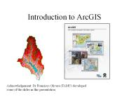
Introduction to ArcGIS. Acknowledgement: Dr Francisco Olivera ... How data are stored in ArcGIS. Components of ArcGIS ArcMap, ... bitmap images ...
| PowerPoint PPT presentation | free to view

Internet enabled GIS GIS Topics and Applications John Reiser Rowan University * * * * * * * Think of Finder as the catalog and repository of GIS data.
| PowerPoint PPT presentation | free to download

What is a Geodatabase? (Modern) 'data storage and management ... Personal: Microsoft Access (before 9.2) Univ. of Texas' GBDS data format. File Geodatabase ...
| PowerPoint PPT presentation | free to view

... (ANFIS) Matlab Matlab Each band pixel into the FIS results in a grid pixel out that is classified. This could be seen as a local function. ...
| PowerPoint PPT presentation | free to view

U.S. Department of Agriculture. Office of the Chief Economist. World Agricultural Outlook Board ... Ernesto Headlined a Hurricane-Free Season ...
| PowerPoint PPT presentation | free to view

... Engine. What Is It? Where to look. http://www.safe.com/index.htm ... They have movies. http://www.safe.com/products/fme/components/movies.htm. Demonstrations ...
| PowerPoint PPT presentation | free to download
Importing Spatial and Attribute Data * * * * Uses and applications United States topographic quadrangles, 1:100,000. Large-scale topographic mapping of the Soviet Union.
| PowerPoint PPT presentation | free to download

Geographic Information Systems : Data Types, Sources and the ArcView Program
| PowerPoint PPT presentation | free to view

Digital Spatial Data. Francisco Olivera, Ph.D., P.E. Department of Civil Engineering ... Cellular-based data structure composed of square cells of equal size ...
| PowerPoint PPT presentation | free to view
Spatial Data and Geographic/Spatial Databases Vania Bogorny www.inf.ufsc.br/~vania vania@inf.ufsc.br
| PowerPoint PPT presentation | free to download

Exercise 1: Creating GIS data points lines and polygons A very common method of creating vector data is to physically create these files through on-screen digitizing.
| PowerPoint PPT presentation | free to download
Title: GeoARM: an Interoperable Framework to Improve Geographic Data Preprocessing and Spatial Association Rule Mining Author: Vania Bogorny Last modified by
| PowerPoint PPT presentation | free to download

Design maps with pre-defined layer symbology, or use advanced ... View maps in 3D. Map live GPS positions from any connected GPS unit with NMEA output (beta) ...
| PowerPoint PPT presentation | free to view