Lensatic PowerPoint PPT Presentations
All Time
Recommended
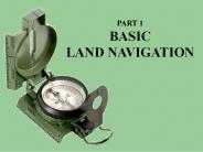
USING THE MILITARY LENSATIC COMPASS Module 1 Lensatic Compass PART 1 Basic Land Navigation 65 AZIMUTH (11.5m = 1,150mils) SIGHTING A LENSATIC COMPASS Module 1 ...
| PowerPoint PPT presentation | free to view
USING THE MILITARY LENSATIC COMPASS Module 5 Terrain Relief PART 1 Basic Land Navigation SUPPLEMENTARY TERRAIN FEATURES: Cut. A cut is a man-made feature resulting ...
| PowerPoint PPT presentation | free to view
USING THE MILITARY LENSATIC COMPASS Module 4 Map Symbols PART 1 Basic Land Navigation This presentation is intended as a quick summary, and not a comprehensive resource.
| PowerPoint PPT presentation | free to view
USING THE MILITARY LENSATIC COMPASS PART 2 Intermediate Land Navigation Module 8 Resection This presentation is intended as a quick summary, and not a comprehensive ...
| PowerPoint PPT presentation | free to view
USING THE MILITARY LENSATIC COMPASS PART 2 Intermediate Land Navigation Module 7 Sense of Direction This presentation is intended as a quick summary, and not a ...
| PowerPoint PPT presentation | free to view
USING THE MILITARY LENSATIC COMPASS PART 2 Intermediate Land Navigation Module 10 Map Speaks Compass Language This presentation is intended as a quick summary, and ...
| PowerPoint PPT presentation | free to view
USING THE MILITARY LENSATIC COMPASS PART 4 Expert Land Navigation Module 18 Navigating Different Terrain This presentation is intended as a quick summary, and not a ...
| PowerPoint PPT presentation | free to view
USING THE MILITARY LENSATIC COMPASS PART 3 Advance Land Navigation Module 15 Plan to Navigate This presentation is intended as a quick summary, and not a ...
| PowerPoint PPT presentation | free to view
SAND DUNE DESERTS When operating in an area with few visual cues, restricted visibility by a sandstorm, you must proceed by Dead Reckoning.
| PowerPoint PPT presentation | free to download
USING THE MILITARY LENSATIC COMPASS PART 4 Expert Land Navigation Module 19 Night Navigation This presentation is intended as a quick summary, and not a comprehensive ...
| PowerPoint PPT presentation | free to view
... 19 Night Navigation night adaptation, protecting night vision, navigate with lensatic compass. ... read azimuth heading in low-light or night conditions. ...
| PowerPoint PPT presentation | free to view
However, the finest maps available are worthless unless the map user knows how to read them. ... Maps must be taken care of and properly folded for field use. ...
| PowerPoint PPT presentation | free to view
... Resection locate position with map only. Modified resection ... RESECTION - With map only (no compass). MODIFIED RESECTION With map or One compass bearing. ...
| PowerPoint PPT presentation | free to view
To get the ideas across presented on these s, many figures, pictures, and ... 6 x 12 = 72 = 7.2 minutes = 7 minutes (Round off to the nearest half minute) ...
| PowerPoint PPT presentation | free to view
USING THE MILITARY LENSATIC COMPASS Module 1 Lensatic Compass PART 1 Basic Land Navigation 65 AZIMUTH (11.5m = 1,150mils) SIGHTING A LENSATIC COMPASS Module 1 ...
| PowerPoint PPT presentation | free to view
USING THE MILITARY LENSATIC COMPASS Module 5 Terrain Relief PART 1 Basic Land Navigation SUPPLEMENTARY TERRAIN FEATURES: Cut. A cut is a man-made feature resulting ...
| PowerPoint PPT presentation | free to view
Determining Travel Distance modules 12, 13, 14. PART 3 Advance ... Module 14 Travel Distance Estimation estimating by 100 meter rule, rule-of-thumb, ... MAP ...
| PowerPoint PPT presentation | free to view
USING THE MILITARY LENSATIC COMPASS PART 4 Expert Land Navigation Module 19 Night Navigation This presentation is intended as a quick summary, and not a comprehensive ...
| PowerPoint PPT presentation | free to view
USING THE MILITARY LENSATIC COMPASS PART 3 Advance Land Navigation Module 17 Additional Land Navigation Skills Again, before we continue, are there any questions?
| PowerPoint PPT presentation | free to view
With an orienteering (Silva) compass: ... With a lensatic compass (this is less accurate than using a protractor or orienteering compass) ...
| PowerPoint PPT presentation | free to view
PART 1 BASIC LAND NAVIGATION Have students practice this. This technique is used when the map does not have a MAGNETIC DECLINATION drawn on the map.
| PowerPoint PPT presentation | free to download
PART 1 BASIC LAND NAVIGATION AT THE END OF THE SLIDE Navigation is not about finding More detail covered in Part 2 INTERMEDATE LAND NAVIGATION.
| PowerPoint PPT presentation | free to view
NAVIGATION Navigating in unmarked or poorly marked terrain Advancement Module 04 Dallas CERT Places for more info http://www.rei.com/learn/expert-advice/navigation ...
| PowerPoint PPT presentation | free to view
part 4 expert land navigation
| PowerPoint PPT presentation | free to download
During this block of instruction you will receive training on identifying the major terrain features, minor terrain features, and colors found on a Military map.
| PowerPoint PPT presentation | free to view
gps 4-h: using the global positioning system in 4-h programming mike clifford
| PowerPoint PPT presentation | free to view
The Compass Some History As far back as 2500 BCE the Chinese knew that a loadstone on a piece of floating wood, would always point itself in the same direction.
| PowerPoint PPT presentation | free to download
Cardinal Directions. North - 0 or 360 East - 90 South - 180 West - 270 ... The geographic position referring to the direction of the North Pole relative to ...
| PowerPoint PPT presentation | free to view
Cadet Basic Training 2005. CBT Land Navigation. CBT Land Navigation 2005 ... Task # 1: Determine magnetic azimuth using compass (STP 071-329-1003) ...
| PowerPoint PPT presentation | free to view
PART 2 INTERMEDIATE LAND NAVIGATION AT THE END OF THE SLIDE Have students try this with the paper and the string AT THE END OF THE SLIDE Pick two points on the map ...
| PowerPoint PPT presentation | free to download
The steeper the slope, the closer the spacing between lines. ... Piece of Barbed Wire. No Drafts. Small Container. Magnetize if Possible. Magnet. Stone ...
| PowerPoint PPT presentation | free to view
PART 4 EXPERT LAND NAVIGATION RETURN TO THE FIRST STEP AND THEN HAVE THE STUDENTS TRY IT AGAIN, BUT WITH THE LIGHTS OUT. Give written exam. Review questions and ...
| PowerPoint PPT presentation | free to download
Prepare a Range Card Instructor SGT Christopher Vester Bco 62nd Engineers Task: Prepare a Range Card Conditions: During daylight in a defensive fighting position ...
| PowerPoint PPT presentation | free to download
M18 A1 claymore mine 2. Hand grenades Uniform and equipment commonly carried during patrolling operations A. E tool B. Canteen, 2 Qt C. Bag, ...
| PowerPoint PPT presentation | free to view
Prepare A Range Card Instructor: SSG Ronald W. Hoskins Prepare A Range Card Task: Prepare A Range Card Conditions: during daylight in a defensive fighting position ...
| PowerPoint PPT presentation | free to view
NCODP SFC COLEMAN AR 350-17 Training is the Army s top priority; it prepares us to fight. As leaders, our sacred responsibility is to ensure that no soldier ever ...
| PowerPoint PPT presentation | free to download
Forging the Warrior Spirit. AVIATION DIVISION. Augmentee ... 1-Sleeping pad or air mattress. 1-Alice pack w/frame. 2-Combat or jungle boots. 4-BDU trousers ...
| PowerPoint PPT presentation | free to view
What is a compass? com pass (k m pes, kom-) n. A device used to determine geographic direction, usually consisting of a magnetic needle or needles horizontally ...
| PowerPoint PPT presentation | free to view
Urban Direction Finding Familiarization and Preparatory Training Overview Urban Direction Finding (UDF) Teams are teams of at least two qualified CAP members equipped ...
| PowerPoint PPT presentation | free to view
Mazamas BCEP John Bartholomew jbartholomew@alum.mit.edu * * * * * * * * * * * * * * * * * * * * * * * * * * * * * * * * * * * * * * * * * * * * GPS Global ...
| PowerPoint PPT presentation | free to download
1st Occupation (Cadets) 30 min. AAR (Section Chief/Cadets) 15 min. Section Time (Cadets) 30 min ... 2nd Occupation (timed competition) 30 min. Total Time 2 hrs ...
| PowerPoint PPT presentation | free to view
... all M16/AR15 series weapons ... with the M16 or AR15; however with the GincVision Sighting ... I could teach her how to shoot the AR15 with the CAT Sight. ...
| PowerPoint PPT presentation | free to view
'Blue 1 this is Black 6. An Air Force aircraft has been forced down in our sector. ... are more effective than lower ones, contingent on task selection and ...
| PowerPoint PPT presentation | free to view
Put your finger on the grid north line, now move it to the magnetic north line. ... This will greatly help you orient yourself on the map. ...
| PowerPoint PPT presentation | free to view
BOLC II TACSOP TRAINING TODAY FOR COMBAT TOMORROW
| PowerPoint PPT presentation | free to view
Title Slide Times New Roman Bold Italic 44 point
| PowerPoint PPT presentation | free to view
Backup Slides MCoE Re-Organization US Army Armor School ... qualified 11B30 s selected Take advantage of NCO Education Opportunities while at Fort ...
| PowerPoint PPT presentation | free to view
A question can be asked any time during the lecture ... Domineering (What are the definitions of each use research) Coordinator. Reluctant ...
| PowerPoint PPT presentation | free to view
To get the ideas across presented on these s, many figures, pictures, and ... or planned route with the wheel, it measures either in centimeters or inches. ...
| PowerPoint PPT presentation | free to view
Night Fision can end your quest for reliable Tritium sights, as this online store consists of a myriad of night sights, gunsights, handgun sights and many other similar products. If you want to buy a quality piece of Tritium sights and that too, at a cheap price, then Night Fision is the place for you. Call us to get better details.
spirit of outdoors - An Online store for outdoor accessories. Buy online camping, trekking and many more.


