Stability and Tornado Forecasting - PowerPoint PPT Presentation
1 / 31
Title:
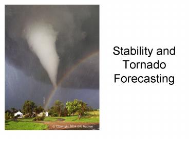
Stability and Tornado Forecasting
Description:
High CAPE = severe storms likely, but not necessarily tornadoes. Need strong shear to create supercells, which are responsible for most violent tornadoes ... – PowerPoint PPT presentation
Number of Views:251
Avg rating:3.0/5.0
Title: Stability and Tornado Forecasting
1
Stability and Tornado Forecasting
2
Tornado Forecasting
Forecast of Tornadic Potential (Soundings)
Identification of pre- tornadic storms (Nowcast)
3
Convective Outlooks (SPC)
- Assess likelihood of severe weather threats for
the day - Tornado
- Hail
- Wind
- Graphically represents where convection and/or
severe weather is possible
4
Day 3 convective outlook
Day 2 convective outlook
5
Day 1 Outlook
Day 1 Tornado chance (Probability of tornado
within 25 miles of a point)
6
- SPC AC 211247
- DAY 1 CONVECTIVE OUTLOOK
- NWS STORM PREDICTION CENTER NORMAN OK
- 0747 AM CDT
- MON APR 21 2008 VALID 211300Z - 221200Z
- ...THERE IS A SLGT RISK OF SVR TSTMS OVER
PARTS OF OK...KS...AND MO... A LARGE UPPER TROUGH
IS PRESENT TODAY OVER THE WESTERN STATES... WITH
SEVERAL SMALLER-SCALE FEATURES ROTATING THROUGH
BASE OF TROUGH INTO THE SOUTHERN/CENTRAL ROCKIES.
ONE SUCH FEATURE IS CURRENTLY ROTATING ACROSS THE
SOUTHERN ROCKIES AND WILL MOVE INTO WEST TX/OK
AND PARTS OF KS LATER TODAY AND TONIGHT. LOW
LEVEL MOISTURE IS RAPIDLY RETURNING NORTHWARD
ACROSS THE PLAINS...WHILE A COLD FRONT SURGES
SOUTHWARD ACROSS WESTERN KS AND THE TX/OK
PANHANDLE. DESPITE SEVERAL FAVORABLE PARAMETERS
FOR SEVERE STORM DEVELOPMENT THIS EVENING OVER
KS/OK/TX...A STRONG CAPPING INVERSION RESULTS IN
A HIGHLY CONDITIONAL SEVERE OUTLOOK TODAY OVER
PARTS OF KS/OK. - ...OK... MORNING SOUNDINGS AT OUN/FWD SHOW A
PRONOUNCED CAP THAT IS LIKELY TO BE MAINTAINED
THROUGH TODAY/TONIGHT. MEANWHILE...LIMITED
VERTICAL
7
Watches/Warnings
- Issued only as needed
- More specific in regards to timing, location, and
expected types of weather - Warnings issued by local NWS offices
8
Approaches to Tornado Forecasting
- Synoptic pattern recognition
- Super outbreak example
- Checklists
- Soundings, Indices
- Climatology
9
Using Soundings To Predict Thunderstorms/Tornadoes
- Key Terms
- Lifting Condensation Level (LCL)
- Level of Free Convection (LFC)
- Equilibrium Level (EL)
- Convective Available Potential Energy (CAPE)
- Convective Inhibition (CIN)
- Helicity
10
LCL
- Level that the cloud base will form due to
lifting by an outside force - Intersection of dry adiabat from the surface
temperature and the mixing ratio line from the
surface dew point
11
(No Transcript)
12
LFC
- Level at which parcel becomes warmer than
environment and can continue to rise on its own - Start at LCL, trace moist adiabat until it
intersects actual temperature trace that is the
LFC
13
(No Transcript)
14
EL
- Point where the saturated parcel becomes cooler
than the environment - Take moist adiabat from LFC until it intersects
the temperature trace - Typically the anvil height
15
(No Transcript)
16
CAPE
- Positive energy between the LFC and EL
- Internal energy that the parcel has to aid its
rising motion (buoyancy) - 500 means convection favorable
- 1000-3000 favors strong convection
- Can be related to the updraft velocity in
thunderstorms
17
(No Transcript)
18
CIN
- Energy required to get the parcel to the LFC
- Values
- Values 200 inhibit convection
19
(No Transcript)
20
Helicity
- Measure of the low-level wind shear
- Higher the better
- More shear more rotation more likely
tornadoes - Values 300 indicate heightened risk of tornadoes
21
(No Transcript)
22
Stability Indices
- Lifted Index From LCL, go up moist adiabat to
500 mb, compare parcel temp to environmental temp
(actual env.) - Anything
- Showalter Index Same as LI, but start at 850 mb
instead of the LCL - Anything
23
Stability Indices
- Total totals Index based on actual lapse rate
and low-level moisture - Higher the better for severe weather (generally
62 indicates possible tornadoes) - SWEAT Index Esp. for severe storms, see text
for details - K Index Esp. for air mass storms, see text for
details
24
How To Forecast For Tornadoes?
- Synoptic situation will determine the
larger-scale risk - Examine soundings
- High CAPE severe storms likely, but not
necessarily tornadoes - Need strong shear to create supercells, which are
responsible for most violent tornadoes - Mesoscale factors very important
- 90 of tornado days/year are not evident through
synoptic analysis (Doswell et al. 1993)
25
Verification of Severe Weather Forecasts
- Contingency Table
- Matrix of categorical forecasts and verification
0 No 1 Yes (e.g. tornado)
26
Contingency Table
- Example 100 trials (thunderstorms). Tornado
warning was issued 50 times. Of those 50, there
were 42 confirmed tornados. Of the 50 times
where no warning was issued, there were 2
confirmed torndoes
27
2
48
42
8
28
2
48
Missed Forecast
Success
42
8
False Alarm
Success
29
Verification Measures - POD
- Probability of Detection (POD) The percentage
of tornadoes (or whatever event you are
forecasting) are detected - POD d / (bd)
b
a
Tornado POD?
c
d
30
Verification Measures - FAR
- False Alarm Rate (FAR) Percent of forecasts
that resulted in a false alarm - FAR c / (ac)
b
a
Tornado FAR?
c
d
31
Critical Success Index (CSI)
- Combines POD and FAR into one measure of skill
- Ranges from 0 (worthless) to 1 (perfect)
Tornado CSI?


