
Snowtams PowerPoint PPT Presentations
All Time
Recommended

During periods when deposits of snow, ice or water associated with these ... 8 Compacted or Rolled Snow. 9 Frozen Ruts or Ridges. Decoding a SNOWTAM. BIKF ...
| PowerPoint PPT presentation | free to view

The ICAO Global ATM Operational Concept tells us that in the future we need to evolve to a seamless global air traffic management concept.
| PowerPoint PPT presentation | free to view

Military Airspace Status. Military Airspace status. Buckeye Military Operation Area (MOA) ... Temporary activation of refueling and military operating areas ...
| PowerPoint PPT presentation | free to view

At the airport this can include airport mapping and survey information ... NES Int l NOF DINS NIWS/AMC AIDAP/XML PilotWeb/ CDM/ATCSCC NDS FS21 AISR NRS ...
| PowerPoint PPT presentation | free to view
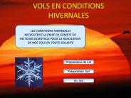
vols en conditions hivernales les conditions hivernales necessitent la prise en compte de facteurs essentiels pour la realisation de nos vols en toute securite
| PowerPoint PPT presentation | free to download

Corso di Meteorologia Aeronautica per il Volo da Diporto o Sportivo Dr. Marco Tadini meteorologo U.M.A. Home Page - Ufficio Meteorologico Aeroportuale
| PowerPoint PPT presentation | free to download

Title: RTF TECNICA MICROFONICA Author: pgigli.co Last modified by: Piero Gigli Created Date: 4/26/2006 7:09:36 AM Document presentation format
| PowerPoint PPT presentation | free to download

... OACI, IATA, Global AIM Consortium Mejorar la eficacia y efectividad de AIM AIM Global Identificar los servicios del futuro Recommendaciones para ir de AIS a ...
| PowerPoint PPT presentation | free to view

Building a Global AIM Enterprise Architecture Creating a Roadmap for Global AIM Interoperability Agenda Introduction to Enterprise Architecture Application to AIM ...
| PowerPoint PPT presentation | free to view

Creation and update of AIP, supplements, circulars based on SDO database (data or table linkage) ... one glance. SDO. Input and validation of static data. INO ...
| PowerPoint PPT presentation | free to view

Define a set of mapping rules for conversion of ground sources (AIPs published ... Primary focus will be on data used by the FMS (former NDBX scope) ...
| PowerPoint PPT presentation | free to view

Aeronautical Information Publications, SID/STAR Procedures, Traffic Flow restrictions ... Vectorial Charts. Ed 4. European Organisation for the Safety of Air ...
| PowerPoint PPT presentation | free to view

NOTAM REALIGNMENT
| PowerPoint PPT presentation | free to view

RUNWAY CONDITION REPORTING
| PowerPoint PPT presentation | free to view

Jim Mills& Warren Relaford US Military NOTAM system. 6. Review of the draft document ... flight crews in a structured computer interpretable format that would ...
| PowerPoint PPT presentation | free to view