
Planimetrics PowerPoint PPT Presentations
All Time
Recommended

Other notes on imagery. 100 Vs 200 foot buffer. Satellite Imagery. Ortho Vs Aerial. Planimetrics. Extent. Affected Layers. Attributes ...
| PowerPoint PPT presentation | free to download
Current method of block creation causes AutoCAD to crash when opening large ... Cleaner files (no fme block to purge out or explode) Thoughts ...
| PowerPoint PPT presentation | free to download

http://resources.esri.com/arcgisserver/apis/javascript/arcgis/index.cfm?fa= home ... ArcGIS Explorer is being reworked. Automatic crash dump sending ...
| PowerPoint PPT presentation | free to download

LIDAR. Originally Delivered to AIMS as: LAS files. Intensity ... Surface product from DDR includes. LIDAR generated as ... LIDAR examples. LIDAR ...
| PowerPoint PPT presentation | free to download

The Big Five (No not Tiger, Phil, Ernie, Vijay, Retief) 2006 Preliminary Floodplains ... Locations of on site hazardous or. radioactive material. Data comes ...
| PowerPoint PPT presentation | free to download

Flood Damage Evaluation Project (FDEP) cooperative effort between ... Added 'tails' to the TINs. TIN with a 'Tail' for HEC-GeoRAS. Terrain Integration Results ...
| PowerPoint PPT presentation | free to view

Residential Driveway Algorithm. Estimate 1. Calculates the percentage of the driveway relative to the lot size. ... Residential Total Estimated Driveway Values ...
| PowerPoint PPT presentation | free to view
... Data Availability Locally Relationships with TDOT (TransCAD modeling) GIS Base Data Extensive Sources: City has Long-Term GIS (15 Years) Transit ...
| PowerPoint PPT presentation | free to download

Digital FIRM vs. Current Effective Paper Map Base Map Topography Flood Data Input from the ... Map Modernization transforms the Nation's flood maps into ...
| PowerPoint PPT presentation | free to view

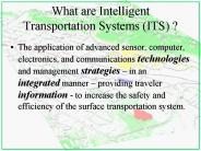
Even the most accurate and reliable data is of little value if it can not be easily accessed. ... Recent advances in information technology have provided tools ...
| PowerPoint PPT presentation | free to view
Quality Control Review of Orthophotography Matt McCormack, I.M.A.G.I.S.
| PowerPoint PPT presentation | free to download

State-Wide Mapping Programs Setting the Stage for Success Presented by: David Lewis, Director Strategic Accounts State Programs Jamie Curtin, Executive Vice President ...
| PowerPoint PPT presentation | free to view

... for ortho photo production ... TN Geospatial Data Sharing Standards. Enterprise Services and ... ECD community planning, land use regulations, ...
| PowerPoint PPT presentation | free to view

insure the best possible use of electronic files representing the ... All NEW project starts with a construction letting after September 2005 shall ...
| PowerPoint PPT presentation | free to view

FEMA Flood Insurance Study
| PowerPoint PPT presentation | free to view
Remote Sensing and GIS for Urban Planning: 3D M. M. Yagoub Geography Program, College of HSS E-mail: myagoub@uaeu.ac.ae http://faculty.uaeu.ac.ae/myagoub
| PowerPoint PPT presentation | free to download

FEMA Flood Insurance Study
| PowerPoint PPT presentation | free to view

'Bootstrapping' to get an organization that has never worked with lidar data up ... Leica Ortho Accelerator (Distributed Processing Engine) Photoshop ...
| PowerPoint PPT presentation | free to view

HENDERSON COUNTY, TX FLOODPLAIN STUDY
| PowerPoint PPT presentation | free to view

NAVARRO COUNTY, TX FLOODPLAIN STUDY
| PowerPoint PPT presentation | free to view

FEMA Flood Insurance Study
| PowerPoint PPT presentation | free to view

ResponsibilitiesVGIN
| PowerPoint PPT presentation | free to view

FLOOD RISK INFORMATION OPEN HOUSE. April 2006. Welcome & Introduction ... Concerns for methodology in BFE or floodway computations. COMMENTS. Errors in street names ...
| PowerPoint PPT presentation | free to view

GIS Shape File Showing DFIRM Mapping Needs for the County ... Floodway Computations. Flood Profiles. Calibrated to Historical Events ...
| PowerPoint PPT presentation | free to view

GIS Shape File Showing DFIRM Mapping Needs for the County. DFIRM and Flood Insurance Study Task ... National Geodetic Vertical Datum (NGVD) 29. Local Datum ...
| PowerPoint PPT presentation | free to view

FEMA Flood Insurance Study
| PowerPoint PPT presentation | free to view

... were saved as images in PowerPointtm to reduce file size and prevent alterations ... Most Popular Responses to 'Other' for Buy-Up Options ...
| PowerPoint PPT presentation | free to view

Vigevano is particularly well known for its beautiful Renaissance "Piazza Ducale", in the centre of the town, one the most beautiful piazzas in Italy, and the Castle, that stands out among all others in Lombardy. Castello Sforzesco is a castle located in an elevated position in the historical center of the town, near Piazza Ducale and the Cathedral of Sant’Ambrogio. The castle covers an area of about 70,000 square meters, being one of the largest fortified complexes in Europe. Castello Sforzesco houses Pinacoteca Casimiro Ottone, the National Archaeological Museum of Lomellina (Museo Archeologico Nazionale della Lomellina) and the Pietro Bertolini International Footwear Museum (Museo Internazionale della Calzatura Pietro Bertolini).
| PowerPoint PPT presentation | free to view

Know the 6 phases of the architectural design and drawings process. The stages of design as described by The American Institute Of Architects will be discussed in this article.
| PowerPoint PPT presentation | free to download

MEP (Mechanical, Electric and Plumbing) installations have a very important impact on a project, since they largely determine the habitability and operating conditions of buildings. However, during the development of a project, designers and builders often find inconsistencies in facility designs that significantly impact both time and budget.
| PowerPoint PPT presentation | free to download

Faculty of Humanities and Social Sciences. United Arab Emirates University ... and interpreted by people without photogrammetry or engineering back ground. ...
| PowerPoint PPT presentation | free to download
lidar gajendra kumar ec 3rd yr. roll no.- 0800131040
| PowerPoint PPT presentation | free to download
John R. Jensen Department of Geography University of South Carolina Columbia, South Carolina 29208 Surface Roughness in RADAR Imagery Expected surface roughness back ...
| PowerPoint PPT presentation | free to download

Basic Surveying CE 263
| PowerPoint PPT presentation | free to download

Title: PowerPoint Presentation Last modified by: Servidor Created Date: 1/1/1601 12:00:00 AM Document presentation format: Presentaci n en pantalla
| PowerPoint PPT presentation | free to download

Title: PowerPoint Presentation Author: Jorge Valdivieso Last modified by: Administrador Created Date: 1/1/1601 12:00:00 AM Document presentation format
| PowerPoint PPT presentation | free to view

Civil Engineering Surveying Prepaid by: 140670106083 140670106002
| PowerPoint PPT presentation | free to view

Required: Readings: 16-1 to 16-9.1 &16-9.5 Figures: 16-1 to 16-4. Recommended, not required, extra readings: Hydrographic Surveys section 16-12.
| PowerPoint PPT presentation | free to download

LiDAR Fundamentals: Part One L. Monika Moskal, PhD Assistant Professor - Remote Sensing & Biospatial Analysis College of Forest Resources & Precision Forestry Cooperative
| PowerPoint PPT presentation | free to view

LIDAR Light Detection And Ranging
| PowerPoint PPT presentation | free to download

Scale, distance, area, etc. Expressed as a representative fraction 1:x or 1/x some agencies use equivalent distances as scale descriptors: e.g. 1 =1 Mile (or ...
| PowerPoint PPT presentation | free to view

LiDAR Fundamentals: Part One L. Monika Moskal, PhD Assistant Professor - Remote Sensing & Biospatial Analysis College of Forest Resources & Precision Forestry Cooperative
| PowerPoint PPT presentation | free to download

Knowledge of the planners, operators, office staff. Flying height ... LIDAR and the software we use in processing will continue to improve with time ...
| PowerPoint PPT presentation | free to download

portada Universidad Aut noma de Chihuahua Facultad de Ciencias Qu micas Material Did ctico Determinaci n de Pb, Ba y Sb resultantes de la deflagraci n de un arma ...
| PowerPoint PPT presentation | free to download

... Digital Orthophotos Pixel size can be in centimeters, inches or feet Class I refers to highest-accuracy survey-grade orthophotos Class II refers to standard, ...
| PowerPoint PPT presentation | free to download

Title: No Slide Title Author: Deepsea Dawn Last modified by: Deepsea Dawn Created Date: 11/15/2001 3:23:06 AM Document presentation format: On-screen Show
| PowerPoint PPT presentation | free to view

Geodesy (surveying) one of the earth sciences, geodesy is concerned with measurements of the Earth and with the Earth s surface representation
| PowerPoint PPT presentation | free to download

Arial Wingdings Cumbre METODO DE LEVANTAMIENTO Diapositiva 2 Diapositiva 3 Diapositiva 4 Diapositiva 5 Diapositiva 6 Diapositiva 7 Diapositiva 8 ...
| PowerPoint PPT presentation | free to download

Image-to-map rectification: a process by which the geometry of an image is made planimetric with reference to a projected map. Image-to-image registration: ...
| PowerPoint PPT presentation | free to view

IX. Overview Of Design Process A. Project Initiation: Three Level Design Approach (Section 9.3.1 of HDS6-01) (Section 4.3.1 to 4.3.3; 4.4 to 4.7 in HEC20-95)
| PowerPoint PPT presentation | free to download

sistema de posicionamiento global (gps). aplicaciones a la ingenier a civil, topograf a, cartograf a y fotogrametr a c digo:05/5740 modulo 1
| PowerPoint PPT presentation | free to view
Lead in to demos and discussion. 4. Steps in Data Model Process ... How well are marine application domain requirements met in the geodatabase structure now? ...
| PowerPoint PPT presentation | free to download

SCENARIO AND VISUALIZATION (SAVI) TOOLS Todd Graham, Project Manager todd.graham@metc.state.mn.us 651/602-1322 www.metrocouncil.org/planning/COO/
| PowerPoint PPT presentation | free to view

Land Cover Interpretation and Mapping Supplemental Material Lecture 1 prepared by R. Lathrop 8/03 Land Cover vs. Land Use Land Cover (LC): the biophysical material ...
| PowerPoint PPT presentation | free to view
Active Microwave Remote Sensing ... a receiver, one or more antennas, GPS, computers Microwaves Band Designations (common wavelengths Wavelength ...
| PowerPoint PPT presentation | free to download