Geotiff PowerPoint PPT Presentations
All Time
Recommended
or with Java-based GUI. Page 5. HEG Functionality. Metadata preservation/creation. ... Download, Documentation, Help: HDFView: http://newsroom.gsfc.nasa.gov/sdptoolkit ...
| PowerPoint PPT presentation | free to download
IDRISI Rosangela Sampaio Reis Idrisi GeoTIFF/TIFF Mosaic Reclass Overlay Image Calculator GeoTIFF/TIFF Utilizado para importar ou exportar arquivos GeoTIFF/TIFF.
| PowerPoint PPT presentation | free to download
The most common formats are: Idrisi RST WinDisp IMG GeoTIFF CSV FAO-RFE customization: user interface FAO-RFE user interface FAO-RFE: automatic processing FAO-RFE: ...
| PowerPoint PPT presentation | free to download
xmlns:stRef='http://ns.adobe.com/xap/1.0/sType/ResourceRef ... rdf:Alt rdf:li xml:lang='x-default' USGS GeoTIFF DRG 1:24000 of Chalmette. /rdf:li ...
| PowerPoint PPT presentation | free to view
HDF-EOS plug-in for HDFView. HDF-EOS2 to GeoTIFF Converter (HEG) ... Modified accuracy check for quaternion in CSC tools. Major Development/Fixes (cont. ...
| PowerPoint PPT presentation | free to download
Main TYPES of map. VECTOR : Shape Files. RASTER : .tiff (geotiff) .jpg (geojpeg) ... Display Thailand map (76 provinces from province shape files with a size of 600 ...
| PowerPoint PPT presentation | free to view
Remote Sensing Realities Bumps you ll run into along the way Different data formats For Landsat this is being standardized to L1T GeoTIFFs Different projections ...
| PowerPoint PPT presentation | free to view
Create thumbnails command for raster references now creates GeoTIFFs instead of TIFFs ... Generate thumbnails for raw images. Define color corrections to ...
| PowerPoint PPT presentation | free to view
customised product. converted to user-friendly format (GeoTIFF, TIFF, JPEG, ... chaining with our basic servies. customise products on-the-fly ...
| PowerPoint PPT presentation | free to view
... performance, user-friendly interface for viewing and chipping streamed imagery. ... Save a chip' as a compliant NITF or GeoTIFF image at user-specified resolution ...
| PowerPoint PPT presentation | free to view
different spatial images on top of each other, without considering the ... be integrated into one ArcIMS service and viewed using web based ArcIMS viewer. ...
| PowerPoint PPT presentation | free to download
USDA FSA-APFO Storage provisioning within a Geospatial Data Warehouse USDA Imagery Planning and Coordination December 5, 2006 David A. Nabity Aerial Photography ...
| PowerPoint PPT presentation | free to download
... at EOS archive centers, which are focused on classes of products. ... Safari 2000 Campaign - NW Botswana. Lake Ngami. Town of Maun. Boteti River. 14 ...
| PowerPoint PPT presentation | free to download
Enabling the Transition of CPC Products to GIS Format Brian Doty Jennifer Adams Michael Halpert Viviane Silva
| PowerPoint PPT presentation | free to view
MODIS Land Product Subsets: Remote Sensing Products for Field Sites Collections 4 and 5
| PowerPoint PPT presentation | free to download
Variable var = (Variable)variables.get(i); Array array = var.read(); NetCDF example ... List vlist = var.getAttributes(); Attribute attrib = vlist.get(i) ...
| PowerPoint PPT presentation | free to view
Enhancing Crop Insurance Program Integrity with Remote Sensing and Data Mining
| PowerPoint PPT presentation | free to download
Chronology. Phases. Users. Stats. Background. Yves-Louis Desnos & Peter Churchill ... Chronology. WGCV & WGISS Chairs Discuss (c. 2001) WGCV Proposal to WGISS (9/2001) ...
| PowerPoint PPT presentation | free to view
OGC 'Geo-interface for Atmosphere, Land, Earth, and Ocean netCDF' (GALEON) ... International University Bremen. NERC NCAS/British Atmospheric Data Center ...
| PowerPoint PPT presentation | free to view
HDFEOS Status, Related Tools and Issues
| PowerPoint PPT presentation | free to download
Major Software Components. GUI (Tcl/Tk or Java) Resampler ... GUI (originally Tcl/Tk, now Java) runs on all target platforms. HDF-EOS Issues ...
| PowerPoint PPT presentation | free to download
Larry Klein, Ray Milburn, Cid Praderas and Abe Taaheri. L-3 Communications Analytics Corp. ... We have developed a tool, which can be used to convert science ...
| PowerPoint PPT presentation | free to download
Transport HTTP GET or POST, prepared for SOAP ... GetCoverage. Requests a single coverage using the above properties as request criteria ...
| PowerPoint PPT presentation | free to download
QinetiQ Service 1 (nrt MODIS) ... ComSine Re-projection Service (1) Completed Order Form. ... ComSine Ortho-correction Service (1) Service Chaining. ATSR ...
| PowerPoint PPT presentation | free to view
Oak Ridge, Tennessee, USA. MODIS Land Products. Subsets for any location ... http://daac.ornl.gov/MODIS/modis.html. Demo with. Collection 4 data. E-mail Result. TOOL 1 ...
| PowerPoint PPT presentation | free to download
Satellite Services Division. August 2003. GIS ... image production which allowed in-house software to be replaced by ... Wildfire GIS map service to ...
| PowerPoint PPT presentation | free to download
EUMeTrain LSA SAF Week Ricardo Silva, IM Session 2 Messing around with the data MONITORING WEATHER CLIMATE SEISMIC ACTIVITY TO A SUSTAINABLE DEVELOPMENT AND A ...
| PowerPoint PPT presentation | free to download
Two versions available: A downloadable desktop version ... Reduces the transfer time of HDF-EOS data sets (if subset is requested) ...
| PowerPoint PPT presentation | free to download
... photo, line, and spot index reference maps for purposes of preservation. ... completed thus far - 0. Samples. 1961. 1982. Brooks County, TX. 1968 ...
| PowerPoint PPT presentation | free to download
Title: Relative Humidity Points Author: maidment Last modified by: Dr. David Maidment Created Date: 2/6/2004 8:34:05 AM Document presentation format
| PowerPoint PPT presentation | free to download
5 - 1 day repeat cycle. On board EOS Terra and Aqua ... Wisconsin-Today History. Daily MODIS true color online since 2002 (pre-dates WisconsinView) ...
| PowerPoint PPT presentation | free to view
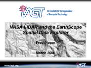
Shaded relief images. Illumination Azimuth: 225 degrees. Illumination ... http://www.earthscope.org/data/explorer.php. http://www.iagt.org/earthscope/es-sde.asp ...
| PowerPoint PPT presentation | free to download
NASA's Earth Observing System Data and Information System provides ... Sea Surface Temperature, Ocean Winds, Circulation and Currents, Topography and Gravity ...
| PowerPoint PPT presentation | free to download
From netCDF to GIS David R. Maidment Unidata Program Center, Boulder CO 6 Feb 2004
| PowerPoint PPT presentation | free to download
Interest in crossing boundaries between GIS and Atmospheric Science communities. ... Data retrieval on spatiotemporal characteristics of weather events. ...
| PowerPoint PPT presentation | free to view
Will address as funds become available based on SWGD priorities ... Personalized data views, bookmarks and data themes. Access via OpenGIS interfaces ...
| PowerPoint PPT presentation | free to download
Generated for all OLI data that can be processed to meet ... Reprocessing driven by algorithm, software, and/or calibration parameter file (CPF) update ...
| PowerPoint PPT presentation | free to download
Advanced Weather Interactive Processing System II (AWIPS II) AWIPS Development Environment (ADE) and the Common AWIPS Visualization Environment
| PowerPoint PPT presentation | free to view
OGC GALEON (Geo-interface for Air, Land, Ocean NetCDF) Phase 1 Status and Phase 2 Plans Ben Domenico*, Unidata UCAR Glenn Rutledge*, NCDC For AGU Joint Assembly, May 2006
| PowerPoint PPT presentation | free to download
J Ram n Arrowsmith Department of Geological Sciences, Arizona State University, ... to user and communicates with the Manager program, relaying relevant information ...
| PowerPoint PPT presentation | free to download
A distributed spatial data and information delivery system for the ... Raster images, vector datasets, and associated metadata. Enhanced spatial data access ...
| PowerPoint PPT presentation | free to view
... fixes for reading binary ephemeris files (files with a ... EPH (Ephemeris Data Access) - GCT (Geo Coordinate Transformation) - IO (Input Output (File I/O) ...
| PowerPoint PPT presentation | free to download
Quick image display. Photogrammetry specific workflows: Digital image dodging. Resolution Calculator. Image file header editing. What Is ISRU?
| PowerPoint PPT presentation | free to view
Earth. Disk. GOES. View and Download Page. The Download Page. Clouds on Blue Marble Data ... IndianaMap (http://inmap.indiana.edu/viewer.htm; joint effort of Indiana ...
| PowerPoint PPT presentation | free to view
ArcGIS to be used for the whole analysis process ... PC's with two 21inch screens; 2.8 Ghz processor and 2 Gbyte RAM. Full ArcGIS software ...
| PowerPoint PPT presentation | free to view
High resolution radar data and products over the Continental United States ... The 2D radar mosaic is created every 2 minutes at 1km resolution. ...
| PowerPoint PPT presentation | free to download
The USDA FSA National Agriculture Imagery Program NAIP
| PowerPoint PPT presentation | free to download
Climate Services Division. NOAA Office of the CIO. NOAA Office of ... NOAA Regional Climate Centers. Ocean and Atmospheric Research. NOAA Climate Program Office ...
| PowerPoint PPT presentation | free to view
Image processing, LiDAR and high resolution 2D interpolation and 3D visualization for data integrati
| PowerPoint PPT presentation | free to view
Free. HDF EOS Support in subsequent releases. www.HDFinfo.com ... HDF-to-Photoshop plug-in for Power Macintosh. Opens 2D HDF Datasets and Raster images directly ...
| PowerPoint PPT presentation | free to download
Terra follows a pattern of orbits which repeats after 233 ... ENVI verison 4.0 (commercial GIS, IDL-based) Imports HDF, but not the HDF-EOS geolocation info. ...
| PowerPoint PPT presentation | free to view
Needed only if either: Result of one band is dependant on the ... Add run-time parameters for IDEA and Eclipse. Add a new Java Application Run Configuration ...
| PowerPoint PPT presentation | free to view
For example, to obtain four years of NDVI data for a 7 x 7 km area from MODIS tiles, users would have to download approximately 10 GB of data.
| PowerPoint PPT presentation | free to download
Thuban. GRASS. OSSIM. GMT. Viewers. Processors. OpenSource GIS ... Thuban. OpenSource GIS 2004. Ottawa, Canada. www.refractions.net. GRASS. OpenSource GIS 2004 ...
| PowerPoint PPT presentation | free to download
32 bit and 8 bit Greyscale imagery. 8 bit Multi Difference Colour Composite ... Greyscale ENVISAT ASAR. Alternating Polarisation ESA, 2004. Image Mode ESA, 2005 ...
| PowerPoint PPT presentation | free to view


