Earthscope PowerPoint PPT Presentations
All Time
Recommended
... Schema of the EarthScope Data Portal request available at http://schemas.earthscope.org/portal/0.4/esdp.wsdl Portal will provide ability to add datasets to a ...
| PowerPoint PPT presentation | free to download
EarthScope: Revealing Earth's Secrets
| PowerPoint PPT presentation | free to download
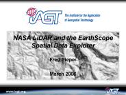
Shaded relief images. Illumination Azimuth: 225 degrees. Illumination ... http://www.earthscope.org/data/explorer.php. http://www.iagt.org/earthscope/es-sde.asp ...
| PowerPoint PPT presentation | free to download
Grand Challenges for EarthScope in Geodesy. Jim Davis. Harvard ... 120-d boxcar smoothing. Linear white noise error correlated error. GreatBREAK Workshop ...
| PowerPoint PPT presentation | free to view
Workshops for Establishing a Stable North American Reference Frame (SNARF) to Enable Geophysical and Geodetic Studies with EarthScope: Annual Report 2004-2005
| PowerPoint PPT presentation | free to download
Current Status of USArray and EarthScope
| PowerPoint PPT presentation | free to view
Develop a unified web interface for searching and downloading EarthScope Data ... portal sends a request to each data center to pack its own data as a zipped file. ...
| PowerPoint PPT presentation | free to download
Merging PASSCAL, local network data & other international data ... How can IRIS and individual PIs contribute to improved earthquake & tsunami ...
| PowerPoint PPT presentation | free to view
Lithospheric Thickening and Foundering: Mountain and Capacity Building in the Andes ... Central Andean Plateau. Normal dipping slab. Active arc ...
| PowerPoint PPT presentation | free to view
The EarthScope Facility: A new experiment in cooperative solid earth science
| PowerPoint PPT presentation | free to view
... (Earthscope/Plate Boundary Observatory provides denser GPS station configuration) ... (New Madrid, Charleston, Wabash Valley), subsidence and uplift ...
| PowerPoint PPT presentation | free to view
The SDSS telescope array is systematically mapping of the entire sky ... Earthscope/Incorporated Research Institutions for Seismology (IRIS) ...
| PowerPoint PPT presentation | free to view
Different theme each day EarthScope, OpenTopography, Data ... Dr. Fabian Walter, SIO. SDSC. Ilkay Altintas. Chris Crosby. Dr. Sriram Krishnan. Dr. Kai Lin ...
| PowerPoint PPT presentation | free to view
Title Slide. EarthScope: Revealing Earth's Secrets. Your Name. Your title. Date. Talk location ... EarthScope is being constructed, operated, and maintained as ...
| PowerPoint PPT presentation | free to view
March 25, 2002. EarthScope CSIT Workshop. Data Archiving and IT Issues for PBO. Douglas Neuhauser ... March 25, 2002. EarthScope CSIT Workshop. USGS Low ...
| PowerPoint PPT presentation | free to view
... Center / University of California, San Diego. University of ... Southern California Earthquake Center (SCEC), EarthScope, IRIS, NASA. GEOSCIENCE CHALLENGES ...
| PowerPoint PPT presentation | free to view
Exploration state of the art. 2005-03, EarthScope National Meeting, Santa Ana, NM. ... Explore current weaknesses in frames, and ways to improve SNARF ...
| PowerPoint PPT presentation | free to view
Want to move forward with more sophisticated methods faster. With EarthScope, and similar ... Long development times (ex: DYNAMO=15 yrs; TERRA=10 yrs) ...
| PowerPoint PPT presentation | free to view
Title: PowerPoint Presentation Author: David Simpson Last modified by: Kaye Shedlock Created Date: 10/30/2002 10:01:35 PM Document presentation format
| PowerPoint PPT presentation | free to view
Visualization and Networking Toolkits with Wavelets Gordon Erlebacher Florida State University David A. Yuen University of Minnesota
| PowerPoint PPT presentation | free to download
Welcome to the first NSF Infrasound Workshop. Informal dinner at Roy's, 5:45 ... responsible for climate variability and predictability on time scales ranging ...
| PowerPoint PPT presentation | free to view
Monitoring Earthquakes in the U'S' Midcontinent:
| PowerPoint PPT presentation | free to download
Constructing Activities Based on Grand Challenges Michael Wysession Washington University St. Louis, MO
| PowerPoint PPT presentation | free to download
12'540 Principles of the Global Positioning System Lecture 23
| PowerPoint PPT presentation | free to download
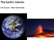
The Earth's interior. Cin-Ty Lee Rice University ... Yummy? Tap and listen? Earthquakes make noise! Earthquakes generate waves through the Earth and we listen ...
| PowerPoint PPT presentation | free to download
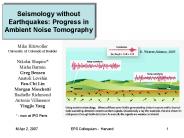
Mike Ritzwoller
| PowerPoint PPT presentation | free to download
Seismogram analysis in two parts: Utah Mine Collapse. Analysis 1: ... The model seismogram should align as closely as possible with the data. Utah Mine Collapse ...
| PowerPoint PPT presentation | free to download
... 1999/02/22-rdf-syntax-ns#' xmlns:iX='http://ns.adobe.com/iX/1.0 ... xmlns:pdf='http://ns.adobe.com/pdf/1.3/' /rdf:Description rdf:Description rdf:about ...
| PowerPoint PPT presentation | free to download
Enter Slide Titles Here
| PowerPoint PPT presentation | free to download
North of CREST: Evidence of the 410-water-filter ('410-LVL' ... Petrology; 36-5 Ma Post-Laramide magmatism. San Juan Mountains, 39-Mile Volcanic Field ' ...
| PowerPoint PPT presentation | free to view
National Science Foundation Education and Human Resources Directorate Division of Undergraduate Education Math and Science Partnership Dan Maki Kathleen Bergin
| PowerPoint PPT presentation | free to download
Cyberinfrastructure for Environmental Observing Systems Chaitan Baru Director, Science R&D San Diego Supercomputer Center
| PowerPoint PPT presentation | free to download
Title: Automatic determination of earthquake focal depth (and focal mechanism?) using cepstral analysis and SOD (?) Author: Chin-Wu Chen Last modified by
| PowerPoint PPT presentation | free to download
Intraplate Deformation and Seismicity: Implication for Seismic Hazard and Risk Estimates in the Central United States Zhenming Wang Kentucky Geological Survey
| PowerPoint PPT presentation | free to view
An interdisciplinary collaboration for research and infrastructure
| PowerPoint PPT presentation | free to view
... of Mines and Geology. Jim Faulds, Nevada Bureau of Mines and Geology ... Jon Price, Nevada Bureau of Mines and Geology. Phil Wannamaker, University of Utah ...
| PowerPoint PPT presentation | free to view
The earthquake-forecast model applied in the National Hazard maps uses a time ... (1) To develop and test a range of viable earthquake-potential models ...
| PowerPoint PPT presentation | free to view
CISN: California Integrated Seismic Network The Program Management Group (PMG): Tony Shakal CGS David Oppenheimer USGS Menlo Park Peggy Hellweg & Doug ...
| PowerPoint PPT presentation | free to download
Attend The project management course in bangalore From ExcelR. Free Mock Sessions With Assured Support From Experienced Faculty. ExcelR Offers The Project Management professional course in bangalore.
| PowerPoint PPT presentation | free to download
The Geowall: Stereo visualization for the Earth Sciences Peter van Keken University of Michigan Paul Morin University of Minnesota Jason Leigh University of Illinois ...
| PowerPoint PPT presentation | free to view
Kinematics and Dynamics of Western U' S' Deformation
| PowerPoint PPT presentation | free to view
P waves are compressional waves, just like sound waves. Along the paths traveled by P or sound waves the ground compresses and dilates. ...
| PowerPoint PPT presentation | free to view
Example: Earth Simulator- GeoFEM project. www.geongrid.org ... nonlinear algorithms generators. Libs for PDEs, shape functions. and other software packages ...
| PowerPoint PPT presentation | free to download
A Short Introduction to the IRIS Data Management Center Data Holdings, Data Organization, and Data Access By Tim Ahern, Program Manager IRIS DMS
| PowerPoint PPT presentation | free to download
Magmatism of the Snake River Plain Yellowstone region ...
| PowerPoint PPT presentation | free to download
Simulating Solid-Earth Processes Associated With Viscous and Viscoelastic Deformation Shijie Zhong Dept. of Physics University of Colorado Boulder, Colorado
| PowerPoint PPT presentation | free to view
Kyle Bohnenstiehl
| PowerPoint PPT presentation | free to view
Support research in the atmospheric, earth, and ocean sciences ... Earth Sciences. Paleobiology, Sedimentary Geology. Geophysics & Geochemistry ...
| PowerPoint PPT presentation | free to download
Impact of the Elections David Applegate American Geological Institute National Research Council Committee on Earth Resources November 2002 Senate Environment & Public ...
| PowerPoint PPT presentation | free to download
GEON Cyberinfrastructure
| PowerPoint PPT presentation | free to download
Develop new algorithms for analyzing earthquake data and creating new user ... Support of Earthquake Early Warning. Many improvements & bug fixes ...
| PowerPoint PPT presentation | free to download


