
Dfirm PowerPoint PPT Presentations
All Time
Recommended

(2) flood hazard information (3) a panel collar. How is a DFIRM Made? ... A new DFIRM panel layout is created (usually on a countywide basis) ...
| PowerPoint PPT presentation | free to view

... to use TIMS - DFIRMS. How to use TIMS - DFIRMS. 1. 2. How to use TIMS - DFIRMS. 3. How to use TIMS - DFIRMS. How to use TIMS - DFIRMS. How to use TIMS - DFIRMS. 1 ...
| PowerPoint PPT presentation | free to view

USGS- Water Discipline WV Water Science Center, Charleston, WV Current GIS projects include: FEMA DFIRM projects Berkeley County drainage area gains and losses
| PowerPoint PPT presentation | free to download

Our major products/services affected by the new datums: NC Floodplain Mapping Program (NCFMP) Digital Flood Insurance Rate Maps (DFIRMs) ...
| PowerPoint PPT presentation | free to view

GIS Shape File Showing DFIRM Mapping Needs for the County. DFIRM and Flood Insurance Study Task ... National Geodetic Vertical Datum (NGVD) 29. Local Datum ...
| PowerPoint PPT presentation | free to view

Analyzing impacts of new mapping (Mecklenberg, NC) ... Potential sources: DFIRM, FEMA Q3. Flood Information Tool. Floodplain Boundary ...
| PowerPoint PPT presentation | free to view

GIS Shape File Showing DFIRM Mapping Needs for the County ... Floodway Computations. Flood Profiles. Calibrated to Historical Events ...
| PowerPoint PPT presentation | free to view

Spatial Relationships between Socio-economic Indicators and Floodplain Maps in North Carolina: Are Digital Flood Insurance Rate Maps a Good Answer for Flood Policy?
| PowerPoint PPT presentation | free to view

Studio52 is the best audiovisual production company in UAE. We are experts in offering video production, digital marketing, content marketing, promo video, corporate video production, IVR production, training video, and various other videos.Read the full article- http://bit.ly/3cUXYgc
| PowerPoint PPT presentation | free to download

FEMA last updated the Fillmore Flood Insurance Rate Map (FIRM) in 1984. FEMA is currently updating the FIRM map in a two step process ...
| PowerPoint PPT presentation | free to view

Emerging Technology for Communication
| PowerPoint PPT presentation | free to view

FEMA Flood Insurance Study
| PowerPoint PPT presentation | free to view

LIDAR provided an excellent source of topographic data. LIDAR quality control extends beyond the initial accuracy checks and survey...
| PowerPoint PPT presentation | free to view

... a G G G p S S S S Ss s s s s ss t t t tt F F F F F F FFFFFFFFT T T T ... TTO O O O O O O'O OOOOOOd d ddddddddd 'f f f'fffffe e e'e ee'eee ...
| PowerPoint PPT presentation | free to download

HENDERSON COUNTY, TX FLOODPLAIN STUDY
| PowerPoint PPT presentation | free to view

NAVARRO COUNTY, TX FLOODPLAIN STUDY
| PowerPoint PPT presentation | free to view

FEMA Flood Insurance Study
| PowerPoint PPT presentation | free to view

FEMA Flood Insurance Study
| PowerPoint PPT presentation | free to view

Wyoming Water Forum
| PowerPoint PPT presentation | free to view

... 3 3 33 f3 3 3 3333f3 33 3 3 33 f3 3 3 ff3fff ff f3f33f3ff3 f3f3 ... ff f f 3 f 3 33 3f 3 3 3 f f3 ff f f f 3 f 3 f ...
| PowerPoint PPT presentation | free to view

FEMA Flood Insurance Study
| PowerPoint PPT presentation | free to view

Monopole et pouvoir de march Introduction D finition d un monopole Maximisation du profit Substituts, elasticit s et pouvoir de march Allocation sous-optimale ...
| PowerPoint PPT presentation | free to download

Aerial mapping and surveying specifications being updated to include GPS, DOQQs, ... Efficient archiving and retrieval allows for rapid map updates and revisions ...
| PowerPoint PPT presentation | free to view

Agreement between Federal government and local communities ... www.fema.gov/plan/prevent/fhm/lv_intro.shtm. Engineers working with Illinois mapping and levees: ...
| PowerPoint PPT presentation | free to view

The National Map. Image Source: Susanna Baumgart, University of California Santa Barbara ... Web (Internet Map) Services. NSDI/TNM Area Integration. State ...
| PowerPoint PPT presentation | free to view

Transition to Digital Maps Online. 17. March 2004. Coastal Methodology Assessment ... Digital Maps Online. Scanned inventory of existing paper maps in 2002 ...
| PowerPoint PPT presentation | free to view

Risk MAP is a FEMA program aimed at reducing losses of life and property through ... Barbour, Winston, Monroe, Macon, Cherokee, Butler, Pickens, Bibb, Fayette, Hale, ...
| PowerPoint PPT presentation | free to view

Scour and deposition. FEMA FIS maps. Hazard maps. Damage (cost) assessment plots ... Scour and Deposition Plot. Review maximum scour and deposition for ...
| PowerPoint PPT presentation | free to view

PRATTVILLE, ALABAMA Population 35,000 Area 34 Square Miles County Seat of Autauga County Mayor: Jim Byard, Jr. 1999 Present Preceded by David Whetstone, Jr. City ...
| PowerPoint PPT presentation | free to download

Title: NATIONAL SPATIAL REFERENCE SYSTEM Author: DAVE DOYLE Last modified by: Mark W.Huber Created Date: 11/10/1997 9:52:36 PM Document presentation format
| PowerPoint PPT presentation | free to download

State of Tennessee and Enterprise GIS Activities Development District Association of Appalachia GIS
| PowerPoint PPT presentation | free to view

Digital FIRM vs. Current Effective Paper Map Base Map Topography Flood Data Input from the ... Map Modernization transforms the Nation's flood maps into ...
| PowerPoint PPT presentation | free to view

MEMPHIS Mapping for Emergency Management, Parallel Hazard Information System ... Automated Critical Asset Management System. User names/password required ...
| PowerPoint PPT presentation | free to download

Alabama Coastal Mapping Update
| PowerPoint PPT presentation | free to view

Moderator: Chris Meehan, Wenck. East Grand Forks 2006 ... Chris Cavett, SEH ... Fork Zumbro river flash flood spurred the City of Pine Island and counties ...
| PowerPoint PPT presentation | free to view

Inland Flooding from Coastal Storms
| PowerPoint PPT presentation | free to view

Supported by HR 882 in PA Legislature. as main point for federal contact. encouraging planning ... Is the first effort undertaken by the 'Integrated PA Enterprise' ...
| PowerPoint PPT presentation | free to view

'Water Predictions for Life Decisions' NOAA NWS Flood Inundation Mapping Services ... Doug Marcy - NOAA NOS Coastal Services Center ...
| PowerPoint PPT presentation | free to view

Mitigation before, rather than after, disasters ... Wildfires. Drought. Climate Change. Flooding Hazard (Q3) 100-Year Event. 9.4% of land ...
| PowerPoint PPT presentation | free to view

Real Estate Portal USA:
| PowerPoint PPT presentation | free to view

Must meet Freeboard, O&M, and Stability Requirements (44 CFR 65.10 Next Slide) ... Freeboard. Closure Structure. Other Site Specific Criteria. 8. PROCEDURE ...
| PowerPoint PPT presentation | free to view

Most recent interest related to hurricanes 'spins off' new vocabularies ... The probability, that X x will occur (x) times out of n events, is given by the ...
| PowerPoint PPT presentation | free to view

National Weather Service 3rd Quarter Review 2001
| PowerPoint PPT presentation | free to view

Geospatial Technology In Utah
| PowerPoint PPT presentation | free to view

The Resources Agency California Department of Water Resources DWR Program for the Repair of the Cali
| PowerPoint PPT presentation | free to view

FLOOD RISK INFORMATION OPEN HOUSE. April 2006. Welcome & Introduction ... Concerns for methodology in BFE or floodway computations. COMMENTS. Errors in street names ...
| PowerPoint PPT presentation | free to view

... mapping, remote sensing, spatially referenced statistical data, and Global Positioning System (GPS) ... and NDEP tracking systems. https://hazards.fema.gov ...
| PowerPoint PPT presentation | free to view

Title: No Slide Title Author: Kate Hilton Last modified by: bretts Created Date: 5/24/2004 1:26:03 PM Document presentation format: On-screen Show (4:3)
| PowerPoint PPT presentation | free to download

Two representatives per County, City and SARA and one from suburban cities ... Therefore, the design consultant will be asked to provide (sub)-consultants for ...
| PowerPoint PPT presentation | free to view

Leverage grant opportunities of The National Map, FGDC, and Geospatial One-Stop. ... Florida study with MMS and CSC on marine boundary issues ...
| PowerPoint PPT presentation | free to view

Enhancing the Communication of Flood Risk Through Inundation Mapping
| PowerPoint PPT presentation | free to view

GEOTECH 2004 Workshop 3 LIDAR Bob Ryan, CP, PLS
| PowerPoint PPT presentation | free to view
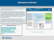
Any org type could register to do this task. SS06 Prepare for scoping ... MIP portal, single sign-on capability provides registered Citrix users access ...
| PowerPoint PPT presentation | free to download

Preliminary FIRMs provided when Cape Fear River Basin Study is complete. 90-day ... Cape Fear River Basin Plan will be finalized and distributed to impacted ...

A nationwide effort to create updated, modernized, digital flood ... FEMA.gov/plan/prevent/fhm (FEMA mapping site) FloodSmart.gov (flood insurance information) ...