PowerPointPrsentation - PowerPoint PPT Presentation
1 / 21
Title: PowerPointPrsentation
1
Institut für Softwaresystemein Wirtschaft,
Umwelt und Verwaltung
ISS
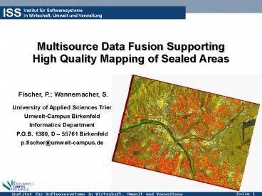
Multisource Data Fusion Supporting High Quality
Mapping of Sealed Areas
Fischer, P. Wannemacher, S.
University of Applied Sciences Trier Umwelt-Campus
Birkenfeld Informatics Department P.O.B. 1380, D
55761 Birkenfeld p.fischer_at_umwelt-campus.de
2
Motivation
- Dimension of new built-up areas in Germany
- 129 ha/day (1997 2000)
- 117 ha/day (2001)
- National plan reduction down to 30 ha/day (2020)
- actually 12,4 of the landscape in Germany is
dedicated to settlements and traffic - New built-up areas in Rhenania-Palatinate
- 54.000 m2/day (Statistical Survey Bad Ems, 2002)
- But only 40-60 of the areas mentioned above are
definitely sealed soils (Bodenschutzprogramm
Bayern 1991 Statistische Berichte 2002) - ? There is a lack in valid information regarding
quality and quantity of the sealed soils
3
Relevance of sealed area information
- Sealed areas
- are regions where the natural soil is covered
by buildings, roads, concrete, etc. so there is
no water infiltration possible anymore - ... deliver base data for the organisation of an
intelligent occupation of the landscape / soils,
e.g. - Questions regarding tolerable rise in settlement
density ? - parameter for the management of urbanized regions
regarding further develoment - ...
- ... deliver base information to environmental
modeling, regarding - Flood risk management
- Acquifer regeneration
- Urbanisation processes
- Protection of rare soil types
- ....
4
Objectives of the work
- Development of a method to quantify the sealed
areas in the state of Rhenania Palatinate (test
case River Rhine Valley) - Satisfaction of user requirements
- Repeatable analysis (High data availability over
space and time) - Scale of the resulting thematic map about
125.000 - automated analysis should be possible
- Low (better no) costs for data acquisition
focus on use of GeoData available in different
archives of the federal government
5
Region of Interest
Source CORINE Landuse
Source TERRA Aster
6
Methods to quantify sealed areas
- Terrestrial methods
- Land survey (z.B. landscape planning)
- Interviews (z.B. waste water management)
- EO-based methods
- Orthophotos (on-screen-digitizing)
- CIR-aerial photos
- airborne Scanners (e.g. HRSC)
- spaceborne Sensors
7
Potential of satellite Earth Observation Data
- Advantages
- Low cost data factor up to 4 with conventional
methods. - digital data, automated processing capabilities
- 3D information,
- frequent update of large regions, independent
from administrative borders, - objectivity and homogeneity of the data
- Disadvantages
- Often lack in geographical precision
- Very high resolution data with limited capacity
in automated operational analysis - Mixed signals
- Shadowing effects
- ....
8
Civil Satellite-Missions (01/2004)
recently 109 civil EO-missions available
(historical and recent)
9
Key parameter in EO-data processing Vegetation
Index
- Assumption vegetated areas are in general
complementary to sealed areas - Calculation of the vegetation index via ratioing
of red/infrared band
10
Potential of GeoData 1 (landsurvey information)
- ATKIS (Authoritative Topographic-Cartographic
Information System) is developed by the surveying
authorities of the states of the federal republic
of Germany (AdV). - Components are object-based digital landscape
models (DLM) and digital topographic maps with a
high positional- (horizontal /- 3 m, vertical
/- 0,5m) and semantic accuracy. - The coverage is nationwide with an update cycle
of 5 years.
IKONOS-PAN (1m resolution)
Overlayed with ATKIS landuse
11
ATKIS Object-Model
- Usage of ATKIS Objekt-model to define areas
where we expect sealed soils (sealing masks)
12
Potential of GeoData 2 (cadastral information)
- Availability of a digital cadastral information
- system (ALK)
- High geometric accuracy ( lt 5 cm)
- But...
- Database not up-to-date
- Partially incomplete (e.g. missing of newly
created buildings) - Lack in relevant information (e.g. sealed parking
lots) because of a reduction of the object-types
to be monitored (reduction of the OBAK-LiKa-RP) - ? Sealing information of the ALK ltlt Reality
13
Fusion of EO- GeoData
- ... will reduce misclassifications of EO-Data
- ... is able to update the GeoData available
14
Multisource Sealed Area Detection
ATKIS Mask (SUV)
Overlay
ALK Mask (sealed)
Resulting areas with need in EO-Data analysis
Traffic net (sealed)
- EO data analysis limited to ATKIS masks
(encircling sealing activities) with exeption of
the available building vectors (cadastral
information) and the traffic net (accurate
sealing info available) - Maximum use of sealed information available in
GeoDatabase - Reduction of possible misclassifications in EO
data processing (sensitive feature extraction)
15
Processing Chain
16
Ex. NDVI combined with Settlement Mask
- SPOT-5 NDVI
- NDVI and ATKIS settlement mask
17
Classified NDVI with ALK Buildings
18
Results City of Mainz, Kaiserstrasse
19
Comparison of different information sources
- ATKIS generalized geometry but semantic
information about landuse available no
information about the degree of sealing - Multisource approach more detailed geometry,
sealing and ATKIS feature information available - Field Mapping generalized geometry with averaged
sealing related info
Multisource
Field Mapping
ATKIS - GeoData
20
Results Visualisation and Environmental Atlas
- Visualisation and delivery of the sealed data on
a pixel base or aggregated to administrative
units - http//www.umweltatlas-rlp.de
21
Conclusions and Outlook
- Conclusions
- Good reproductability of the results
- High spatial resolution
- High data availability in federal administration
- Low percentage of misclassifications ( 5
compared with ground trouth data) - ... but difficulties to get high quality high
resolution EO-data on demand - Processing chain not fully automised
- Future work
- Development of a method to replace Satellite data
by Orthophotos - Improvement of automatised processing


