
Land use and transportation - PowerPoint PPT Presentation
1 / 80
Title:
Land use and transportation
Description:
Land use and transportation. Ground transportation: modeling roads vs. rail and ... Consider a place as both origin and destination. Accessibility changes land ... – PowerPoint PPT presentation
Number of Views:73
Avg rating:3.0/5.0
Title: Land use and transportation
1
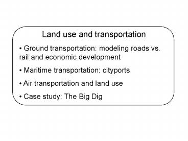
- Land use and transportation
- Ground transportation modeling roads vs. rail
and economic development - Maritime transportation cityports
- Air transportation and land use
- Case study The Big Dig
2
- Land use and ground transportation
- Context and change
- General theories
- Predicting LU/transportation interactions
- Roads vs. rail
3
- The context
- Analyzing a moving target
- Technological changes
- Geographical scale
- Site and situation
4
- Transportation, land use, and accessibility
- More travel opportunities
- Decreased cost or time
- Consider a place as both origin and destination
- Accessibility changes land uses via price
- Agricultural, residential, retail, industrial,
office - Interaction of land prices and zoning
5
- Transportation, land use, and accessibility
- Land use thus determines activity patterns
- Density (shorter, faster trips)
- Mixed-use development (ditto)
- Neighborhood design
- Distance to transit
6
- Transportation, land use, and accessibility
- And activity dictates transportation demands
- Modal choice (slower may be better)
- Number of trips, length of trips
- Congestion, ridership
- Location of infrastructure
- Land use accounts for 1/3 of travel behavior
7
- Models of transportation and land use
- Urban economic theory bid rent curves
8
- Models of transportation and land use
- Urban economic theory bid rent curves
9
- Models of transportation and land use
- Gravity-based models
- Consider the attraction between two places
- Consider the distance between them
- Economic equilibrium models
- Consider rational choices of individuals
10
- Example Sacramento, CA
- Study to compare transportation only and
transportation-land use (integrated) models - Population near 2 million, growing 2 per year
- Medium- to low-density
- Work trips 76 alone, 17 carpool, 4 walk or
bike, 3 transit
11
Basic integrated model
MEPLAN (used in Sacramento)
Start here
12
- Sacramento model inputs
- 11 categories of jobs
- 3 levels of household income
- 7 categories of land use
- 32 zones of analysis
- No good measure of goods movement available
13
- Sacramento scenarios
- Base case (no-build)
- Light rail
- Advanced transit
- TOD (transit-oriented development)
- HOV lanes
- HOT lanes
- Pricing policies
- Combinations thereof
14
- Results of MEPLAN
- HOV lanes reduce trips, increase VMT
- Pricing most effective at reducing trips
15
- Results of MEPLAN
- HOV lanes encourage leapfrogging
- Transit (and subsidies) encourage TOD
16
- Conclusions for Sacramento
- Models produced similar results, different
magnitude - Including land use allows for feedback
- Less congestion means longer trips
- Data-intensive and thus costly
- Net economic benefits can hide inequity
17
- Limitations to transportation-land use models
- How do you compare to a no-build?
- Long and interwoven time frames
- Data-intensive simplicity vs. accuracy
- The chicken and the egg causality
18
- Land use and maritime transportation
- Ports and cityports
- The anyport model (Rotterdam)
- Port expansion (San Fran/Oakland)
19
- Ports and cityports
- Historical focus of the city
- Four components to a port
- Maritime access (harbor)
- Maritime interface (coastline)
- Infrastructures (quays, docks, cranes)
- Land access (roads, rail)
20
- Anyport model
- Changing function and location of port
- First stage Primitive/medieval
- Center of city
21
- Anyport model
- Second stage Expanding cityport
- Colonies, hinterlands help growth
- New, larger docks built adjacent
22
- Anyport model
- Third stage Modern industrial city
- Rail, industry help growth
- New berths necessary
23
- Anyport model
- Fourth stage Specialization
- Containerization requirements
- Separate location from city
24
- Anyport model
- Fifth stage Redevelopment
- Original location(s) obsolete
- Entertainment, housing, office
25
(No Transcript)
26
(No Transcript)
27
(No Transcript)
28
(No Transcript)
29
(No Transcript)
30
- Port expansion
- Expansion of infrastructure
- More and larger berths
- Both require more land
- Environmental consequences
- Pollution (noise and air)
- Dredging
- Congestion
31
(No Transcript)
32
San Francisco, 1960s
San Francisco, 2000s
33
Oakland, 1935
Oakland, 1968
Oakland, 2000
34
Airports and the Transportation-Land Use
Connection Julie CidellDepartment of
GeographyCSU-San Bernardino
- Background on airports and land use
- How do we measure airport noise?
- What impact does airport noise have on land use?
- OHare and residential land use in Chicago
35
Transportation and land use
- Historical connections
- Ports and cities
- Railroads and the Great Plains
- Roads and suburban sprawl
- What about air transportation?
36
Transportation and land use
- Circular and cumulative causation
- Transportation increases accessibility
- Accessibility causes land prices to change land
use occurs based on land prices - Land uses determine when and where people travel
(activity patterns) - Activity patterns determine the demand for
transportation
37
Transportation and land use
- Does this work for air transportation?
- Private providers of transport
- Large-scale network, long distances
- Generally one airport per city
- Local land uses are airport-driven
- But regionally, it depends on the city
38
Airports and economic development
- Regional economic development
- More airline service, more jobs
- Especially more high-tech jobs
- Local economic development
- Standard theories dont look locally
- Jobs tend to go where they would otherwise
- May actually be a negative effect on jobs and
housing
39
Airports and environmental impact
- Air and water pollution
- NOx, ozone, glycol
- Hard to pick out air pollution from urban
background - Water pollution relatively easy to fix
- Noise pollution
- Based on number, type of aircraft
- Based on land uses nearby
40
Airports and noise
- Noise contours
- Determined by federal legislation (Part 150)
- Mathematical model includes number and type of
aircraft, where and when they fly, weather
conditions, etc. - Day-night level (DNL)
- Noise averaged over all 24 hours
- 65 DNL the critical level (vacuum cleaner)
41
(No Transcript)
42
- My question How have land uses changed over time
around OHare Airport in Chicago? - Busiest airport in the world
- Half built-up before airport, half later
- In the middle of expansion debate
- Familiar with area
43
Chicago and OHare International Airport
- Operated by City of Chicago
- Attached by annexation (bordered by suburbs)
- History
- Douglas aircraft plant in WWII
- Replaced Midway with jets
- Last expansion 1971
44
I-294
I-90
I-290
45
Land Use Around OHare
- Suburbs to east and south generally built first
- Cities to north and west generally after the
airport - Overlay using GIS
- Noise contour (65 DNL)
- Residential land uses
- Topographic maps
- City zoning and land use maps
46
(No Transcript)
47
Land use compatibility index
- 1) 1990 housing inside 65 DNL
- 0 points more than 60
- 1 point between 20 and 60
- 2 points less than 20
- 2) 1950 to 1990 change in of housing units
inside 65 DNL - 0 points more than 5 increase
- 1 point little change
- 2 points more than 5 decrease
- 3) Percent of housing in 65 DNL built since 1970,
compared to entire city - 0 points more than 5 higher
- 1 point little change
- 2 points more than 5 lower
48
(High)
49
Does compatibility airport support?
- Two airport-related organizations of cities
- OHare Noise Compatibility Commission
- Suburban OHare Commission
- Almost complete negative correllation between
municipal support and land use compatibility
50
ONCC (pro-airport) SOC (anti-airport)
51
Conclusions from Chicago
- Land use compatibility has more to do with
geography than with planning - Size and age of municipality
- Changing airport layout
- Land use compatibility does not match municipal
political views - Economic benefits are not necessarily regional
52
So what?
- Not just accessibility, but equity
- Chicagos current expansion plan
53
(No Transcript)
54
So what?
- Not just accessibility, but equity
- Chicagos current expansion plan
- Politics and history matter a lot
- Examine arguments for expansion more carefully
- At what scale is airport expansion an issue?
55
The Big Dig
- Bostons Central Artery/Tunnel (CA/T) Project
56
- "In a nutshell, the Big Dig is the reconstruction
and construction of two sections of interstate
highway, nearly eight linear miles, running
through the heart of Boston. Half of these miles
are underground or underwater, tunneling beneath
the mucky bottoms of harbors, dodging a maze of
subway lines, building foundations, old wharves,
and other obstacles. Many parts of the highway
are 12 lanes wide. That works out to 161 lane
miles of superhighway in tunnels, bridges,
viaducts, and surface roads" (McNichols 10).
57
(No Transcript)
58
Three things to know about Boston
- Rearranging the landscape is not only possible,
but has a long history - Transportation is very important and
- Keeping communities and historic sites intact
despite transportation infrastructure is more
important.
59
(No Transcript)
60
(No Transcript)
61
(No Transcript)
62
(No Transcript)
63
(No Transcript)
64
- History of protests
- Central Artery
- Inner Belt
- Logan Airport
65
(No Transcript)
66
Timeline 1983 Apr. Work begins on
EIS 1987 Apr. Congress approves scope and
funding 1990 Nov. Congress allocates 755
million 1991 Jan. MOEA approves FEIR (except for
bridge) May FHWA approves EIS Dec. Constructi
on begins (on tunnel) 1992 Oct. First contract is
completed (hooray!) 1993 July DEIS/DEIR for
bridge filed 1994 Mar. MOEA approves bridge
EIR June FHWA approves bridge EIS
67
Timeline 1995 Aug. Construction for underground
I-93 begins Dec. Tunnel opens to commercial
traffic 1999 Oct. Storrow Connector
opens 2003 Jan. I-90 connector to Logan Airport
opens Mar. Northbound tunnel opens, including
bridge Dec. Southbound tunnel opens 90
done 2004 Dec. Projected removal of Central
Artery
68
Mitigation/Outreach
- Two main types
- Reducing community impact
- Keeping the roadway and city functioning
- And three categories
- Traffic (detours, signage)
- Community outreach
- Environmental issues
- About a third of the total budget
69
The Leonard P. Zakim Bunker Hill Bridge
70
The Big Dig has issues
- On budget, on time! (yeah, right)
- Labor scandals
- Cost overruns
- Utility lines
- Freezing the ground
71
Cost overruns
72
Cost overruns
73
Cost overruns
74
Utility lines
75
Utility lines
Undercutting the Artery
76
Utility lines
Freezing the ground
Undercutting the Artery
77
On the Bright Side
- Public outreach has worked
- Tours, lectures
- Marketing
- Books, art exhibitions
- Consumer goods
78
(No Transcript)
79
Whats next?
- Possible future options
- 27 acres available in the heart of downtown for
redevelopment - 27 acres of green space in the heart of downtown
- Some combination thereof?
80
(No Transcript)
Recommended
CrystalGraphics Presentations


