Diapositive 1 - PowerPoint PPT Presentation
1 / 27
Title:
Diapositive 1
Description:
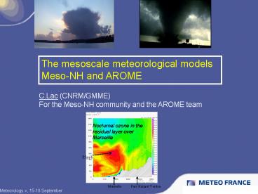
The mesoscale meteorological models Meso-NH and AROME ... Parc Naturel Verdon. Marseille. 85ppb. Nocturnal ozone in the residual layer over Marseille. Outlook ... – PowerPoint PPT presentation
Number of Views:72
Avg rating:3.0/5.0
Title: Diapositive 1
1
The mesoscale meteorological models Meso-NH and
AROME
C.Lac (CNRM/GMME) For the Meso-NH community and
the AROME team
Nocturnal ozone in the residual layer over
Marseille
Astronomy meets Meteorology , 15-18 September
2
Outlook
- Introduction General consideration on
meteorological predictions - Overview of meso-scale models
- Meso-NH From meso-scales to Large Eddy
Simulations. - The new operational meso-scale model AROME
3
Space and time scales
4
On the importance of the resolution
- Prognostic variables of the model are mean
variables on the grid box
5
Processes that need to be parametrized
6
What kind of models ?
- All these kinds of models need different level of
parametrization - Climate models and Global weather prediction
All the physics parametrized - Mesoscale models Convection (deep) resolved.
- Large Eddy Simulation. The most energetic eddies
in turbulence are resolved, but it still needs to
parameterize small-scale turbulence, radiation,
microphysics.
7
Mesoscale models
8
Meso-NH model
A research model, jointly developped by
Meteo-France and Laboratoire dAérologie
(CNRS/UPS)
40 users laboratories
http//mesonh.aero.obs-mip.fr/mesonh/
1. Recent improvements in the dynamics 2. Focus
on the turbulence . Importance of the surface
coupling.
9
2D test case of orographic trapped waves
t 5000 s
Horizontal wind
Vertical velocity
New advection schemes
Turbulent Kinetic Energy
Cloud
A typical situation for optical turbulence
T.Maric
10
Diurnal cycle of boundary layer height
Buoyancy effects
11
General principles of the turbulence scheme
gt0 in convective lt0 in stable
12
CONVECTIVE BOUNDARY LAYER with LES Water vapor
variability - Couvreux et al. (2005)
S(qv)lt0
. . max (pdf) _ min (pdf)
DxDy 100m, Dzlt50m, Dt7h
13
STABLE BOUNDARY LAYER
Difficulty to simulate due to local circulations
(drainage flows), intermittent effects (gravity
waves), low level jets (LLJ).
14
Results (I) Mean profiles
- The maximum of the wind and the
- height are well captured
- The LLJ height coincides with the
- inversion height
- The surface temperature obtained from
- the LES cools down much more than
- the observations
M.A. Jiménez Universitat de les Illes Balears
15
STABLE BOUNDARY LAYER Comparison MesoNH/MM5 at
meso-scale
4H
23H
?x 1km, ?zmin 3m, 86 lev.
23H
4H
Obs.
A strongly stable night
MM5
Meso-NH
4H
23H
23H
4H
Bravo et al., 2008
16
On the importance of the surface coupling for the
turbulence
17
The SURFEX (SURface Externalized) land surface
scheme
see P.Le Moignes presentation
18
Atmospheric CO2 modelling May 27 2005
Boundary layer heterogeneity
Sarrat et al.(2007a)
19
(No Transcript)
20
A recent improvement in SURFEX the CANOPY scheme
(Masson, 2008)
- 1D Surface Boundary Layer scheme, with 6 added
levels between the first atmospheric level and
the surface - An added term for U, q, q, TKE
- T2m becomes pronostic
21
AROME (Applications of Research to Operations at
MesoscalE)
- Almost-current operational meso-scale system
(2.5km) with data assimilation (P.Brousseaus
talk) - Dynamics from ALADIN-NH
- Physics from Meso-NH
22
Objectives of AROME
- Expected to improve heavy precipitation
forecasts with strong emphasis on Mediterranean
flash-floods - Prediction of local events (fog, breeze, urban
effects, orographic) - Applications chemistry, hydrology, fog, ocean,
roads - A complex data assimilation system (further
details in P.Brousseaus presentation)
23
Diurnal convection (2)
Obs radar
24
Cloudiness
- Total cloudiness
- AROME 12 h
- vs Sat Vis
25
Model performance low-level scores
- objective scores of AROME-France using French
automatic surface obs network (hourly data every
30km)?
10m windspeed
MSL pressure
Rmse Arome
Rmse Aladin
Rmse Arome
Rmse Aladin
Bias Arome
Bias Arome
forecast range (h)?
forecast range (h)?
Bias Aladin
Bias Aladin
2m Temperature
Rmse Arome
Rmse Aladin
Scores over France on 3 months Nov07-Jan08
(Arome in pink)
Bias Arome
forecast range (h)?
Bias Aladin
26
Conclusion
27
Thank you for your attention


