
The CEOS Working Group on Calibration and Validation - PowerPoint PPT Presentation
1 / 47
Title: The CEOS Working Group on Calibration and Validation
1
The CEOS Working Group on Calibration and
Validation
WGCV Working Group on Calibration Validation
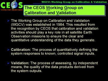
- The Working Group on Calibration and Validation
(WGCV) was established in 1984. This resulted
from the recognition by CEOS that calibration and
validation activities should play a key role in
all satellite Earth Observation missions to
ensure the clear and quantitative understanding
of the data they generate. - Calibration The process of quantitatively
defining the system responses to known,
controlled signal inputs. - Validation The process of assessing, by
independent means, the quality of the data
products derived from the system outputs.
2
CEOS WGCV Subgroups
WGCV Working Group on Calibration Validation
- Synthetic Aperture Radar (SAR)
- Chair Dr. S. Srivastava, CSA
- Infrared Visible Optical Sensors (IVOS)
- Chair Dr. N. Fox, NPL
- Microwave Sensors
- Chair C. Buck, ESA
- Terrain Mapping (TM)
- Chair Prof. J. Peter Muller, UCL
- Land Product Validation (LPV)
- Chair Dr. F. Baret, INRA
- Atmospheric Composition (ACSG)
- Chair Dr. E.Hilsenrath, NASA
WGCV (NASA)
SAR (CSA)
IVOS (NPL)
MS (ESA)
TM (UCL)
LPV (INRA)
ACSG (NASA)
3
BackgroundInteroperability is Crucial to GEOSS
- In the implementation of GEOSS, harmonization of
observations, integration of information from
in situ, airborne and space-based observations
through data assimilation and models, and early
detection of significant and extreme events will
be advocated. - The success of GEOSS will depend on data and
information providers accepting and implementing
a set of interoperability arrangements, including
technical specifications for collecting,
processing, storing, and disseminating shared
data, metadata, and products. - (from the GEOSS 10 yr.
Implementation plan)
4
BackgroundInteroperability is Crucial to GEOSS
- GEOSS interoperability will be based on
non-proprietary standards, with preference to
formal international standards. - Interoperability will be focused on interfaces,
defining only how system components interface
with each other and thereby minimizing any impact
on affected systems other than where such
affected systems have interfaces to the shared
architecture - (from the GEOSS 10 yr. Implementation plan)
5
Background GEOSS Architecture
- Earth System Models
- Oceans
- Ice
- Land
- Atmosphere
- Solid Earth
- Biosphere
Predictions
Societal Benefits
High Performance Computing, Communication,
Visualization
Decision Support Assessments Decision Support
Systems
- Earth Observation
- Systems
- Remotely sensed
- In situ
Standards Interoperability
Observations
From The Architecture of GEOSS (GEO4DOC 4.1 2
April 5, 2004)
6
Background GEOSS Information Flow
- Earth System Models
- Oceans
- Ice
- Land
- Atmosphere
- Solid Earth
- Biosphere
Predictions
Societal Benefits
High Performance Computing, Communication,
Visualization
Decision Support Assessments Decision Support
Systems
- Earth Observation
- Systems
- Remotely sensed
- In situ
Standards Interoperability
Observations
7
GEOSS Information Architecture
The WGCV GEOSS Information Pyramid
Cal/Val strengthens the base as shown in the
following slides
Societal benefits
Decisions policy management
Recommendations
Decision support Assessments and Systems
Predictions
Earth System Models Atmosphere, Oceans, Ice,
Land/Biosphere
Data, Standards and Interoperability
Earth Observation Systems
Remote Sensing observations
In situ surveys and measurements
8
Background Components of GEOSS Architecture
Global Earth Observation System of Systems
Observation Component
Data Processing Component
Data Exchange and Dissemination Component
- GEOSS architecture builds incrementally on
existing systems to create a distributed system
of systems, incorporating - an observation component
- a data processing and archiving component
- a data exchange and dissemination component
From The Architecture of GEOSS (Global Earth
Observation System of Systems) GEO4DOC 4.1 (2)
4.5.2004
9
Background Components of GEOSS Architecture
Global Earth Observation Individual System
Observation Component
Data Processing Component
Data Exchange and Dissemination Component
- GEOSS architecture builds incrementally on
existing systems to create a distributed system
of systems. WGCV activities contribute to the
following GEOSS components - Observation component
- Data processing and archiving component
- To ensure
- data and products interoperability, exchange and
dissemination
10
Inadequate Cal/Val in GEOSS Architecture
Global Earth Observation System of Systems
Observation Component
Data Processing Component
Data Exchange and Dissemination Component
Observation Component
Data Processing Component
Data Exchange and Dissemination Component
Observation Component
Data Processing Component
Data Exchange and Dissemination Component
Observation Component
Data Processing Component
Data Exchange and Dissemination Component
Whats missing in this scenario?
A simplistic view of a System of Systems results
in the need to deal with potentially disparate
information forcing policy makers to choose
their outcomes.
11
WGCV contribution to GEOSS Architecture
Global Earth Observation System of Systems
Observation Component
Data Processing Component
Data Exchange and Dissemination Component
Observation Component
Data Processing Component
Data Exchange and Dissemination Component
Observation Component
Data Processing Component
Data Exchange and Dissemination Component
Observation Component
Data Processing Component
Data Exchange and Dissemination Component
Calibration / Validation Component
Role of WGCV in a true System of Systems where
the operating space must cut across individual
Systems to provide integrated data for decision
models
12
Inadequate Cal/Val in GEOSS Architecture
Global Earth Observation System of Systems
Observation Component
Data Processing Component
Data Exchange and Dissemination Component
Observation Component
Data Processing Component
Data Exchange and Dissemination Component
Observation Component
Data Processing Component
Data Exchange and Dissemination Component
Observation Component
Data Processing Component
Data Exchange and Dissemination Component
Calibration / Validation Component
Inadequate integration of data sources can lead
to disparate model outcomes, introducing
uncertainty into the decision process
13
Establishing Calibration and Validation
guidelines is a necessary ingredient in achieving
Data Interoperability
- WGCV proposes to establish Calibration and
Validation guidelines, to ensure interoperability
of GEOSS member satellite data sources, based on
the current space agencies collaboration
agreements, common formats and standards. - WGCV proposes that all GEOSS partners participate
in the establishment of the following common
practices - Document the methodologies used to derive and
further process satellite measurements. - Create and maintain, in conjunction with WGISS,
an internet-accessible information database
containing, on an instrument or satellite basis,
links to all instrument characteristics needed
for insuring inter-operability. - Provide/publish Cal/Val reference methods in a
readily accessible form. - These activities will ensure that the various
data are integrable.
14
Elaboration Components of GEOSS Architecture
The high level GEOSS architecture is a
componentization of a structure required to
accomplish the GEOSS objectives which is
consistent with the structure of most
contemporary Earth Observing data systems. There
is a need to define the components of GEOSS
functionality required to enable the fulfillment
of GEOSS objectives through this architecture.
15
Further elaboration Components of GEOSS
Functionality
GEOSS Technical Task Areas
GEOSS Data Quality Framework
Data Compliance with Interoperability Requirements
User Community Dissemination
The high level GEOSS functionality
componentization introduces a structure whch
ensures accomplishment of required GEOSS
objectives within the proposed GEOSS
architecture. There is a need to specify
functionality for the components of GEOSS
architecture to enable the fulfillment of GEOSS
objectives through this architecture.
These components are designed to ensure data
integrability and interoperability.
16
WGCV Proposal
Instrument characteristics (Radiometry, Spectral
resolution, Geometry)
Sensor Intercomparison Satellite data, in-situ
measurements, and metadata
Reference Methods and protocols (Cal./Val
Techniques)
Compliance with Interoperability Requirements
Global standards, Global products, Global
information base for management decisions
Users (Commercial Community, Operational Agencies
and Policymakers)
17
WGCV Proposal
WGCV Propose GEOSS Cal/Val Data Framework
Sensor Intercomparison Database Satellite data,
in-situ measurements, and metadata
Diagnostic sites (land/sea/atmosphere)
Calibration Metrics
Ancillary information networkse.g. AERONET
Database In-situ data
Database Sensor data
18
WGCV Working Group on Calibration Validation
Conclusion The WGCV White Paper entitled Data
Quality Guidelines for Satellite Sensor
Observations Relevant to GEOSS Calibration and
Validation Issues outlines an approach to ensure
the quality assessment of space-borne instrument
data in the context of a service driven global
operational Earth observation remote sensing
system.
19
WGCV Working Group on Calibration Validation
Conclusion (Continued) This approach exploits
ongoing work and available expertise among the
CEOS working group members, and provides a
mechanism for further development over the
10-year timescale of the GEOSS Implementation
Plan. The White Paper is a living document and
will be available on the WGCV website
at http//wgcv.ceos.org/
20
WGCV Working Group on Calibration Validation
WGCV Vicarious Calibration Strategy
Lake Frome
Arizaro/Barreal Blanco
RR Valley
21
WGCV Working Group on Calibration Validation
WGCV Validation Site Strategy
Forests
Agriculture
Minerals
Deserts
Grasslands
Glaciers
Australia
Canada
United States
Argentina
Sahara
Antarctica
22
WGCV Working Group on Calibration Validation
Sample Calibration Strategy based on EO-1 ALI and
Hyperion Calibration
- Prelaunch
- Calibrate and characterize (component and system
level) - Characterize the calibration and characterization
- Postlaunch
- Lamps
- Solar
- Lunar (astronomical)
- Vicarious
- Special Targets (limb scanning, active
illumination) - Statistical (trending, 90 yaw)
- Direct comparison against other satellites
23
EO-1 ALI CALIBRATION MEASUREMENT MATRIX
PRIMARY MEASUREMENT
SECONDARY MEASUREMENT
P-6
24
Solar Calibration
ALI
Diffuser
Solar Beam
Aperture Selector
Secondary
Cover
Scattered Light
25
Extra-terrestrial calibration! (Views with the
EO-1 ALI Pan band)
Venus
Half Moon
Jupiter
Saturn
Full Moon
26
Extra-terrestrial calibration! (Views with the
EO-1 ALI Pan band)
The Pleiades
Photograph ALI detections
27
Radiometric Calibration
- Lunar Calibration
- Calculate Lunar spectral irradiance (EM(?))
- Compare to the USGS Robotic Lunar
Observatory lunar
irradiance model - Intersatellite Comparison
- Landsat 7
- Sites Compared
- CA Super Site Jan 2001
- Railroad Valley Jan 2001
- Lake Frome Jan 2001
- Compared Bands 1, 2, 3, 5, 7 due to similarity of
spectral responses - Terra comparisons forthcoming
28
Image Quality (Edge Sharpness)
Lunar Image Expanded by a Factor of 8
Horizontal Slice Through Expanded Lunar Image
Rise and Fall About 1 Pixel in Normal Image.
29
.
Focus Lunar Edge
.
.
.
.
.
.
.
.
.
.
.
30
ALI versus ETM Local Geometry
Maricopa July 27, 2001 (
DOY208)
ETM
L1G
band 1
ALI
L1R
band 2
31
Atwood State Wildlife Area
EO-1 ALI Sterling, Colorado Jan 7, 2001
Traces of snow and the regular geometric patterns
of cultivated fields are evident in this 23 KM
wide image obtained under PPT pitch control south
of Sterling.
32
Hyperion Characteristics
Consistent with Pre-Launch Calibration or not
measured
33
Post Launch MTF Approach
- Calculate cross-track and in-track MTF using a
step response and impulse response example - Results of on-orbit analysis give good agreement
with the pre-launch laboratory measurements
34
Example Cross-track MTF
- Scene is Port Eglin from Dec 24, 2000. Bridge is
the Mid-bay bridge . Bridge width is 13.02
meters. - Bridge angle to the S/C direction is small so
every 5th line is used to develop the high
resolution bridge image. - MTF result at Nyquist is between 0.39 to 0.42
while the pre-flight measurement was 0.42.
35
Special targets for characterization
Planets -Venus
Searchlights -California
Gas Flares -Moomba
90 deg Yaw
36
Hyperion Spectral Calibration atmospheric
absorption lines
Hyperion Spectra red Atmospheric Reference
black Diffuse Reflectance of cover blue
37
EO-1 Accelerated Mission Southern
Hemisphere Field Campaigns January February 2001
Australian Test Sites
Argentine/AVIRIS Sites
38
Lake Frome Calibration Site
39
(No Transcript)
40
(No Transcript)
41
(No Transcript)
42
Instrument deployment coincident with EO-1 ALI
and Landsat7 ETM overpasses
43
Venice field site
44
Ground Truth Site Lake Frome, Au
Ground Measurements
Atmosphere Measurements
MS 3-2-1
MS 8-7-6
EO-1 ALI MS 7-5-5p
EO-1 ALI MS 3-2-1
45
EVEOSD Vegetation Sampling
46
Field Data Collection
47
WGCV Working Group on Calibration Validation
Thank you! If you wish to contribute to WGCV-26
to be held in Chieng Mai, Thailand from 31
October through 1 November, 2006, please email me
at Stephen.Ungar_at_nasa.gov (copy
pcampbel_at_pop900.gsfc.nasa.gov)
Recommended
CrystalGraphics Presentations


