
Trilateration PowerPoint PPT Presentations
All Time
Recommended

Adjustment of Trilateration Introduction For a brief period of time, trilateration was a highly effective method of establishing horizontal control coordinates.
| PowerPoint PPT presentation | free to download

TULIP Trilateration Utility for Locating IP addresses Presented By Faran Javed BIT-5 Project Committee Motivation Dynamic Geolocation solely based on delay measurements.
| PowerPoint PPT presentation | free to download

... efficient method combining photogrammetry and field triangulation/trilateration ... Data acquisition for distance-dependant growth models ...
| PowerPoint PPT presentation | free to download

MIT Computer Science & Artificial Intelligence Laboratory. MIT Dept. of Mechanical Engineering ... Science & Artificial Intelligence Laboratory. Alexander Bahr ...
| PowerPoint PPT presentation | free to view

Nodes with defined location after indirect trilateration (ITL) ... Statistical estimation of location of nodes with unknown positions, and radio ...
| PowerPoint PPT presentation | free to view

VOR Base Stations for Indoor 802.11 Positioning (Badrinath etal, Rutgets) ... Use range based trilateration to augment the angles only positioning ...
| PowerPoint PPT presentation | free to view

Newton: 'Absolute, true, and mathematical time , in and of ... Receptor imitates. 4 satellites. trilateration. Llu s Galbany - IFAE thursday meeting 3rd May 22 ...
| PowerPoint PPT presentation | free to view

University of Wyoming, Computer Science Department, Laramie, Wyoming, ... William M. Spears, Jerry C. ... Oscilloscope snapshot. RF arrival time. Sound ...
| PowerPoint PPT presentation | free to view

Test data set collection beginning early July, repeated at intervals ... Prototype SR survey tool September. 4. Actual Schedule ...
| PowerPoint PPT presentation | free to download

Focus Tracking System provides a wide range of cost effective and reliable real-time GPS tracking systems, devices and trackers for vehicles, cars, bikes and bus personal use.
| PowerPoint PPT presentation | free to download

Focus Tracking System provides a wide range of cost effective and reliable real-time GPS tracking systems, devices and trackers for vehicles, cars, bikes and bus personal use.
| PowerPoint PPT presentation | free to download

Arial Calibri Wingdings Times New Roman Default Design Bitmap Image GLOBAL POSITIONING SYSTEM FOR ... AIR NAVIGATION GPS IN COCKPIT ...
| PowerPoint PPT presentation | free to view

and phase between data capturing), resolution and intentional addition of obstacles. ... This is partly due to the fact that there isn't a standard watermarking ...
| PowerPoint PPT presentation | free to view

The Global Positioning System (GPS) is a worldwide radio-navigation system ... How Stuff Works. http://electronics.howstuffworks.com/gps1.htm ...
| PowerPoint PPT presentation | free to view

Digitizing from paper maps. Scanning. Photogrammetry. Remote sensing ... Hawaii. Colorado Springs. Control Segment. T. Transmits information. Control Segment ...
| PowerPoint PPT presentation | free to view

Fine-Grained Localization in Sensor and Ad-Hoc Networks Ph.D. Dissertation Defense David Goldenberg Dissertation Advisor: Y. Richard Yang Committee Members: Jim ...
| PowerPoint PPT presentation | free to download

Illustration of phase transition. Probability that Gn(r) is k-connected or globally rigid ... localizable in a sort of decentralized fashion. Rennes 081004. 47 ...
| PowerPoint PPT presentation | free to view

Ad hoc and Sensor Networks Chapter 9: Localization & positioning Holger Karl Goals of this chapter Means for a node to determine its physical position (with respect ...
| PowerPoint PPT presentation | free to view
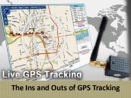
When most people of think of GPS tracking, they automatically think of the automotive industry. But, GPS trackers are used across several different areas including on airplanes, on ships, and even on people.
| PowerPoint PPT presentation | free to download

Autonomous Data Exchange in MultiRobot Collectives
| PowerPoint PPT presentation | free to view

Global Positioning Systems and GIS An Introduction Tom Vought and Katie Franke
| PowerPoint PPT presentation | free to view

December 3-4, Green Bank. GBT PTCS In Progress Review. Laser Rangefinder ... focus at source near NCP 'Track' at 360 ... parts nearing obsolesence (IRIG, ...
| PowerPoint PPT presentation | free to download

Consists of 24 operational satellites. Provides specially coded satellite signals that ... Source: Garmin GPS Guide for Beginners. GPS position 3 satellites ...
| PowerPoint PPT presentation | free to view

... in the same direction Mounting in a set of gimbals allows us to measure the rotation of the body Tuning Fork Gyroscope Vibrating Ring Gyroscope w ...
| PowerPoint PPT presentation | free to view

Falcon AFB. Hawaii. Ascension. Island. Kwajalein. Marshall Islands. Diego Garcia ... How much is Falcon AFB distorting the signals? Differential Positioning ...
| PowerPoint PPT presentation | free to view

... Optische und hybride Verfahren F r sub-dm Genauigkeit bleiben ... On-the-fly Ambiguity Resolution for the Locata Positioning System, Master ...
| PowerPoint PPT presentation | free to view

(www.3g.co.uk) Advanced Forward ... Wifi Positioning System Skyhook Wireless has been driving the country mapping out WiFi hotspots ... Has database of 16.5 million ...
| PowerPoint PPT presentation | free to view

Developed by the US Dept of Defence. These satellites launched from 1978-1994 ... and info to Master Control Station at Falcon Air Force Base in Colorado Springs ...
| PowerPoint PPT presentation | free to view

Estimate the location of itself from the relationship of distance to beacon nodes ... Broadcast(flags, location(if any)) If 3 nbrs with location or 3 nbrs ...
| PowerPoint PPT presentation | free to view

DataGrid WAN Monitoring Infrastructure (DWMI) Terapaths Monitoring Project ... ViPER - Visualization for PingER. AMP PingER Integration. PingER Executive Plots ...
| PowerPoint PPT presentation | free to download

Hong Kong Principal Datum (HKPD) all heights and levels on land. relationship to mean sea level. ... Another map produced by Tate and Newland in DD Survey 1899-1904. ...
| PowerPoint PPT presentation | free to view

Radio interference. Approaches to. Autonomous Control. Vision. Interactive & dynamic response ... Add manual override radio control. Implementation for. Mini-Project ...
| PowerPoint PPT presentation | free to view

Geolocation Technologies Suitable to Meet Regulatory Requirements for TV White Spaces Authors: Abstract This tutorial is to be presented during the IEEE 802 Plenary ...
| PowerPoint PPT presentation | free to download
... based Mobile Positioning Technology - Position of target ... SS7/Mobile IN Technologies for Positioning - leverage the SS7 and ... Interrogation (ATI) ...
| PowerPoint PPT presentation | free to download

Obtain positions for all nodes while only knowing those of a small fraction of nodes. ... When there are only a fraction of the sensors in the network know ...
| PowerPoint PPT presentation | free to view

What is GPS? ... gps basics
| PowerPoint PPT presentation | free to view

With time of flight (ToF) measurements, multipath fading results in peak correlation shifts ... One type is small, cheap and computationally limited ...
| PowerPoint PPT presentation | free to view

Geolocation Technologies Suitable to Meet Regulatory Requirements for TV White Spaces Authors: Abstract ... It can allow for some indoor operation.
| PowerPoint PPT presentation | free to download

MAGGIE NIIT- SLAC. On Going Projects. Measurement & Analysis of Global Grid & Internet ... DataGrid WAN Monitoring Infrastructure (DWMI) Terapaths Monitoring Project ...
| PowerPoint PPT presentation | free to view

Introduction to the Global Positioning System (GPS) Introduction to the Global Positioning System (GPS) Learning Outcomes Participants will be able to describe the ...
| PowerPoint PPT presentation | free to download

Ad hoc and Sensor Networks Chapter 9: Localization & positioning Holger Karl Outline Introduction AHLoS Ad-Hoc Localization Systeme and overview Atomic ...
| PowerPoint PPT presentation | free to download
Title: PowerPoint Presentation Last modified by: ABC Created Date: 1/1/1601 12:00:00 AM Document presentation format: On-screen Show Other titles
| PowerPoint PPT presentation | free to download

Title: PowerPoint Presentation - 12.540 Principles of the Global Positioning System Author: Thomas Herring Last modified by: Thomas Herring Created Date
| PowerPoint PPT presentation | free to download

Glonass provides 100 meters accuracy with its C/A (deliberately degraded) signals and 10-20 meter accuracy with its P (military) signals.
| PowerPoint PPT presentation | free to view

Uses metrology devices such as Laser Rangefinders and Quadrant Detector, ... Set up the Metrology system and the GBT using their respective user interfaces ...
| PowerPoint PPT presentation | free to download

... (small telescope and angular distance measurements-angle subtended by a known distance Aerial photogrammetry coordinates inferred from positions in photographs.
| PowerPoint PPT presentation | free to download

Some issues arising in ad-hoc wireless sensor networks are: location calculation, deployment, tracking and coverage ... Weak points can suggest future ...
| PowerPoint PPT presentation | free to download

Measurement & Analysis of Global Grid & Internet End to end performance (MAGGIE) ... ViPER - Visualization for PingER. AMP PingER Integration. PingER Executive Plots ...
| PowerPoint PPT presentation | free to view

Wireless Sensor Networks Positioning Algorithms & Energy Management Sherry Adair Beaux Sharifi CS526 Spring 2005 Agenda Motivation Positioning Algorithms Energy ...
| PowerPoint PPT presentation | free to download

Real-time Watermarking Techniques for Sensor Networks. Jessica Feng, Miodrag ... Watermarking: Graph Coloring. jessicaf@cs.ucla.edu '1010001010' Basic Concept ...
| PowerPoint PPT presentation | free to view

Location in Pervasive Computing Shwetak N. Patel University of Washington More info: shwetak.com Special thanks to Alex Varshavsky and Gaetano Borriello for their ...
| PowerPoint PPT presentation | free to download
Applications of Computational Geometry COSC 2126 Computational Geometry
| PowerPoint PPT presentation | free to download

Localization of mobile devices. Xian Zhong. March 10, 2003. 6/22/09. CS691. 2. Overview ... Each sensor is self-sufficient to sense its environment, perform simple ...
| PowerPoint PPT presentation | free to view

... Triangulation Solving over ... Localization Challenges May not have base stations or ... GPS-less Techniques Beacon Based Techniques Relative Location Based ...
| PowerPoint PPT presentation | free to view

GPS Overview TEC7132 April 2004 What is GPS? Radio-based navigation system developed by DoD Initial operation in 1993 Fully operational in 1995 System is called ...
| PowerPoint PPT presentation | free to view

Sensitive to constraints of ad-hoc sensor networks ... Illustration: Pipelined Aggregation. 1. 2. 2. 1. 3. 2. 1. 1. 1. 1. 1. 1. 1. 2. 3. 1. 4. 3. 5. 4. 3. 2. 1 ...
| PowerPoint PPT presentation | free to view