
Raingauge PowerPoint PPT Presentations
All Time
Recommended

Size: 8' dia x 13.75' high. Acoustic disdrometer. Minimum drop size ~ 0.5 mm. 2DVD video disdrometer. Determines both size and shape which ...
| PowerPoint PPT presentation | free to view

tipping bucket raingauges. drop counting raingauges. disdrometers. optical sensors ... Tipping bucket gauge - not useful for this purpose ...
| PowerPoint PPT presentation | free to download
local processes and to address parameterization (and other) issues in ... Advanced Lightning Direction Finder (5) Raingauges (100 event logging; 1600 simple) ...
| PowerPoint PPT presentation | free to download

Time lag effect. National S&T Center for Disaster Reduction ... rainrate B. rainrate A. Correlation Coefficient of radar-raingauge comparison ...
| PowerPoint PPT presentation | free to view

... 1.6x10⁻⁵ % of Earth s surface Habib and Krajewski, 2001 Rain Rate [mm/h] Michelson, SMHI Accumulation a winter season log (Raingauge-Radar Difference) ...
| PowerPoint PPT presentation | free to view

Objectives Analysis of spatio-temporal variability of precipitation over major river basins of India Study of past changes in water availability and their sensitivity ...
| PowerPoint PPT presentation | free to download

(No precipitation under threshold dBZ) Z-R Fitting : - Median Fitting ( Under and Over the 30 dBZ ) Z-R pairs Threshold Num. Z-R Fitting : - Z-R ...
| PowerPoint PPT presentation | free to download

Daily Rainfall for the Indian Monsoon Region. from Merged Satellite and Gauge Values: ... IR data: Take care of Cirrus clouds. Combined IR Microwave Techniques ...
| PowerPoint PPT presentation | free to view

title: estudo da previs o sazonal de vaz es nos aproveitamentos hidrel tricos dos sistemas sul e sudeste e seus impactos sobre a gera o de energia el trica
| PowerPoint PPT presentation | free to download

C. Zhang (AOML), B. Albrecht (AOML), D. Enfield (AOML) ... S. Schubert (NASA/GSFC) Global / Regional Analyses and NAME Data Impact ...
| PowerPoint PPT presentation | free to view

Automatic Weather Station(AWS) Network - Radar Network - Haenam Supersite ... Operational Weather Radar. Observation eliments. Time resolution. No. of station ...
| PowerPoint PPT presentation | free to view

max 700 mm. max 80 mm. max 80 mm. max 150 mm. max 300 mm ... http://www.lthe.hmg.inpg.fr/OHM-CV/P400_bdd.php. 3.La chasse aux canards. Colognac. Sommi res ...
| PowerPoint PPT presentation | free to view

(maybe depending on how wet the collector has remained since the last event) Tipping bucket gauge - not useful for this purpose ...
| PowerPoint PPT presentation | free to view

Title: PowerPoint Presentation Last modified by: hongjie.xie Created Date: 1/1/1601 12:00:00 AM Document presentation format: On-screen Show Other titles
| PowerPoint PPT presentation | free to download

Urban Flood Risk Management in a Changing Climate: Sustainable and Adaptation Challenges Country Report - Hong Kong, China ESCAP/WMO Typhoon Committee
| PowerPoint PPT presentation | free to download

FP 076 Quality assurance of hydrological data
| PowerPoint PPT presentation | free to view

People from CESBIO involved in AMMA (African Monsoon Multi-Disciplinary Analyses) ... sun photometer (Agoufou) Our interest in having the best' albedo products ! ...
| PowerPoint PPT presentation | free to download

Does not work in your computer. Add the toolbox. Create a new geoprocessor ... Final format: all values are stored at one *.txt file. Study Area. Exploring more ArcGIS ...
| PowerPoint PPT presentation | free to download

Daily Mapping of 24 hr Rainfall at Pixel Scale over South Africa using Satellite, ... rainfall fields using the 'String of Beads' Model (Pegram and Clothier, 2001) ...
| PowerPoint PPT presentation | free to view

Drop size distribution data from WXT, disdrometer (RD-69) and POSS from J rvenp , Sorto ... Comparisons between disdrometer, WXT (and POSS) DSD data. ...
| PowerPoint PPT presentation | free to download

WEATHER RADAR FOR URBAN PLUVIAL FLOOD FORECASTING Professor Chris Collier National Centre for Atmospheric Science, Head of Strategic Partnerships
| PowerPoint PPT presentation | free to download

Rainfall PRESENTED BY: GROUP-INTRODUCTION Explain about the topic in few points supported by pictures, diagrams, animations, video clips , flow chart etc. Variation ...
| PowerPoint PPT presentation | free to download

Rainfall Parameters
| PowerPoint PPT presentation | free to view

Converted C band tracking Radars with Weather channel ... S Band Doppler Weather Radar Megha 2700. Converted C Band Tracking Radar with weather channel ...
| PowerPoint PPT presentation | free to view

Field instrumentation
| PowerPoint PPT presentation | free to download

The Radar Quality Control and ... coordinate system Data Processing Ground echo masks Radar Echo Classification and GE mitigation Signal Processing or ...
| PowerPoint PPT presentation | free to view

by the GPCC for operational global ... Sorting data from the synoptic structure into time-series. ... factors from synoptic stations to other stations. ...
| PowerPoint PPT presentation | free to view

24-05-06 14.30 gat-spc reflectivity. is the distance effect ... 03-08-06 13.15 gat-spc weight. attenuation effect is of crucial importance. Scores tp (18 h) ...
| PowerPoint PPT presentation | free to view

Snoqualmie. Hydromet Performance 2. Observed. MM5-DHSVM. NWRFC ... Snoqualmie Cedar. Average Relative Error in Peak Flow Forecast. Obs-based. Control. No Bias ...
| PowerPoint PPT presentation | free to download

U.S. CLIVAR Pan American Workshop. Boulder, September 2003. Outline ... it can explain much of the simulated uncertainty over the area up to 7 days ...
| PowerPoint PPT presentation | free to view

Semi-arid Region Study. Cold Region Study. Stable Water Isotope Intercomparison. CEOP ... (1)Research on rainfall distribution (2)Research on flood prediction ...
| PowerPoint PPT presentation | free to view

Code on Demand (COD) Mobile Agent (MA) Design Paradigms. B. Resource. Know-how. A. Know-how ... COD (Code on Demand) REV (Remote Evaluation) MA (Mobile Agent) ...
| PowerPoint PPT presentation | free to view
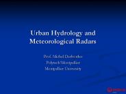
Urban Hydrology and Meteorological Radars Prof. Michel Desbordes Polytech Montpellier Montpellier University Urban Hydrology Urban Hydrology is a scientific and ...
| PowerPoint PPT presentation | free to download

Cabauw. status of instruments. Henk Klein Baltink. Atmospheric ... Radiosonde. IRR. Windprofiler/RASS. GPS IWV. Surface/tower measurements. Total Sky Imager ...
| PowerPoint PPT presentation | free to view

SOME RELATIONSHIPS BETWEEN MESOSCALE CONVECTIVE SYSTEMS LIFE CYCLE AND OBSERVED ... resolution: hour (*) provided by Centro de Previsi n del Tiempo y Clima (CPTEC) ...
| PowerPoint PPT presentation | free to view

ScaRaB : a wide band radiometer for radiative fluxes measurement (transversal scan, 40 km) ... (MADRAS); Michel Viollier (ScaRaB); Sophie Cloch (data bases) ...
| PowerPoint PPT presentation | free to view

Validation and Inter-comparison of Satellite Rainfall ... T. Dinku, P. Ceccato, E. Grover-Kopec, S. J. Connor and C. F. Ropelewski. tufa@iri.columbia.edu ...
| PowerPoint PPT presentation | free to view

2003 5 23 1 : 0 ...
| PowerPoint PPT presentation | free to view
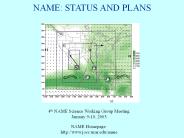
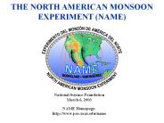
NAME: STATUS AND PLANS 4th NAME Science Working Group Meeting January 9-10, 2003 NAME Homepage: http://www.joss.ucar.edu/name OUTLINE OVERVIEW What is NAME?
| PowerPoint PPT presentation | free to download

Anthony Illingworth, Robin Hogan , Ewan O'Connor, U of Reading, UK ... Adrian Tomkins, ECMWF, Charles Wrench, RAL. Herman Russchenberg, Oleg Krasnov TUD, NL ...
| PowerPoint PPT presentation | free to download

Urban Hydrology Initiative on Coastal Zone Urban Flood Decision Support System Mumbai by Prof' Kapil
| PowerPoint PPT presentation | free to view

Title: Author: Last modified by: meulenvd Created Date: 8/30/2004 4:59:43 AM Document presentation format
| PowerPoint PPT presentation | free to view

Cumulative decile forecast results. 11/28/09. 14. Forecast Success by Quintile. 1=very low 4 = high ... in forecasting rainfall anomalies to within two deciles ...
| PowerPoint PPT presentation | free to view

Key weather systems in the West African and Tropical Atlantic regions. ... ( Ecole Sup rieure Polytechnique / Universit Cheikh Anta Diop de Dakar ), A Gaye ...
| PowerPoint PPT presentation | free to view

Upwelling radiation is scattered by ice. particles in the tops of ... Conversion from retrieval to rain rate (algo.) Temporal sampling. ERRORS: LIMITATIONS: ...
| PowerPoint PPT presentation | free to download

GROUND VALIDATION FOR MEGHATROPIQUES. USING DOPLER WEATHER ... INSTALL NEW DWR MEGHA-5400 ON BOARD ORV SAGAR KANYA. ISRO RADAR DEVELOPMENT UNIT, BANGALORE. ...
| PowerPoint PPT presentation | free to view

Combination of MSG and TRMM for precipitation estimation over Africa (AMMA project experience) ... Collocation between Pr image and 2A25 TRMM data ...
| PowerPoint PPT presentation | free to view

Unit Conversion (handout, exercise) Unit Table (handout) Distance. Time ... (Distilled Water) OUTDOOR Exercise (First thing in the morning) Weather on the Internet ...
| PowerPoint PPT presentation | free to view

Systematic error in satellite rainfall estimates and uncertainties in planting ... therefore we focus on the use of rainfall estimates based on satellite imagery. ...
| PowerPoint PPT presentation | free to view

CE 3205 Water and Environmental Engineering Watershed and Introduction to Precipitation Mdm. Norhidayah Rasin * Rain gauge Network Since the catching area of the rain ...
| PowerPoint PPT presentation | free to view

Radar (Scanning C-band Doppler; Vertically pointing Ka-band Doppler) Rawinsonde ... Equipment, personnel, transportation, data collection, research ...
| PowerPoint PPT presentation | free to download

The data cut off time is very short. Cycle Analysis: ... The total number of grid-points is reduced by about 30% in the reduced Gaussian ...
| PowerPoint PPT presentation | free to download

?? ?(??????????) ? ??(?????????) ??????????. ?????????????. ??????(2000??3?????) ????????????? ... opposite to the land-sea breeze ...
| PowerPoint PPT presentation | free to download

Conventional approach is to use radar and gauge data as inputs. ... Hydrology Requirements. Catchment Characteristics. Topography, subsurface, land use etc. ...
| PowerPoint PPT presentation | free to view

1School of Civil Engineering and Geosciences, Newcastle University. ... Belford and hydrometry location. Top field gauging station. Pheasant feeder gauging station ...
| PowerPoint PPT presentation | free to view