Microstation PowerPoint PPT Presentations
All Time
Recommended
... enables you to choose master units and sub units by name. Working Units ... The most significant changes in the dialogs will be in the area of level selection. ...
| PowerPoint PPT presentation | free to view
Architecture is a discipline that has evolved over the years, thanks to technological advances that have transformed the way buildings are designed and constructed. One of the most important tools in this process is MicroStation software. After completing MicroStation Training, it allows architects to create three-dimensional digital models of their projects.
| PowerPoint PPT presentation | free to download
MicroStation GeoGraphics. Create, store and analyze spatially referenced data ... Data in GeoGraphics is stored in projects. Project includes: ...
| PowerPoint PPT presentation | free to view
Title: Remote Lab MicroStation V8 User Update Author: bob.bossler Last modified by: CH2M HILL Created Date: 2/9/2005 6:25:48 PM Document presentation format
| PowerPoint PPT presentation | free to view
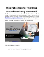
MicroStation is a solution professionals trust to develop projects, model and manage infrastructures.It is more sophisticated than a tool.This is an affordable solution that offers control, efficiency and security. After taking MicroStation Training in Melbourne, users present innovative projects and creative visualizations and also consolidate critical elements of these projects in a single environment for effective and safe deliveries.
| PowerPoint PPT presentation | free to download
Beyond MicroStation VBA Vince Thompson Geometric Technology VBA Project Manager MicroStation Menu Command: Utilities-Macro-Project Manager VBA Macros use mvba ...
| PowerPoint PPT presentation | free to view
plt text files being replaced by xml-based .pltcfg files ... Symbology comparison mode. Explode options. Match multiple selections. Plot style compatibility ...
| PowerPoint PPT presentation | free to view
MOST CONSULTING FIRMS WORKING WITH STATE DOTS WILL USE MICROSTATION ... Chamfer. Delete Vertex. Insert Vertex. Fillet. Trim. IntelliTrim. Delete Part of Element ...
| PowerPoint PPT presentation | free to view
Requested and supported by the local agencies of Boulder County, City of Boulder, ... Black tailed prairie dogs are located throughout the project. ...
| PowerPoint PPT presentation | free to view
Holds levels, symbology, Text Styles, Dimension Styles, etc. Use'em. ... Can set symbology, settings, hatching, etc. Can be connected to Tools. Can be set up as ...
| PowerPoint PPT presentation | free to download
... for completion of data conversion. 13 Square Miles have been manually converted to facilitate 3 phases of the Urban Drainage ... empty GEOPAK Drainage ...
| PowerPoint PPT presentation | free to view
Wealth of information in the current CAD system. ... Preferred City of Lincoln Design Software. Geographic Analysis Capabilities. Asset Management ...
| PowerPoint PPT presentation | free to view
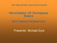
San Diego Bentley Users Group Presents MicroStation V8 Workspace Basics (AKA Opening Pandora s Box) Presenter: Michael Eyre MicroStation Workspace Basics What is a ...
| PowerPoint PPT presentation | free to download
tu/e geertjan de vos generative components - kpf - cad-/gsa-model - smart geometry parametrisch modelleren - axel kilian - generative design - swiss ...
| PowerPoint PPT presentation | free to view
The Top 10 for becoming a. MicroStation CAD Guru. 2003 MCMC Summer Conference. 1. AccuDraw ... DD Design. Dimensioning. Construction Commands. File Fence ...
| PowerPoint PPT presentation | free to view
... IDRISI Maptitude GRASS MapInfo (Pitney Bowes) AutoCAD Microstation ... updated with full support Training IDRISI Open Code Single Packaged Product ...
| PowerPoint PPT presentation | free to download
GEOGRAPHIC INFORMATION SYSTEMS Dr. Ahmet izmeli ... Microstation(Intergraph), MapInfo, SmallWorld, CARIS, etc... Some examples for open source GIS softwares: Grass, ...
| PowerPoint PPT presentation | free to download
... .COM Bentley Bridge Solutions MicroStation CloudWorx GEOPAK Bridge InRoads Bridge RM Bridge LEAP Bridge Bentley Rebar STAAD.Pro STAAD.foundation ProSteel 3D ...
| PowerPoint PPT presentation | free to view
... 2D drawing 2. 3D model 3. 3D rendered model General 2D/3D Bentley Microstation 3D modeling Bentley Triforma BIM tool Bentley Architecture ...
| PowerPoint PPT presentation | free to view
Microsoft Office 2000, 2003. Internet Explorer 6. Microsoft .Net Framework. MicroStation 2004 ... 'By level' is used to define symbology per level ...
| PowerPoint PPT presentation | free to view
Bit Map (.bmp) MicroStation (.hln) Word (.doc) Excel (. xls) Graphic Interchange Format (.gif) ... Entire Attachment tab must not exceed 10 Meg ...
| PowerPoint PPT presentation | free to view
February 19, 2003. Kansas City, MO. Mid Continent MicroStation Community. 2003 Winter Conference. Your Name and Company. Session Title. 2003 MCMC Winter Conference ...
| PowerPoint PPT presentation | free to view
Real-time 4D Modelling MicroStation/Microsoft Project Integration. Lessons ... Build a project-model database on a relational database using IFCs ...
| PowerPoint PPT presentation | free to view
After the introduction of CAD software,design processes became faster and design time is reduced. Due to this new product introduction time is lowered. This presentation will focus on different attributes of AutoCAD, Solid Edge, Pro-Engineer, Catia and Microstation
| PowerPoint PPT presentation | free to download
We deal with both residential and commercial 3d architectural rendering projects. With our 3d virtual tour services, we ensure you 360 ° view of your project, right from your mobile devices. We mainly work on advanced architectural designing platforms like EPLAN, Solid Edge, MicroStation, Auto CAD, Solid Works, PRO-E, and SketchUp Pro.
| PowerPoint PPT presentation | free to download
Used primarily in construction industries to complement 3D design packages (Autodesk Revit, AutoCAD and MicroStation) Navisworks allows users to open and combine 3D models, navigate them in real time and examine the model at using a set of tools including comments, replay, point of view and action.
| PowerPoint PPT presentation | free to download
OF INDIA. Set up in 1767 and has evolved rich traditions over the years. ... currently used by SOI in topographic maps prepared by them are in MicroStation ...
| PowerPoint PPT presentation | free to view
Using extended software like Microstation, AutoCAD professionals run through the range of building technically fantasy around you just to fill your desired requirements with ease.Drafting your drawings creatively tends to be our only goal in creating CAD Conversions. Microdra Designs Solutions in sense be the latest CAD Drafting Service Providers In India in giving accurate results in this field for more than years.
| PowerPoint PPT presentation | free to download
Navisworks is a 3D outline audit bundle for Microsoft Windows. Utilized fundamentally as a part of development businesses to supplement 3D configuration bundles, (for example, Autodesk Revit, AutoCAD, and MicroStation). Navisworks permits clients to open and consolidate 3D models, explore around them continuously and survey the model utilizing an arrangement of apparatuses including remarks, redlining, perspective, and estimations. A determination of modules improves the bundle including obstruction location, 4D time reproduction, photorealistic rendering and PDF-like circulating.
| PowerPoint PPT presentation | free to download
AABSyS IT is a preferred mapping service provider for the leading global utility majors. With our GIS, remote sensing and computer aided design and drafting solutions to Electric and Gas Utility majors worldwide, AABSyS ensures continuity of business standards and relevance. AABSyS specializes in reliant and efficient GIS platforms including ArcFM, ArcFM UT, GE Smallworld, Ericsson Network Engineer, 3-GIS, AutoCAD, MicroStation and other industry-standard software for imparting end-to-end utility mapping services. View more: https://aabsys.com/electric-and-gas-utility/
Cadd/Cam/Cae training Centre in Chennai, Tamilnadu which focuses on industry based training. The only CAD|CAM|CAE training centre which has designed cad courses on the industrial requirements. All Students at CADD SCHOOL will awarded international Certification. CADD SCHOOL is one of the authorized training provider for autodesk. CADD SCHOOL prepares sutdents to handle real time design techniques and be ready to Students face the CAD Job market.
| PowerPoint PPT presentation | free to download
Title: Slajd 1 Author: Pyka Last modified by: Krystian Pyka Created Date: 12/14/2006 5:36:25 PM Document presentation format: Pokaz na ekranie Company
| PowerPoint PPT presentation | free to download
... result in a difference of about 2 feet. At 10,000,000 feet ... By default, V7 files with a MU of ft will convert to International Feet. Converting V7 to V8 ...
| PowerPoint PPT presentation | free to view
In the dynamic realm of construction, where precision and efficiency reign supreme, construction drawing management software has emerged as an indispensable tool. This innovative technology is reshaping the way projects are conceptualized, designed, executed, and managed, ushering in a new era of streamlined workflows and enhanced collaboration. Read More: www.ifieldsmart.com/blogs/construction-drawing-softwares-crucial-role-in-modern-projects Visit: www.ifieldsmart.com/construction-drawing-management-software
| PowerPoint PPT presentation | free to download
ProjectWise Navigator V8 XM Edition Joe Croser Global Marketing Director, Platform & SELECT
| PowerPoint PPT presentation | free to view
Can preset a rounding value. Keeps lines straight. 2003 MCMC Summer Conference ... Also used in combination with Ctrl, Alt, Shift to allow up to 96 Function Key ...
| PowerPoint PPT presentation | free to view
Elevate your AEC endeavors with Conquering BIM Services. Our guide reveals the top 7 software selections, empowering you to streamline and optimize your next project.
| PowerPoint PPT presentation | free to download
Fleetway is equipped to perform surveys on physical plants, ... Fleetway uses a Leica HDS6000 compact ultra-high speed laser scanner and associated software ...
| PowerPoint PPT presentation | free to view
... AC02-76SF00515 by the Stanford Linear Accelerator Center, Stanford, California ... The SLAC loop road map was drawn from GPS and Total Station survey data in the ...
| PowerPoint PPT presentation | free to download
Models What are they really? definition mod.el (mod `el), n. b) a preliminary representation of something, serving as the plan from which the final, usually larger ...
| PowerPoint PPT presentation | free to view
CAD READER PERTEMUAN 4 Computer Aided Design (CAD) CAD drawing berfungsi seperti halnya jenis feature theme lain dlm ArcView. Pada CAD drawing kemungkinan menggunakan ...
| PowerPoint PPT presentation | free to download
T rk p szet Szoftvert pusok Zentai L szl E tv s Lor nd Tudom nyegyetem T rk ptudom nyi s Geoinformatikai Tansz k http://lazarus.elte.hu
| PowerPoint PPT presentation | free to download
... Incorporated The GEOPAK VBA Object Model A collection of Object definitions giving the VBA programmer access to various areas of the GEOPAK Suite of products, ...
| PowerPoint PPT presentation | free to view
The use of computers in the design process (from the 2d CAD s) ... Isometric view. Right view. Basic Drawing Tools. Points, lines, arcs, ellipses, polygons ...
| PowerPoint PPT presentation | free to view
The use of computers in the design process (from the 2d CAD s) ... Geomatics (apart from goinging very well with aged reds, ports and a good Cognac) ...
| PowerPoint PPT presentation | free to view
ERDAS Imagine (Leica) Geomatica (PCI Geomatics) ENVI (ITT visuals) Definiens ... Major platforms -ERDAS Imagine (Leica), ENVI (ITT Solutions) Geomatica (PCI ...
| PowerPoint PPT presentation | free to download
Graphics Only (Free) GeoMedia. Web Map. ODBC. Ongoing Tasks. Database Maintenance and Update: ... Graphics. Inventory data. History data. Condition Data ...
| PowerPoint PPT presentation | free to view
Import for Thermal. very specific in it's requirements about spatial information ... do not import a full 3D CAD model from another program ...
| PowerPoint PPT presentation | free to view
Waters from these piezometers are the natural ones, not influenced by the dump, third group - waters from piezometer P-9 belong to this group, ...
| PowerPoint PPT presentation | free to download
Henderson Middle School EAST Lab
| PowerPoint PPT presentation | free to view
Title: PowerPoint Presentation Author: Cathy Newell Last modified by: Cyndi.Smith Created Date: 4/4/2003 9:09:31 PM Document presentation format: On-screen Show
| PowerPoint PPT presentation | free to view
VPI Based Vertical Alignment Design Tools. Component ... VPI BASED VERT. ALIGNMENT. Must reference previously stored chain ... COMPONENT BASED VERT. ALIGNMENT ...
| PowerPoint PPT presentation | free to view
How do I get the Workspaces? Update Workspace Program. Changelog. Design and Intent ... Organization of tools the workspace limits the tools available to the user ...
| PowerPoint PPT presentation | free to view
Bentley Solutions for Rail Engineering
| PowerPoint PPT presentation | free to view
Put simply - Bentley's mission is to help improve the world's ... Cadastre. Copper. Electric. Inside Plant. Enterprise data store. Middle tier. Client tier ...
| PowerPoint PPT presentation | free to view
3.4 Orthography of (farm)houses. 3.5 Capitals in names of farms. 3.6 Splitting names ... Orthography. Languages. Dutch. Frisian. Frisian and Dutch names. How to ...
| PowerPoint PPT presentation | free to download


