
Ldcm PowerPoint PPT Presentations
All Time
Recommended


Title: PowerPoint Presentation Last modified by: John Dwyer Created Date: 1/1/1601 12:00:00 AM Document presentation format: On-screen Show Other titles
| PowerPoint PPT presentation | free to view

Generated for all OLI data that can be processed to meet ... Reprocessing driven by algorithm, software, and/or calibration parameter file (CPF) update ...
| PowerPoint PPT presentation | free to download

Aquarius. NPP. Glory. LDCM. OCO. OSTM. GPM. Spacecraft. Flight ... Constellation Systems. Exploration Syst Research & Tech. Prometheus Nuclear Syst & Tech ...
| PowerPoint PPT presentation | free to view

Landsat Overview Jim Irons 9:15. USGS EROS Overview Mike Headley 9:30. LDCM Mission, Ops Con and MOE Overview Steve Coyle 9:45. RFP Overview Vicki Dulski 10:05 ...
| PowerPoint PPT presentation | free to view

The second version was posted in April, 01 and reviewed at the Second LDCM ... A band center at 1375 nm (120 m GSD) for cirrus cloud detection and correction ...
| PowerPoint PPT presentation | free to view

Curtis Woodcock. Geography, Boston University. Lots of Good News! Landsat Data Continuity Mission (LDCM) Procurement near completion ...
| PowerPoint PPT presentation | free to download

Provides more flexibility to offerors and the USGS/EDC in negotiating for the ... Description Document for MIT/LL Services replaces the LDCM Catalog ...
| PowerPoint PPT presentation | free to view
Dimitar Ouzounov1, Pat Coronado1, Jim Irons1 ,Mike Story2, Rainer Ressl3 ... Team selected Curtis Woodcock, Boston U., as Team Leader ...
| PowerPoint PPT presentation | free to download

Landsat Science Team Meeting, USGS EROS, Sioux Falls, SD. Page 1 ... Land Remote Sensing Data Archive (NSLRSDA) at USGS EROS, Sioux Falls, SD ...
| PowerPoint PPT presentation | free to view

... Secure existing Landsat holdings from IGS (consolidate at EDC) (first) Achieve sustained consistent Landsat-class observations (second) ...
| PowerPoint PPT presentation | free to download

... the post-fire rapid assessment process led by the Burn Area Emergency Response (BAER) Team. ... cover and surface properties. Landsat. Mesoscale. Models ...
| PowerPoint PPT presentation | free to view

This plan is due to the House and Senate Committees on Appropriations no later ... Optimize the satellite development schedule to achieve the shortest possible ...
| PowerPoint PPT presentation | free to view

EROS Data Center. Landsat Program. USGS Landsat Goals ... EROS Data Center. Landsat Program. Landsat 7 ETM SLC-Off New Product Development Status (Phase 1) ...
| PowerPoint PPT presentation | free to view

R. Bindschadler and P. Vornberger (SAIC), NASA Goddard Space Flight Center ... 50m location accuracy with ephemeris data) stacking order and cutlines ...
| PowerPoint PPT presentation | free to view

A data specification-based, multi-step procurement. The procurement DOES NOT: ... Two-step process is a mutually beneficial approach ...
| PowerPoint PPT presentation | free to view

The World s Model for International Collaboration in Earth Observation Landsat 1 - 3 Multi-Spectral Scanner (MSS) 79 meter Return Beam Vidicon (RBV) 80/40 meter
| PowerPoint PPT presentation | free to download

Modeling Non-Point Source Pollution and Erosion into Gulf Coast Bays and Marshes ... Mobile Bay. St. Louis Bay. The University of Mississippi Geoinformatics Center ...
| PowerPoint PPT presentation | free to view

A Decision Support System for Ecosystem-Based Management ofTropical Coral Reef Environments ... Socio-Economic Importance. Over 60% of the world's reefs are under threat.
| PowerPoint PPT presentation | free to view

24-hour ET from 'instantaneous' overpass. METRIC used for Landsat overpass dates, and. Penman-Monteith equation between overpasses. Use of hot and cold pixels for ...
| PowerPoint PPT presentation | free to view

Calibration Status for Current Instruments and Plans for Future Instruments: ... Research Scanning Polarimeter, POLDER, MODIS, Sun Photometer network [EOSP] ...
| PowerPoint PPT presentation | free to download

Title: TECHNICAL AND HISTORICAL PERSPECTIVES OF REMOTE SENSING Author: Bunky Last modified by: Sara A. Garver Created Date: 4/1/2001 9:36:46 PM Document presentation ...
| PowerPoint PPT presentation | free to view
Joint Workshop Applied Sciences Objectives Ed Sheffner Applied Sciences Program NASA HQ
| PowerPoint PPT presentation | free to download
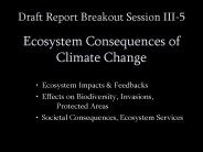
Draft Report Breakout Session III-5 Ecosystem Consequences of Climate Change Ecosystem Impacts & Feedbacks Effects on Biodiversity, Invasions, Protected Areas
| PowerPoint PPT presentation | free to download

GOES-R AWG Product Validation Tool Development Snow Cover Team Thomas Painter UCAR Andrew Rost, Kelley Eicher, Chris Bovitz NOHRSC *
| PowerPoint PPT presentation | free to view

The National Land Imaging Program Ensuring Landsat Operational Data Continuity in the 21st Century
| PowerPoint PPT presentation | free to view
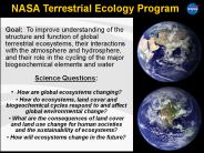
NASA Terrestrial Ecology Program Goal: To improve understanding of the structure and function of global terrestrial ecosystems, their interactions with the atmosphere ...
| PowerPoint PPT presentation | free to download
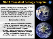
What are the consequences of land cover and land use change for human societies and the sustainability of ecosystems? How will . ecosystems . change in the future?
| PowerPoint PPT presentation | free to download

Fairbanks Command and Data Acquisition Station
| PowerPoint PPT presentation | free to view

Terrestrial Ecology Program
| PowerPoint PPT presentation | free to download

NASA/USGS EROS. 4-16 days (pointable) 15m ... USGS-EROS. Burned Area Emergency Response Imagery Support. Collaborative effort between USFS-RSAC and USGS-EROS ...
| PowerPoint PPT presentation | free to download

Atmospheric Correction of Landsat Sea Surface Temperature by Using Terra MODIS Junsoo Kim, Hyangsun Han and Hoonyol Lee Department of Geophysics, Kangwon National ...
| PowerPoint PPT presentation | free to download

Assessment of coral reef ecosystems using EOS platforms and numerical ocean circulation models
| PowerPoint PPT presentation | free to download

Landsat Data Gap Study Activities Remote Sensing Technologies Project http://calval.cr.usgs.gov/ Greg Stensaas, USGS Gyanesh Chander, Jon B. Christopherson SAIC
| PowerPoint PPT presentation | free to download

ground resolution, five-year design life: microbolometer technology ... records' Allen, R.G. 'The Need to Continue High Resolution Thermal Imagery ...
| PowerPoint PPT presentation | free to view

Title: PowerPoint Presentation Last modified by: jmahoney Created Date: 1/1/1601 12:00:00 AM Document presentation format: On-screen Show Other titles
| PowerPoint PPT presentation | free to download
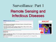
Remote Sensing and Infectious Diseases
| PowerPoint PPT presentation | free to download

Students learn about marine ecosystems & habitability factors controlling life ... Seasons and Biomes is an inquiry- and project- based initiative that monitors ...
| PowerPoint PPT presentation | free to view

Landsat Calibration Scientist, NASA/GSFC Landsat Project ... New processing logic was added to detect and correct the step offsets in the quaternion data ...
| PowerPoint PPT presentation | free to view
... for all US government, non-military aeronautic and space activities. ... of science, exploration, and aeronautics consistent with the redirection of ...
| PowerPoint PPT presentation | free to download
Land Report Back Chris Justice
| PowerPoint PPT presentation | free to download

Landsat 7 and its Enhanced Thematic Mapper-Plus (ETM ) sensor reach the end of ... SS Survivability Sensor. ALT Radar Altimeter. TSIS Total Solar Irradiance Sensor ...
| PowerPoint PPT presentation | free to view

How do calibration and validation requirements impact observatory maneuvers and ... Yaw maneuver. Recommend that this be a requirement for instrument/spacecraft/LTAP ...
| PowerPoint PPT presentation | free to view

Also we need a 'VCL' type instrument for the vertical dimension in vegetation ... Analysis of suitability of GeoCover images for 1990 for Southern Africa by GLCF ...
| PowerPoint PPT presentation | free to download
NASA Biodiversity Research
| PowerPoint PPT presentation | free to download

Developed to demonstrate the usefulness of remote sensing data for land and ... Boreal Forests. Spacecraft. Attitude. Solid State Recorder (SSR) Audience. Application ...
| PowerPoint PPT presentation | free to view

... Remote sensing and modeling of changes in land use ... bubble optics, pCO2 - Regional Process Studies - Land/sea interactions, exchanges, transformations, ...
| PowerPoint PPT presentation | free to download

The flames consume biomass and organic matter to produce carbon dioxide (along ... they have more water to draw upon, cooling themselves through evaporation. ...
| PowerPoint PPT presentation | free to view

Title: Diapositiva 1 Author: PMartinez Last modified by: PMartinez Created Date: 4/4/2006 12:07:28 PM Document presentation format: Presentaci n en pantalla
| PowerPoint PPT presentation | free to view

Landsat Data Gap Studies: Potential Data Gap Sources
| PowerPoint PPT presentation | free to view

Curtis Woodcock. Geography, Boston University. Definitions. Landsat-Class 100m, multispectral, global systematic coverage. VHS (very high spatial) - Class ...
| PowerPoint PPT presentation | free to download

... public and national leaders as IMPORTANT, not simply interesting and challenging. The nation and the public are looking to us to lead AND TO SUCCEED. ...
| PowerPoint PPT presentation | free to download

Over 900 Users of data extending from 82 ingest sites ... There are 947 registered users on the NASA DR Portal ... Case Studies. Process Understanding. Improvements: ...
| PowerPoint PPT presentation | free to download
NASA s Earth Science Planning Update presented at the Joint Meeting of Ocean Sciences and Surface Water Hydrology in Support of Wide-Swath Altimetry Measurements
| PowerPoint PPT presentation | free to download

F. Muller-Karger, M. Eakin, L. Guild, C. Hu, M. Vega, R. Nemani, T. Christensen, L. Wood, C. Ravillious, C. Nim, J. Li, C. Fitzgerald, J. Hendee, L. Gramer, S. Lynds
| PowerPoint PPT presentation | free to download