
Altimetric PowerPoint PPT Presentations
All Time
Recommended

Least Squares Collocation. The optimum estimate using geoid height or geoid slopes is: ... 2D FFT Interpolation using collocation. ...
| PowerPoint PPT presentation | free to view

... D. Roman. National Geodetic Survey. NOAA. Montreal, Canada, May 17-21, 2004. Recent geoid ... in Banff, Alberta, Canada from July 31 - August ...
| PowerPoint PPT presentation | free to view

The Global Altimetric Gravity Field (3): Accuracy assesment. Applications ... Presently several global marine gravity fields are available on 2' by 2' ...
| PowerPoint PPT presentation | free to view

1. Space Research Centre, Polish Academy of Sciences, Warsaw, Poland ... is the minimum time span of the SLA data to estimate a trend in sea level change ? ...
| PowerPoint PPT presentation | free to download

In revision We have evaluated the capability to estimate rating curve at virtual gauges bu relating the altimetric wter elevation and the discharge propagated along ...
| PowerPoint PPT presentation | free to download

Harmonic analysis of the time series - Detided signal comparison (observed ... sea level models and softwares, - altimetric products (from CTO) and expertise ...
| PowerPoint PPT presentation | free to view

Least Squares Collocation. Global Marine Altimetric Gravity Field ... This will be treated in the subsequent Least Squares Collocation interpolation procedure. ...
| PowerPoint PPT presentation | free to view

WP3 Task T3.1. Luciana Fenoglio-Marc, Niels Kjaer (P14 and P2) ... 2) Decadal to inter-annual part of altimetric time series. 3) Dominant inter-annual ...
| PowerPoint PPT presentation | free to view

Model: OPA1.12 on a 1/4 ... Pr sentation PowerPoint Last modified by: jacques verron Document presentation format: Personnalis Company: LEGI Other titles:
| PowerPoint PPT presentation | free to download

... Systems Development Near Real-Time Data Production & Distribution Archive & Access STAR Satellite Oceanography & Climatology Division NASA/JPL CNES EUMETSAT ...
| PowerPoint PPT presentation | free to download

Peter Killworth Alison Macdonald ... Mindy Berger Pacific UOT: Warren White, Marguerette Schultz, Norm Hall ADCP: Pat Caldwell, Norio Baba, Shin Tani SSS: ...
| PowerPoint PPT presentation | free to download

Radar altimetry Frontiers 4:
| PowerPoint PPT presentation | free to view


ODINAFRICA/GLOSS Sea Level Training Course TIDE GAUGES AND ALTIMETRY IN THE GULF OF GUINEA 13-24 November 2006, Oostende Angora AMAN Contents The system - Principles ...
| PowerPoint PPT presentation | free to download

Relative calibration: island tide gauge network (poor ... TOPEX vs. Christmas Island Sea Level. ASIC**3 Workshop -- May 2006. Altimeter Algorithm Error ...
| PowerPoint PPT presentation | free to download

TOPICS Operational needs Operational constraints Remote sensing and weather Rainfall estimation ... using Meteosat Tropical Rainfall Measuring Mission using radar ...
| PowerPoint PPT presentation | free to download

J. Font, O. Chic. ICM-CSIC, Barcelona. MAMA 6th Meeting, Tunis, 7-8 March 2005 ... Plan for the access in operational mode. Links to satellite data providers ...
| PowerPoint PPT presentation | free to download

Session: GP52A-02 Decade of Geopotential Research III Use of G99SSS to evaluate the static gravity geopotential derived from the GRACE, CHAMP, and GOCE missions
| PowerPoint PPT presentation | free to download

Session: GP52A-02 Decade of Geopotential Research III Use of G99SSS to evaluate the static gravity geopotential derived from the GRACE, CHAMP, and GOCE missions
| PowerPoint PPT presentation | free to download
... gradiometer in space. an ambient temperature, capacitive gradiometer ... the gradiometer accelerometers and GPS receiver are based on European technology ...
| PowerPoint PPT presentation | free to download

Towards the Next Earth Gravitational Model to Degree 2160: Status and Progress Dynamic Planet 2005 Cairns, Australia 22-26 August 2005 Steve Kenyon, John Factor, NGA
| PowerPoint PPT presentation | free to download
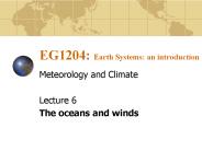
EG1204: Earth Systems: an introduction Meteorology and Climate Lecture 6 The oceans and winds Topics we will cover Ocean structure and circulation Sea surface ...
| PowerPoint PPT presentation | free to download
Gravity, Geoid and Heights
| PowerPoint PPT presentation | free to download

Gravity Field and the Geoid
| PowerPoint PPT presentation | free to view

Geodesy (surveying) one of the earth sciences, geodesy is concerned with measurements of the Earth and with the Earth s surface representation
| PowerPoint PPT presentation | free to download
İbrahim ÇAMALAN Meteoroloji Mühendisi
| PowerPoint PPT presentation | free to download

Towards a HighResolution GlobalOcean and SeaIce Data Synthesis
| PowerPoint PPT presentation | free to view

Propagation of wave signals in models and altimetry for the North Atlantic ... Model simulations carried out using a 6 layer, isopycnic model (MICOM). Data study ...
| PowerPoint PPT presentation | free to download

... Slide 11 Slide 12 Bearing calculations.. Distance calculations Results ASV navigating on Clinton Lake Conclusion Acknowledgements References Slide 20 ...
| PowerPoint PPT presentation | free to download

ODINAFRICAGLOSS Sea Level Training Course
| PowerPoint PPT presentation | free to view

REMOTE MEASUREMENT AND MONITORING OF INLAND WATER HEIGHTS GLOBALLY USING MULTIMISSION SATELLITE RADA
| PowerPoint PPT presentation | free to view
Argo Status M. Belbeoch, Argo TC (inputs from AST)
| PowerPoint PPT presentation | free to download
The role of GODAE as a prescriber for the altimetry constellation ... Map of SLA (1994/07/20) for TP (left) and TP ERS1geodetic (right) ...
| PowerPoint PPT presentation | free to download

H: The position and height of the satellite is computed, ... Hydrography / surveying Bathymetry - GPS. Operational sea level services ...
| PowerPoint PPT presentation | free to view
Regional Coastal Ocean Modeling: Forcing
| PowerPoint PPT presentation | free to download

But OAM forecasts are not yet available from ocean modeling groups. Ocean weather forecast systems currently being developed ...
| PowerPoint PPT presentation | free to view

... is guided by observed cross-sections obtained in specialized field experiments. ... Depth of 26C. isotherm. derived at TPC ... Depth of 26oC isotherm ...
| PowerPoint PPT presentation | free to download

users needs as seen by space agencies. One ' high accuracy ' reference mission. TOPEX/Poseidon , Jason series (including Jason ... Constellations (Iridium-NEXT? ...
| PowerPoint PPT presentation | free to view
| PowerPoint PPT presentation | free to download

Algorithmic and tradeoff study for the Generation of a GOCE User Toolbox
| PowerPoint PPT presentation | free to view


... issues requires highest quality possible (heat content, steric sea level change) ... on steric height (0/2000): ~ 5 dyn mm. Argo: QC issues, pressure sensor ...
| PowerPoint PPT presentation | free to download

METEOROLOGY & OCEAN SATELLITE DATA ARCHIVAL CENTRE (MOSDAC) ... INSTITUTE USER WHO HAS LOW BIT RATE INTERNET ACCESS CAN GET HUGE DATA ON MEDIA IN A WEEK TIME ...
| PowerPoint PPT presentation | free to view

Some Proposed IGOS Science Objectives and Observational Requirements ... Captain Ashley McKinley holding the first aerial surveying camera used in Antarctica. ...
| PowerPoint PPT presentation | free to view
Param tres de surface oc anique par t l d tection Oceanic surface parameters by remote sensing Dominique DAGORNE IRD Centre de Bretagne US025
| PowerPoint PPT presentation | free to download

GPS-Derived Heights Part 1 Development and Description of NGS Guidelines
| PowerPoint PPT presentation | free to download

60 day filtering. Main results: Intercomparaison. Along track spatial scales ... A leap frog scheme is used for the time stepping. ...
| PowerPoint PPT presentation | free to download

High Resolution Ocean and SeaIce Data Synthesis using the Columbia Supercomputer
| PowerPoint PPT presentation | free to view

Height Mod Overview
| PowerPoint PPT presentation | free to download

Department of Geophysics, Graduate School of Science, Tohoku University, Sendai, Japan ... 'Major contributor to time variability in STCC and KE regions' ...
| PowerPoint PPT presentation | free to view

Towards a HighResolution Global
| PowerPoint PPT presentation | free to view

The Bhola cyclone in 1970 killed 500,000 people in Bangladesh, ... hazards Floods and tropical cyclones are some of the deadliest and costliest natural hazards.
| PowerPoint PPT presentation | free to view

... out at the National Geospatial-Intelligence Agency is also presented to document ... The figure to the right shows a zoom over lakes in central Africa. ...
| PowerPoint PPT presentation | free to download

Automated DSM generation
| PowerPoint PPT presentation | free to download

Using Altimetry Waveform Data and Ancillary Information from SRTM and LANDSAT to retrieve River Characteristics By Vivien ENJOLRAS1)* and Ernesto RODRIGUEZ(2)
| PowerPoint PPT presentation | free to download

Laboratory for Space Geodesy and Remote Sensing, The Ohio State University, ... reprocess the GEOSAT Geophysical Data Record (GDR) (Lillibridge and Cheney, 1997) ...
| PowerPoint PPT presentation | free to download