Alongshore PowerPoint PPT Presentations
All Time
Recommended
Littoral alongshore transport cells
| PowerPoint PPT presentation | free to view
The coastal ocean off Peru and Chile is ... Anchovy Distribution. Conclusions ... Chile, the vertical distribution of anchovy is strongly affected by remotely ...
| PowerPoint PPT presentation | free to view
'The vertical advection of nutrient-rich subsurface waters ... Martins & Pelegri, submitted. Savidge et al, 1992. Orals 30-Jul-2004. 7. Alongshore Wind Stress ...
| PowerPoint PPT presentation | free to view
Different time-scales involved in coastal stability problems. Traditional measurements only cover a couple ... Alongshore currents : not enough data) Examples ...
| PowerPoint PPT presentation | free to view
Lagrangian Statistics of three RAFOS floats. NPS 80, 81 and 82 in the California Undercurrent ... in the cuddy), the dispersion is hard to determine. ...
| PowerPoint PPT presentation | free to view
COPY LINK HERE ; good.readbooks.link/pwshow/1469660903 [READ DOWNLOAD] Shipwrecked: Coastal Disasters and the Making of the American Beach | Reframing the American story from the vantage point of the nation's watery edges, Jamin Wells shows that disasters have not only bedeviled the American beach--they created it. Though the American beach is now one of the most commercialized, contested, and engineered places on the planet, few p
| PowerPoint PPT presentation | free to download
Linear Wind Model. Rotate wind vectors according to complex ... Uwcor (x,y,t) = slope(x,y)*Uwind (t) U (x,y,t) = Uwcor (x,y,t) U (x,y,t) Linear Wind Model ...
| PowerPoint PPT presentation | free to download
Military Relevancy: Littoral operations, mine warfare ... This data was compared to 2002 waverider buoy data collected at Marina and Sand City. ...
| PowerPoint PPT presentation | free to download
Integrated boundary current observations in the global climate system Investigators: U.Send, R.Davis, D.Rudnick, B.Cornuelle, D.Roemmich, P. Niiler
| PowerPoint PPT presentation | free to view
Physical Oceanography of the Yellow and East China Sea. Dr. Steven R. Ramp. Research Professor ... Mean surface currents in the ECS, averaged from 31 years of ...
| PowerPoint PPT presentation | free to view
Nearshore coastal processes Longshore current velocity There are several expressions to calculate longshore current velocity For an infinitely long, straight beach ...
| PowerPoint PPT presentation | free to view
David Leech. Kevin Taylor. Institute of Marine Science. University of Alaska Fairbanks ... Landfast ice and non-uniform melt affects wind stress distribution ...
| PowerPoint PPT presentation | free to view
Department of Chemistry, Funda o Universidade do Rio Grande, Rio Grande, Brazil ... Push-point piezometer for groundwater sampling. Non-steady state box model ...
| PowerPoint PPT presentation | free to download
... non-biological components of the marine ecosystem (e.g. coupled atmosphere-ocean ... predictions of climate change and weather and their effects on coastal ...
| PowerPoint PPT presentation | free to download
A Nested MultiStatic HF RadarArray for the New Jersey Shelf Observing System NJSOS Scott Glenn
| PowerPoint PPT presentation | free to download
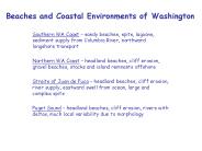
Beaches and Coastal Environments of Washington Southern WA Coast sandy beaches, spits, lagoons, sediment supply from Columbia River, northward longshore transport
| PowerPoint PPT presentation | free to download
... or system parameter by capturing the inherent trends in a data time series. ... Data Driven Modelling: NN Implementation. Assume tn = f ( tn-1, tn-2, ..., tn k) ...
| PowerPoint PPT presentation | free to view
1 Institute of Marine Science, University of Alaska, Fairbanks, AK 99709 ... Spall, M. A. and D. C. Chapman, On the efficiency of baroclinic eddy heat ...
| PowerPoint PPT presentation | free to download
Protective structures along the Nile Delta coast ... Qin: The rate of littoral drift entering in the cells. Qout :The rate of littoral drift going out ...
| PowerPoint PPT presentation | free to view
The Warming of the California Current: Dynamics, ... Loge Tot. Vol. 5. 7. 6. 4. 1990. 1970. 1950. 2000. 1980. 1960 -10. 10. 0. Impacts on the Ecosystem ...
| PowerPoint PPT presentation | free to view
The Influence of Diel Vertical Migration on Krill Recruitment to Monterey Bay Sarah Carr Summer Internship Project Monterey Bay Aquarium Research Institute
| PowerPoint PPT presentation | free to download
Study area. Egmond (NL), Argus site: Jan van Speijk lighthouse. Beach nourishment: ... Future work. Expand analysis to beach width and/or volumes ...
| PowerPoint PPT presentation | free to view
Interannual Variation of Sea Surface Temperature Distribution in the Taiwan ... Mode1. Pingtan. EOF Mode 1. r=-0.68. Dongshan. EOF Mode 1. r=-0.64 ...
| PowerPoint PPT presentation | free to view
Seawalls Beach Nourishment ... Beach Nourishment. Cost? Source of sand/sediment. Effect/s of sand removal ... Pre-nourishment feasibility studies. Funding ...
| PowerPoint PPT presentation | free to view
Ruud Spanhoff (RIKZ) and Stijn de Keijzer (University of Amsterdam) ... Monitor a nourished beach with Argus video remote sensing technology in terms of ...
| PowerPoint PPT presentation | free to view
Overview of Kalifornia Coastal Processes and Tsunami Inundation
| PowerPoint PPT presentation | free to view
Sin ttulo de diapositiva
| PowerPoint PPT presentation | free to download
Eastward advection (from Point Conception) Terrestrial input ... December, 2001, Advection from western channel. Measured W-E Nitrate Gradient: ...
| PowerPoint PPT presentation | free to view
Negatively buoyant plumes can also occur and are caused by high suspended ... plume will initially expand horizontally, and thin vertically, and eventually ...
| PowerPoint PPT presentation | free to download
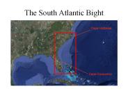
The South Atlantic Bight Cape Hatteras Cape Canaveral
| PowerPoint PPT presentation | free to download
Plume survey of OCSD sewage plume off Huntington Beach. Wastewater Outfalls. ... low energy ... in bay, estuary, harbor, or lagoon. Enclosed Beaches. Heal the Bay ...
| PowerPoint PPT presentation | free to view
Summer fog variability in the coast redwood region: climatic relevance and ecological implications
| PowerPoint PPT presentation | free to view
Rotary Cross Spectral Analysis of Low Frequency Currents With Co-located Wind ... Scanning acoustic altimeter. Under-water video camera. and laser light ...
| PowerPoint PPT presentation | free to view
Title: Lecture 21 Author: Steven L Mullen Last modified by: Emil Kursinski Created Date: 10/1/2000 5:47:54 PM Document presentation format: On-screen Show
| PowerPoint PPT presentation | free to download
depth ranges from 6m at the coast to 40m offshore. Grid resolution varies from 500m at the coast to 4km offshore. ... upwelling at the coast. Diffusivity ...
| PowerPoint PPT presentation | free to download
This could be due to our mistakes or HYCOM errors on the representing the propagation of the waves Future Work More simulations should be run in order to analyze ...
| PowerPoint PPT presentation | free to download
... waves increase cf by vertically mixing surface-generated turbulence to the sea ... Mixing from breaking wave-induced turbulence and stratification caused by ...
| PowerPoint PPT presentation | free to view
We will employ a doctrinal Rapid Environmental Assessment (REA) process, using ... it in the 4D Cube as part of deliberate and contingency military operations. ...
| PowerPoint PPT presentation | free to view
Dano Roelvink, Ap van Dongeren, Ad Reniers, Dirk-Jan ... focus on shallow water, swash, overwashing, breaching. Swash and overwashing dominated by LF ...
| PowerPoint PPT presentation | free to view
The Regional Ocean Modeling System (ROMS) 4D-Var Assimilation Systems applied to the California Current System Andy Moore, Gregoire Broquet, Hernan Arango, Chris ...
| PowerPoint PPT presentation | free to view
Beyond mausam: Through the looking glass. Small basin. Tropical. Time-dependent winds ... Beyond mausam: Through the looking glass ...
| PowerPoint PPT presentation | free to view
A shoreface nourishment supplies sand in between the outer breaker bars along ... food source to sea ducks, for instance the common scoter Melanitta nigra. ...
| PowerPoint PPT presentation | free to view
Polly Creek. Polly Creek. Bluff erosion 0.6m / yr. Risk of losing ... Crescent River Polly Creek. Lower Risk of Losing. Slope Mountain. Silver Salmon ...
| PowerPoint PPT presentation | free to view
Western Boundary Circulation (Schott et al. 2004) - shipboard sections at 5 S (8 ... J rgen Fischer, Lothar Stramma Carsten Eden, Rainer Zantopp, Karina Affler ...
| PowerPoint PPT presentation | free to view
However, the remote setting and rugged orography hinder accurate assessments of ... average ~55% of the baroclinic, geostrophic transport (0-150 dbars) across the ...
| PowerPoint PPT presentation | free to download
Urban Coastal Greenways:
| PowerPoint PPT presentation | free to view
Will include some of your questions from last week and this week. See Study Guides 1 and 2 (by this evening) posted on syllabus for sample questions. ...
| PowerPoint PPT presentation | free to view
... and Oceans. weather.unisys.com. Upwelling Regions. El ... weather.unisys.com. El Nino-Southern Oscillation (ENSO) An important atmospheric-ocean feedback ...
| PowerPoint PPT presentation | free to view
Inertial oscillation: no external forces, advection and vertical vel. ... apply wind-stress on surface (influences advection, location of density fronts) ...
| PowerPoint PPT presentation | free to view
Advance the understanding of the physical mechanisms that influence biological ... BENTHOS & SEDIMENTS. Foraminifera diversity trends, Eichler et al. ...
| PowerPoint PPT presentation | free to view
Ekman layer is thinner in the fully coupled case, with higher offshore velocities ... Offshore Ekman transport computed from the atmospheric wind stress differs ...
| PowerPoint PPT presentation | free to download
... this project, two specific objectives for which the optical plankton counter is ... Figure 1. Optical Plankton Counter (OPC) mounted on a Scan Fish MK II. ...
| PowerPoint PPT presentation | free to view
Scientific research and conservation of seamounts in the Azores and the NorthEast Atlantic region
| PowerPoint PPT presentation | free to download
Salinity controls the horizontal and vertical density gradients and therefore ... Quantifying variations in salinity (or freshwater forcing) is difficult here ...
| PowerPoint PPT presentation | free to download
Woods Hole researchers include Tom Austin, Roger Stokey, Ben Allen, Ned ... cruises making use of the real-time datasets and model forecasts for adaptive ...
| PowerPoint PPT presentation | free to download
College of Oceanic and Atmospheric ... Regional Ocean-Atmosphere Modeling (ROAM) system main components ... Fig.1. ROAM chart, a single-executable modeling ...
| PowerPoint PPT presentation | free to view


![get⚡[PDF]❤ Shipwrecked: Coastal Disasters and the Making of the American Beach PowerPoint PPT Presentation](https://s3.amazonaws.com/images.powershow.com/10051052.th0.jpg)


