3d Mapping And Modeling PowerPoint PPT Presentations
All Time
Recommended
run.cctm04.pa.237. CTM_CONC.uh04 in $WK/cctm04/2000237. CCTM RUNS ... Process Analysis: pa ... Conformal map projections. Flexible vertical coordinate system ...
| PowerPoint PPT presentation | free to view
data model = limited representation of reality. a discretization or partitioning of space ... Data Model. Representation of information about a form or a process ...
| PowerPoint PPT presentation | free to download
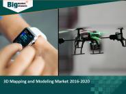
3D mapping and modeling is widely used in many industries to get a detailed representation of a product. It helps companies to design new products through the development of virtual prototypes. It is used across different verticals such as construction, healthcare, aerospace, defense, and automotive. 3D Mapping and Modeling Market to grow at a CAGR of 8.54% during the period 2016-2020. View more details of "3D Mapping and Modeling Market" @ http://www.bigmarketresearch.com/global-3d-mapping-and-modeling-market
| PowerPoint PPT presentation | free to download
Rocky Mountain Mapping Center. USGS Remote Sensing and Invasive Species ... Final Trend Surface Map. Model Output GIS Map. See Schnase et al. 2002, Kalkhan et al. 2003 ...
| PowerPoint PPT presentation | free to view
Download Sample of report @ http://tinyurl.com/je7pr9g 3D mapping and modeling market has been tremendously growing in the past few years with increasing investors and funds obtained from the top technology players.
| PowerPoint PPT presentation | free to download
Quasi-stationary states. of the EMR model's. deterministic ... period = 52 months, damping: 11 months. Floquet modes are related. to the eigenvectors of the ...
| PowerPoint PPT presentation | free to download
Get a Sample of 3D Mapping And 3D Modeling Software Market research report from – https://goo.gl/6PRGJm This report studies the global 3D Mapping and 3D Modeling Software market, analyzes and researches the 3D Mapping and 3D Modeling Software development status and forecast in United States, EU, Japan, China, India and Southeast Asia. This report focuses on the top players in global market, like Apple SAAB Airbus Defence and Space Google Autodesk
| PowerPoint PPT presentation | free to download
... random sample of points is taken from the large scale map (one point ... from the USGS Middle East Oil Resources Survey geologic map of the Arabian Pennisula. ...
| PowerPoint PPT presentation | free to view
Modeling diffusion in heterogeneous media: Data driven microstructure reconstruction models, stochastic collocation and the variational multiscale method*
| PowerPoint PPT presentation | free to view
Transformation of operator with given input-output map for power. systems and its components to Jordan form is equivalent to construction of ...
| PowerPoint PPT presentation | free to view
... NatureServe to develop the classification (Josse et al 2003), but had no map ... Data for Brazil was compiled at 1:1,000,000 scale with the remainder of South ...
| PowerPoint PPT presentation | free to download
Do model mappings really map? On derived information in model ... Kingston, Canada. Q: What is model mapping? Mapping (in the math sense) between models? ...
| PowerPoint PPT presentation | free to download
... Netherlands, Slovakia, Poland, Lebanon, Guatemala, Bolivia, Germany, El Salvador. ... Case study 'Registration Map Quality' (Kadaster) & CCDM. Prototype MDA ...
| PowerPoint PPT presentation | free to view
Mississippi State University. 2. Modeling Efforts at MSU. Common Information Model ... Drexel University (DU) Iowa State University (ISU) Northeastern University (NEU) ...
| PowerPoint PPT presentation | free to view
Chapter 2: Spatial Concepts and Data Models 2.1 Introduction 2.2 Models of Spatial Information 2.3 Three-Step Database Design 2.4 Extending ER with Spatial Concepts
| PowerPoint PPT presentation | free to download
Concept Mapping A Next Generation Strategy For Planning and Evaluating Systems Change Presenters Lenore B. Behar, Director Child & Family Program Strategies William M ...
| PowerPoint PPT presentation | free to download
Object Model Baojian Hua huabj@mail.ustc.edu.cn
| PowerPoint PPT presentation | free to view
Technology Mapping Outline What is Technology Mapping? Technology Mapping Algorithms Technology Mapping as Graph Covering Choosing base functions Creating subject ...
| PowerPoint PPT presentation | free to view
Mapping the Earth A globe is a scale model of the earth. It is useful for showing the entire earth. A pattern of lines circles the globe in east-west and north-south ...
| PowerPoint PPT presentation | free to view
Chapter 5 Value Stream Mapping What is VSM? It is a method of creating a one page picture of all of the processes that occur in the defined scope.
| PowerPoint PPT presentation | free to download
Purple = revisions to an older map, compiled from aerial photos. If an area has become urbanized, this ... USGS- United States Geologic Survey. Ratio- 1:24000 ...
| PowerPoint PPT presentation | free to download
Data Models Objectives Why data ... Relational Database Management System (RDBMS) Performs same basic functions provided by hierarchical and network DBMS systems, ...
| PowerPoint PPT presentation | free to download
As the leading services for LiDAR mapping in India, our team specializes in LiDAR surveys, digital orthophotography, and photogrammetry services. We have the work force, hardware, and ability to give quick reaction to your basic review, photography, and mapping needs, paying little mind to where your undertaking is found. For more information visit us at- http://www.yolaxinfra.com/drone-lidar-survey.php
| PowerPoint PPT presentation | free to download
Modeling styles: 1. Structural Modeling: As a set of interconnected components (to represent structure), 2. Dataflow Modeling: As a set of concurrent assignment ...
| PowerPoint PPT presentation | free to download
various forecasting model and advance software are enlisted....with their examples
| PowerPoint PPT presentation | free to view
Technology To Learn Mapping Grade 3 Social Studies (Mapping skills/Place)
| PowerPoint PPT presentation | free to view
Model Driven Architecture Secure Systems Group Patrick Morrison September 7, 2006 MDA Definition Model Driven Architecture - The OMG approach for specifying system as ...
| PowerPoint PPT presentation | free to download
Title: Database Modeling in Bioinformatics Author: Beate Marx Last modified by: mulder Created Date: 9/23/1999 3:45:52 PM Document presentation format
| PowerPoint PPT presentation | free to download
Weather Station Models Meteorologists use a system of assignment and coding to report a variety of weather conditions at a single location on a weather map.
| PowerPoint PPT presentation | free to view
Before a construction project starts, land surveying includes taking measurements of a particular piece of land. Before crews break ground, much planning & design are included. Drone mapping services are very popular nowadays. Time and costs can be decreased, inaccessible maps areas can be covered, fewer disruptions; more accurate data can be measured. The above information will provide a detailed overview of its benefits.
| PowerPoint PPT presentation | free to download
Human Capabilities: Mental Models CS352 Announcements Notice upcoming due dates (web page). Where we are in PRICPE: Predispositions: Did this in Project Proposal.
| PowerPoint PPT presentation | free to view
Value Stream Mapping and Management
| PowerPoint PPT presentation | free to view
Object model to ER Logical transformation. PIM- PSM. the classic design to impl transformation ... lost learning during construction. Peter Coad's Gutenberg ...
| PowerPoint PPT presentation | free to view
Guelph, Ontario, Canada. Colin di Cenzo ... Map different parameters between MC2 and MM5. Parallel processor CMAQ runs on LINUX ...
| PowerPoint PPT presentation | free to download
To get Modelling courses in Mumbai from top training institutes and get Modelling certification. Get detailed information on best institutes, fees, coaching quality, duration, syllabus, placement services, photos, maps, user ratings and reviews in Mumbai
| PowerPoint PPT presentation | free to download
The EFDC Model Is a Public Domain Surface Water Modeling System Incorporating ... River (VA), York River (VA), Potomac River (MD), Peconic Bay (NY), Indian River ...
| PowerPoint PPT presentation | free to view
model the construction of a concept map to the class. ... Faculty of Education belongs The Chinese University of Hong Kong (CUHK) ...
| PowerPoint PPT presentation | free to view
A model may be descriptive (as in Physics) ... The model representation is created from a given system. ... Model Interpretation ...
| PowerPoint PPT presentation | free to view
Land Cover Mapping Using Landsat 8 Imagery
| PowerPoint PPT presentation | free to download
Faculty of Education belongs The Chinese University of Hong Kong (CUHK) ... see how some domains of knowledge represented on the map are related to each other. ...
| PowerPoint PPT presentation | free to view
Title: Conceptual Design Using the ER Model Subject: Database Management Systems Author: Raghu Ramakrishnan Keywords: Module 5, Lectures 1 and 2 Last modified by
| PowerPoint PPT presentation | free to view
Map information comes in (longitude, latitude) form that needs to be converted ... Geographical Aspects of Poliomyelitis in North-eastern USA, July-October 1916, ...
| PowerPoint PPT presentation | free to download
AR, MA, ARMA, ARIMA, ... 6. Markov Modeling. Simple model. Discretized load levels map to states ... State includes last d discretized levels. Capture momentum, ...
| PowerPoint PPT presentation | free to download
Grid-based Map Analysis and GIS Modeling. Understanding Spatial Patterns and Relationships ... Multimedia Mapping full integration of GIS, Internet and ...
| PowerPoint PPT presentation | free to download
Interactions with background vacuum, remnants, or active ... (vertex-by-vertex argument of s) The infrared cutoff contour ... Perugia Models Huge model ...
| PowerPoint PPT presentation | free to download
Title: Data Modeling using XML Schemas Author: pcguest Last modified by: Mohamed Eltabakh Created Date: 4/4/2003 7:16:57 PM Document presentation format
| PowerPoint PPT presentation | free to download
MAPS. A MAP IS A FLAT TWO-DIMENSIONAL REPRESENTATION OF ... THE UNITED STATES GEOLOGICAL SURVEY (USGS) HAS MAPPED THE ENTIRE UNITED STATES. USGS WAS FOUNDED: ...
| PowerPoint PPT presentation | free to view
University of Hawaii 1998. World Culture Model defining culture ... Islands. Region. Bodies of water. Unique features. Natural disasters. Values and Beliefs ...
| PowerPoint PPT presentation | free to view
Mainly used in language systems, portable libraries. One-to-one. In this model, the library maps each thread to a different lightweight process. Advantages: ...
| PowerPoint PPT presentation | free to view
Title: ISO 11404 for Data Models Author: Frank Farance Last modified by: Frank Farance Created Date: 12/9/1999 6:53:05 PM Document presentation format
| PowerPoint PPT presentation | free to view
Introduction to Semantic Mapping What is Semantic Mapping? Web of words and related concepts Unknown word in center of web surrounded by examples Examples can be ...
| PowerPoint PPT presentation | free to download
Map textures to vertical planes (as in TIP) ... N superpixels in constellation. Line and intersection detectors. Not used: constellation shape (contiguous, N ...
| PowerPoint PPT presentation | free to download
Cerebellar Model Articulation Controller. Introduction. The CMAC is a mathematical ... The CMAC is type of local neural network. The CMAC is provided with the ...
| PowerPoint PPT presentation | free to view
Need to build/clean topology for digitized/scanned maps. Unconnected nodes are snapped ... Digitized maps have same coor. As source map. You may have to ...
| PowerPoint PPT presentation | free to view
New standard for business process modeling. Consists of one diagram ... Enhances current process modeling tools. Can be used with Visio. Enhances swimlane maps ...
| PowerPoint PPT presentation | free to view


