
Exercise 4: elevation - PowerPoint PPT Presentation
1 / 32
Title:
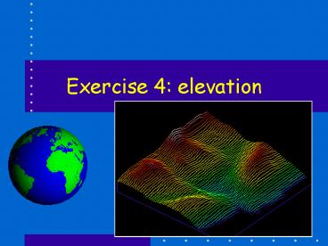
Exercise 4: elevation
Description:
... and PP. Basics of DEMs. Quite a bit of playing with palettes ... A bit of arithmetic. Making an IDIRISI Profile. Calculate Slope and Aspect. RECLASS function ... – PowerPoint PPT presentation
Number of Views:21
Avg rating:3.0/5.0
Title: Exercise 4: elevation
1
Exercise 4 elevation
2
Overview, Ex4 and PP
- Basics of DEMs
- Quite a bit of playing with palettes
- A bit of arithmetic
- Making an IDIRISI Profile
- Calculate Slope and Aspect
- RECLASS function
- Modeling
3
BASICS
- A DEM has values in each cell that are distance
units (ft,m, furlongs. ) above some arbitrary
zero plane - Usually height above MSL
- Most operations on DEMs do not care much about
the height-above-what. - BUT, some do! (Booby Trap)
4
Slope and Aspect
- Slope in or degrees
- Aspect azimuth in which slope faces
- Azimuth Degrees from North, 0 to 360 degrees,
0 and 360 are the same - A BOOBY TRAP HERE IS THAT YOU PRODUCE SLOPE IN
DEGREES RATHER THAN - MAX VALUE SHOULD BE LIKE
31.
5
Compass Rose
6
Aspect
An EAST facing slope
N
A WEST facing slope
W
E
7
Calculating slope aspect
Launching SURFACE opens this dialog
8
And you get this
9
Now that is straight forward
- Only one booby trap what is it?
- Now you have images of raw slope and aspect but
they are not very useful - Why not?
- So we fix that by RECLASSifying the images.
10
RECLASS
- RECLASS allows you to change the values of cells
regardless of where in the raster they are
located. - This is done by specifying a new value and a
range of values to be changed to that new value - The RECLASS dialog has three fields
New value
Start value
To just less than
11
Reclass into slope classes
- Unless you are doing something where individual
slope values are needed you will usually use
slope classes. - Arent that accurate anyway
- Here are the classes
- Slope class 1 0 to JLT 5
- Slope class 2 5 to JLT 10
- .
- Slope class 5 25 to JLT 1000
12
How is that done?
- Click on the RECLASS icon
- Enter Values
13
What does a .rcl file look like?
IDRISI EDITOR
OPEN
Or you could do the same thing by?
14
Quant
Reclassed (to integer) Qual
My 5 class Qual Palette And edited legend values ?
15
Reclassing Aspect
- Aspect is a little more complex but the process
is the same - Reclass into point of the compass
- Edit legend
- How is the Reclass done?...
16
Range for East
The range of values forEast is From 67.5 To
Just Less Than 122.5
0
22.5
45
67.5
90
122.5
North is more complicated.
17
Range for North
North has to be donetwice! 0 to JLT
22.5 AND 337.5 to JLT 361
0
22.5
337.5
45
315
67.5
90
122.5
Why JLT 361?? WHY NOT 360???
18
RECLLASS Aspect
SlopeClasses.rcl
RECLASSing raw ASPECT into points of the compass
19
Change Legend!
20
Summary so far
- Elevation is a basic layer of most applications
of raster GIS - Elevation images are called DEMs
- Slope and Aspect are derived from DEMs
- Slope and Aspect are always more generalized than
the original elevation layer the kernel bit - Edges of an image never have correct slope or
Aspect values - Both slope and aspect are usually classified
- The units of a classified image are Classes
21
Lets do this in the modeler
- To use the Modeler we have to launch it
- Once loaded you build the model, testing as you
go - Then you save it
22
Launch the Modeler
Delete
Run
Insert map
Display
Insert Module
Insert link
23
Insert DEM
24
Insert Surface Module
25
Set Surface Parameters
26
Link input and module
27
Name the output
28
Run
29
Do the whole at once
30
AND
31
Legend?
- Cant update the legend automatically
- BUT I can open the metadata while in the modeler
and do it manually! - Advantage you have a record of what you
did!!!!! - Disadvantage might take a little longer unless
you make a mistake somewhere in the manual
processing and have to reconstruct what you did!
32
Summary
- DEM are basic to most analyses
- Slope and Aspect are calculated from DEMs
- Resolution is 3x that of DEM and edges are
screwed up - Slope and Aspect are usually classified
- Life can be better if you use the modeler
Recommended
CrystalGraphics Presentations


