National Weather Service Des Moines IA - PowerPoint PPT Presentation
1 / 11
Title: National Weather Service Des Moines IA
1
Clarus Initiative Coordinating Committee Meeting
5 20-21 September 2007
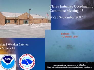
Blizzard 1-2 March, 2007
National Weather Service
Des Moines IA
IDOT
2
National Weather Service Des Moines, IA
Mission provide watches, warnings, advisories,
and forecasts for the protection of
life and property
- 10 Forecasters and 4 MIT/HMTs provide 24/7
operational coverage - Support Staff includes DAPM, ITO, and Service
Hydrologist with responsibilities for data ingest
and dissemination
3
Snow and Ice Storm 24-25 February 2007
- Widespread tree and power line damage across
much of the northeast two thirds of the County
Warning Area (CWA) - At the height of the storm, at least 265,000
customers were without power - Final damage figures for the three utility
entities involved in the ice storm were around
138,000,000 - Six to twelve inches of snow was common across
much of northwest half of Iowa - Although ice storms are not documented that well,
this storm appears to be the worst ice storm in
Iowa in the past 40 years due to the large areal
extent of the storm. - Storm Data Report
4
SHORT TERM FORECAST 24 FEBRUARY 2007
.NOW
,,,WINTER STORM WARNING THROUGH MIDDAY
SUNDAY LIGHT TO MODERATE FREEZING RAIN WILL
CONTINUE THROUGH EARLY EVENINGTHEN BECOME MIXED
WITH SNOW AND SLEETFOLLOWED BY A CHANGE OVER TO
ALL SNOW BETWEEN 9 PM AND MIDNIGHT. EXPECT VERY
SLICK CONDITIONSESPECIALLY UNTREATED ROADS AND
ELEVATED SURFACES. LATER TONIGHTHEAVY SNOW AND
HIGH WIND WILL PRODUCE VERY HAZARDOUS CONDITIONS.
5
Iowa Environmental Mesonet IEM Freeze
application
6
SHORT TERM FORECAST 20 JANUARY 2007
.NOW AREAS OF FOG WILL CONTINUE TO RESTRICT
VISIBILITIES THROUGH SUNRISE ACROSS MUCH OF
CENTRAL IOWA. VISIBILITIES WILL RANGE GREATLY
DURING THE EARLY MORNING WITH HORIZONTAL
VISIBILITIES GOING FROM 5 MILES OR GREATER TO
LESS THAN ONE QUARTER MILE OVER A VERY SHORT
DISTANCE. IN ADDITIONMOISTURE WITH THE FOG WILL
FORM A THIN COATING OF ICE ON OUTSIDE SURFACES
AND WILL LIKELY PRODUCE SOME SLICK SPOTS ON AREA
ROADS AND HIGHWAYS.
7
Blizzard 1-2 March 2007
- A large area of northwest Iowa received 10 to 18
inches of snow - Widespread blizzard conditions resulted in
numerous road closures over the northwest half of
the state. Large portions of Interstates 80 and
35 closed. - Hundreds of people were stranded in their cars
during the height of the blizzard. The National
Guard was called out to conduct numerous rescue
missions. - Reports of 5 to 10 foot snow drifts were common
across western and northern Iowa, with drifts of
16 feet reported in the Carroll area. - The blizzard was considered the worst in decades
for parts of western Iowa. - Storm Data Report
IDOT
IDOT
8
Coordination with IDOT during high impact weather
events
- Iowa State DOT called NWS during the early
morning hours of 2 March 2007 to discuss timing
of heavy snow and strong winds - IDOT proactively closed interstates before
conditions became impassible - IDOT road conditions utilized extensively for
short term forecast trends
9
Coordination with County IDOT Offices and County
Engineers
10
Other Examples of Coordination and Data use
- IDOT ON MICRN NETWORK
- IDOT MESSAGE BOARDS
- IDOT REST AREA WEATHER KIOSKS
- RWIS DATA USED FOR VERIFICATION OF NWS FORECASTS
11
Any questions or comments ? Rich.Kinney_at_noaa.gov
National Weather Service
Des Moines IA
The views expressed are those of the author and
do not necessarily represent those of the
National Weather Service.


