
6' VISUALIZATION of DATA 2D - PowerPoint PPT Presentation
1 / 10
Title:
6' VISUALIZATION of DATA 2D
Description:
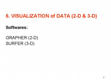
1. 6. VISUALIZATION of DATA (2-D & 3-D) Softwares: GRAPHER (2-D) SURFER (3-D) 2. IN-CLASS PROBLEM SESSION 4. Objective: Learning repetitive execution, a ... – PowerPoint PPT presentation
Number of Views:24
Avg rating:3.0/5.0
Title: 6' VISUALIZATION of DATA 2D
1
6. VISUALIZATION of DATA (2-D 3-D)
SoftwaresGRAPHER (2-D)SURFER (3-D)
2
IN-CLASS PROBLEM SESSION 4
- Objective Learning repetitive execution, a
numerical method - (Numerical Integration of Functions) and a tool
for the visualization of - 2-D data (GRAPHER)
- Assignment
- Step 1 Write a program to approximate the
integral of a given - function over the interval (a,b) by using the
rectangle method - with altitudes chosen at the midpoints of the
subintervals. - Choose a, b and subinterval as 0., 5. and 0.5.
- Step 2 Write the numerical values of x and yx21
calculated at Step 1 - into a previously opened file (.dat) as the
formatted output data. - Then plot x versus y values in .dat file by
using GRAPHER software.
3
IN-CLASS PROBLEM SESSION 6
- Objective Learning a tool for visualization of
3-D data - (SURFER)
- Assignment Contour the elevation values (3rd
column) - at x and y coordinates (1st and 2nd columns) in
given - 3-D data (elevation_3d.dat) by using SURFER
program. - Analysis the gridding methods defined in the
surfer - program in terms of their performances and
problems.
4
The data (elevation_3d.dat) is from Davis,1986, p
361.
5
Triangulation method of estimating positions of
contour lines (Davis, 1986, p 357)
6
Gridding Method Triangulation (Davis, 1986, p
364).
7
Contour map by triangulation (Davis, 1986, p 365)
8
Reference Davis, J. C. 1986, Statistics and
DataAnalysis in Geology, John Wiley and Sons.
9
SURFER
- Surfer is a grid based contour program.
- Gridding is the process of using original data
points - (observations) in an XYZ data file to generate
calculated data - points on a regularly spaced grid (a grid file,
.grd). - Interpolation schemes estimate the value of the
surface at - locations where no original data exists, based on
the known - data values (observations).
- Surfer then uses the grid to generate the contour
map or - surface plot.
10
- Under most circumstances, there are few problems
when using - a grid file to produce a contour map versus
using the original raw - data to produce the contour map.
- Surfer Gridding (Golden Software)
- http//www.seismo.unr.edu/ftp/pub/louie/class/333/
contour/surfer.pdf - Spatial Aliasing
- http//www.seismo.unr.edu/ftp/pub/louie/class/333/
contour/lab.html - Sample Gridding Methods
- http//www.colorado.edu/geography/gcraft/warmup/aq
uifer/jpghtml/methods.html
Recommended
CrystalGraphics Presentations


