Agenda - PowerPoint PPT Presentation
1 / 23
Title:
Agenda
Description:
Cumulative Watershed Effects Modeling. SMR (Soil Moisture Routing) model. WEPP (Water Erosion Prediction Project) model. CCHE1D (One Dimensional Channel Network Model) ... – PowerPoint PPT presentation
Number of Views:74
Avg rating:3.0/5.0
Title: Agenda
1
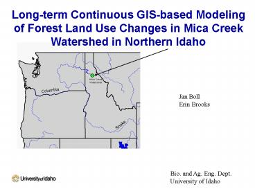
Long-term Continuous GIS-based Modeling of Forest
Land Use Changes in Mica Creek Watershed in
Northern Idaho
Jan Boll Erin Brooks
Bio. and Ag. Eng. Dept. University of Idaho
2
Cumulative Watershed Effects Modeling
- SMR (Soil Moisture Routing) model
- WEPP (Water Erosion Prediction Project) model
- CCHE1D (One Dimensional Channel Network Model)
SMR
CCHE1D
WEPP
3
Nested watershed system
Control
Partial cut
Clearcut
4
(No Transcript)
5
(No Transcript)
6
(No Transcript)
7
Soil Moisture Routing (SMR) Model
8
Soil Moisture Routing (SMR) Model
9
Soil Moisture Routing (SMR) Model
10
SMR Soil Properties
- 4 m total soil depth
- 0.5 m Topsoil _at_ 51 saturated moisture content
- 3.5 m subsoil _at_ 13 saturated moisture content
OR
2.4 m total soil depth 0.5 m topsoil _at_ 51
saturated moisture content 1.9 m subsoil _at_ 25
saturation moisture content
11
Mass Balance (Flume 1)
ET reduced after clearcutting SMR over- or
underpredicts Q
12
(No Transcript)
13
Runoff
Soil depth
14
WEPP Model
15
(No Transcript)
16
(No Transcript)
17
(No Transcript)
18
(No Transcript)
19
CCHE1D
Flume 3
Flume 4
Flume 2
Flume 1
20
Typical observed X-sectional data at Mica Creek
near cross-section 2
21
(No Transcript)
22
Bank Erosion using a critical shear stress of 7 Pa
23
Future Work
- Improve WEPP/SMR flow simulations
- Snow and soil parameters in WEPP
- Energy balance snowmelt in SMR?
- Incorporate WEPP/SMR output into CCHE1D
- Parameterize CCHE1D using cross-sectional data


![get⚡[PDF]❤ Pocket Planner 2024-2025: Small 2-Year Monthly Agenda for Purse | 24 Months PowerPoint PPT Presentation](https://s3.amazonaws.com/images.powershow.com/10081698.th0.jpg?_=20240719098)


![[PDF] DOWNLOAD Agenda 2021: Poker, crâne | Janvier à Décembre 2021 | A PowerPoint PPT Presentation](https://s3.amazonaws.com/images.powershow.com/10095955.th0.jpg?_=20240811046)


