
PowerPoint bemutat - PowerPoint PPT Presentation
1 / 25
Title: PowerPoint bemutat
1
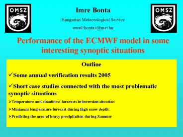
Imre Bonta Hungarian Meteorological
Service emailbonta.i_at_met.hu Performance of the
ECMWF model in some interesting synoptic
situations
- Outline
- Some annual verification results 2005
- Short case studies connected with the most
problematic synoptic situations - Temperature and cloudiness forecasts in inversion
situation - Minimum temperature forecast during high snow
depth. - Predicting the area of heavy precipitaiton during
Summer
2
Verification system at HMS based on coded
forecast
The basis of our objective verification system is
the coded form of the six days forecast made
daily at the forecasting division. Since the form
of the forecasts are equal, the forecasters and
the models predictions can be verified with the
same software package calculating the same
structure of statistical scores. Thus any
comparison can be done easily either between the
models or between model and forecasters
OOKI HHNN BBJJ CCVW SSSS AALL YYXX 1210
0424 83// 682/ 36// 0308 08// 1220 0424
8/// 8/2/ 36// 0308 07// 1230 0424 8///
8/2/ 36// 0409 08// 1240 0424 8/// 8/2/
36// 0308 08// 1250 0424 83// 682/ 36//
0410 06// 1260 0424 83// 682/ 36// 0411
06//
C
3
Verification 2005 ALADIN ECMWF Forecaster
In case of minimum and maximum temperature as
well as total cloud cover, the operational
forecaster was able to improve on the model
forecasts on average for all forecast ranges.
4
Verification 2005 ALADIN ECMWF Forecaster
In case of precipitation and wind the ALADIN
model was the best. Regarding the average wind
speed till D5 and the wind gust forecasts
generated automatically from the model output
proved to be the best on average with a
significantly higher skill compared to
Forecasters.
5
- The most problematic synoptic situations
- Inversion situation (16 Jan., 02 Feb. 2006 )
- In spite of the new scheme of ECMWF model (Martin
Köhler, ECMWF Newsletter No. 104-Summer 2005),
the inversion situation is not always captured by
the model. Therefore, in these cases the model
results need to be modified by the forecasters.
Matra mountain Highest peak in Hungary 1015 m
A persistent layer of stratus has developed at
about 900 m over the Carpathian-Basin
6
Inversion situation 16. 01. 2006. Unsuccessful
cloudiness forecast in case of inversion
situation Most of the low cloudiness was not
predicted either by ECMWF nor ALADIN model.
In the model cloudless areas
ECMWF total cloudiness forecast 14. 01. 2006
12UTC FC t48
MSG image 16 January 2006 11UTC
The MSG image compared with the total cloudiness
forecast
7
Temperature profiles (emagram) for Budapest
green ECMWF (analysis and 48 h forecast), violet
ALADIN (48 h forecast), red Radiosond
14. 01. 2006 12UTC FC t48
14. 01. 2006 12UTC FC t00
850
900
850
900
1000
1000
In the forecast the inversion layer shifted to
the ground, and the relative humidity decreased
near the bottom of the real inversion layer,
below 900 hPa.
In the ECMWF analysis the inversion layer starts
closer to the surface than in the reality
No change in the observed temp. profile
8
Inversion situation 16. 01. 2006. Cross
section of ECMWF T511 RHU forecast (line directed
from SW towards NE) 15. 01. 2006 00UTC FC t36
Total cloud.
700 hPa
In the model, high values of relative humidity
(exceeding 80?) can only be found near the
surface, while in the reality humid layer is just
below 1 km as the sounding shows
dry
850 hPa
925 hPa
wet
9
Inversion situation 16. 01. 2006. ECMWF total
cloudiness forecast 15 January 00 UTC00, 12, 36)
15.01.2006 00UTC FC t00
15.01.2006 00UTC FC t12
15.01.2006 00UTC FC t36
10
Inversion situation 16. 01. 2006. 16. 01.
2006. Most of the low cloudiness was not
predicted either by ECMWF nor ALADIN leading to
wrong temperature forecasts
Performance of the model and forecaster (Bp.)
ECMWF ALADIN
Forecasters Obs. Cloudiness (oktas) 1-2
0-1 6,5-7,4
8,0 during the day Minimum -7
-10 -3 -4
The forecasters could improve on the model
11
Inversion situation ( 02 Febr. 2006) MSG image
( 02 Febr. 2006) compared with forecasts from
different starting dates
02. 02. 2006 00UTC FC t12
MSG image 02. 02. 2006 1245 UTC
01. 02. 2006 12UTC FC t24
12
The minimum temperature is overpredicted in case
of high snow depth
MINIMUM -20 -30
Snow depth (14.02.2003)20-40 cm
Error of minimum temperature ALADINECMWF model
13
The minimum temperature is overpredicted in case
of high snow depth (20 cm) Similar situation and
similar experience in February 2005!!
Minimum temperature (areal average) forecast in
South-East Hungary Date 07 Febr.
08 Febr. 09 Febr. ECMWF -13
-13 -15 ALADIN
-10 -11 -11
Forecasters -15 -19
-21 Measured -20
-21 -21
The minimum temperature and the snow depth, 08
Febr. 2005
-11/5 cm
-13/8 cm
-20/12 cm
-11/2 cm
-20/14 cm
-25/18 cm
-12/2 cm
The forecasters could improve on the model
results significantly
14
Wrong minimum temperature forecast due to the
unrealistic high snow depth in the model (07 Jan.
2006)
Snow-depth in the reality
ECMWF snow-depth (cm) 08, January 06 UTC
0
40
2
0
0
6
0
6
0
0
20- 30
Budapest
20- 30
10-20
5- 10
5- 10
5- 10
15
Wrong minimum temperature forecast due to the
unrealistic high snow depth in the model (07 Jan.
2006 12UTC ) Total cloudiness, wind forecasts 07
January 2006 12UTC FC t18 and t42
T850-6 T925-4
T850-4 T925-3
Minimum temperature forecast for Budapest For 08.
01. 06 UTC -13 For
09. 01. 06 UTC-16 Mesaured
-4
-7
16
Due to the unrealistic high snow depth in the
model the minimum temperature is underpredicted
(09 and 08 January, 2006)
2m temperature forecast/Measured values
07 January 2006 12UTC FC t42
07 January 2006 12UTC FC t18
-13/-7
-12/-10
-14/-10
-14/-8
-10/-8
-7/-8
-16/-7
-12/-11
-5/-5
-13/-4
-2/-2
-8/-8
-9/-7
-9/-4
-1/-1
-5/-8
-6/-6
-2/-4
-2/-3
-6/-5
17
Predicting the area of heavy precipitaiton during
SummerEPS or deterministic model for short
rangeAccumulated precipitation 11-12 Aug. 2005
(12.08. 00-12 UTC)
Budapest
Siófok
Budapest 0 mm Siófok 4 mm
18
EPS or deterministic model for short range Three
consecutive precipitation forecasts from
different base dates but valid for the same
period. The forecasts change run by run a
lot. ECMWF Forecast for Hungary, valid 12. 08.
2005 00-12 UTC Based10.08.12UTC
Based 11.08. 00UTC Based
11.08.12UTC
Budapest
Siófok
The subsequent forecasts of ECMWF gradually
become closer to the observed precipitation
pattern and 12 hours before the start of the
event the determinstic forecast was correct.
More than 20 mm
German model ALADIN model Based 11.08.
00UTC
19
Three consecutive plumps diagram for Budapest and
Siófok
Operative 28 mm Ensemble mean 8 mm
Operative (yelow) 10 mm Ensemble mean (brown) 7
mm
Based on 10. 12 UTC 36 hours before the start of
the event
The deterministic forecast due its higher
resolution produced better results!!!!!
Operative 2 mm Ensemble mean 7 mm
Operative 3 mm Ensemble mean 8 mm
Based on 11. 00 UTC (24 hours before the start of
the event)
Operative 0,5 mm Ensemble mean 10 mm Measured
value4 mm
Operative 0,1 mm Ensemble mean 7 mm Measured
value0 mm
Based on 11. 12 UTC (12 hours before the start of
the event)
20
Predicting the area of heavy precipitation during
Summer EPS or deterministic model for short
range24 hour precipitation amount in August 2005
Measured precipitation ECMWF
forecastbased on 02.August 2005 12UTC
Valid 04. 08. 06 UTC-05. 08.
06 UTC
Precipitation mm/24 h
Budapest
Budapest
More than 100 mm in the model, but 200 km towards
to the east
More than 100 mm in the reality
21
EPS or deterministic model for short range
ECMWF model
ALADIN model
Based02 08
2005 12 UTC Based03 08 2005 12 UTC
Based04 08 2005 00 UTC Valid04 08 06 UTC-05 08
06 UTC
Budapest
Budapest
Budapest
Just as in the ECMWF deterministic forecasts
(based on 02 08 2005 12 UTC and 03 08 2005 12
UTC), the precipitation over Hungary is largely
missed in ALADIN model as well.
Precipitation mm/24 h
22
Predicting the area of heavy precipitation during
Summer EPS or deterministic model for short
range Plumps diagram for Budapest. Based on 02
08 12UTC, 03 08 00UTC, 03 08 12UTC
Big uncertainty
23
In contrast to the T511 forecast, which predicted
the event too far east, the EPS was more
successful in predicting the area of the event
the 20 of the members showing a consistent
signal more to the west, closer to the event.
Ensemble members
The EPS needs to be taken into account for short
range as well!!!
24
- CONCLUSION
- In case of temperature and total cloud cover, the
ECMWF model overtakes the ALADIN model (according
to the verification based on coded forecasts
2005), and regarding these elements the
operational forecaster was able to improve on the
model forecasts on average for all forecast
ranges. In case of precipitation and wind the
ALADIN model seems generally better. - In spite of the new scheme of ECMWF model, the
inversion situation is not always captured by the
model. Therefore, in these cases the model
results need to be modified by the forecasters. - During period of high snow depth the models tend
to overestimate the minimum temperature. But some
cases can be found, when due to the unrealistic
high snow-depth in the model the minimum
temperature is underpredicted - The cases studies connected with heavy
precipitation event show, that it is difficult to
make a decision whether short range forecast
should be based on the the finer resolution
deterministic model or the EPS.
25
Thank you for your attention !
Recommended
CrystalGraphics Presentations


