
Locational and Land Partitioning System - PowerPoint PPT Presentation
1 / 19
Title:
Locational and Land Partitioning System
Description:
east-west, and one vertical (y), representing north-south. ... East and west rows of townships are called tiers (or townships) and are numbered ... – PowerPoint PPT presentation
Number of Views:84
Avg rating:3.0/5.0
Title: Locational and Land Partitioning System
1
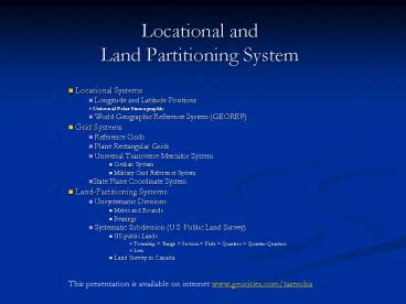
Locational and Land Partitioning System
- Locational Systems
- Longitude and Latitude Positions
- Universal Polar Stereographic
- World Geographic Reference System (GEOREF)
- Grid Systems
- Reference Grids
- Plane Rectangular Grids
- Universal Transverse Mercator System
- Civilian System
- Military Grid Reference System
- State Plane Coordinate System
- Land-Partitioning Systems
- Unsystematic Divisions
- Metes and Bounds
- Bearings
- Systematic Subdivision (U.S. Public Land Survey)
- US public Lands
- Township gt Range gt Section gt Plats gt Quarters gt
Quarter-Quarters - Lots
2
Why we need this systems?
- Provides a brief description of local and global
systems for use in precise positioning,
navigation, and geographic information systems
for the location of points in space. - There are many different coordinate systems,
based on a variety of geodetic datums, units,
projections, and reference systems in use today.
3
Locational System
- Longitude and Latitude Positions
- Universal Polar Stereographic (UPS)
- World Geographic Reference System (GEOREF)
4
Latitude and longitude
- The most commonly used coordinate system today is
the latitude, longitude, and height system. - The Prime Meridian and the Equator are the
reference planes used to define latitude and
longitude. - Not good for land partitioning because distance
between these lines is variable - Distance between meridians decreases toward poles
- One degree of latitude does not equal one degree
of longitude except on the equator.
5
Universal Polar Stereographic (UPS)
- The Universal Polar Stereographic projection
(UPS) is defined above 84 degrees north latitude
and south of 80 degrees south latitude. - The Eastings and Northings are computed using a
polar aspect stereographic projection. - Zones are computed using a different character
set for south and north Polar regions.
6
World Geographic Reference System (GEOREF)
- The World Geographic Reference System is used for
aircraft navigation. - GEOREF is based on latitude and longitude.
- The globe is divided into twelve bands of
latitude and twenty-four zones of longitude, each
15 degrees in extent.
7
Grid Systems
- Reference Grids
- Plane Rectangular Grids
- Universal Transverse Mercator System
- Civilian System
- Military Grid Reference System
- State Plane Coordinate System
8
Reference Grids
- Supplements to map index
- Included in ATLAS and Street Maps
- Use letters to designate horizontal Bands and
Number to designate vertical bands - Shortcoming These grids are specific to
individual maps
9
Plane Rectangular Grids
- Superimposed on a map to provide an easily used
locational system without introducing corrections
for the curvature of the earth. - Rectangular Coordinate Systems
- A map projection is made by transforming the
spherical surface to a plane. - A rectangular plane coordinate grid is placed
over the map projection. The origin of the
coordinate grid is often placed somewhere near
the center of interest on the map. The
perpendicular axes of the coordinate grid are
usually made to coincide with straight-line
meridians and/or parallels, if they exist. - It is a standard practice for large-scale maps to
be on conformal projections. Under such
projections, coordinate reference grids maintain
the accuracy you need to calculate directions and
distances. - Conventional way to specify a pair of coordinates
is, first, to give X value called easting, and
then Y value called northing. - To further simplify calculation, both easting and
northing coordinates are often made positive by
shifting the origin to the southwest corner. To
accomplish this, two arbitrary large values,
called false easting and false northing, are
given to the Y-axis and X-axis origin. - Cartesian Co-ordinate System
- Origin (initial point), a unit of distance,
x-axis, y-axis. - The Cartesian coordinate system uses two axes
one horizontal (x), representing east-west, and
one vertical (y), representing north-south. - Locations of geographic objects are defined
relative to the origin, using the notation (x,y). - Generally, the east-west first and the
north-south coordinate second - (e.g. 642000195000 or 642195)
10
Universal Transverse Mercator (UTM)
- Civilian System
- UTM coordinates define two dimensional,
horizontal, positions. - UTM zone numbers designate 6 degree longitudinal
strips. The zones are numbered from 1 to 60
eastward, beginning at the central meridian. - UTM zone characters designate 8 degree zones
extending north and south from the equator. - Eastings are measured from the central meridian
Northings are measured from the equator - It is a metric system. The meter is the basic
unit for measurement.
Widely adopted by topographic maps, satellite
imagery, natural resource databases, etc in the
US and other countries.
11
Universal Transverse Mercator (UTM)
- Military Grid Reference System (MGRS)
- The Military Grid Reference System (MGRS) is an
extension of the UTM system. UTM zone number and
zone character are used to identify an area 6
degrees in east-west extent and 8 degrees in
north-south extent. - UTM zone number and designator are followed by
100 km square easting and northing identifiers. - The system uses a set of alphabetic characters
for the 100 km grid squares. - Starting at the 180 degree meridian the
characters A to Z (omitting I and O) are used for
18 degrees before starting over. - From the equator north the characters A to V
(omitting I and O) are used for 100 km squares,
repeating every 2,000 km.
A to V 22 Character (Remove I and O, left 20
character)
Depend upon accuracy reference is shortened
(round figure)
12
State Plane Coordinate System
- The State Plane Coordinate system were developed
in order to provide local reference systems which
divides the U.S. into a hundred or more distinct
grid surfaces (Zones). - Some smaller states use a single state plane zone
However, Larger states are divided into several
zones. - State plane zone boundaries often follow county
boundaries. - Lambert Conformal Conic (LCC) projections are
used for rectangular zones with a larger
east-west than north- south extent. - UTM projections are used for rectangular zones
with a larger north- south than east-west extent. - False origin is established outside the zone so
that measurement gets positive value. (False
Easting and False Northing)
13
Land-Partitioning Systems
- Unsystematic Divisions
- Metes and Bounds
- Bearings
- Systematic Subdivision (U.S. Public Land Survey)
- US public Lands
- Township gt Range gt Section gt Plats gt Quarters gt
Quarter-Quarters - Lots
- Land Survey in Canada
- Patterns in Areas of French Settlements
- Patterns in Areas of English Settlements
- Westward Expansion
14
Metes and Bounds, Bearings
- Metes and Bounds identify the boundaries of land
parcels by describing lengths and directions of
lines. - Lines are described with respect to natural or
artificial monuments and baselines defined by
these monuments. - The metes and bounds survey is based on a point
of beginning, an established monument. - Line lengths are measured along a horizontal
level plane. - Directions are bearing angles measured with
respect to a previous line in the survey. - Direction in metes and bounds survey are
indicated by the use of bearings.
15
U.S. Public Land Survey System
- INITIAL POINTS
- In each area an initial point is established by
astronomical observations. There are 35
Principal Meridians in the public lands systems
based on 37 initial points. - From each initial point a true north-south line
called a principal meridian is established to the
limits of the area to be covered. - From each initial point a true east-west line
called a base line is established to the limits
of the area to be covered. - PARALLELS AND MERIDIANS
- Parallels are run as true parallels of latitude
24 miles apart north and south of base line. - Standard parallels are numbered consecutively
north and south of the base line, e.g. Second
Standard Parallel North. - Meridians are run as true meridians 24 miles
apart east and west of the principal meridian - Guide meridians are numbered consecutively east
and west of the principal meridian, e.g. First
Guide Meridian East. - QUADRANGLES, RANGE AND TOWNSHIP LINES
- A quadrangle is divided into townships by running
range (R) and township (T) lines. - Range lines are true meridians running north at 6
mile intervals on the base line and standard
parallel lines. - Township lines are true parallels established at
6 mile intervals on the principal meridian, guide
meridians, and range lines.
- Public lands are divided into quadrangles.
- Quadrangles are 24 miles on a side.
- Quadrangles are divided into townships (16).
- Each township is 36 square miles (6 miles x 6
miles). - Townships are divided into sections (36).
- Each section is 640 acres (1 mile by 1 mile).
- Sections can be subdivided in a variety of ways.
16
U.S. Public Land Survey System
- TOWNSHIPS
- A township is identified by a unique description
based on its principal meridian. - North and south rows of townships are called
ranges and are numbered consecutively east and
west of the principal meridian. - East and west rows of townships are called tiers
(or townships) and are numbered in order north
and south of the base line. - DESCRIPTIONS OF LAND PARCELS
- Descriptions of land within the public lands
system are designated by boundaries that are
unique, clear, and concise. Examples - Sec. 6, T 8 N, R 19 E, 5th PM.
- The SE1/2, SW1/4, Sec. 21, T 2 N, R 5 W, Ute
Prin. Mer.E 80 acres, NE1/4, Sec. 14, T 15 S, R
10 E, 6th PM. - LOTS
- Land units where normal system of fraction cannot
be applied - Usually on edges of townships
- Stream or lake more than 25 acres is encountered
- MEANDER LINE
- When Lots are established, a line is called
meander line surveyed along water bodys mean
high water elevation.
- Public lands are divided into quadrangles.
- Quadrangles are 24 miles on a side.
- Quadrangles are divided into townships (16).
- Each township is 36 square miles (6 miles x 6
miles). - Townships are divided into sections (36).
- Each section is 640 acres (1 mile by 1 mile).
- Sections can be subdivided in a variety of ways.
17
Land Survey in Canada
- Patterns in area of French settlements
- French Govt granted Large land holding called
seigneuries having owner seigneurs. - Seigneuries sub-divided in to lots called rotures
(allocated to individual farmers) - Sub-division was largely controlled by rivers,
highway and communication links of the time - Patterns in area of English settlements
- Lots of 100 to 300 acres surveyed in large
rectilinear blocks - Lots are approximately paralleling the irregular
banks of rivers. - Westward expansion
- Dominion land survey system (Canada land survey
system) provide orderly framework for expansion
into the prairies and the mountains of the west. - It is basically same as in the USPLS (U.S. Public
Land Survey)
18
Cultural Influences
- The cultural landscapes provides insights that
relate to aesthetics, conservations, pollution,
land use, zoning, and myriad other concerns. - Roman method of subdivision Centuriation a
landscape of rural central Italy are long lasted.
19
Miscellaneous Systems
- Postal Codes
- Maidenhead Grid Squares
- ATT, V and H Coordinate System
- Navigation System Coordinates (Useful for
aircraft)
Recommended
CrystalGraphics Presentations


