
Designing for Nonmotorists: Shared Use Paths - PowerPoint PPT Presentation
1 / 48
Title:
Designing for Nonmotorists: Shared Use Paths
Description:
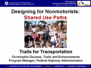
Designing for Nonmotorists: Shared Use Paths Trails for Transportation Christopher Douwes, Trails and Enhancements Program Manager, Federal Highway Administration – PowerPoint PPT presentation
Number of Views:34
Avg rating:3.0/5.0
Title: Designing for Nonmotorists: Shared Use Paths
1
Designing for Nonmotorists Shared Use Paths
- Trails for Transportation
- Christopher Douwes, Trails and Enhancements
Program Manager, Federal Highway Administration
2
Designing for Nonmotorists Course Overview
- Part 3 Off-Road Facilities
- Shared Use Paths
- Recreational Trails
- Motorized Trails
- Part 4 Resources
- Training, Publications, and Websites
- Credits
3
Shared Use Paths
4
What is a Shared Use Path?
- The term shared use path means a multi-use
trail or other path, physically separated from
motorized vehicular traffic by an open space or
barrier, either within a highway right-of-way or
within an independent right-of-way, and usable
for transportation purposes. - Shared use paths may be used by pedestrians,
bicyclists, skaters, equestrians, and other
nonmotorized users.
5
Sidewalk or Trail?
- What is the difference between a sidewalk and a
trail? Part function, part location. - If it acts like a sidewalk, its a sidewalk.
- If it acts like a trail, its a trail.
- If it is in between..
- Facilities on park land parallel to streets.
- Doesnt matter who maintains (parks or streets
department). The function matters. - People will always argue fine details..
6
Provisions
- If you build a shared use path.
- Make sure it works for all users.
- Accommodate pre-existing legal users, including
equestrians. - Ensure Accessibility to be covered in the
Accessible Design course. - Ensure construction to guidelines Verify!
7
Good Examples
- Oregon integrates recreational trails and
transportation facilities Portland Esplanade - Trails connect parks and recreation MKT Trail,
Columbia MO
8
Bad Example
- What do these curves do?
- Landscape architect vs
- Engineer?
- Practical vs pretty?
- Transportation vs recreation?
- Opposite side of the road from a high school and
other origins or destinations no crosswalks. - It may be part of a larger plan.
9
Shared Use Paths Guidelines
- American Association of State Highway
- and Transportation Officials (AASHTO)
- Guide for the Development of Bicycle Facilities
1999. https//bookstore.transportation.org/. - The 2010 version is under final review.
- Guide for the Planning, Design, and Operation of
Pedestrian Facilities 2004. https//bookstore.tra
nsportation.org/
10
Shared Use Paths Surface
- Surface Firm and stable.
- Must accommodate wheelchairs.
- Accommodate narrow-tire bicycles.
- Accommodate people pushing baby strollers (good
test equipment). - Slip resistance desired, but not required.
- Required for public rights-of-way (PROW).
- Pavement is not required. Pavement may not be
appropriate in some settings (rural).
11
Shared Use Paths Surface
- There are no Federal laws or regulations that
require a shared use path to be paved.
12
Shared Use Paths Surface
- Firm and stable.
- Some crushed aggregates can be firm and stable.
- Rotational Penetrometer
- Measures firmness and stability of
- ground and floor surfaces.
- www.beneficialdesigns.com/surfaces/surface.htmlro
tational
13
Shared Use Paths Surface
- Pavement
- Asphalt or Concrete?
- Asphalt often cheaper to construct, but may
suffer water, frost, and tree root damage. - Concrete may be cheaper in the long run may
better withstand flooding, frost, roots, etc. - Concrete use saw cut for joints.
- Check for accessibility and a smooth surface.
14
Shared Use Paths Tread Obstacles
- Tread Obstacles Avoid, Minimize, and Prevent.
- Prevent roots, rocks, ruts, bumps, cracks, etc.
- Maintain a smooth path sweep, fix
irregularities. - Exception Detectable warnings at crossings.
15
Shared Use Paths Gaps
- Gaps Avoid, Minimize, and Prevent.
- Keep drainage grates off the trail.
- Minimize openings, pavement and bridge joints,
open bridge decks, railroad crossings,
boardwalks. - Openings shall not permit passage of a 0.5 inch /
13 mm diameter sphere. - Elongated openings should be perpendicular or
diagonal to travel direction. - Some exceptions for boardwalks 0.75 inch/19 mm.
16
Shared Use Paths Speed
- Design Speed AASHTO Guide is 20 mi/h.
- Draft 2010 AASHTO Guide proposes 14 mi/h.
- REASON Most bicyclists are slower than the
design bicyclist, pedestrians, other users. - Consider not having completely straight paths
- May encourage excessive speed.
- May result in speed variation conflicts.
- Boring experience.
17
Shared Use Paths Width
- How much use will there be?
- 8 foot minimum for low-use facilities
- Connectors between cul-de-sac neighborhoods.
- To avoid inviting cut-through motor vehicles.
- Prefer 10 foot minimum, recommend 12 foot, more
if needed. - Avoid designing only
- for the minimum.
18
Shared Use Paths Width
- High use facilities Consider separating heels
and wheels on two separate paths.
19
Shared Use Paths Width
- Passing Space
- Accessibility requirement At least 60 inches
(1525 mm) width within 1,000 foot (300 m)
intervals. - Usually not an issue for Shared Use Paths.
- Avoid designing only for the minimum.
20
Shared Use Paths Slope
- Slope Accessibility is the primary
consideration. - Based on Outdoor Developed Areas Guidelines.
- Access Board to propose stricter guidelines
- Either Public Rights of Way (PROW), or
- Outdoor Recreation Access Routes (ORAR).
- At highway crossings Highway slope is trail
cross slope, highway cross slope is trail slope.
21
Shared Use Paths Slope
- Slope lt5 to the extent feasible.
- Slope ORAR Trail
- 120 (5) any length any length
- 112 (8.33) up to 50 feet up to 200 feet
- 110 (10) up to 30 feet up to 30 feet
- 18 (12.5) no up to 10 feet
- Trail No more than 30 of the total trail length
shall exceed 112 (8.33).
22
Shared Use Paths Slope
- Avoid abrupt grade changes
- Not only annoying, they can be dangerous.
23
Shared Use Paths Rest Intervals
- Rest Intervals A place to stop and rest.
- Where running slopes exceed 120 (5), at
intervals no greater than the lengths permitted
under running slope. - Size 60 inch (1525 mm) length, at least as wide
as the widest trail segment adjacent to the rest
area. - PROW Level Landing 2.
- ORAR 3 (5 if drainage needs).
- Trail 5 (exempt if not possible).
- Rest area may be off to the side.
24
Shared Use Paths Cross Slope
- Cross Slope lt2 on paved surfaces.
- PROW ORAR Trail
- General 2 3 5, 3 preferred
- Exception 5 5 10
- At street crossings without stop control or at
midblock. - If needed for drainage on an unpaved surface.
- Superelevation? Accessibility trumps.
25
Shared Use Paths Vertical Clearance
- Accessibility 80 inches minimum.
- Equestrian Use 10 feet minimum.
26
Shared Use Paths Vertical Clearance
- Maintenance vehicles 12 feet? More?
- Provide warnings or barriers for low overhead
clearance detectable by people with visual
impairments.
27
Shared Use Paths Protruding Objects
- Avoid protruding objects in the treadway
- Poles, wires, signs, other objects.
- Tree branches, hanging vines.
- Mark unavoidable objects with retroreflective
markings. - Covered in Accessible Design Course.
28
Shared Use Path Crossings
- Use Public Rights-of-Way Guidelines.
- Treat as an intersection.
- Who gets the right of way? Where is the volume?
- Include detectable warnings.
29
Trails in Freeway Rights-of-Way
- QUESTION Can trails be built along an Interstate
or other freeway right-of-way? - ANSWER
- Yes! There are examples.
- Ensure barrier separation between the trail and
freeway lanes. - www.fhwa.dot.gov/environment/bikeped/freeways.htm
30
Shared Use Paths Near Railroads
- QUESTION Can Shared Use Paths (or other trails)
coexist with railroads? - ANSWER
- It depends.
- Right-of-way.
- Safety
- Security
- No trespassing!
31
Shared Use Paths Near Railroads
- Many factors to consider.
- See FHWA/FRA Rails-with-Trails Lessons Learned
www.fhwa.dot.gov/environment/rectrails/rwt/index.h
tm - Trail may reduce trespassing on railroad
property. - Trail is easier to use than walking on tracks.
- Use a barrier
- Fence or vegetation.
- Ditch.
- Vertical grade.
32
Rails-to-Trails
- Good examples of shared use paths.
- Low grade, good sight lines, wide, stable base.
- It could handle trains, it can handle bicyclists
and pedestrians! - Access points must be accessible.
- Pay attention to property rights issues.
33
Bollards A Bad Idea. Why?
- What are some possible problems?
34
Bollards A Bad Idea
- Bollards should never be a default treatment.
- Bollards are a potentially fatal safety hazard.
- Unjustified bollards can create liability
exposure. - Bollards, gates, fences, or other barriers can
slow emergency response access. - Bollards are often ineffective people go around,
or damage the bollards or area. - A landscaped median is better.
- Dont use unless intrusions are documented.
35
Bollards A Bad Idea
- If installed, bollard, gates, fences, or other
barriers - Must not restrict access for people with
disabilities. - Must be easily visible in low light conditions.
- Have enough sight distance so users can adjust
speed. - Should permit passage, without dismounting, for
adult tricycles, bicycles towing trailers, and
tandem bicycles. - Accommodate all users legally permitted to use
the trail. - Must be easily removable for emergency vehicle
access. - Never use even numbers of bollards, possibly
creating head-on collisions.. (see previous
examples).
36
Environmental Impacts
- Shared use paths may qualify for Categorical
Exclusions, but they can impact - Drainage patterns and wetlands.
- Wildlife threatened and endangered species.
- Historic, cultural, archaeological resources.
- Privacy perceptions for adjacent properties.
- Light pollution.
37
Bridges Essential Links
- Bridges are needed for any transportation
network. - Union Street Railroad Bridge, Salem OR.
- A half-mile span over the Willamette River.
- The project improved bicycle and pedestrian
safety and access, and provided a critical link
in local, regional, and State transportation and
trail networks.
38
Bridges Essential Links
- Be creative.
- Reuse historic bridges.
- Reuse railroad flatcars.
39
Rail Bridge to Trail BridgeWalkway Over the
HudsonPoughkeepsie Highland NY
40
Big Dam BridgeNear Little Rock AR
- Over Lock Dam.
- Built and managed by
- by Pulaski County.
41
Tunnels and Underpasses
- Design for the tallest likely user
- Maintenance vehicles
- Equestrians
- Snow level
- Think about
- maintenance.
42
Tunnels and Underpasses
- Design for Perception of Security
- Good visibility through the underpass
- No hiding places.
- Lighting if needed.
- Highway underpasses
- Underpass approach
- grade may be easier than
- a bridge over.
- Drainage issues.
43
Signs
- See MUTCD Chapter 9 http//mutcd.fhwa.dot.gov/.
44
Support Facilities
- Trailside and Trailhead Facilities
- Rest rooms, water.
- Benches along trails, hitching posts, bike racks.
- Buildings and built site facilities must meet
accessibility guidelines for built facilities. - Not our job Park amenities picnic pavilions,
campgrounds, ball fields, boat launches, etc. - Not our job school running tracks, lighting.
45
Motorized Use on Shared Use Paths
- Generally prohibited. Exceptions
- Motorized wheelchairs
- Snowmobiles or electric bicycles at State or
local option - See Framework for Considering Motorized Use on
Nonmotorized Trails and Pedestrian Walkways - www.fhwa.dot.gov/environment/bikeped/framework.htm
- Electric vehicles currently not allowed (except
electric bicycles at State or local option).
46
Motorized Use or Larger Vehicles on Shared Use
Paths
- Coming soon to a trail near you?
47
Critique?
- What do you see that you like?
- What do you see that you dont like?
48
Questions, Comments, etc.
- ?????
Recommended
CrystalGraphics Presentations


