
Agenda - PowerPoint PPT Presentation
Title: Agenda
1
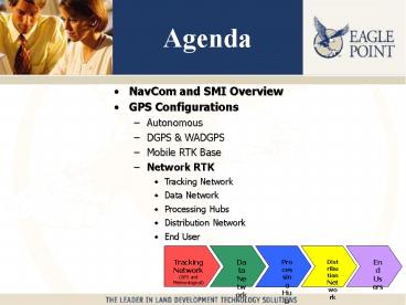
Agenda
- NavCom and SMI Overview
- GPS Configurations
- Autonomous
- DGPS WADGPS
- Mobile RTK Base
- Network RTK
- Tracking Network
- Data Network
- Processing Hubs
- Distribution Network
- End User
Tracking Network (GPS and Meteorological)
Data Network
Distribution Network
End Users
Processing Hub
2
GPS Configurations
- Autonomous
- DGPS
- WADGPS SBAS
- Mobile RTK Base
- Network RTK
3
DGPS
- 95 the state of Iowa is currently covered by at
least two signals. The addition of the 3 planned
Iowa DGPS stations 100 of the state will be
covered by 3 or more signals. - SMI Flex produces better than 12 cm DGPS
Horizontal and 25 cm Vertical up to 200 km from
reference station.
4
WADGPS
- WAAS
- The U.S. Federal Aviation Administration (FAA)
has developed a WADGPS system that is referred to
as the Wide-Area Augmentation System (WAAS)
NavCom Developed first FAA approved receiver,
NavCom has the most accurate WAAS receiver to
date - LAAS
- FAA is also developing a Local Area Augmentation
System (Specification Developed for FAA by
NavCom) - Others
- Japan has developed a similar system referred to
as MSAS - The European nations have also developed a
similar system named EGNOS
5
SMI WAAS
- 50 cm (lt 2 feet)
- Only receiver capable of Sub-Meter WAAS
- First FAA Approved WAAS Receiver
- WAAS lt 0.5 meter FREE
- StarFire lt 0.1 meter Subscription
- GIS / Mapping Grade
- Monument Discovery
- Control Location
- Base Verification
- Construction Clear Zones
6
StarFire Overview
Uplink to 3 Inmarsat
Continuous Global GPS Tracking Network
Global Corrections Broadcast to Users
VSAT, Internet ISDN Links
Reliable Low-Latency Data Links
Two High Redundancy Hot Hubs
7
StarFire
- All Raw Data Sent to Two Processing Centers
- Redondo Beach, Western USA
- Moline, Central USA
- Each Processing Center Computes
- GPS Real Time Orbit Corrections every Minute
Resolution lt1cm - GPS Real Time Clock Corrections every few Seconds
Resolution lt1cm - United States Naval Observatory Used as Master
Clock with (Five Alternate Atomic Clock Sites)
8
StarFire
- The StarFire Network (Real-Time Gypsy) is the
world's first Global Satellite Based Augmentation
System (GSBAS) capable of real-time decimeter
accuracy. Performance is no longer a function of
your distance from a reference station
9
RTK
- Real-time Kinematic is a special form of
Differential GPS with two major differences - Provides up to one hundred times greater accuracy
than Differential GPS. - Short initialization period following power-up,
during this time the accuracy changes from
meter-level down to decimeter-level, to
centimeter-level and, in good conditions with
good receivers, centimeter-level. - Common Mode Errors are removed
- Accuracy is a function of range from base
10
SMI RTK
- NavCom receivers utilize proprietary RTK
algorithms providing extremely fast ambiguity
resolution and superb accuracy. - Performance, relative to competition, is
excellent - Single epoch ambiguity resolution more than 80
of the time. - High reliability (99.99 successful integer
ambiguity resolution) - Automatic restores the communication link
following outages - 1 Second Acquisition Time
11
SMI Flex Reacquire Time
12
SMI FlexRTK Extend
- Uses RTG to Backup of RTK
- When RTK is lost, typically due to communications
link limitations , RTG can be used to coast
with minimal loss of accuracy (sub-inch). - The short (10 minute) to medium (30 minute) term
drift of RTG is equivalent to RTK levels of
accuracy. - Unlimited Range (No Range Induced Errors)
- Maximum Error is 4 (decimeter) After Approx. 1
Hour
13
SMI FlexRTK Extend
Position Error (Centimeters)
Time (Minutes)
14
SMI FlexSureNav
- When L2 measurements are lost, they can easily be
synthesized based on the L1 measurements, the
estimated ionospheric delays, and the combination
of integer ambiguity. When L2 measurements
return, the slipped cycles on L2 can be detected
based on the new measurements and the estimated
states. - Synthesized measurements can be L1, L2 or L5, if
any one of the three are retained. - Requiring only L1 carrier phase with very low
elevation limits (5 RTG, 7 RTK) provides a much
more robust solution in poor signal
environments than any other system available
today. - Along side/under trees, near high power lines,
under metal overhead structures, etc.)
15
SureNavCanapé Area Others vs. SMI Flex
16
Post Processing
- Static
- OPUS
- RINEX
- WayPoint
- Others
- SMI Flex
- 64 MB Ram
- Simultaneous
- Static
- RTK Base
- RTK Rover
- RTG Base/Rover
17
SMI Redundancy
- 30 Fallback Modes
- Ability to Operate with Loss Of
- RTK Radio Link (20 Minutes)
- L2 Signal (15 Minutes Per SA)
- SBAS Link (10 Minutes)
- Etc
18
RTK Base Station Network
Tracking Network (GPS and Meteorological)
Data Network
Processing Hub
Distribution Network
End Users
19
Base Stations
- Single Base (Permanent or Mobile)
- Single Base Receiver
- Multi Base (Multi-Address)
- Similar to Single Base
- Must change Radio Address or Network ID
- Verification / Averaging
- Multi-Base (Single Address)
- Runs on Microsoft Windows NT/2000/XP operating
system. - Processes, besides the raw data from all current
GPS-receivers, also RTCM correction data as input
data. - Processes data from many GNSS Receivers centrally
in real time by means of a strict multi-station
solution including a quick On-The-Way (OTW)
ambiguity solution. - Offers, by means of the multi-station solution,
great advantages concerning accuracy and
reliability, compared with the parallel single
station (baseline) computation of several RTK
receivers. - Achieves accuracies of few millimeters, by using
antenna and multipath calibrations. By applying a
special algorithm for analysis, accuracies of
less than 1 mm are possible for the change of
coordinates! - Delivers as output, besides a co-ordinate vector
in any coordinate representation (geocentric,
ellipsoidal, local system), the related full
variance or covariance matrix. By that means,
significant deformation analyses are possible.As
a rule, transmission capacities of 9600 bits per
second are sufficient. For RTCM correction data
even 2400 bps are sufficient for 12 satellites at
1 second update rate.
20
SMI Multi-Base
- One correction plane for each (State Space Model
SSM) - Reference Area
- Ion
- Tropo
- Satellites
- L1
- L2 (L5)
- Clock
- Orbit
- Etc.
- High Order Polynomials available (bidirectional
communication links)
21
SMI Multi-Base
- NO RANGE INDUCED ERRORS
- Virtual Base Station type systems have range
induced errors as the rover travels from its
initialization point - Accuracy is typically in the 3mm range (7 mm for
sparse RTK networks 60 miles between reference
stations) - Coordinate variances of 1 mm are detectable at
rovers
22
SMI Multi-BaseImplementation
- Brandenburg Flex Network
- Northwest Part of Network
- 12 Reference Stations
- Max Distance 116km (72mi)
- State Space Model (SSM)
- Rover Test Location
23
Tracking Network
Tracking Network (GPS and Meteorological)
Data Network
Processing Hub
Distribution Network
End Users
24
Tracking Network
- Two Primary Instruments
- Dual Frequency GPS Receiver
- Paroscientific MET3 (or Vaisala PTU200GPS)
meteorological sensor - Stable Mounting System
- Network Connection
25
Tracking Network
- Using SMI FKP Iowa Requires 14 - 25
- 17 represents an ideal compromise between
accuracy cost - Detailed site selection process required
- Possible out of state locations may be utilized
to increase statewide redundancy - Using Other Systems (NetRS, SpiderNet, etc.)
- Iowa Requires about 100
- Out of state locations would need to be utilized
26
Data Network
Tracking Network (GPS and Meteorological)
Data Network
Processing Hub
Distribution Network
End Users
27
Data Network
- Transports Raw GPS Meteorological Measurements
to Processing Hub - Existing IDOT WAN/LAN
- Internet
- Dialup Landlines
- Radio (SCADA Style)
- Cellular
- Average 500 bps Required Bandwidth
28
Processing Hub
Tracking Network (GPS and Meteorological)
Data Network
Processing Hub
Distribution Network
End Users
29
...
- Three Primary Functions
- Data Collection from Reference Stations
- Network Modeling Monitoring
- Correction Distribution Storage
- Redundancy
- IP Based
Reference Site 1
Reference Site 2
Reference Site 3
Reference Site N
Mobile Phone Service Provider
Intranet / Internet
...
Radio Transmission Towers
Ames Hub
Optional Backup Hub
Workstation 1 Ref. Station Control, Data
Collection, Integrity Monitoring Data Archival
Workstation 1 Ref. Station Control, Data
Collection, Integrity Monitoring Data Archival
Workstation 2 Network Processing Correction
Distribution
Workstation 2 Network Processing Correction
Distribution
Server 3 Web Server for Data Retrieval
Server 3 Web Server for Data Retrieval
30
Processing Hub(Geo)
- Remote control of the reference stations
- Broadcast of multiple correction formats (NTRIP,
FKP, RTCM, etc) - Automatic monitoring of reference stations,
measurement data communications - Ability to use meteorological data from sensor
collocated with reference stations - Fault detection, notification
- generation of alarms
- Generation of operational
- performance statistics
- Conversion of Raw Data to
- RINEX Format for Archival
- Web Availability, Automatic
- CORS Uploads
31
Distribution Network
Tracking Network (GPS and Meteorological)
Data Network
Processing Hub
Distribution Network
End Users
32
Distribution Network
- Cellular (Digital)
- Low Network Costs
- High Reoccurring User Costs
- Unreliable
- FM Subcarrier
- Satellite (Phone or Broadcast)
- UHF (410-470 MHz)
- Unreliable (Popular Spectrum)
- Major FCC Restrictions
- Eagle Points VHF (220 MHz)
- Private
- Public Safety Grade
- Excellent Propagation
- No FCC Coordination
- No User Costs
These cellular maps are not a guarantee of
coverage and may contain areas with no
service This map is a general prediction of
where outdoor coverage apply based on our
internal data. Wireless service is subject to
limitations, particularly near boundaries and in
remote areas. Customer equipment, cell site
availability, topography and other environmental
considerations also affect service, which may
vary significantly within buildings. Service
outside the Verizon Wireless network, although
depicted as America's Choice or National
SingleRate, is based on information from other
carriers or publicly available information, and
we cannot ensure its accuracy. With "All-Digital"
devices you can make and receive calls only when
digital service is available in the America's
Choice Home Airtime Rate and Coverage Area and
when digital service is available while roaming.
When digital service is not available your device
will not operate or be able to make 911 calls.
33
Distribution Network
- Same satellite used for SMIs StarFire System
- 492 kbps IP data (transmit receive)
- ISDN Voice
- Simultaneous Ethernet, USB, ISDN, RTK and WLAN
- Full IP RTK GPS, Email, VPN, Internet, etc
34
Distribution Network
- Pacific Crest UHF
- Upwards of 300 Watt Transmitters
- gt 30 Mile Range
- Dual Transmissions
- Enhanced RTK lt 1/2
- Standard Differential GPS lt 1.0
- VRS Stations
- Can be located anywhere IP connectivity exists
35
Distribution Network (220MHz)
- 10 Towers provides 2x Redundancy
- Real-time network monitoring for unauthorized
in-band interference - 90 Mile Coverage Radius
- 500 Watts on 1000 Towers Allowed
- True Unlimited Users
- Entire state covered by only three channels
36
End UsersSMI Flex Rover
Tracking Network (GPS and Meteorological)
Data Network
Processing Hub
Distribution Network
End Users
37
Data Collectors
- Allegro CX
- Jettce
- Other Pocket PC Devices
- IPAQ
- Recon
- Other Windows CE Devices
- Ranger
- TSCe
- DAP Titan
- Symbol Technologies
38
SMI
- Specialty Instruments
- Numerous GPS Systems
- Digital Levels
- Laser Range Finders
- Reflectorless Total Stations
- No Brand Restrictions
- Best Drivers
- 4000 Coordinate Systems
- Coordinate Conversion
- Infield synchronization
- Infield job transfer
39
SMI
- Overlay Operation
- Advanced Road Staking Routines
- Level Program W/3 Wire Support
- Unique GPS Localization
- Occupy Point Only (Geodetic BS)
- Occupy Back Sight
- True Free Station (resection)
- State Plane Self Survey
- State Plane Known Point
40
GPS Support
- NEMA GGA
- NEMA LLQ
- NEMA PJK
- Javad
- Leica (530)
- Ashtech Z
- Manual Mode
- NavCom RTK
- NavCom RTG (StarFire)
- NavCom RTK/RTG
- Topcon
- NovaTel (GGA)
- Trimble (GGA)
- Allen Osborne (GGA)
41
SMI Rover
- 50 Hz Raw (Positions _at_ 25 Hz)
- Most Receivers operate at 1 Hz or 5 Hz
- Some good Receivers at 10 Hz
- 5-25 Times More Positions Per Second
- More Positions Less Occupy Time
- More Positions Higher Accuracy
- Fast Navigation (Real-time Stakeout)
1 Hz 1 Cycle Per Second
42
SMI Rover
- Best Accuracy
- 4 mm RMS (short baselines)
- 50 Better Multipath Than All Others
- Patented
- NavCom Engineers is easy to detect
- Trees
- Power Lines
- Buildings
- Built-in Ground Plane
- Best Signal To Noise Ratio
- Survey Grade Masking Down to 7
- Average 2 Additional Satellites (7 vs. 15)
43
Physical Specifications
- Multiple Configurations
- Integrated Pole System
- Pole Backpack
- Backpack Only
- Base Station (Static/DGPS/RTK/RTG)
- Hot Swappable Batteries
- Superior Environmental Specifications
- Military Specifications
- -40d F to 130d F
- 2 m Pole Drop to Concrete (Operational)
- Temporarily Submersible
44
Compatibility Usability
- Universal Protocol Support
- Numerous Rover Brands Supported
- RTK (NCT Proprietary, RTCM, CMR)
- Code (RTCM, WAAS, WCT, RTG)
- NEMA (ALM, GGA, GLL, GSA, GSV, RMC, VTG, ZDA,
GST) - Static (NCT Proprietary, RINEX, WayPoint)
- Operational in Void Areas
- SureNav (L1 Navigation Backup)
- RTK Extend (RTG Backup of RTK Base Station)
- Cell Modem Receiver / Radio Repeater (RTK)
- StarFire lt 4
- WAAS lt 2
- Seamless switch between GPS Total Stations
45
SMI GPS Overviewpresented to the Iowa DOT
Recommended
CrystalGraphics Presentations


![get⚡[PDF]❤ Pocket Planner 2024-2025: Small 2-Year Monthly Agenda for Purse | 24 Months PowerPoint PPT Presentation](https://s3.amazonaws.com/images.powershow.com/10081698.th0.jpg?_=20240719098)


![[PDF] DOWNLOAD Agenda 2021: Poker, crâne | Janvier à Décembre 2021 | A PowerPoint PPT Presentation](https://s3.amazonaws.com/images.powershow.com/10095955.th0.jpg?_=20240811046)


