ICIMOD metadatadata system using ArcIMS 3.1 - PowerPoint PPT Presentation
1 / 25
Title:
ICIMOD metadatadata system using ArcIMS 3.1
Description:
Memorandum of Understandings/Agreements. Framework Agreement (UNEP and ICIMOD) ... affected by global warming in the mountains of the Hindu Kush-Himalayan Region ... – PowerPoint PPT presentation
Number of Views:109
Avg rating:3.0/5.0
Title: ICIMOD metadatadata system using ArcIMS 3.1
1
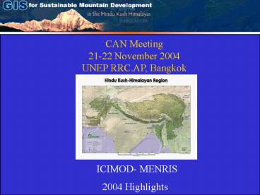
CAN Meeting 21-22 November 2004 UNEP RRC.AP,
Bangkok
ICIMOD- MENRIS 2004 Highlights
2
Signing of MoUs
Memorandum of Understandings/Agreements
- Framework Agreement (UNEP and ICIMOD)
- NCSD Nepal (MOPE, UNEP and ICIMOD)
- Atmospheric Brown Cloud (MOPE, UNEP, ICIMOD and
UCSD) - Kathmandu Valley City SoE (MOPE, UNEP and
ICIMOD)
3
Capacity Building and Networking
Regional Training Courses On major environmental
themes for mountain areas
Geo-informatics for Integrated Water resources
Management in HKH (16 weeks) Application of
Geo-Informatics for National Park Conservation
and Management (2 Weeks) Inventory of GLOFs
Affected by Global Warming in the Mountains of
Himalayan Region (2 weeks)
4
Capacity Building and Networking
National Training Courses
Urban Hazard risk assessment for Lalitpur
Municipality (3 weeks) In collaboration with
International Institute for Geo-information
Science and Earth Observations (ITC), The
Netherlands and National Society for Earthquake
Technology-Nepal (NSET-Nepal).
Training on GIS for Forest Data Management (2
weeks), In collaboration with Natural Resources
Management Programme
5
Capacity Building and Networking
Development of Training Manuals and Materials
6
Capacity Building and Networking
Dissemination/Policy Workshop
3 GLOF Dissemination workshop were organized this
year in Pakistan, India and China
1 day dissemination workshop in Islamabad,
Pakistan
1 day dissemination workshop Tibet Autonomous
Region, in China
1 day dissemination workshop in Shimla, India
7
Capacity Building and Networking
Transboundary Air Pollution
- Partnership with UNEP, UCSD and MoPE and other
stakeholders
Male Instruments in IAAS Rampur
Construction has started at the ICIMOD
headquarters for installation and commissioning
the equipments for the ABC Study
8
Data Harmonization and Indicators
Indicators of Development Nepal Socio-economic
Both these Publications are translated in Nepali
as well
- Policy products
- Similar initiatives
- HP, India
- Bangladesh
In collaboration with CBS and SNV-Nepal
Publication launching on January 29, 2004
9
Data Harmonization and Indicators
GIS Database Catalog
12 new Datasets have been added in the Catalog
MENRIS Metadata Editor
New and user friendly Metadata Editor has been
developed
10
Data Harmonization and Indicators
Image Catalogue
Spatial Search on Image Catalog database
30 new in Images have been added to the Catalog
11
Data Harmonization and Indicators
Map Catalog
More than 200 new maps have been added in the Map
Catalog this year
Districts of Nepal Indicators of Development 2003
Mapping Nepal Census Indicators 2001 Trends
12
Data Clearing House
Multilingual Content in the Mountain GIS Portal
Mapping Nepal Census Indicators 2001 Trends in
Nepali
Districts of Nepal Indicators of Development -
2003 in Nepali
13
Thematic GIS Portal
Data Clearing House
Portal for the HKH Region prepared together with
NRM
Biodiversity Portal
GIS Portal for Protected Areas in Nepal, in
collaboration with IUCN-Nepal
14
Mountain GIS Network
Data Clearing House
Nepal Country Pages in Mountain GIS Portal
In collaboration with Central Bureau of
Statistics, HMG-Nepal
15
Data Clearing House
Regional Water Quality Network and Database
The South Asia Water Analysis Network (SAWAN)
In collaboration with Sandia National
Laboratories, USA
Monitoring Stations across HKH Region
16
National Sustainable Development Strategy and
Action
National Sustainable Development Strategy
Workshop and Training
- NCSD workshop (April 2004)
- MoPE
- National Planning Commission (NPC)
- UNDP
- GOs and NGOs in Nepal
- NCSD Training (Sept 2004)
- MOPE
- HMG/N Ministries
- INGO
- NGO
- Civil Society and Private Sector
17
Country Environmental Analysis Nepal
Country Environmental Analysis - Nepal
- ADB/N assignment
- Role of environment and natural resources
- Existing and institutional and regulatory
framework - Strategic priorities in the environment sector
- ADBs assistant/investment
18
Application and Decision Support System in
support of sustainable mountain development
agenda in the HKH region- A Few Examples
19
Application and Decision Support System
Reports and data on2004 Inventory of glaciers,
glacial lakes and the identification of
potential glacial lake outburst floods (GLOFs)
affected by global warming in the mountains of
the Hindu Kush-Himalayan Region
GLOF Reports 2004
20
Application and Decision Support System
Transboundary Biodiversity Management in
collaboration with Natural Resource Management
Protected Area Linkages
Change Analysis
Change in forest cover (1977 2000)
Singhalila Senchel Corridor
21
SNP data - DEM
Application and Decision Support System
Decision Support System (DSS) for National Park
Management
Sagarmatha National Park data
- Basic topographic data
- Thematic data
SNP data- Satellite images
22
Landcover based on LISS 3 Image
Application and Decision Support System
Assessing sustainable agricultural system in the
HKH regionan ecological approach
Himachal Agricultural Information System Files
(HASIF)
Digital Elevation ModelHASIF
Climatic Index Map
23
Application and Decision Support System
Regional Land cover Mapping
Myanmar
Land Cover of Nepal from Geocover
24
Application and Decision Support System
Regional Land cover Mapping
Mosaics of NaturalVue and Geocover of the HKH,
received from EarthSat Inc.
25
Thank You!


