Alaska Volcano Observatory - PowerPoint PPT Presentation
1 / 5
Title:
Alaska Volcano Observatory
Description:
Tephra 2 (Connor, et al., 2001; Bonadonna, et al., 2005) Fall 3D (Costa et al., 2006) ... the ASHFALL simulations with tephra thickness measurements of McGimsey, ... – PowerPoint PPT presentation
Number of Views:54
Avg rating:3.0/5.0
Title: Alaska Volcano Observatory
1
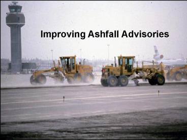
Improving Ashfall Advisories
The Alaska Volcano Observatory is a cooperative
program of the U.S. Geological Survey, the
University of Alaska Fairbanks Geophysical
Institute, and the Alaska Division of Geological
and Geophysical Surveys
2
Current situation
- No simple operational tool or model to accurately
forecast fallout area and amount (e.g. thickness)
is used routinely in Alaska existing models are
either inadequate or difficult to run quickly - Model development has focused on ash cloud motion
- Ashfall warnings (NWS and USGS and others) lack
standardized language - Augustine lesson confusion about impacts and
lack of guidance about areas of concern
including aircraft facilities on the ground
3
In development
- User-friendly ash fallout graphical tool for AVO
and possibly NWS use based on a New Zealand
approach is under development - Long-term goal is to develop a more robust model
that uses more realistic inputs and approaches - Standardized ashfall advisory terminology
proposed for adoption - Clearer public guidance statements
- Better coordination of messages among agencies
4
(No Transcript)
5
Draft terms proposed by USGS and NWS
6
ASHFALL WARNING MESSAGE
WWAK72 PAFC 180001 NPWALU URGENT - WEATHER
MESSAGE NATIONAL WEATHER SERVICE ANCHORAGE AK 840
AM AST TUE JAN 17 2006 AKZ161-180230- BRISTOL
BAY- INCLUDING...KING SALMON...DILLINGHAM...NAKNEK
...PILOT POINT 255 PM AST TUE JAN 17
2006 ...ASHFALL WARNING IN EFFECT UNTIL 5 PM AST
THIS AFTERNOON FOR THE ILIAMNA AREA... THE
ALASKA VOLCANO OBSERVATORY HAS REPORTED THAT
AUGUSTINE VOLCANO ERUPTED AROUND 758 AM AST THIS
MORNING. AN ASH CLOUD HAS BEEN DETECTED BY THE
NATIONAL WEATHER SERVICE DOPPLER RADAR AND WAS
REPORTED BY PILOTS. A LIGHT AMOUNT OF ASH IS
CURRENTLY FALLING AT ILIAMNA BUT AS MUCH AS ¼
INCH COULD FALL BY LATE THIS AFTERNOON. AVOID
EXCESSIVE EXPOSURE TO ASH WHICH IS AN EYE AND
RESPIRATORY IRRITANT. THOSE WITH RESPIRATORY
SENSITIVITIES SHOULD TAKE EXTRA PERCAUTIONS TO
MINIMIZE EXPOSURE. SEAL WINDOWS AND DOORS.
PROTECT ELECTRONICS AND COVER AIR INTAKES. AVOID
DRIVING AND LISTEN TO YOUR LOCAL RADIO STATION
FOR FURTHER INFORMATION. FOR ADDITIONAL
INFORMATION VISIT WWW.VOLCANO.GOV THE NEXT
STATEMENT WILL BE ISSUED AS NECESSARY.
7
Ash Fallout Forecasting
- No standard technique/method for estimating ash
accumulation on the ground - Several models in use
- ASHFALL (Hurst and Turner, 1999)
- Tephra 2 (Connor, et al., 2001 Bonadonna, et
al., 2005) - Fall 3D (Costa et al., 2006)
- HAZMAP (Macedonio, et al., 1988 Barberi, et al.,
1990) - These are all advection-diffusion models based on
Suzuki, et al., 1983 - ASHFALL has received limited use for Alaskan
eruptions (Augustine, 2006) - It did a poor job of reproducing known fallout
patterns documented for the 1992 eruptions of
Crater Peak
8
ASHFALL Model Simulation for Sept. 16-17, 1992
Crater Peak Eruption
Comparison of the ASHFALL simulations with tephra
thickness measurements of McGimsey, et al. (2001)
for the Sept. 16-17, 1992 eruption of Crater
Peak. The model underpredicts ash thickness for
areas far from the vent (gt250 km) and
overpredicts thickness for areas closer to the
vent (lt250 km) This is largely due to the
uncertainty in assigning values for the various
input parameters which is somewhat arbitrary.
This problem is compounded if the model is used
as a forecasting tool where input parameters are
unknown. Also, it is impossible to know
beforehand what the particle size distribution of
the ash cloud will be and thus it is difficult to
estimate the settling velocity of the various
particle size classes that make up the ash cloud.
9
Ash Fallout Forecasting
- A more defensible approach to the problem is to
combine distance - ash thickness relations for
known eruption types with output from ash cloud
tracking models such as PUFF - PUFF can define the approximate spatial extent
over which fallout is likely - A simple power law relation based on known ash
fallout provides an estimate of thickness at any
distance downwind of the vent
10
Ash Fallout Forecasting
- Operational use of other advection-diffusion
models is not yet practical because of the run
times required - USGS will be developing new methods/techniques
for estimation of ash fallout, but it may be
several years before a realistic, user-friendly
model is available


