
Unavco PowerPoint PPT Presentations
All Time
Recommended

Update of UNAVCO GPS Activities
| PowerPoint PPT presentation | free to view

runs Riva and web services for making movies. losangeles.jpl.nasa.gov: 8 processor ... Making WMS clients publicly available and downloadable (as portlets) ...
| PowerPoint PPT presentation | free to view

Tuesday----- 8:30 - 8:45 Welcome by Meghan Miller, President of UNAVCO 8:45 - 9:00 Introduction of instructors and course outline 9:00 - 9:15 Introduction ...
| PowerPoint PPT presentation | free to download

Tuesday. 8:30 - 8:45 Welcome by Meghan Miller, President of UNAVCO. 8:45 - 9:00 Introduction of instructors and course outline ...
| PowerPoint PPT presentation | free to download

Geodesy in the 21st century Shimon Wdowinski University of Miami Susan Eriksson UNAVCO Related but .. Big Idea #2: Earth is 4.6 billion years old. 2.7 Over Earth ...
| PowerPoint PPT presentation | free to view
Unavco GG Lec 03. 4. GPS phase noise modeling ... Scatter of residuals is characterized by chi-squared per degree of freedom: should near unity. ...
| PowerPoint PPT presentation | free to download

(University of Nevada Reno) Helmut Mayer, Susan Eriksson (UNAVCO, Boulder, CO) ... Reference Frame: Africa(Nubia) GPS Vectors Interpolation. Eastern Mediterranean ...
| PowerPoint PPT presentation | free to view

1:55 EarhtScope's Plate Boundary Observatory. Greg Anderson, UNAVCO, Inc. ... Pam Fromhertz & Giovanni Sella. B. Real-Time Positioning from the User's Perspective ...
| PowerPoint PPT presentation | free to view
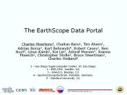
... Schema of the EarthScope Data Portal request available at http://schemas.earthscope.org/portal/0.4/esdp.wsdl Portal will provide ability to add datasets to a ...
| PowerPoint PPT presentation | free to download
Enter Slide Titles Here
| PowerPoint PPT presentation | free to download
Constructing Activities Based on Grand Challenges Michael Wysession Washington University St. Louis, MO
| PowerPoint PPT presentation | free to download


Detection of GPS station position errors due to ... Alaska Volcano (AV04) 06/04/08. IGS ACWS TAH Errors. 24. Earth, Atmospheric and Planetary Sciences ...
| PowerPoint PPT presentation | free to download

Title: Tectonics Author: John Waldron Last modified by: John Waldron Created Date: 9/1/2002 8:31:37 PM Document presentation format: On-screen Show
| PowerPoint PPT presentation | free to view

Monitoring software, data archiving, data systems ... Monitoring Software ... Campaign survey data. Ties between techniques, tide gauges etc. AFREF Data Centre ...
| PowerPoint PPT presentation | free to view


GPS Infrastructure Overview
| PowerPoint PPT presentation | free to view

12.540 Principles of the Global Positioning System Lecture 24 Prof. Thomas Herring Room 54-611; 253-5941 tah@mit.edu http://geoweb.mit.edu/~tah/12.540
| PowerPoint PPT presentation | free to download

Alaska Sources of Control SDMI Task 4 Goal & Approach Conduct a survey of existing control sources. Public and private sources that could be acquired for Alaska ...
| PowerPoint PPT presentation | free to view


Plate tectonics theory
| PowerPoint PPT presentation | free to view

Collaborative 3D and 4D Visualization in a Distributed Data System
| PowerPoint PPT presentation | free to view

Statistical analysis of site effects on Plate Boundary Observatory time series
| PowerPoint PPT presentation | free to view

... Okal & Synolakis 2004) M9 generates much larger tsunami Planning assumed maximum magnitude 8 Seawalls 5-10 m high CNN NYT Stein & Okal, ...
| PowerPoint PPT presentation | free to download

Data Acquisition on the Edge Challenges of Polar Remote Autonomous GPS Networks
| PowerPoint PPT presentation | free to view

Different theme each day EarthScope, OpenTopography, Data ... Dr. Fabian Walter, SIO. SDSC. Ilkay Altintas. Chris Crosby. Dr. Sriram Krishnan. Dr. Kai Lin ...
| PowerPoint PPT presentation | free to view


Title: PowerPoint Presentation Author: Rocco Malservisi Last modified by: Rocco Malservisi Created Date: 5/1/2005 3:50:26 PM Document presentation format
| PowerPoint PPT presentation | free to download

Title Slide. EarthScope: Revealing Earth's Secrets. Your Name. Your title. Date. Talk location ... EarthScope is being constructed, operated, and maintained as ...
| PowerPoint PPT presentation | free to view

The Integrated Data Viewer IDV: A tool for geoscientific visualization and analysis
| PowerPoint PPT presentation | free to view

How do we know if plate-like calculations are really modeling tectonic plates, and does it matter? Scott D. King Dept. of Earth and Atmospheric Sciences
| PowerPoint PPT presentation | free to view

Title: PowerPoint Presentation Author: David Simpson Last modified by: Kaye Shedlock Created Date: 10/30/2002 10:01:35 PM Document presentation format
| PowerPoint PPT presentation | free to view

Kyle Bohnenstiehl
| PowerPoint PPT presentation | free to view

Realtime GPS and Earthquake Early Warning
| PowerPoint PPT presentation | free to download

http://csrc.ucsd.edu. Site Information Manager. Map Browser. RINEX Data. Coordinates ... GPS Long Beach City College. Subsidence. Tidal Datum. High-Precision Geoid ...
| PowerPoint PPT presentation | free to view

Pocket GPS Manager (PGM) Expediting CSRC Project Execution, Delivery & Analysis
| PowerPoint PPT presentation | free to view

Various Radio Modem Options. Low Elevation Tracking System Performance ... PRN 17 Currently Unhealthy. L2C Signal Strength. L2C Productivity Advantage ...
| PowerPoint PPT presentation | free to view

Parkinson, B. W., J. Spilker, P. Axelrad and P. Enge, Global Positioning System ... aircraft and moving vehicles Atmospheric delay studies Text books No specific ...
| PowerPoint PPT presentation | free to download
GEON Cyberinfrastructure
| PowerPoint PPT presentation | free to download

Practical questions: How to get DEM & visualize data in a ... Long Valley Caldera, Hooper et al. 2004. Select pixels with stable scattering behavior over time ...
| PowerPoint PPT presentation | free to view

CORS USERS FORUM Towards RealTime Positioning
| PowerPoint PPT presentation | free to view

Positioning America for the Future. NATIONAL OCEANIC AND ATMOSPHERIC ADMINISTRATION ... BARD. SCIGN. BARGN. EBRY. BAYONET. International GPS Service (IGS) ...
| PowerPoint PPT presentation | free to view

The IRIS Earthquake Browser (IEB) is an interactive map service for finding and ... The user chooses earthquake times, locations, depths, magnitudes, and how ...
| PowerPoint PPT presentation | free to view

Develop a unified web interface for searching and downloading EarthScope Data ... portal sends a request to each data center to pack its own data as a zipped file. ...
| PowerPoint PPT presentation | free to download
Power Spectral Density of dU Residuals average PSD for 14 continuous stations follows flicker noise large excess power at annual periods phases of annual ...
| PowerPoint PPT presentation | free to download

Utility Programs and Scripts Instillation File conversions Plotting Analysis tools
| PowerPoint PPT presentation | free to download

Oregon RealTime GPS Network
| PowerPoint PPT presentation | free to view

Plate Tectonics Prof. Thomas Herring MIT Contact Information Prof. Thomas Herring, Department of Earth, Atmospheric and Planetary Sciences, MIT Room 54-618 Phone 253 ...
| PowerPoint PPT presentation | free to download

Title: SPCS Computations and Use Subject: SPCS Author: Donald M. Mulcare Last modified by: Donald M. Mulcare Created Date: 11/10/1997 9:52:36 PM Category
| PowerPoint PPT presentation | free to download

Use state-of-the-art IT to support the 'day-to-day' conduct of science ... A Scientific Effort Vector. Background. Research. Data Collection and. Compilation; Learning ...
| PowerPoint PPT presentation | free to download

GAMIT: Series of programs that analyze GPS phase data to estimate parameters: ... so these days); GLOBK tries to continue as far as it can by defaulting values ...
| PowerPoint PPT presentation | free to download

Title: No Slide Title Author: rtravis Last modified by: Miranda Chin Created Date: 8/23/2000 6:41:53 PM Document presentation format: On-screen Show
| PowerPoint PPT presentation | free to download

GNSS Activity at the. Main Astronomical Observatory NASU. Oleg Khoda, Mikhailo Lytvyn. Main Astronomical Observatory. National Academy of Sciences of Ukraine (Kiev, ...
| PowerPoint PPT presentation | free to view

AFREF site selection: interaction with other scientific and technical applications
| PowerPoint PPT presentation | free to view