
Remote Sensing Applications PowerPoint PPT Presentations
All Time
Recommended

Satellite Remote Sensing 1. Types of Remote Sensing Based on Source of Energy Platform 2. Types of Satellite 3. Types of Sensors 4. Limitations of Remote Sensing
| PowerPoint PPT presentation | free to download
Remote Sensing Applications
| PowerPoint PPT presentation | free to download

Satellite Remote Sensing Technologies for Water Studies, Assir Province; Saudi Arabia Dr. AlOtaibi Eed Lafi Assistant Professor of Remote Sensing & Geographical ...
| PowerPoint PPT presentation | free to view

Surveillance Satellites Dee W. Pack The Aerospace Corporation Space Science Applications Laboratory Remote Sensing Department M2/266, P.O. Box 92957, Los Angeles, CA ...
| PowerPoint PPT presentation | free to view

Remote Sensing Applications
| PowerPoint PPT presentation | free to view

Radar altimeter. Measures wave height. Remote Sensing Applications. Oceanography ... Radar altimeter. Measures wave height. Sea surface height. Seafloor topography ...
| PowerPoint PPT presentation | free to view

Applications of surface UVB estimates effect on Vitamin D synthesis in skin: ... need to understand how much UVB exposure is optimal for different populations ...
| PowerPoint PPT presentation | free to download

2nd Ewiem Nimdie International Summer School Satellite remote sensing applications in Meteorology Gizaw Mengistu, Dept. of Physics, Addis Ababa University, Ethiopia
| PowerPoint PPT presentation | free to view

Side-scan. Remote Sensing, Principles and Applications. SONAR. Depth sounder ... Side-scan. Similar to SLAR. Positioning difficult. Fish, cable, processing unit ...
| PowerPoint PPT presentation | free to view

Subtractive viewing. Remote Sensing, Principles and Applications. HUMAN ... SUBTRACTIVE COLOUR. Cyan, yellow, magenta primaries. Used in printing and painting ...
| PowerPoint PPT presentation | free to view

Can be used as input to numerical modelling of the subsurface (not ... Falcon Airborne Gravity System. Department of Geomatics. Remote Sensing Applications ...
| PowerPoint PPT presentation | free to view

Air Quality applications of Remote Sensing Data
| PowerPoint PPT presentation | free to view

Applications of Remote Sensing: The Cryosphere (Snow & Ice ) Menglin Jin, San Jose Stte University Outline Physical principles International satellite sensors ...
| PowerPoint PPT presentation | free to view

Remote sensing applications in Oceanography: How much we can see using ocean color? Martin A Montes Ph.D Rutgers University Institute of Marine and Coastal Sciences
| PowerPoint PPT presentation | free to view

Microwave Remote Sensing: 2' Theory, Algorithms and Applications
| PowerPoint PPT presentation | free to view

Use of Satellite Remote Sensing for Public Health Applications: The HELIX-Atlanta Experience Bill Crosson Mohammad Al-Hamdan, Maury Estes, Ashutosh Limaye, Dale ...
| PowerPoint PPT presentation | free to download

Department of Geomatics. Remote Sensing, Principles and Applications. SATELLITE IMAGING SYSTEMS ... Radar altimeter. Measures wave height. Department of Geomatics ...
| PowerPoint PPT presentation | free to view

59th GCFI, Belize City. Satellite Remote Sensing of Sea Surface Temperature: ... Process and compress raw HDF (AVHRR) format. Automatic with satellite overpass ...
| PowerPoint PPT presentation | free to view

Remote Sensing in Agriculture and Aquaculture. Determination of a quantity ... during a flight and sends corrective signals to the aileron and elevator servos. ...
| PowerPoint PPT presentation | free to view

Satellite remote sensing applications in aquatic and terrestrial coastal areas
| PowerPoint PPT presentation | free to view

Fire Detection and Mapping using Satellite Remote Sensing: Sensors, Systems, and Solutions
| PowerPoint PPT presentation | free to view

Technical possibilities estabilished by WETLIVONIA for remote sensing, GIS and ... ERDAS IMAGINE , from Leica Geosystems Geospatial Imaging, is the leading imagery ...
| PowerPoint PPT presentation | free to view

Polarimetric remote sensing of aerosols (ground- and satellite-based) ... Wide-Angle Aerosol Spectral Polarimeter (WASP) Key attributes: ...
| PowerPoint PPT presentation | free to view

Weather monitoring and forecasting was one of the first civilian (as opposed to military) applications of satellite remote sensing, dating back to the first true ...
| PowerPoint PPT presentation | free to download

Remote Sensing Space-based Earth exploration and planetary exploration began with the International Geophysical Year (IGY) which was also the beginning of the space ...
| PowerPoint PPT presentation | free to view
Fundamentals of Remote Sensing and Air photo Interpretation. Prentice Hall: New Jersey. ... http://www.asprs.org - American Society of Photo. And RS. ...
| PowerPoint PPT presentation | free to download


Why should a Geomatics student study it? Remote Sensing, Principles ... Lillesand and Kiefer Remote sensing and Image Interpretation. 2nd Ed. Wiley and sons. ...
| PowerPoint PPT presentation | free to view


ERS186: Environmental Remote Sensing Lecture 9: Soils Overview Applications Soil Science Physical Principles Reflectance (specular and diffuse scattering) Absorption ...
| PowerPoint PPT presentation | free to download

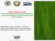
REMOTE SENSING OF IPM: Reflectance Measurements of Aphid Infestation and Density Estimation in Wheat Growing under Field Conditions. Mustafa Mirik, Gerald J. Michels ...
| PowerPoint PPT presentation | free to download

EXAMPLES OF APPLICATIONS WITH REMOTE SENSING IMAGES dr.ir. Jan Clevers Centre for Geo-Information Dept. Environmental Sciences Wageningen UR AGRICULTURE Satellite ...
| PowerPoint PPT presentation | free to view
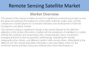
Remote Sensing Satellite Market by System, Application, End User, and Region-Forecast 2027
| PowerPoint PPT presentation | free to download
Sensor Network Applications Wireless Sensor Networks for Habitat Monitoring [Mainwaring+ 2002] Wireless Sensor Networks for Habitat Monitoring [Mainwaring+ 2002 ...
| PowerPoint PPT presentation | free to download

Sensor Network Applications Wireless Sensor Networks for Habitat Monitoring [Mainwaring+ 2002] Wireless Sensor Networks for Habitat Monitoring [Mainwaring+ 2002 ...
| PowerPoint PPT presentation | free to download

A newly published report by Market Statsville Group (MSG), titled Global Remote Sensing Technology Market provides an exhaustive analysis of significant industry insights and historical and projected global market figures.
| PowerPoint PPT presentation | free to download

Remote Sensing, GIS and Its application Md. Bodruddoza Mia Phd Student, Earth Resources Engineering Kyushu University, Japan And Lecturer, Department of Geology,
| PowerPoint PPT presentation | free to download

Remote Sensing at RSMAS a new NESDIS connection Peter J. Minnett Meteorology and Physical Oceanography Rosenstiel School of Marine and Atmospheric Science
| PowerPoint PPT presentation | free to view

Indian Remote Sensing Programme
| PowerPoint PPT presentation | free to view

The Remote Sensing Services market is projected to grow from USD 13.2 billion in 2022 to USD 26.6 billion by 2027, at a CAGR of 14.9%.
| PowerPoint PPT presentation | free to download

Remote Sensing Basics Dr. Ana I. Prados University of Maryland Baltimore County /JCET, Baltimore, MD NASA Goddard Space Flight Center, Greenbelt, MD
| PowerPoint PPT presentation | free to view

Why should a Geomatics student study it? Remote Sensing, Principles and ... 9 Environmental Monitoring/ Oceanography. Literature review. 10 Marine Applications. ...
| PowerPoint PPT presentation | free to view

Remote Sensing Introduction
| PowerPoint PPT presentation | free to view

METR155 Remote Sensing - Lecture 1 Professor Menglin Susan Jin San Jose State University, Department of Meteorology and Climate Science Class notes- www.met.sjsu.edu/~jin
| PowerPoint PPT presentation | free to view

The report "Remote Sensing Services Market by Platform (Satellites, UAVs, Manned Aircraft, and Ground), End User (Defense and Commercial), Resolution (Spatial, Spectral, Radiometric, and Temporal), and Region - Global Forecast to 2022", The remote sensing services market is estimated to be USD 10.68 Billion in 2017 and is projected to reach USD 21.62 Billion by 2022, at a CAGR of 15.14% during the forecast period.
| PowerPoint PPT presentation | free to download
Remote Sensing and Infectious Diseases
| PowerPoint PPT presentation | free to download
Introduction to Remote Sensing
| PowerPoint PPT presentation | free to download
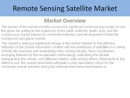
Remote Sensing Satellite Market by System, Application, End User, and Region-Forecast 2027
| PowerPoint PPT presentation | free to download

History of Remote Sensing
| PowerPoint PPT presentation | free to view
Remote sensing and geographic information systems (GIS) have exploded in popularity in numerous industries for visualisation, monitoring, management, and prospective development over the last few decades. Visit: https://www.falconsurveyme.com/
| PowerPoint PPT presentation | free to download

Remote Sensing Technology Market
| PowerPoint PPT presentation | free to download

Remote Sensing Image Acquisition Supplement to Lecture 1 material prepared by R. Lathrop 9/99 updated 8/03 includes s previously prepared by S. Madry and C. Colvard
| PowerPoint PPT presentation | free to view

AT 76.03 Remote Sensing by: Dr. Kiyoshi Honda Semester: August RS&GIS School of Advanced Technologies Asian Institute of Technology
| PowerPoint PPT presentation | free to view

Capstone Design -- Robotics Robot Sensing and Sensors Jizhong Xiao Dept. of Electrical Engineering City College of New York jxiao@ccny.cuny.edu Brief Review What is a ...
| PowerPoint PPT presentation | free to view