Overtopping PowerPoint PPT Presentations
All Time
Recommended
Simulating Overtopping of seawall defences . B.D. Rogers *, M.V. McCabe, P.K. Stansby, D.A. Apsley *RCUK Research Fellow. School of MACE
| PowerPoint PPT presentation | free to view
Overtopping Katrina
| PowerPoint PPT presentation | free to view
DAM OVERALL RISK ANALYSIS- IN PARTICULAR TO OVERTOPPING. ???. ???????????? ... two types of error associated with flood frequency analysis (quantile estimation) ...
| PowerPoint PPT presentation | free to view
The VOWS Project. The VOWS project (Violent Overtopping by Waves at Seawalls) was ... Figure 2. These photographs were taken by the author of the west harbour seawall ...
| PowerPoint PPT presentation | free to view
Numerical Study of Erosion-proof of Loose Sand in an Overtopped Plunging Scour Process FLOW3D Investigators: Ge Wang, Chung R. Song, Jinwon Kim and Alexander, H.-D ...
| PowerPoint PPT presentation | free to view
Middle East Technical University. Civil Engineering Department. Ankara-Turkey. Probabilistic Design/Analysis ... alteration of operational policies ...
| PowerPoint PPT presentation | free to view
... September The River Systems cannot drain Riverbank overtopping and flood ... flood controlling structures are not so effective to offer protection against ...
| PowerPoint PPT presentation | free to view
Canal Section Normally a trapezoidal section is adopted. ... This distance should be sufficient to prevent overtopping of the canal lining or banks due to waves.
| PowerPoint PPT presentation | free to view
Geopressurized methane Methane in porous rock overtopped by clay layer At ... US European moratoria Coalbed methane Geopressurized methane Methane hydrates ...
| PowerPoint PPT presentation | free to download
... as influenced by elevation and soil depth ... linked to tree growth BC Ecological classification system BC Ecological classification system BC Ecological ...
| PowerPoint PPT presentation | free to download
Allied /All-City Inc. services commercial maintenance specialists who detect and diagnose problems knowing where the leak is ,such as in concrete floors or walls can stop costly repairs by not opening whole floors or walls.
| PowerPoint PPT presentation | free to download
RCC Facing Using Vibrating Plate Compaction Methods Many Farms Dam Spillway Trackhoe with vibrating plate compactor Many Farms Dam Spillway Trackhoe with vibrating ...
| PowerPoint PPT presentation | free to view
New Orleans Levee Failures Chalston Layacan Elizabeth Lenker Jamie Mellies Outline Background Hurricane Katrina Levee System Destruction Failures General Problems ...
| PowerPoint PPT presentation | free to view
Quake Lake The Story of the 1959 Hebgen Lake Earthquake Hebgen Lake, Montana In 1959, a 7.5 magnitude earthquake struck the area known as Hebgen Lake, Montana, just ...
| PowerPoint PPT presentation | free to view
FLOOD DRAINAGE MAP OF NORTH BIHAR. Remote Sensing Map of Marooned areas ... Being ascertained. Purnea. 18. Being ascertained. 2. Begusarai. 17. 0.050. 7. Kishanganj ...
| PowerPoint PPT presentation | free to view
Because Emergencies Don t Wait For Ideal Conditions . * * And Problems Can Happen In A Flash Be Prepared With Products From Landmark Earth Solutions (LES ...
| PowerPoint PPT presentation | free to download
A CAT 2 HURRICANE THEN, IT HAD WINDS OF ABOUT 110 MILES PER HOUR (183 KM/HR) ... GULF OF MEXICO OIL PRODUCTION IS EXPECTED TO BE RESUMED IN ABOUT A WEEK. ...
| PowerPoint PPT presentation | free to view
Simulating rill and gully flow concentrates the discharge and improves the ... The gully geometry is defined by a maximum depth, width and flow roughness. ...
| PowerPoint PPT presentation | free to view
Utilizing LiDAR for Engineering Applications ... Utilizing LiDAR ... LiDAR is suitable for planning and in some cases even final design or aspects of ...
| PowerPoint PPT presentation | free to download
Computational Modelling of Free Surface Flows: wave impact and wave power
| PowerPoint PPT presentation | free to view
Seismic Response and Design of Dams
| PowerPoint PPT presentation | free to download
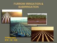
FURROW IRRIGATION & SUBIRRIGATION P.PRAKASH BTE - 06 - 025 * * * * * * * * SUBIRRIGATION Subirrigation Applying water from beneath the soil surface By constructing ...
| PowerPoint PPT presentation | free to download
LA Coastal Protection and Restoration Reports to Congress What is Category 5 Protection? Rebuilding the New Orleans Region Forum September 2006
| PowerPoint PPT presentation | free to download
U'S' Army Corps of Engineers photo by Alan Dooley
| PowerPoint PPT presentation | free to view
Since 1891, the Canadian Electrical ... In 1974, CEA initiated its R&D Program to serve the research needs of Canadian ... land dam on Toutle River ...
| PowerPoint PPT presentation | free to view
Split flow into crest slope and DS face slope ... Upstream face erosion. Primary Breach Data Parameters ... Mapper Delineated North Breach. Risk Hazard Mapping ...
| PowerPoint PPT presentation | free to view
... ... 3 f ff fff3f3 33 3f333 f3 f 3 f 3 f 3 f f ...
| PowerPoint PPT presentation | free to view
incorporating last year s disaster information in this year s educational surges (part 1) a primer of knowledge that can multipy and spill over for the benefit of ...
| PowerPoint PPT presentation | free to download
Use 2-D Shallow Water Equations to provide advice for wave basin experiments ... provide a cheap 2D (plan) model of the wave basin which gives qualitative ...
| PowerPoint PPT presentation | free to view
7,500 national guards were activated by Texas Governor, Rick Perry, ... (National Hurricane Center) According to weather records dating back to 1851, ...
| PowerPoint PPT presentation | free to download
LINING IMPACT ON WATER LOSSES IN WATERCOURSES Dr. M. Arshad Dr. Q. Zaman Dr. A. Madani
| PowerPoint PPT presentation | free to view
Frequently, when the drop inlet is the same size as the remainder of the pipe, orifice flow will control and the pipe will never flow full.
| PowerPoint PPT presentation | free to view
ENERGIA OCEANICA Jose Aquiles Baesso Grimoni Departamento de Engenharia de Energia e Automa o El tricas Escola Polit cnica da USP aquiles@pea.usp.br
| PowerPoint PPT presentation | free to download
Failure of Levees Due to Hurricane Katrina and Future of Hurricane Protection Systems in New Orleans
| PowerPoint PPT presentation | free to download
Slope Resistance Roadway Data Cross Section Profile Culvert Length Maps Field Surveys Roadway Plans * Data Requirements Design Headwater Critical pts ...
| PowerPoint PPT presentation | free to download
Things that Happened Before You were Born (The earth and SWMM were created) a story by ... an integrated modelling system for Littoral Processes And Coastline Kinetics ...
| PowerPoint PPT presentation | free to download
Sharif University of Technology Civil Engineering Department Tehran-Iran Dam Safety An Approach to Prevent Dam Incidents Lack of shear strength and discontinuity in ...
| PowerPoint PPT presentation | free to download
Sandbagging Techniques US Army Corps of Engineers Kansas City District Participation Sandbag demonstrations and training classes are put on by flood engineers each ...
| PowerPoint PPT presentation | free to download
Coastal Climate Change impacts in South ... Hazard assessment Previous and current work informs coastal zoning to identify areas subject to current and future ...
| PowerPoint PPT presentation | free to view
USACE GEEZER BRIEF 2001
| PowerPoint PPT presentation | free to view
listen and make notes during PowerPoint. carefully craft some ... The rain can't soak into the ground. Nepal -deforestation. More people. More farmland needed ...
| PowerPoint PPT presentation | free to view
Mitigation of the Tsunami Hazard
| PowerPoint PPT presentation | free to view
Trancoso Watershed Model/Flood Protection Project Problem In recent years, the community of Trancoso, Zacatecas has suffered flooding problems, particularly in the ...
| PowerPoint PPT presentation | free to download
Unconventional Natural Gas Kenneth M. Klemow, Ph.D. BIO / EES 105 at Wilkes University
| PowerPoint PPT presentation | free to download
1. Cochise County Road Design and Construction Standards and Specifications ... A 'road' is a vehicular travelway that serves 2 or more lots or parcels. ...
| PowerPoint PPT presentation | free to view
Breach Control Resiliency Opportunity
| PowerPoint PPT presentation | free to view
Benthic Cryptofauna. Fish and Territory. Topics. Death. recruitment. Clonal Life History ... Contact and interaction between soft tissues of coral. No contact ...
| PowerPoint PPT presentation | free to view
Baird. 1. INITIATE PROCESS ... Baird ... Baird. Create a 'signature project' for the Coastal Infrastructure program that is defined by: ...
| PowerPoint PPT presentation | free to view
Silviculture. Definition. Objectives. Terminology. Regeneration methods. Silviculture ... Silviculture. Approaches to management. Commodity /financial efficiency ...
| PowerPoint PPT presentation | free to view
Title: Presentation temp Author: Cong Mai Van Last modified by: Patty Created Date: 2/23/2005 7:12:19 AM Document presentation format: On-screen Show
| PowerPoint PPT presentation | free to download
Turbulence affects attached organisms, less influence on the substrate ... mussel beds. urchins. Encrusting algae, foliose algae, urchins ...
| PowerPoint PPT presentation | free to view
... runoff hydrograph from rainfall hyetograph using unit hydrograph technique (Who ... Rainfall hyetograph. Watershed Data. Q (t) Q (t) C(t) Q (t) C(t) Q (t) ...
| PowerPoint PPT presentation | free to download
| PowerPoint PPT presentation | free to view
The Potential for Agricultural Land Use Changes in the Raccoon River Basin to Reduce Flood Risk: A Policy Brief for the Iowa Flood Center Cathy, Phil, Keith, Calvin ...
| PowerPoint PPT presentation | free to view
TURNING THE 29-30 AUGUST DISASTER IN NEW ORLEANS AND THE GULF COAST OF THE USA ... THE LEVEE SYSTEM IS CENTRAL TO THE RECOVERY AND RECONSTRUCTION OF NEW ORLEANS. ...
| PowerPoint PPT presentation | free to view
the evolution of jobsite sediment control technology
| PowerPoint PPT presentation | free to view


