Landuses PowerPoint PPT Presentations
All Time
Recommended
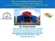
Albertas Landuses, Population, and Residential Patterns Challenges and Opportunities for Albertas Re
| PowerPoint PPT presentation | free to view
... WWWWWWWWWWWWWWWWWWWWWWWWWWWWaW WGWpWSWsW WtWFWTWOWdWWfWeWWW WWWWW WW WW WW F* ' ... 456789:CDEFGHIJSTUVWXYZcdefghijstuvwxyz GpSs tFTO ...
| PowerPoint PPT presentation | free to view
Its properties vary with depth and are determined by climate, parent material, ... use urban forest as a recreational resource for bike riding and other activities. ...
| PowerPoint PPT presentation | free to view
Middle Tennessee State University, Murfreesboro, TN. Why no pawn shops in ... 19th century Europe, middle class cult of the family ('domestic ideology' ...
| PowerPoint PPT presentation | free to download
Scope study area down to portion of watershed in Franklin County Planned Methodology Apply landuse estimate method described in Impervious Cover and Land Use in the ...
| PowerPoint PPT presentation | free to view
irrigation water management level i conservation planning and iwm * conservation planning objectives - why are we here? producer production labor on-farm ...
| PowerPoint PPT presentation | free to download
Best Management Practices and the Chesapeake Bay Program Watershed Model Jeff Sweeney University of Maryland Chesapeake Bay Program Office jsweeney@chesapeakebay.net
| PowerPoint PPT presentation | free to view
Chesapeake Bay Program Model Update Rich Batiuk Associate Director for Science U.S. EPA Chesapeake Bay Program Everything You Ever Wanted to Know about Chesapeake Bay ...
| PowerPoint PPT presentation | free to download
Forest. Natural Grass. Nutrient Inputs to the Land. Manure ... jurisdictions: Forest and mixed ... Forest Harvesting Practices. Shoreline Erosion ...
| PowerPoint PPT presentation | free to view
Landuse Planning
| PowerPoint PPT presentation | free to download
Water Quality Management Program Staff Training
| PowerPoint PPT presentation | free to view
MANNING'S N VALUES ASSICITED WITH LANDUSE LAYER AND FLOODPLAIN INUNDATION MODELING USING ArcGIS ... Gage datum 280.16 feet above sea level NGVD29. h = 33.38 ft. ...
| PowerPoint PPT presentation | free to view
The purpose of this study is to determine the quality of water in ... Rockcastle Creek near Walmart and Cracker Barrel - Commercial. Holland's Mill - Forested ...
| PowerPoint PPT presentation | free to view
... for deciding the best present and future use of each parcel of land in an area ... Zoning - process in which various parcels of land are designated for a ...
| PowerPoint PPT presentation | free to download
Identify the competing and complimentary institutional function in ... Natural Wetland Mosaic-USFWS Wetland. Wood River-BLM Riverine and Wetland Restoration ...
| PowerPoint PPT presentation | free to view
To develop guidance on specific water quality issues ... Each state shall identify those water quality-limited segments requiring TMDLs. Water quality-limited segment: ...
| PowerPoint PPT presentation | free to view
Length in feet x $ cost/ft = total $cost. One way to get length is to ... links are 1.414 x as long as orthogonal links and each cell is 165 feet in dimension. ...
| PowerPoint PPT presentation | free to view
Operational use of Earth Observation data in agriculture
| PowerPoint PPT presentation | free to view
Digital Soil Mapping in JRC Endre Dobos
| PowerPoint PPT presentation | free to view
DOES LOGGING IMPACT UPON WATER QUALITY? $64,000 question that largely remains unanswered. The question itself is not CONSTRUCTIVE - it offers no solution and no ...
| PowerPoint PPT presentation | free to view
APPLYING GIS CURRICULUMN IN AN INTERNATIONAL SCHOOL IN HONG KONG. David Brian. Head of Humanities ... Student Extended Essay - Access to Shorelines Map ...
| PowerPoint PPT presentation | free to view
Riparian and mangrove vegetation. Riparian vegetation is the thicker vegetation ... GIS and environmental management (riparian vegetation and land use) NOTES ...
| PowerPoint PPT presentation | free to view
RENUMA: A REGIONAL SCALE NUTRIENT LOADING MODEL FOR MANAGEMENT Dennis P. Swaney1*, Robert W. Howarth1 and Beth Boyer2 1Cornell University, Ithaca, NY USA
| PowerPoint PPT presentation | free to download
Title: No Slide Title Author: Tiktak Last modified by: Aaldrik Created Date: 12/14/2000 7:53:40 AM Document presentation format: On-screen Show Company
| PowerPoint PPT presentation | free to view
Title: Author: AGATA Yasushi Last modified by: AGATA Yasushi Created Date: 4/7/2003 3:07:31 AM
| PowerPoint PPT presentation | free to download
Impacts of land-use change on urban hydrology can be simulated by L-THIA model
| PowerPoint PPT presentation | free to download
GIS & Planning, Looking Back and Looking ... Commission Approval Many Rural Subdivisions being created ... Office created Landuse layer ...
| PowerPoint PPT presentation | free to download
Title: Folie 1 Author: Ihr Benutzername Last modified by: reimer Created Date: 2/11/2004 2:22:06 PM Document presentation format: Bildschirmpr sentation
| PowerPoint PPT presentation | free to download
Community Planning Appraisal Urras Coimhearsnachd Shl ite Sleat Community Trust CADISPA ~ University of Strathclyde Geoff Fagan . Ruth McKain .
| PowerPoint PPT presentation | free to view
The average American creates about 4.4 lbs of trash per day. There are about 308 million Americans. That is 1.4 billion lbs per day! Enough to cover 1 million ...
| PowerPoint PPT presentation | free to view
The Application of GIS Tools to Inform Rural Telecom ... in the policy development and planning ... of residential subscribers Landuse patterns and business ...
| PowerPoint PPT presentation | free to view
The Water Withdrawal Assessment Process Context within regional water policy discussions Aquatic ecosystems now a priority user No Adverse Resource Impact
| PowerPoint PPT presentation | free to download
Integrating Remote sensing and GIS for mapping community rangelands Lucy Waruingi African Conservation Centre KENYA Objectives of Study Community rangelands Dry lands ...
| PowerPoint PPT presentation | free to view
Title: No Slide Title Author: ICMAM Last modified by: Administrator Created Date: 4/26/2001 6:44:40 AM Document presentation format: Custom Company
| PowerPoint PPT presentation | free to view
Title: Framtiden i det gamla? Author: Hakan Tunon Last modified by: Katerina Mantopoulou Created Date: 5/31/2003 7:09:34 PM Document presentation format
| PowerPoint PPT presentation | free to download
Karst Carbon Sequestration Reporter: Xueli Chen, Zichen Lee, Shing Chi Ian Wang SHENZHEN MIDDLE SCHOOL Solutions 1 Improving terminal efficiency 2 ...
| PowerPoint PPT presentation | free to download
Title: basesheet Author: Cees van Westen Last modified by: westen Created Date: 1/22/1997 4:59:08 PM Document presentation format: On-screen Show Other titles
| PowerPoint PPT presentation | free to download
Title: Author: sunden Last modified by: tai-ming Created Date: 9/15/2006 12:30:15 AM Document presentation format:
| PowerPoint PPT presentation | free to download
Title: The Effect of Urbanisation on Biodiversity Author: User Last modified by: Svetlio Created Date: 8/23/2001 12:12:44 PM Document presentation format
| PowerPoint PPT presentation | free to download
Title: Can Contamination potential of ground water to pesticides be identified from hydrogeological parameters? Author: bdixon Last modified by
| PowerPoint PPT presentation | free to view
Title: Quantifying Pollutant Loads Author: deq-ess Last modified by: Dave Fongers Created Date: 6/8/2006 7:18:29 PM Document presentation format: On-screen Show
| PowerPoint PPT presentation | free to view
Soil Point Information & Landuse ... consideration is data quality Data lifecycle Planning & Definition Collection Storage Access & Use Archive & Disposal ...
| PowerPoint PPT presentation | free to view
Title: Chapter 10: XML Author: Kersten Last modified by: Kersten Created Date: 10/27/2003 8:18:07 PM Document presentation format: On-screen Show Company
| PowerPoint PPT presentation | free to download
Assessing Economic and Ecological Tradeoffs from Tradable Landuse Rights: Application to Canada s Boreal Mixedwood Forest Marian L. Weber Alberta Research Council
| PowerPoint PPT presentation | free to download
Title: Slide 1 Author: School of Resource Management Last modified by: School of Resource Management Created Date: 10/31/2004 9:53:31 PM Document presentation format
| PowerPoint PPT presentation | free to view
GIS models are commonly used for site selection, landuse planning and habitat modeling. These applications are all based on multi-layer selection in GIS.
| PowerPoint PPT presentation | free to download
Introduction to RF Planning A good plan should address the following Issues : Provision of required Capacity. Optimum usage of available frequency spectrum.
| PowerPoint PPT presentation | free to download
On-screen interpretation technique have been used to study digitally enhance satellite data on the basis of image interpretation ... of the satellite data was ...
| PowerPoint PPT presentation | free to download
Lack of adequate water and sanitation facilities. Environmental degradation ... High priority at promoting public transport, particularly suburban railways ...
| PowerPoint PPT presentation | free to download
Climate variability and extremes are of fundamental importance for an assessment ... using an RCM driven by boundary conditions from time-slice GCM simulations ...
| PowerPoint PPT presentation | free to view
Fertilizer use. Fertilizer source. Primary production. Chemical fertilizer distribution. Primary production. Production trend. Primary production ...
| PowerPoint PPT presentation | free to view
Revised Leaving Certificate Geography Made up of . 3 Core Units 1 of 2 Elective Units Higher Level students study 1 of 4 Optional Units. Geographical Investigation
| PowerPoint PPT presentation | free to download
GIS + Crop model User Interface Climate database GIS layers (Soils, Landuse, ) Promise grid for each cell of the grid, the GIS tool will extract the input ...
| PowerPoint PPT presentation | free to download
The work reported here was developed under STAR Research Assistance Agreement CR ... Cressie, N., Frey, J., Harch, B., and Smith, M.: 2006, Spatial Prediction on a ...
| PowerPoint PPT presentation | free to download
Landuse-plan, Landvalue-plan ... Physical Planning &Design (a)Landuse-plan distribution of development area in different functions/effective &non-effective area. (b) ...
| PowerPoint PPT presentation | free to view
Title: PowerPoint Author: Last modified by: Created Date: 5/9/2003 8:17:54 AM Document presentation format
| PowerPoint PPT presentation | free to download


