Itrf PowerPoint PPT Presentations
All Time
Recommended
Laboratoire de Recherche en G od sie. Institut G ographique ... Amur. Antarctica. Arabia. Australia. Caribbean. Eurasia. India. North America. Nazca. Okhotsk ...
| PowerPoint PPT presentation | free to view
IGS Contribution to ITRF Zuheir Altamimi & Xavier Collilieux IGN, France Outline IGS/GPS contribution to ITRF Some lessons from ITRF2005 IGS network and loading ...
| PowerPoint PPT presentation | free to download
Status of ITRF Development and SLR Contribution Key Word: Vertical Velocities and GIA Zuheir Altamimi Xavier Collilieux David Coulot IGN France Warning Preliminary ...
| PowerPoint PPT presentation | free to download
Email Notification. Clearance Process. People / Super Directory. ITRF / Active Directory ... Automatic Email Account Creation for Specific Type of People. Full ...
| PowerPoint PPT presentation | free to view
Justifier les activit s de soutien l'activit scientifique dans la discipline ... Ces activit s sont en support aux pr c dentes et plus g n ralement la recherche. ...
| PowerPoint PPT presentation | free to view
... itrf ppp ppp leo grace a, grace b ppp 5 ...
| PowerPoint PPT presentation | free to download
IGN, France. Some features of ITRF2005 residuals. ITRF2005 vs IGS05 in regional analysis ? ... Assessment of tie errors & impact on ITRF ...
| PowerPoint PPT presentation | free to download
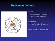
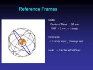
Reference Frames Global Center of Mass ~ 30 mm ITRF ~ 2 mm,
| PowerPoint PPT presentation | free to download
... (for ITRF only IDS made use of this satellites) Connect the techniques in space ( space-ties ) using the local ties between the on-board instruments ...
| PowerPoint PPT presentation | free to download
EOP, geocenter, ITRF, station determination -- 5 papers ... Relativity's prediction of the Lense-Thirring precession at the 8-12% level (1-sigma) ...
| PowerPoint PPT presentation | free to download
Geoscience Australia (GA) increasingly was undertaking GPS processing in the ... potential for confusion in Australia, ie. GDA94 versus ITRF ...
| PowerPoint PPT presentation | free to view
Collocation. Co-ordinate Transformations and Conversions to ITRF ... (grid formed using collocation; interpolation on a variable grid) OSTN02 (United Kingdom) ...
| PowerPoint PPT presentation | free to view
Achieve compatibility with GLONASS and Galileo ... Galileo plans to define its operational reference frame based on the ITRF. ...
| PowerPoint PPT presentation | free to view
To have a Unified Geodetic Reference Frame for Africa as a Fundamental basis for ... Satellite System (GNSS) Technology and Consistence with ITRF and IGS Standard ...
| PowerPoint PPT presentation | free to view
the State Committee of the Real Property Cadastre of the Government of the ... Leica SR 520 and LEIAT502. Data used. Co-ordinates: IERS ITRF 2000 epoch 2002.9 ...
| PowerPoint PPT presentation | free to view
Title: Author: VSZ Last modified by: vlad Created Date: 3/25/2002 2:51:29 PM Document presentation format
| PowerPoint PPT presentation | free to view
AFREF Technical Workshop, University of Cape Town, July 09 ... Fixed to the stable part of the Eurasian plate. Co-moving with the plate: law of time evolution ...
| PowerPoint PPT presentation | free to view
Title: PowerPoint Presentation Author: GPO User Last modified by: Yan.Wang Created Date: 6/2/2005 1:13:57 PM Document presentation format: On-screen Show
| PowerPoint PPT presentation | free to download
SLR, GNSS, VLBI, and DORIS Networks: ILRS IGS IVS IDS. C. Noll/NASA GSFC ... Network breakdown: ILRS SLR=42, IGS GNSS=407, IVS VLBI=45, IDS DORIS=58 ...
| PowerPoint PPT presentation | free to download
National Readjustment of NAD 83
| PowerPoint PPT presentation | free to download
Positioning America for the Future. NATIONAL OCEANIC AND ... 7 par metros dados en este ... con respecto al tiempo dados a cierta poca tk: ...
| PowerPoint PPT presentation | free to view
Title: Horizontal Motion from Glacial Isostatic Adjustment and GPS Author: Oso Last modified by: R diger Haas Created Date: 2/9/2001 10:27:35 AM
| PowerPoint PPT presentation | free to download
Title: Prezentacja programu PowerPoint Last modified by: wk Created Date: 10/15/2001 8:58:16 AM Document presentation format: Pokaz na ekranie Other titles
| PowerPoint PPT presentation | free to view
Title: No Slide Title Author: rtravis Last modified by: Miranda Chin Created Date: 8/23/2000 6:41:53 PM Document presentation format: On-screen Show
| PowerPoint PPT presentation | free to download
plate noam algo pie1 nlib. plate pcfc sni1 mkea chat ... Day 176: ALGO PIE1 DRAO WILL ALBH NANO rms 1.5 mm ... Day 177 BRMU ALGO NLIB PIE1 YELL WILL. rms 2.0 mm ...
| PowerPoint PPT presentation | free to download
Thought Experiments on Plate Fixed coordinates and Temporal coordinates A webinar for Monthly Height Mod Meeting Dru Smith Chief Geodesist
| PowerPoint PPT presentation | free to download
National Ocean Service. National Geodetic Survey ... National Ocean Service. National Geodetic Survey. Each antenna type has a unique phase pattern ...
| PowerPoint PPT presentation | free to view
Note on orthometric heights. Orthometric height differences are provided by leveling ONLY when there is ... Helmert Orthometric Heights. Geometry of the Ellipsoid ...
| PowerPoint PPT presentation | free to download
16th International Workshop on Laser Ranging, Poznan, Poland, October ... New trop. models. IGS. New homogeneous time series (only individual GPS series, PDR) ...
| PowerPoint PPT presentation | free to download
Title: GPS-Derived Orthometric Heights Part1 Author: Curt Smith and Chris Pearson Last modified by: VICKI.VEILLEUX Created Date: 12/22/1998 9:11:46 PM
| PowerPoint PPT presentation | free to download
Title: No Slide Title Author: rtravis Last modified by: Gordon Adams Created Date: 8/23/2000 6:41:53 PM Document presentation format: On-screen Show
| PowerPoint PPT presentation | free to download
ULUSAL DATUM DNSM KONUSUNDA TKGM GEODEZI SUBESINCE YAPILAN ALISMA
| PowerPoint PPT presentation | free to view
Elements of the National Spatial Reference System
| PowerPoint PPT presentation | free to view
GPS-Derived Heights Part 1 Development and Description of NGS Guidelines
| PowerPoint PPT presentation | free to download
Physically meaningful frame in which to visualize site motions ... reference sites as velocity solution. Final time series should use (almost) all sites for ...
| PowerPoint PPT presentation | free to download
Zero-meridian for Bureau Internationale de l' Heure (BHI) determined so that ... Polbev gelse, 1994-1997, Fuld linie : middel pol bev gelse, 1900-1996. 7. Kap. ...
| PowerPoint PPT presentation | free to download
Title: Slayt 1 Author: Ercenk Last modified by: At n P rt Created Date: 7/15/2004 10:46:05 AM Document presentation format: Ekran G sterisi Company
| PowerPoint PPT presentation | free to view
Demonstrate the general process of 7 parameter datum transformations ... The Geoid (Mean Sea Level) Local Datum. AGD84 (best fits Australia) Geocentric Datum ...
| PowerPoint PPT presentation | free to view
SCHOOL OF ARCHITECTURE, PLANNING & GEOMATICS. UNIVERSITY OF CAPE TOWN. Co-ordinate Systerms and Datums in Africa. OUTLINE : Definitions ...
| PowerPoint PPT presentation | free to view
Overview of Datums Commonly Used in Michigan and the National Spatial Reference System
| PowerPoint PPT presentation | free to download
Title: 1 Last modified by: umka Document presentation format: Other titles: Times New Roman Arial Unicode MS Tahoma StarSymbol ...
| PowerPoint PPT presentation | free to view
Composite Geoids. Gravimetric Geoid systematic misfit with benchmarks ... A, B, and 1st order GPS only. ABCRMH criteria for 1st, 2nd, and 3rd order leveling ...
| PowerPoint PPT presentation | free to download
Geodetic and Tidal Vertical Datums
| PowerPoint PPT presentation | free to view
... GPS Positioning cm level positioning with two receivers requires existing ground geodetic infrastructure Absolute GPS Positioning cm level ...
| PowerPoint PPT presentation | free to download
INTEGRITY MONITORING SYSTEM FOR SPACE-BASED NAVIGATION AND POSITIONING IN MALAYSIA Ooi Wei Han1, Moslin S.I1., Ahmad N.1, Subari M.D.1, Musa T.A.2, Othman R.2, Omar A ...
| PowerPoint PPT presentation | free to download
Techniques for High Accuracy Relative and Absolute Localization of TerraSAR-X / TanDEM-X Data U. Balss, M. Eineder, T. Fritz, H. Breit, and C. Minet
| PowerPoint PPT presentation | free to download
Improved Access to an Accurate Geodetic Reference Frame for the Caribbean
| PowerPoint PPT presentation | free to download
Title: Anal za dat v GIS Author: Jan Wild Last modified by: Jan Wild Created Date: 12/3/2003 1:49:13 PM Document presentation format: P edv d n na obrazovce
| PowerPoint PPT presentation | free to download
XY eccentricity vs scale. mm. meters. Correlation coefficient. scale ... 3D eccentricity vs scale. Concluding remarks. Unbalanced data distribution since 2002 ...
| PowerPoint PPT presentation | free to download
Sea Levels around the Caribbean
| PowerPoint PPT presentation | free to view
Report on the 4th EPN LAC Workshop, September 18-19. Graz, Austria ... The plenum of the Workshop became convinced to favor the distribution of the EPN ...
| PowerPoint PPT presentation | free to view
More than 200 CORS stations with 2 hour datasets were used for the test since the CORS positions are well known This scatter plot ... tropospheric modelling In ...
| PowerPoint PPT presentation | free to download
Title: Author: VSZ Last modified by: vsz Created Date: 3/25/2002 2:51:29 PM Document presentation format
| PowerPoint PPT presentation | free to view
COMBINA O DE SOLU ES GEOD SICAS ESPACIAIS PARA A RBMC Aluna: Maria L gia Chuerubim Orientadores: Jo o Carlos Chaves Jo o Francisco Galera Monico
| PowerPoint PPT presentation | free to download
Satellite phase center positions effects. 12/12/01. Fall AGU 2001. 9. Scale estimates ... Fall AGU 2001. 11. Effects of changes in the satellite phase center position ...
| PowerPoint PPT presentation | free to download
Science and art of determining relative positions of points above, on, or beneath earth surface ... vector data. Requirements for Scanning. Data capture is fast ...
| PowerPoint PPT presentation | free to download


