
Gisp PowerPoint PPT Presentations
All Time
Recommended

Additional (Flex) Points in any of the three Categories: 52 ... Flex points allows one to make up for a lack in one category with an excess in another (eg. ...
| PowerPoint PPT presentation | free to view

GRASS GIS Geographic Resources Analysis Support System Kurt Menke, GISP GRASS GIS What is it? A robust Open Source GIS that runs on a wide variety of computer ...
| PowerPoint PPT presentation | free to download
GISMO Team Meeting May 3, 2006 Vexcel Corporation Agenda May 3 draft agenda at Vexcel 0900 Project Status, Jezek 0915 Radar system status ...
| PowerPoint PPT presentation | free to download

The GISP Partnership Network _____________________________
| PowerPoint PPT presentation | free to view

... Y Y Y Y Y Y Y Y Y Y Y Y Y Y Y Y Y Y Y Y Y Y Y Y Y Y Y Y Y Y Y ... Reference Viewing Condition in IEC61966-2.1,Reference Viewing Condition in ...
| PowerPoint PPT presentation | free to download

Local Update of Census Addresses (LUCA) 98 & 99, New Construction ... Perfect Match. Offsets = 200-600 Feet. RED = County's Data. Blue = Census Data. Road Centerline ...
| PowerPoint PPT presentation | free to view

... 4 hours IDHS Support Library of ESRI Licenses WebEOC Flexviewers Specialized GIS skills Funding How our DRTF will be Organized 3-5 credentialed members ...
| PowerPoint PPT presentation | free to download

A. High-level Policy Advocacy and Championship for the GISP ... Partners in the Implementation of GISP. Procurement of ICT Resources and Professional Services ...
| PowerPoint PPT presentation | free to view

Where gIsp includes pressure effects; R is the mass ratio: mass(start) / mass (burnout) ... ve ~= gIsp ~= 3000 m/s (for typical chemical reactive propellants) ...
| PowerPoint PPT presentation | free to view
Indiana State Land Office Digital Conversion Project Overview Justin P. Peters, GISP Introduction: The State Land Office was established in 1887 by order of the ...
| PowerPoint PPT presentation | free to download

Welcome to IS 335 Expert Systems and Decision Support Systems Dr.Khalid A. Eldrandaly,PhD,GISP Professor of IS Dr.Khalid Eldrandaly
| PowerPoint PPT presentation | free to view

NGAC Interagency Data Sharing and Collaboration Spotlight Session: Best Practices and Lessons Learned Robert F. Austin, PhD, GISP Washington, DC
| PowerPoint PPT presentation | free to download

(1) IAS management, public awareness, stakeholder support, institutional ... Statement by delegates to Austral Pacific Workshop (GISP). Honolulu, October 2002 ...
| PowerPoint PPT presentation | free to view

FORBIDDEN STREET: SEX OFFENDER EXCLUSION ZONE MAPPING Val Swift, GISP GIS Administrator Hamilton County Surveyor s Office (Since 1993) WHY THE SURVEYOR S OFFICE?
| PowerPoint PPT presentation | free to download

... with LBRS Standards. An In-House Effort. Shoreh Elhami, GISP. GIS ... what's involved in an In-House effort and encourage similar GIS shops ... house update ...
| PowerPoint PPT presentation | free to view

Why a TDWG Invasive Species Information Systems Interest Group? ... Invasive species issue has spawned numerous information systems ...
| PowerPoint PPT presentation | free to view

... Reported rates: United States, 1970-1998 and the Healthy People year 2000 objective ... The Healthy People year 2000 objective is 100 per 100,000 population. ...
| PowerPoint PPT presentation | free to download

Brief Ideas for the Sustainability of the IABIN Invasives Information Network (I3N) As presented to the Inter-American Biodiversity Information Network Visioning Meeting
| PowerPoint PPT presentation | free to download

NBII Cross-Node Coordination of the Invasive Species Theme. PBIN (Fornwall/Steiner) ... http://invasivespecies.nbii.gov. Created for users who browse NBII ...
| PowerPoint PPT presentation | free to view

Major focus on utilizing best available data to make best maps possible ... Live entertainment, good food and refreshing beverages. PaMAGIC Board Election ...
| PowerPoint PPT presentation | free to view

GIS Professional Certification. Lynda Wayne. NSGIC Annual Meeting ... Lynda Wayne, Contributions. ASPRS, UCGIS, AAG, and others. Program Characteristics ...
| PowerPoint PPT presentation | free to view
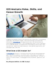
GIS Analysts play a crucial role in analyzing and visualizing geographic data to solve real-world problems. They use Geographic Information System (GIS) tools to map trends, optimize logistics, and support decision-making in urban planning, environmental management, and disaster response. With expertise in spatial analysis, GIS Analysts transform raw data into actionable insights, helping industries and governments make informed choices.
| PowerPoint PPT presentation | free to download

Integrating Infrastructure Network Features with Polygon Features to Optimize ... Spatial Analysis to Expedite Data Conflation and Feature Extraction ...
| PowerPoint PPT presentation | free to view

bar graphs use the scale on the left. The line graphs use the scale on the right. ... was based on nontreponemal tests results. All sites used the Rapid Plasma ...
| PowerPoint PPT presentation | free to view

Monsoon System Study Working Group What progress has been ... QUin. QUout. QVout. QVin. W. 1.25 x1.25. Method for Colored Moisture Analyses. Indian Ocean ...
| PowerPoint PPT presentation | free to view

Title: PowerPoint Author: nakamura Last modified by: higu Created Date: 3/11/2003 11:15:21 PM Document presentation format
| PowerPoint PPT presentation | free to download

Recolecci n de datos desde 2003. Uso de base de datos de Argentina ... Desde 2003. Congrega los sectores privado, p blico y la sociedad civil ...
| PowerPoint PPT presentation | free to view

Global Ballast Water Management Programme GloBALL
| PowerPoint PPT presentation | free to view

GIS & Planning, Looking Back and Looking ... Commission Approval Many Rural Subdivisions being created ... Office created Landuse layer ...
| PowerPoint PPT presentation | free to download
Glaciers and Ice Sheet Interferometric Radar
| PowerPoint PPT presentation | free to download

Importance of GIS Logistical, Land Management and Planning
| PowerPoint PPT presentation | free to view

Past climate changes : general presentation and tools. Antarctic ice cores : from ... douce travers des pr cipitations. Geographical extension of rapid changes ...
| PowerPoint PPT presentation | free to view

Supporting policy, regulations, and institutions for sustainable ... 28.5 m ha Amazon rainforest (ARPA, Brazil) Mobilizing certification for SFM in Vietnam ...
| PowerPoint PPT presentation | free to view

Glaciers and Ice Sheet Interferometric Radar
| PowerPoint PPT presentation | free to download

DIRECCION DE ASUNTOS POL TICOS Y SOCIALES. DIRECCION ADMINISTRATIVA DE ... ARCHIVO. GRANJA NAZARETH. COMIT DESOSTENIBILID. TECNICO X CONTAB. ASESOR JURIDIICO ...
| PowerPoint PPT presentation | free to view

NPMS Pipeline Information and GIS
| PowerPoint PPT presentation | free to view

Access to all catalogs from single entry-point ... Web-enabling? I3N website template with manuals in three languages. Central website redesign ...
| PowerPoint PPT presentation | free to view

Some Greenland Ice Sheets are hundreds of thousands years old ... between glacial and interglacial periods for only two centuries. The Day After Tomorrow ...
| PowerPoint PPT presentation | free to view

PPT s: http://map.sdsu.edu/publications ... London Street Map (1854) http://www.ph.ucla.edu/epi/snow/Snowpart2_files/frame.htm ( 10-15) ...
| PowerPoint PPT presentation | free to download

and the need for taxonomic support ... http://icpm.massey.ac.nz. Assessment of taxonomic services is a key component of the evaluation ...
| PowerPoint PPT presentation | free to download

Sexually Transmitted Disease Surveillance 2005. Division of STD Prevention. Chlamydia. Sexually Transmitted Disease Surveillance 2005. Division of STD Prevention ...
| PowerPoint PPT presentation | free to view

TARGETED STUDIES OF SEXUALLY TRANSMITTED DISEASES (STDs) IN. THE UNITED STATES MILITARY ... Marine Corps uses the Navy system. Coast Guard does not have a name/acronym ...
| PowerPoint PPT presentation | free to view

Title: Understanding LIDAR Technology Burlington County GIS Users Group May 16, 2005 Author: tblak Last modified by: Brian Mayfield Created Date
| PowerPoint PPT presentation | free to view

Invasive Alien Species: Future Challenges
| PowerPoint PPT presentation | free to view

E-government: Using technology for the benefit of the citizens ... Establishment of 'Tehila' the government secured Internet service provider ...
| PowerPoint PPT presentation | free to view

Chlamydial and Gonococcal Infections 2006 CDC STD Treatment Guidelines Mild PID Recommended Regimen B Ceftriaxone 250 mg IM once PLUS Doxycycline 100 mg orally 2 ...
| PowerPoint PPT presentation | free to download

Jet Aircraft / Ford (Taurus) costs over last 40 years. Pegasus v. Scout ... Large deployable increases profile area ( 50) ~ 200 passes to lower apogee 35,000 km ...
| PowerPoint PPT presentation | free to view

IABIN's I3N Project. a brief synopsis of the United States portion ... NBII Cross-Node Coordination of the Invasive Species Theme. Pacific Basin Information Node ...
| PowerPoint PPT presentation | free to view


Evidence for warming of the Arctic. Recent studies using a variety of methods and sources of information (sonar, ... Tephra in ice core. SEM and electron microprobe ...
| PowerPoint PPT presentation | free to download

Abrupt changes in atmospheric. circulation from Greenland Ice Cores. Greenland Summit Location ... Annual Mean Temperature about -30 C. Evidence of Abrupt ...
| PowerPoint PPT presentation | free to download

Efforts to manage invasive species will be greatly enhanced ... tiny island in Seychelles. Can ants collapse the economy. of an island? ...
| PowerPoint PPT presentation | free to view

Berkeley County looking to develop long-range strategy for park land acquisition. ... If parcels unfeasible, run new query using next highest suitability values and ...
| PowerPoint PPT presentation | free to download

... Overview for The Bahamas. The Bahamas Environment, Science and Technology ... A public lecture on invasive animal species in The Bahamas, December 5th, 2001. ...
| PowerPoint PPT presentation | free to view

ESTRATEGIA NACIONAL PARA EL MANEJO DE ESPECIES EX TICAS INVASORAS. Un modelo para desarrollo ... evaluaci n de la estrategia nacional. Recursos para ...
| PowerPoint PPT presentation | free to view

Do falls of volcanic ash (tephra) bring with them large amounts of excess, ... Tephra is not a source of extra trace elements, to the oceans or land on which it falls ...
| PowerPoint PPT presentation | free to view