Gis Mapping PowerPoint PPT Presentations
All Time
Recommended
GIS Overview: Management of GIS Projects, GIS at the City of Seattle and GIS Careers
| PowerPoint PPT presentation | free to view
GIS in Action Getting Started With GIS Chapter 9 9 GIS in Action 9.1 Introducing GIS in Action 9.2 Case Study 1: GIS Fights the Gypsy Moth 9.3 Case Study 2: GIS and ...
| PowerPoint PPT presentation | free to view
GIS AND CENSUS MAPPING IN ST' LUCIA
| PowerPoint PPT presentation | free to download
Data for institutional services was captured and Namplan dataset was ... A constituency with two urban centers will have 01' for the ... New GIS ...
| PowerPoint PPT presentation | free to download
Floodplain Mapping using HEC-RAS and ArcView GIS. Eric Tate. Francisco Olivera. David Maidment ... Motivation: Why map floodplains in GIS? ...
| PowerPoint PPT presentation | free to download
Web-based and Mobile GIS for High School GIS Career Awareness. by Dr. Ming-Hsiang (Ming) Tsou ... Barnacle (Boat Channel Study: HTH Biotech Website) Flatworm ...
| PowerPoint PPT presentation | free to download
Geographic information system is much more than a map in a computer ... It is not a program that can just display maps, like a street atlas program ...
| PowerPoint PPT presentation | free to view
What is this GIS stuff? GIS at UD: Geographic ... create. modify. data. ... Can download raw data from here, open it up in Excel, save as dBaseIV file and ...
| PowerPoint PPT presentation | free to view
University of California Riverside. GIS: Transform and Enhance Social Research ... Map shows spatial relationship among the states ...
| PowerPoint PPT presentation | free to download
GIS Mapping for Utilities Jessica Lillie Why your utility needs GIS NOW!!! How does your system keep track of its underground utilities? As-builts and blue prints ...
| PowerPoint PPT presentation | free to view
SDFRN Workshop April 13, 2005, San Diego Natural History Museum Combining Web-based GIS and Wireless Mobile GIS for Wildfire Recovery and Watershed Management
| PowerPoint PPT presentation | free to download
neo-tectonic fault line. 2m displacement. quartzite. Use of GPS and GIS for field mapping ... He suspects that this wall is built exactly on a neo-tectonic fault line. ...
| PowerPoint PPT presentation | free to view
Major focus on utilizing best available data to make best maps possible ... Live entertainment, good food and refreshing beverages. PaMAGIC Board Election ...
| PowerPoint PPT presentation | free to view
AFF Mapper also requires your data to be aggregated but does not require geocoding. ... Think about what sort of maps and visualizations work best for each purpose ...
| PowerPoint PPT presentation | free to view
University of California Riverside. GIS: Transform and Enhance Social Research ... Multiple Sources linked on a single map: City of New Orleans and Katrina ...
| PowerPoint PPT presentation | free to view
Exploration of continental Shelf edges. This is a multibeam map image of a continental shelf edge ... (www.caris.com/calender/details.cfm?img=200708 ...
| PowerPoint PPT presentation | free to download
Who are McElhanney and MapInfo Corp? What is GIS? Making ... and be resubmitted asap. MapInfo GIS for Independent Power Producers. MapInfo GIS for Mapping, ...
| PowerPoint PPT presentation | free to view
... Maps. Web Mapping. AWWU. Submitted by. Tim Kelly. DNR, State of Alaska ... Geologic map of the Mt. McKinley (Denali) and Mt. Foraker area of the Alaska Range ...
| PowerPoint PPT presentation | free to view
... definitions which is represented completely rigorous and unambiguous fashion. ... Trade Magazines: GIS World; Books with vendor information: ESRI Inc. ...
| PowerPoint PPT presentation | free to view
GIS with spatial intelligence includes map literacy, the ability to transform ... map Europe.tab by Tino Johansson 2004. IGU 19.08.2004. ...
| PowerPoint PPT presentation | free to view
What is GIS? Geographic Information Systems (GIS) are computerized systems designed for the storage, retrieval and analysis of geographically referenced data
| PowerPoint PPT presentation | free to view
Outline. GIS overview. GIS data and layers. GIS applications and examples. Software overview. GIS tutorial 1 overview. GIS TUTORIAL 1 - Basic Workbook
| PowerPoint PPT presentation | free to download
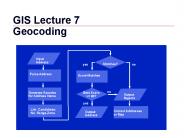
Street Map. Polygon Address Matching. Improving the Process. Geomasking. WEB Sites. GIS 3 ... GIS 13. Linear Address Matching (Streets) Urban street maps ...
| PowerPoint PPT presentation | free to download
... analysis differentiates GIS from computer assisted mapping (CAD), both spatially ... GIS resulted from the need to OVERLAY different map layers: ...
| PowerPoint PPT presentation | free to view
As an emerging trend of technology the field of GIS (Geographic Information System) is steadily expanding. The global cloud GIS Market is growing approximately at a CAGR of 13% during 2018-2023. Since the region of America are making huge investments in the use of GIS technology in various sector if industries such as natural resources, utilities & other hence Americas is dominating the market & holds the largest market share followed by EMEA, APAC, and India. T
| PowerPoint PPT presentation | free to download
As the leading services for LiDAR mapping in India, our team specializes in LiDAR surveys, digital orthophotography, and photogrammetry services. We have the work force, hardware, and ability to give quick reaction to your basic review, photography, and mapping needs, paying little mind to where your undertaking is found. For more information visit us at- http://www.yolaxinfra.com/drone-lidar-survey.php
| PowerPoint PPT presentation | free to download
Geographical information systems (GIS) . . -
| PowerPoint PPT presentation | free to download
Request Sample of Report @ https://bit.ly/2IndIJi Mobile mapping solutions are widely used by the organizations to acquire GIS data. It accounts for over 70% of the total stake in the mobile mapping market. Mapping companies, such as Google, Apple, and Baidu, are heavily leveraging the mobile mapping solutions to acquire the georeferenced data and enhance the accuracy of their maps. The cost-effectiveness and the accuracy of the mobile mapping are the primary factors, augmenting the demand among the organizations.
| PowerPoint PPT presentation | free to download
Internet enabled GIS GIS Topics and Applications John Reiser Rowan University * * * * * * * Think of Finder as the catalog and repository of GIS data.
| PowerPoint PPT presentation | free to download
Land Cover Mapping for the Southwest Regional GAP Analysis Project John Lowry and R. Douglas Ramsey Remote Sensing/GIS Laboratory Utah State University
| PowerPoint PPT presentation | free to view
Indshine’s GIS software is designed to store, manage and analyze all forms of geographical and spatial data. You can produce maps and other graphic displays of geographical information using Indshine’s GIS software for comprehensive analysis and presentation. Get to know more about GIS software here.
| PowerPoint PPT presentation | free to download
Planted the Seed of GIS in Public Health. Mapping and Public Health ... Potential Problems with GIS: 'Gee Wiz' effect. Ecological Fallacy. Maps Can Lie ...
| PowerPoint PPT presentation | free to view
Topics to be Covered. An overview of GIS history, definitions. What ... Logistics (Fed Ex, DHL, etc.) 33 'Learning is not compulsory...neither is survival. ...
| PowerPoint PPT presentation | free to view
University of Arizona. US Forest Service. Eastern Arizona Counties. ORGANIZATION ... CWPP Mapping Firewise Communities USA. Smoke Management. Needs Assessment ...
| PowerPoint PPT presentation | free to download
Title: Functional approach to GIS design and implementation Author: Sungsoon Hwang Last modified by: Sungsoon Hwang Created Date: 3/29/2006 4:15:13 AM
| PowerPoint PPT presentation | free to download
If you’re in search of GIS companies in Dubai, you’ve come to the right page. Here you will get to know the actual importance of GIS technology while performing a land survey.
| PowerPoint PPT presentation | free to download
Land Cover Mapping Using Landsat 8 Imagery
| PowerPoint PPT presentation | free to download
GIS Geographic Information System Cluster 1 CPAS What is GIS? Geographic Information System (GIS) is a system of computer hardware, software, and procedures designed ...
| PowerPoint PPT presentation | free to download
... Has Something to do With Maps. GIS Has Something to do With ... What Do We Know About Maps? Types of Maps (Familiar Examples) Street Maps. Environmental Maps ...
| PowerPoint PPT presentation | free to view
PENNDOT Generic Mapping Interface (GMI) Project Enhancing the Enterprise Through GIS Web Services Joe McGinnes, PENNDOT Manager, Geographic Information Division
| PowerPoint PPT presentation | free to download
Internet Map Servers ( Web GIS ) Longley et al., Chapter 11
| PowerPoint PPT presentation | free to download
GIS is not 'canned maps. ... Static Maps No More. Earthquakes of 1977. Tracking Butterflies with. Journey ... Online Mapping. World Cinema Visits. GIS Research ...
| PowerPoint PPT presentation | free to view
As an emerging trend of technology the field of GIS (Geographic Information System) is steadily expanding. The global cloud GIS Market is growing approximately at a CAGR of 13% during 2018-2023. Since the region of America are making huge investments in the use of GIS technology in various sector if industries such as natural resources, utilities & other hence Americas is dominating the market & holds the largest market share followed by EMEA, APAC, and India.
| PowerPoint PPT presentation | free to download
Indian Census has been a major supplier of map products in the country both in ... CensusInfo India allows generation of maps up to sub-district level. Steps ...
| PowerPoint PPT presentation | free to download
Grid-based Map Analysis and GIS Modeling. Understanding Spatial Patterns and Relationships ... Multimedia Mapping full integration of GIS, Internet and ...
| PowerPoint PPT presentation | free to download
Rocky Mountain Mapping Center. USGS Remote Sensing and Invasive Species ... Final Trend Surface Map. Model Output GIS Map. See Schnase et al. 2002, Kalkhan et al. 2003 ...
| PowerPoint PPT presentation | free to view
... 5 Measurements, error of closure. Lecture #6 Closure, ... Maps. Aerial. Photos. Course. Notes. Laser. Ultra - Sonics. Email. Grades. JAVA. Total. Stations ...
| PowerPoint PPT presentation | free to view
A geographic information system (GIS) ... 49 CFR part 195 Large volumes of complex data that must be managed organized displayed Oil industry GIS chronology Early ...
| PowerPoint PPT presentation | free to view
Use of GIS Systems in Official Statistics
| PowerPoint PPT presentation | free to download
GIS is capable of assisting the storage, retrieval and manipulation of spatially ... the creation of GIS/LIS from historical records and aerial photogrammetry. ...
| PowerPoint PPT presentation | free to view
Virginia State Map. Virginia State Map. Replace Approx. 60 Maps Currently Displayed in ... Political Boundary Map with Emphasis on: Transportation ...
| PowerPoint PPT presentation | free to view
This show designed to illustrate SANDAG's current and future uses of GIS technology. For use at conferences, in house meetings and anywhere people might have ...
| PowerPoint PPT presentation | free to view
Internet GIS and Geospatial Information Technology
| PowerPoint PPT presentation | free to download
AN INTRODUCTION TO GIS SYSTEMS TAKEN AND MODIFIED FROM TEXT BY David J. Buckley Corporate GIS Solutions Manager Pacific Meridian Resources, Inc. WHAT IS A GIS ?
| PowerPoint PPT presentation | free to view


