Geocoded PowerPoint PPT Presentations
All Time
Recommended
Integration of GIS. 3. European Digital Library, EDL. http: ... Map-based access; Access by spatial locations; Conservation and promotion of library materials; ...
| PowerPoint PPT presentation | free to view
Come with Maps and some Data. Spreadsheets, Statistical ... 5 - Can easily overlay and visually compare Geocoded maps to one another. Advantages (cont. ...
| PowerPoint PPT presentation | free to view
FIPS code. Census codes often used as geocodes in GIS ... See 'list.htm', pictured here. Mineral County zip file: tgr30061.zip ...
| PowerPoint PPT presentation | free to view
map and Scan. pattern. Multimode interferometry: implementation. Page 8 ... Las Vegas. Geocoded phase ampl. Bn: 35 m. IS2. WSS: 14/3/03, IMS: 29/11/02. SRTM DEM ...
| PowerPoint PPT presentation | free to download
Uses geocoded street data to find locations of 911 calls. ... plotted deaths from cholera on a street map along with locations of water well pump handles. ...
| PowerPoint PPT presentation | free to view
Cases geocoded to a zip code centroid may not be located in the correct census tract. ... 2000 Census block populations aggregated into zip codes (Tele Atlas, 2006) ...
| PowerPoint PPT presentation | free to view
Travel Time (requires travel speeds) Speed limit would be useful ... Topologically correct i.e. overpasses (e.g. Parry Ave & Kwinana Fwy) Speed limits ...
| PowerPoint PPT presentation | free to view
Division of Animal Industry - Premises Locations Livestock premises locations from USDA APHIS Veterinary Services database. Not available for download.
| PowerPoint PPT presentation | free to download
Starting on August 28th, the 911 call center started to receive hurricane related calls' The calls v
| PowerPoint PPT presentation | free to view
MapQuest.com for addresses; Anywho.com for phone number and name ... Anywho.com works well for reverse telephone lookups and name lookups ...
| PowerPoint PPT presentation | free to view
Title: Slide 1 Author: cscaffid Last modified by: Irwin Kwan Created Date: 8/16/2006 12:00:00 AM Document presentation format: On-screen Show (4:3) Other titles
| PowerPoint PPT presentation | free to view
Use of GIS Systems in Official Statistics
| PowerPoint PPT presentation | free to download
exceeds 6.5? EFM (USGS-02) SA median. Field-02. Mom-Mag. Distance ... exceeds 6.5? SA median. IMR. Mom-Mag. Distance. System Notes Possible Use of IMR Results ...
| PowerPoint PPT presentation | free to view
Estimating Commute Trips. The Evergreen State College ... The records from Commute Trip Survey reviewed to confirm addresses or provide ...
| PowerPoint PPT presentation | free to download
To make it easier for small and medium-sized medical institutes, we are offering a flat 10% off on our Quick Maps extension. In addition to that, we will also make sure that the implementation process remains as smooth and short as possible.
| PowerPoint PPT presentation | free to download
Austin, Texas. COGNA October 20, 2004. Integrating Local Data Sets into The National Map ... 1100 W 49th Street, Austin TX 78756. gets converted to ...
| PowerPoint PPT presentation | free to view
Environmental Justice analysis ... online.htm. Data Problems ... Perform buffer analysis in similar fashion (one km is precedence set in literature) ...
| PowerPoint PPT presentation | free to view
Each year in the United States. accidents kill more than 7,000 ... Wilder Research Foundation. St. Paul Public Schools, Student Data. St. Paul Public Works ...
| PowerPoint PPT presentation | free to view
Map customer locations. Planning deliveries ... On a map: specific point. Two main purposes of geomasking ... http://www.mapquest.com. http://www.zipinfo.com ...
| PowerPoint PPT presentation | free to view
Class Project Brian McKean RATIONALE I was asked by the assistant to the Dean at the school of social work to map all of the field locations where research is being ...
| PowerPoint PPT presentation | free to view
AUSTRALIA. CANADA. FRANCE. UK. MEXICO. ANGOLA. NIGER. USA ... Mumbai Free Map. San Francisco Indyvoters. Civic Mapping. for ordinary people. 23. pathmaking: ...
| PowerPoint PPT presentation | free to view
Title: Slide 1 Author: cscaffid Last modified by: cscaffid Created Date: 8/16/2006 12:00:00 AM Document presentation format: On-screen Show (4:3) Other titles
| PowerPoint PPT presentation | free to view
Public health departments use ZIP code level analysis to identify areas where ... Cannot rely on ZIP codes alone for accurate geographic analysis. Data entry error ...
| PowerPoint PPT presentation | free to view
Behind the scenes, DOCKER uses descriptions of components and their constraints (developed ... suggest additional steps needed to make the pathway work ...
| PowerPoint PPT presentation | free to view
Type 1B Segment in Riverside CA, showing TEA Type, Census Count, and USPS Address Locations ... Permits updates to HU frame using USPS lists ...
| PowerPoint PPT presentation | free to view
Select selection sensitivity for search. New address locator is now listed and can be used to geocode any table with the same format. ...
| PowerPoint PPT presentation | free to view
pleides100@yahoo.com. About Me. Schooling in Geology ... Older maps used NAD27. Newer maps use the more accurate NAD83 made using satellites and sophisticated ...
| PowerPoint PPT presentation | free to download
Oracle10g Database: A Spatial VLDB Case Study Xavier R. Lopez Director, Server Technologies Oracle Corporation Overview Role of Spatial Database Technology Oracle ...
| PowerPoint PPT presentation | free to view
Linked through a geocode (e.g. county, zip code, street address) Spatial and Attribute Data ... Only 158,552 (59.72%) with zip code, county and city correspondence ...
| PowerPoint PPT presentation | free to download
Title: PowerPoint Presentation Author: Internal Systems Last modified by: daniel seurer Created Date: 3/26/2004 9:05:48 AM Document presentation format
| PowerPoint PPT presentation | free to download
Calculation of commuting-distances in ArcView 3.x. Michael Berg Rasmussen. Statistics Denmark ... but if we could get to know the distance people actually have ...
| PowerPoint PPT presentation | free to view
Use phone books, paper maps, Zip code directories. 2005 Survey ... reference files, level of geocoding (zip code, street, city), hand geocoding ...
| PowerPoint PPT presentation | free to view
Learn how to make the most of your CRM records with Dynamics CRM Map integration. Plot multiple entities, manage records, and more.
| PowerPoint PPT presentation | free to download
These tax maps are used for locating and describing properties that are linked ... 3) Red line shows distance between the two. Page 21 ...
| PowerPoint PPT presentation | free to view
GIS tools then compare expected to observed rates around env. hazards ... LBW evaluated within 300 meters of roadways with 10,000 cars per day. Preliminary Results ...
| PowerPoint PPT presentation | free to view
Web Gis for geomarketing and mobile mapping: Peroni beer company case study Salvatore Amaduzzi University of Udine (Italy)
| PowerPoint PPT presentation | free to download
Environmental Health Sciences and Biostatistics. Bloomberg School of Public Health ... in Env Health Sci and Biostatistics. PhD in Statistics. Research agenda ...
| PowerPoint PPT presentation | free to download
... a client-side application (needs a download) so not used in this list of ... Use a text editor (Notepad, PFE32) to load the text file, change a description, ...
| PowerPoint PPT presentation | free to download
Enhancements to TIGER School District Boundaries - 2004 ... Submitted to Census Bureau for review & most were accepted into TIGER ...
| PowerPoint PPT presentation | free to view
Linking Dispatch, Paramedic, Hospital, and Regional Planning Data. in Portland, Oregon: ... location by contacting either paramedic or Bureau of Emergency ...
| PowerPoint PPT presentation | free to download
7m euros (plus 2m in overheads) over 5 years to fund Strategic Research Cluster ... Will generate substantial benefits to Ireland's geotechnology sector ...
| PowerPoint PPT presentation | free to view
The unpopular threads don't vanish - users are surrounded by the 'wall of boringness' It's easy to lose threads that are active and interesting just because people ...
| PowerPoint PPT presentation | free to view
... L To R From R To Street ID Site Moorfield 26836 Lane 101 119 102 120 23948 Site Moorfield 26836 Lane 121 199 122 198 23948 How Does it Work? Direct Matching ...
| PowerPoint PPT presentation | free to download
... Data Acquisition in Transportation Commute Atlanta. Commute Atlanta study ... All figures created by Commute Atlanta researchers, except spatial interpolation ...
| PowerPoint PPT presentation | free to view
????????????????????????????????????????????????????? ... 'Sean Hannity' Other Operations. ALTER TABLE books ADD COLUMN subtitle varchar(50) AFTER title; ...
| PowerPoint PPT presentation | free to view
Raise public awareness of sky quality issues worldwide. Collect ... Discovery Channel News. Astronomical League (US) Royal Academy (UK) Iranian Astro. Soc. ...
| PowerPoint PPT presentation | free to view
An Excel file with Michigan County-wise data aggregates is chosen. ... Bring homework, questions, answers, food, ideas, resources... ( October 2nd, 2 pm Eastern) ...
| PowerPoint PPT presentation | free to view
TWO TYPES OF ADDRESS MATCHING ARE USED. Street network based (stnetall) ... Specifies the street translation file. Specifies the fictitious addresses file ...
| PowerPoint PPT presentation | free to view
What is the OGC? The Open Geospatial Consortium, inc. (OGC) is a non-profit international ... LBS research Team, Telematics Research Division, ETRI, South Korea ...
| PowerPoint PPT presentation | free to view
... address attribute to the address range of a mapped feature a road. ... if the match score is over a certain threshold, the program will map. the record. ...
| PowerPoint PPT presentation | free to view
1999 Version 3.0 (raster truetype fonts added) 2000 Version 3.3 (MapScript, PROJ4) ... It's Free. It's Fast. It's Easy. Great user community. It grows ...
| PowerPoint PPT presentation | free to view
Emigration of native-born population. Measured by the Census 2000. 11. State/County ... Distribute total US estimate of emigration of native-born population ...
| PowerPoint PPT presentation | free to download
Spatial Statistic, GIS, Crime Analysis
| PowerPoint PPT presentation | free to view
Introduction to the Disaster Management Map (DMM) Plotting ... Then use the zoom 'r' to view at the desired zoom level. 13. Map Selection. National Map ...
| PowerPoint PPT presentation | free to view
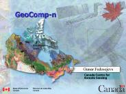
GeoComp-n GeoComp-n Natural Resources Canada Gunar Fedosejevs Canada Centre for Remote Sensing Natural Resources Canada Ressources naturelles Canada GeoComp - n, an ...
| PowerPoint PPT presentation | free to download
Situs (house number) Coordinates. Milepost/log points. Our goal ... ROI: Crash Data Analysis ... community a vehicle that enables others to view/analyze data ...
| PowerPoint PPT presentation | free to view


