
Coaps PowerPoint PPT Presentations
All Time
Recommended


2-Year Period 25-Year Period Signals Trend. Smoothed ... MY POWER POINT AT: coaps.fsu.edu/Marshall. THE END. Probability of Hurricane Landfall: U.S. Coast ...
| PowerPoint PPT presentation | free to view

Sites are located on servers, ex. www.coaps.fsu.edu is a domain, and ... img src='images/star.gif' alt='Star Picture' height='100' width='200' / Attributes ...
| PowerPoint PPT presentation | free to download

YoungKwon Lim, D'W' Shin, S' Cocke, T' E' LaRow, J' J' OBrien, and E' P' Chassignet Center for Ocean
| PowerPoint PPT presentation | free to download
... for specific information Wind Climatology Aviation Construction Water Sports Engineering Firms General Use Wind Climatology Based on daily ... Tuscon Lecture ...
| PowerPoint PPT presentation | free to download

... de alto risco e parto ces reo) Unidade de Coleta de Leite Humano e M todo Canguru DESENHO DA REDE CEGONHA - BAHIA UCI neonatal Laborat rio ...
| PowerPoint PPT presentation | free to download


the tornado alley. Neutral ENSO phase increases the risk of severe freezes by 3:1 odds. ... La Ni a brings drier than normal conditions (30%-40%) and warmer ...
| PowerPoint PPT presentation | free to view

Auto thumbnails of images. No more emailing screenshots of problems! wiki.hycom.org ... Open Source and Free! User Authentication using LDAP ...
| PowerPoint PPT presentation | free to view
Title: The Gulf Stream Last modified by: Bob Chant Document presentation format: Custom Other titles: Bradley Hand ITC TT-Bold Stone Sans ITC TT-Semi ...
| PowerPoint PPT presentation | free to download

Title: The Gulf Stream Last modified by: Bob Chant Document presentation format: Custom Other titles: Bradley Hand ITC TT-Bold Stone Sans ITC TT-Semi ...
| PowerPoint PPT presentation | free to download

Observed variation is better captured by downscaling. ... CFS overestimates the observed variation. Anomaly time series : CFS data show smaller amplitude variation. ...
| PowerPoint PPT presentation | free to download

... inland--flooding shoreline homes and hotels and eroding Florida's famous beaches, ... Northern Florida, the group says, will suffer the most from loss of ...
| PowerPoint PPT presentation | free to view

Title: Potential Predictability of U.S. Summer Climate with Perfect Soil Moisture Author: yang Last modified by: fyang Created Date: 3/29/2004 10:16:22 PM
| PowerPoint PPT presentation | free to view

Possible causes: South Asian black carbon emission. Climate regime shift. Global warming. Shift of Africa-North China teleconncection. SST trend. South. China. Central ...
| PowerPoint PPT presentation | free to download

Estimated from an 8 day average (Feb. 21 March 1, 2002) ... Missing Data (1 day; Feb. 19, 2002) Relative to RSS's ... (24 hours later Snow forecast bombs) ...
| PowerPoint PPT presentation | free to view

ONR, Secretary of the Navy Grant awarded to James J. O'Brien and by the ... What signatures foretell when a tropical remnant vortex will yield a warm seclusion? ...
| PowerPoint PPT presentation | free to view

Climate Forecasts for Improving Management of Energy and Hydropower ... Relationship PDO = California Summertime Temperatures. Correlations, Mode 1-Tmean, JJA ...
| PowerPoint PPT presentation | free to view

SECC Partners Florida State Univeristy climate studies, coupled modeling, climate forecasts, forestry University of Florida extension, crop modeling, decision ...
| PowerPoint PPT presentation | free to download

Warm Seclusion Extratropical Cyclones
| PowerPoint PPT presentation | free to view

To examine the region for patterns in trends at each decile ... Variability in summertime temperatures shows up in the upper deciles ...
| PowerPoint PPT presentation | free to view

This could be due to our mistakes or HYCOM errors on the representing the propagation of the waves Future Work More simulations should be run in order to analyze ...
| PowerPoint PPT presentation | free to download

Climate Information and Agricultural Risk Management A Systemic Approach to Understanding Farmers Decision-Making T. A. Crane*, C. Roncoli*, N. E. Breuer+, J. O ...
| PowerPoint PPT presentation | free to view

Interactions with weather and climate information ... Weather.com. 9. Online (indeterminate) 9. Data Trans. Network. 16. Local TV. 18. Weather Channel (TV) ...
| PowerPoint PPT presentation | free to download
... (SOS) and common O&M and SensorML profiles for selected sensors (SWE), installed at vessels and in real-time monitoring systems * ODIP Prototype 1 ...
| PowerPoint PPT presentation | free to download

Determine if CCM3 can recreate AO based on accepted values in literature ... NAM Northern Annular Mode. Thompson and Wallace, 2000. Figure 1A. Naturally occurring ...
| PowerPoint PPT presentation | free to view

... available to the research crew (e.g., pitch/roll, heading, ... James J. O'Brien. Shawn R. Smith (chair) FSU/Meteorology. Carol Anne Clayson. LDEO/Columbia ...
| PowerPoint PPT presentation | free to view

(i) Advance the Nation's intraseasonal, seasonal-to-interannual climate ... Photos: US Bureau of Reclamation, NOAA-CIRES Western Water Assessment ... Challenges ...
| PowerPoint PPT presentation | free to view

Alexis Lugo-Fernandez, Minerals Management Service. Mark Luther, University of South Florida ... Serving archived Texas Automated Buoy System (TABS) data ...
| PowerPoint PPT presentation | free to view

Tony Amos, University of Texas Marine Science Institute. Landry Bernard, NAVOCEANO ... Alexis Lugo-Fernandez, Minerals Management Service. Mark Luther, ...
| PowerPoint PPT presentation | free to view

Extreme Drought 2nd Percentile (1 in 50 years) Exceptional 1st Percentile (1 in 100 years) ... UGA's Automated Weather Stations. http:// www.georgiaweather. ...
| PowerPoint PPT presentation | free to view

Formal Memorandum of Agreement establishing Regional Association for ... Thomas McGee, Gulf of Mexico Hydrates Research Consortium, University of Mississippi ...
| PowerPoint PPT presentation | free to view

Forecasting cotton yields over the southeastern US. using NOAA NCEP/NCAR Reanalysis data and ... potentially useful to forecast cotton yields in the SE-USA ...
| PowerPoint PPT presentation | free to download

| PowerPoint PPT presentation | free to download

Flags are applied values at the parametric level. ... The method also allows for flags that do not indicate problems, but interesting ...
| PowerPoint PPT presentation | free to download

The Gulf of Mexico Coastal Ocean Observing System: a Regional Component of the U'S' Integrated Ocean
| PowerPoint PPT presentation | free to view

... by 120 m, the water mass transports at the Gibraltar and Sicily straits are ... The Gibraltar strait is now 170 m deep and the Sicily strait is reduced to a ...
| PowerPoint PPT presentation | free to view

The Gulf of Mexico Coastal Ocean Observing System: a Regional Component of the U'S' Integrated Ocean
| PowerPoint PPT presentation | free to view

Societal/political needs in Europe high (IPCC, mitigation, ... UREADMY, MetOffice (FOAM), MPI-M (HOPE), IPSL (OPA/ORCA) Regional Climate: SHMI, DMI, MetOffice ...
| PowerPoint PPT presentation | free to view

... the front created by the NAC is poorly resolved due to the coarse resolution. ... Is the MOW pathway variability in the Northeast Atlantic related to the NAO? ...
| PowerPoint PPT presentation | free to view
N34 lead N34 lag. N34 lead N34 lag (a) Observation (b) CFS CGCM (52 year long run) ... Lag correlation with respect to 20-yr moving window during 55 years. OBS (IMR) ...
| PowerPoint PPT presentation | free to download

MARCDAT-II, Exeter, UK ... Presently, RV marine reports make up only a small fraction of ... Whether and how they provide routine marine weather reports? ...
| PowerPoint PPT presentation | free to download

We combine hindcast climate modeling, bias correction and statistical analysis ... maps to improve climate hindcast simulations and reduce uncertainties in ...
| PowerPoint PPT presentation | free to view

related to the distribution and description of real-time ocean data. ... Disparity in requirements for different user groups could lead to two or more datasets ...
| PowerPoint PPT presentation | free to view

There have been several retrieval algorithms with different rain flags. ... Taylor's hypothesis can be used to estimate the spatial scale to which ...
| PowerPoint PPT presentation | free to download

Model and experiment setup. The Navy Coastal Ocean Model (NCOM) is used for ... The model domain is shown in Figure 1. The horizontal resolution is 1/60 . The ...
| PowerPoint PPT presentation | free to view

Gulf of Mexico Coastal Ocean Observing System GCOOS: A Component of the U'S' Integrated Ocean Observ
| PowerPoint PPT presentation | free to view

CASE 150-190, T190 2310, 2510 and 2712 Compact Tractors Service Repair Manual Instant Download (Part Number 9-77981)
| PowerPoint PPT presentation | free to download

Monitoring for beach health by all Gulf states; ... Ocean color/chlorophyll fields, University ... Stakeholder and Education and Outreach Councils-next pages ...
| PowerPoint PPT presentation | free to view

CASE 150-190, T190 2310, 2510 and 2712 Compact Tractors Service Repair Manual Instant Download (Part Number 9-77981)
| PowerPoint PPT presentation | free to download

CASE 2712 Compact Tractor Service Repair Manual Instant Download
| PowerPoint PPT presentation | free to download

CASE 150-190, T190 2310, 2510 and 2712 Compact Tractors Service Repair Manual Instant Download (Part Number 9-77981)
| PowerPoint PPT presentation | free to download

CASE 2712 Compact Tractor Service Repair Manual Instant Download
| PowerPoint PPT presentation | free to download

CASE 150-190, T190 2310, 2510 and 2712 Compact Tractors Service Repair Manual Instant Download (Part Number 9-77981)
| PowerPoint PPT presentation | free to download

CASE 2712 Compact Tractor Service Repair Manual Instant Download
| PowerPoint PPT presentation | free to download
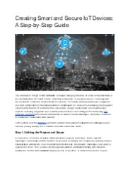
The Internet of Things, or IoT services, is indeed changing the face of some of the industries in the world-whether it’s smart homes, industrial automation, or medical science. But along with the revolution comes the responsibility for security. This article will help developers, engineers, and tech enthusiasts on the implementation of intelligent IoT devices by hardening them against cybersecurity threats. It addresses the conceptual, design, deployment, and maintenance aspects, including pragmatic tips, industry best practices, and strategies for developing IoT network solutions that meet current needs as well as future challenges. It provides a solution to balance IoT innovation with security.
| PowerPoint PPT presentation | free to download