Aviation Weather PowerPoint PPT Presentations
All Time
Recommended
... Areas of Responsibility for AWC listed as KKCI, FACA Area Outlined ... Figure 5: A comparison of the Domestic Area Forecast Areas, the OFAGX and the FACA ...
| PowerPoint PPT presentation | free to view
Multi-channel algorithms such as the Global Convective Diagnostic( GDC) ... Multi Channel differences can differentiate between volcanic ash and weather clouds. ...
| PowerPoint PPT presentation | free to download
Federal Aviation Regulations Author: ... Weather Hazards Objectives Thunderstorms Thunderstorms Thunderstorms Thunderstorms Thunderstorms Thunderstorms ...
| PowerPoint PPT presentation | free to view
provide a safe, secure, and efficient global aviation system that contributes to ... Weather is a critical element that has a direct impact on the safety, capacity, ...
| PowerPoint PPT presentation | free to view
A Roadmap for Improving Aviation Weather ... Mr. Tom Fahey, Northwest Airlines, Manager, Meteorology ... Northwest Airlines (NWA) Turbulence Plot (TP) System ...
| PowerPoint PPT presentation | free to view
The Role of Private Weather Companies Weather Decision Technologies The Premier Weather Content Prov
| PowerPoint PPT presentation | free to view
Cooperative Efforts Can Drive Down the Accident Rate European Civil Aviation Conference One Hundred and Twenty-Fourth Meeting of the Directors
| PowerPoint PPT presentation | free to download
AVIATION WEATHER DEBBIE SCHAUM Cross section cont. This should display a cross section view. It will always have your starting destination on the left side.
| PowerPoint PPT presentation | free to view
AVIATION WEATHER Thunderstorms Tornadoes Thunderstorms AVIATION WEATHER Thunderstorms Tornadoes Thunderstorms * Dirt being sucked in the updraft Towering cumulus ...
| PowerPoint PPT presentation | free to download
Aviation Weather Air Temperature and Pressure Affecting Aircraft Weather Charts Icing Aircraft Performance Take Off Distance Chart Microburst / Windshear Wingtip ...
| PowerPoint PPT presentation | free to download
Training the World s Best Aviators FM 1-230 References for today Atmosphere 2-1 thru 2-3 Temperature 3-1 thru 3-5 Atmospheric Circulation 6-1 thru 6-5 Air Masses 9 ...
| PowerPoint PPT presentation | free to view
... cut off updrafts Takes on a stratiform appearance Life of a single-cell thunderstorm is usually
| PowerPoint PPT presentation | free to view
... temp 3 degrees Flight Weather Briefing DD-Form 175-1 110304 TH67 / 2741 OZR / 1300 none 020 11010 +12 030 13015 +12 040 14015 +11 050 15020/+09 060 ...
| PowerPoint PPT presentation | free to view
Aviation Weather Hazards LT Clayton Martin NAS Patuxent River Air Operations Fog (radiation fog, advection fog) Precipitation (snow, heavy rain) Low Clouds (lifting ...
| PowerPoint PPT presentation | free to download
GA is not like the airlines. GA aircraft/pilots are less weather tolerant ... Ink Blot Test. VFR not recommended. Legitimate - sometimes. Over warning - 'cry wolf' ...
| PowerPoint PPT presentation | free to view
NetJets: Unique Aviation Weather *
| PowerPoint PPT presentation | free to view
... useable graphical weather information on a single, full color display ... Color Bars. View Menu. Product Status Button colors: White: the product is not displayed ...
| PowerPoint PPT presentation | free to view
NASA Aviation Safety Investment Strategy Team (ASIST) prioritized research needs ... Dan Baize (LaRC) AWIN. Page 17. WxAP Aviation Weather Information Overview ...
| PowerPoint PPT presentation | free to view
Eastern Airlines Flight 66. Pan Am Flight 759. Delta Airlines Flight 191. USAir Flight 1016. Eastern Air Lines 66. June 24, 1975 ...
| PowerPoint PPT presentation | free to download
Alaska Aviation Weather Unit
| PowerPoint PPT presentation | free to view
WHERE AMERICA'S CLIMATE AND WEATHER SERVICES BEGIN. VISITING SCIENTIST ... Topic: The Runway Winds Forecast Product (from MIT/LL): Concepts and Development. ...
| PowerPoint PPT presentation | free to view
Aviation Weather Forecasting System Market Forecast to 2028 - COVID-19 Impact and Global Analysis By Component (Hardware, Software, and Services), Application (Weather Stations, Weather Drones, Weather Balloons, and Others), and Forecast Type (Short Range, Medium Range, Extended Range, and Long Range)
| PowerPoint PPT presentation | free to download
SkyScope: An Aviation Weather Visualization System Wesley Coelho Bertrand Low
| PowerPoint PPT presentation | free to download
OUTLINE NWS Aviation Weather Forecasting Training Requirements Learning Materials Available FY2001 Development Efforts NWS Aviation Weather Forecasting Training ...
| PowerPoint PPT presentation | free to download
Level 2 Element: Weather Accident Prevention (WxAP) Level 3 Project: Aviation Weather ... Finer time and spatial separations between radiosonde measurements. 26 ...
| PowerPoint PPT presentation | free to view
Aviation Weather: Opportunities for Implementation. Panel 2 - Product Dissemination ... NASA is defining requirements for AWIN (Aviation Weather Information Network) ...
| PowerPoint PPT presentation | free to download
Aviation Weather Center Meteorological Information System. A more ... 7 Dave's Choice. The pattern designates confidence; The color designates the coverage; ...
| PowerPoint PPT presentation | free to view
Main window uses tabs instead of a SplitPane ... Cause of red minimum condition indicator also appears in red ... Singapore Airlines Captain. 1 Internet user ...
| PowerPoint PPT presentation | free to download
Cause of red minimum condition indicator also appears in red ... Red-green colourblind users may have difficulty. Informal User Feedback ...
| PowerPoint PPT presentation | free to download
National Weather Service. Graphical Hazards for Aviation. Supporting the Nation's Commerce ... hazardous in-flight weather information over present text ...
| PowerPoint PPT presentation | free to view
Friends and Partners in Aviation Weather (FPAW) Weather Technology in the Cockpit (WTIC) Near, Mid, and Far Term Research Status By: Gary Pokodner, Program ...
| PowerPoint PPT presentation | free to view
ATN: Aeronautical Telecommunication Network. HFDL: High Frequency Data Link. VDL: VHF Data Link ... AN ENGINEER'S PROPOSAL. Gridding. Indexing. Balancing ...
| PowerPoint PPT presentation | free to view
The demand for weather radar systems has been increasing significantly in recent years, primarily driven by the need for accurate weather monitoring and forecasting. With climate change and extreme weather events becoming more frequent, it has become essential to have reliable and efficient tools for predicting severe weather conditions. Weather radar systems help in improving the accuracy of weather forecasts, enabling early warnings and preparations for potentially hazardous weather events. Additionally, these systems find applications in various industries such as aviation, agriculture, defense, and transportation, where accurate weather information is crucial for decision-making and risk mitigation.
| PowerPoint PPT presentation | free to download
Weather as a Factor in Aviation $6B annual socio-economic impact (ATA) ... Reduced jet engine performance, possible stalls (KLM Flight 867 fell 2 miles in ...
| PowerPoint PPT presentation | free to view
Examples of
| PowerPoint PPT presentation | free to view
Presentation to the Aviation Weather Users Forum: Opportunities for Implementation ... Further cockpit display guidelines including use of colors and symbology ...
| PowerPoint PPT presentation | free to download
Commercial Aviation Safety Team CAST Aviation Safety Information Analysis Sharing ASIAS Presented to
| PowerPoint PPT presentation | free to view
(range is distance (km) from SLC tornado) FAA's Terminal Doppler Weather Radar (TDWR) ... Lowest elevation angle is 0.3 degrees. This is about 152 meters above ...
| PowerPoint PPT presentation | free to view
European Commercial Aviation Safety Team (ECAST) Future Aviation Safety Team (FAST) ... safety (e.g. SRP) processes, FSF/ALAR tool kit, Human factors tool kit etc. ...
| PowerPoint PPT presentation | free to view
Martin Kothbauer (Air Canada Jazz): 'The customers need to be part of the improvement process' ... Martin Kothbauer (Air Canada Jazz): 'Work towards seamless ...
| PowerPoint PPT presentation | free to view
... adobe.com/xap/1.0/sType/ResourceRef#' xmlns:photoshop='http://ns.adobe.com ... ns.adobe.com/exif/1.0/' dc:format='image/jpeg' xap:CreatorTool='Adobe Photoshop ...
| PowerPoint PPT presentation | free to view
Global Navigation Satellite Systems (GNSS) for Aviation United Nations International Committee on GNSS 1 - 2 December, 2005 Ken Alexander United States (US)
| PowerPoint PPT presentation | free to download
A grant from the Wolf Aviation Foundation helped make it possible! ... But Many of these Airports need a Makeover. New Businesses. Business Expansion ...
| PowerPoint PPT presentation | free to view
This presentation will explain all about weather-Science
| PowerPoint PPT presentation | free to download
Weather Cumulonimbus To pilots, the cumulonimbus cloud is perhaps the most dangerous cloud type. Heating of the air near the Earth s surface creates an air mass ...
| PowerPoint PPT presentation | free to view
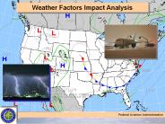
Weather Factors Impact Analysis Federal Aviation Administration Weather Impact Classification Purpose is to classify weather impact on airline scheduled flights on an ...
| PowerPoint PPT presentation | free to download
The innovative (CFBWH) Combines Flight Based Weather Handling for Safer Skies system revolutionizes aviation safety by integrating real-time weather data directly into flight operations. This advanced approach ensures pilots receive precise and timely updates, enabling safer navigation through adverse conditions. By improving weather forecasting and enhancing situational awareness, CFBWH minimizes weather-related flight delays, reduces risks, and optimizes flight routes, leading to safer and more efficient air travel.
| PowerPoint PPT presentation | free to download
Weather Charts & Briefings: PIREPS, Progs & METARS Chapter 13 Aviation Weather Briefing 1-800-WX-BRIEF Area Forecasts (FA) Weather Charts & Briefings: AWOS and ASOS ...
| PowerPoint PPT presentation | free to view
WEATHER (FG for fog, RA for rain, TS for thunder, SN for snow) SKY (FEW070, BKN005) ... Aviation Weather Center. Located in the National Weather Service ...
| PowerPoint PPT presentation | free to view
Aviation Weather services. AWIS, AWBS, AWWS, PATWAS. How to get a briefing. Aviation Weather observations. Wind, cloud, temperature, RVR. METARs. Know each group ...
| PowerPoint PPT presentation | free to download
Combines Flight Based Weather Handling (CFBWH) is a cutting-edge approach that enhances aviation safety and operational efficiency. It integrates real-time weather data with advanced flight management systems to optimize flight routes, improve safety measures, and reduce delays caused by adverse weather conditions. CFBWH allows airlines to make proactive decisions based on accurate weather forecasts, ensuring smoother operations and minimizing weather-related risks, leading to better overall performance and passenger experience.
| PowerPoint PPT presentation | free to download
FISP - 30 Days 'O' Level Supply Support. CCSP - 90 Days ... AUSTERE ENVRMNT- YET MUST ANTICIPATE FIE/FOE FLOW -F/A-18 & KC-130 COLOCATED. Marine Aviation ...
| PowerPoint PPT presentation | free to view
AVIATION 120 Meteorology Today s Agenda Midterm Exam Review Vertical structure of the atmosphere Temperature profile Variations from standard Weather VS Climate ...
| PowerPoint PPT presentation | free to view
SUMMER SEVERE WEATHER. Transport Canada. Aviation ... Extreme local changes in wind speed/direction. Microbursts and Macrobursts. More to be discussed ...
| PowerPoint PPT presentation | free to download
... LWIS Broadcast, take-off and landing clearance and pilot request are issued as ... Aviation weather reporting sites are listed in the CFS. Date/Time of ...
| PowerPoint PPT presentation | free to view
Supported Non-NASA Model. GOES, METEOSAT, GMS, TOMS, TRMM,QuikScat ... GIFTS Imager and Sounder. NPP, NPOESS, etc. CrIS, IASI, NOAA-series. Airborne/Field Ex. ...
| PowerPoint PPT presentation | free to view


