Avhrr PowerPoint PPT Presentations
All Time
Recommended
Title: PowerPoint Presentation Author: heidinger Last modified by: heidinger Created Date: 3/15/2005 2:20:52 AM Document presentation format: On-screen Show
| PowerPoint PPT presentation | free to download
Generation of Cloud Products from NOAA s Operational Satellite Imagers While advanced imagers such as VIIRS and ABI will provide significantly improved cloud remote ...
| PowerPoint PPT presentation | free to download
Validation of global vegetation indices and their time series (A CEOS Land ... with modeled GPP (IBIS) at Tapaj s. GPP from Lucy Hutyra (Harvard Univ) Ichii, K ...
| PowerPoint PPT presentation | free to view
Title: Monitoring of IR Clear-sky Radiances over Oceans for SST (MICROS): Towards Establishing Cross-Calibration Links Between AVHRRs Onboard NOAA-16, -17, -18, -19 ...
| PowerPoint PPT presentation | free to download
Status of improving the use of MODIS, AVHRR, and VIIRS polar winds in the GDAS/GFS David Santek, Brett Hoover, Sharon Nebuda, James Jung Cooperative Institute for ...
| PowerPoint PPT presentation | free to view
SST is a key environmental data record, and also comparatively easy to validate ... that single 'global' linear retrieval equation is regionally sub-optimal ...
| PowerPoint PPT presentation | free to view
500m Land Bands, Two 250m channels (included based on the ... Synergism with Satellite obs., Climate Models. A Paradigm Shift: EOS MODIS QA and Validation ...
| PowerPoint PPT presentation | free to view
Weather radar ... Local thermodynamic equilibrium. thermodynamic cloud top temperature. 8 ... A weather radar is not the best possible tool for the CTH ...
| PowerPoint PPT presentation | free to view
Inter-Sensor Validation of NDVI time series from AVHRR, SPOT-Vegetation, SeaWIFS, MODIS, and LandSAT ETM+ Molly E. Brown + Jorge E. Pinzon+ Jeffery T. Morisettex
| PowerPoint PPT presentation | free to download
PATMOS-x offers new products at a higher resolution from improved data. ... Example Year to Year Variation in High Cloud Amount from PATMOS-x ...
| PowerPoint PPT presentation | free to download
AVHRR Visible Band Calibration / Intercalibration (for Climate Studies) ... It flies on the NOAA Polar Orbiting Satellites (POES) ...
| PowerPoint PPT presentation | free to view
Calibration Status for Current Instruments and Plans for Future Instruments: ... Research Scanning Polarimeter, POLDER, MODIS, Sun Photometer network [EOSP] ...
| PowerPoint PPT presentation | free to download
... found in the NOAA KLM User's Guide (http://www2.ncdc.noaa.gov/docs/klm ... global mapping initiative by the USGS EROS Data Center in Sioux Falls, Dakota, ...
| PowerPoint PPT presentation | free to download
Using Sun Glint and Antarctic Ice Sheets to Calibrate MODIS and AVHRR Observations of Reflected Sunlight William R. Tahnk and James A. Coakley, Jr
| PowerPoint PPT presentation | free to download
Subtrack Distance: nadir, image stretch, geonav. Launch Delay: concurrent events, watches. ... clearest point, Crescent City / Mt Shasta. Channel 4: Spectral Response ...
| PowerPoint PPT presentation | free to view
Long term daily observation of the entire earth which can be used to establish ... NASA and NOAA have built a long record of daily global observations of the earth. ...
| PowerPoint PPT presentation | free to view
Two decades of AVHRR and MODIS satellite data records over Canadian Prairies at 250m1km spatial reso
| PowerPoint PPT presentation | free to view
... (SNO) occur when the ground track of two satellites cross at the same time. ... SNO's occur between all polar orbiting satellites. ...
| PowerPoint PPT presentation | free to download
Carries out orbit planning, data capture and data ... each volcano, program carries out the following ... Carries out cloud analysis of region surrounding ...
| PowerPoint PPT presentation | free to view
... for burned areas detection on Paran Medio Flooding Valley in Argentina. ... on the islands belonging to the Paran River Flooding Valley to obtain soft ...
| PowerPoint PPT presentation | free to view
The impossibility of interpreting all the data received from earth observation satellites. ... J. A. Piedra, M. Canton and F. Guindos ...
| PowerPoint PPT presentation | free to view
Preliminary results from the new AVHRR Pathfinder Atmospheres ... extends PATMOS by processing the NOAA-klm data and the data from AVHRR's in morning orbits ...
| PowerPoint PPT presentation | free to view
... and James A. Coakley, Jr ... Luderer, G., J.A. Coakley, Jr., and W.R. Tahnk, 2005: Using sun ... R. and J.A. Coakley, Jr., 2005: Calibration of visible and ...
| PowerPoint PPT presentation | free to view
... MODIS NDVI Datasets. Molly E. Brown. David J. Lary. Hamse Mussa ... Train Data on 80% of points, randomly sampled, on MODIS-AVHRR overlap period (Jan 00-Dec 03) ...
| PowerPoint PPT presentation | free to download
UW/HIRS shows some similar features but with less distinct patterns. ISCCP also shows generally negative trends over many regions. ...
| PowerPoint PPT presentation | free to download
Landsat A key climate sensor. Absolutely crucial land climate sensors: Landsat 1972 now. AVHRR-MODIS-VIIRS continuum 1981 -- now. Lidar for the 3rd Dimension ...
| PowerPoint PPT presentation | free to download
(elephants, bears died exist in the world. Sumatran tigers, snakes, ... Indian Ocean. Sumatra. Borneo. Java Sea. NOAA AVHRR - Zoom. UNEP EAP.AP. 21 October 1997 ...
| PowerPoint PPT presentation | free to view
Started analyses for AVHRR-1 and POLDER data. Working to include TOMS, OCTS, and AVHRR-2 ... MODIS (Terra & Aqua), MISR, AVHRR-1, ENVISAT, POLDER others ...
| PowerPoint PPT presentation | free to view
OC3522 - Remote Sensing of the Atmosphere and Ocean - Summer 2001 Sea Surface Temperature From Schwartzchild s Equation: AVHRR Channels 1 2 3 ...
| PowerPoint PPT presentation | free to view
Geostationary and Polar Orbiting Meteorological Satellites. And: Basics of ... Advanced Very High Resolution Radiometer (AVHRR/3) ...
| PowerPoint PPT presentation | free to view
The Center of Excellence in Remote Sensing Education and Research (CERSER) on ... sensed Advanced Very High Resolution Radiometer (AVHRR) and Sea Wide Field-of ...
| PowerPoint PPT presentation | free to download
High Resolution, Commercial, Remote Sensing Data ... The PAL data set has been calibrated over the entire temporal range of AVHRR and ...
| PowerPoint PPT presentation | free to view
SEVIRI SST products were tested for GOES-R ABI preparedness. MUT NOAA-18 AVHRR Night TS histogram AVHRR SST in situ Fig. 4: MUT night TS vs. view zenith angle ...
| PowerPoint PPT presentation | free to download
... during a Frontal Passage. Colorado State University. Aaron Wang. SiB-RAMS ... soil map IGBP 10 km. vegetation map AVHRR satellite 1 km from U. of Maryland ...
| PowerPoint PPT presentation | free to download
Change Analysis. Land Cover Change in China, 1982 1992. Introduction ... Advanced Very High Resolution Radiometer. NOAA - AVHRR Data. Platform Characteristics ...
| PowerPoint PPT presentation | free to view
... AVHRR (Advanced Very High Resolution Radiometer) satellite image taken at 2.24pm ... Moderate Resolution Imaging Spectro-Radiometer) satellites. (10.20am) ...
| PowerPoint PPT presentation | free to view
(Reynolds and Smith, 1995) using ship reports and AVHRR ... per year calculated from global rainfall by the Global Precipitation Climatology Project and ...
| PowerPoint PPT presentation | free to view
59th GCFI, Belize City. Satellite Remote Sensing of Sea Surface Temperature: ... Process and compress raw HDF (AVHRR) format. Automatic with satellite overpass ...
| PowerPoint PPT presentation | free to view
Geostationary (split window, sounder) AVHRR. MODIS. SSMI, AMSU, other ... Sounder technique most recently (since 2003) Good definition of diurnal cycle ...
| PowerPoint PPT presentation | free to view
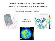
Polar Atmospheric Composition: Some Measurements and Products A Report on Action item STG3-A11 Jeff Key NOAA/NESDIS Clouds AVHRR Polar Pathfinder extended (APP-x ...
| PowerPoint PPT presentation | free to download
Towards Operational Satellite-based Detection and Short Term Nowcasting ... Mount St. Helens AVHRR Example. VAAC Height up to 11000 m. VAAC Height up to 6000 m ...
| PowerPoint PPT presentation | free to download
Confirmation of the 2000-2004 trend in AVHRR NDVI Comparison with Other AVHRR NDVI treatments NDVI from other sensors Other products from other sensors How the ...
| PowerPoint PPT presentation | free to download
NASA GSFC: Ed Masuoka (PI), Nazmi Saleous, Jeff Privette, Jim Tucker ... AVHRR/MODIS harmonization. Evaluation/Validation AVHRR and MODIS. 2nd user workshop ...
| PowerPoint PPT presentation | free to download
Advanced Very High Resolution Radiometer (AVHRR) on NOAA Polar-orbiting ... Along-Track Scanning Radiometer (ATSR) aboard the European Remote Sensing Satellite (ERS-2) ...
| PowerPoint PPT presentation | free to view
Aerosols and Clouds. AVHRR satellite 'false color' image. Red: darker clouds (large droplets) Green: brighter clouds (small droplets) Blue: clear sky ...
| PowerPoint PPT presentation | free to view
Whisk-broom or cross-track scanner: Examples: AVHRR, SeaWiFS. ... Push-broom or along-track scanner: examples include Landsat-7, MERIS ...
| PowerPoint PPT presentation | free to view
Integrated GMES Project on Landcover and Vegetation. geoland ... variables (albedo, LAI, FAPAR, fCover) from VGT, AVHRR, Polder, Meris. ...
| PowerPoint PPT presentation | free to view
HF Coastal Radars (surface currents) ... Terascan Receiving Station Operating ... AVHRR data calibrated and navigated for the Mediterranean Sea (TDF format) ...
| PowerPoint PPT presentation | free to view
Toward the SST Climate Data Record from Space. Kenneth S. Casey - NOAA National ... Advanced Very High Resolution Radiometer (AVHRR) on NOAA Polar Orbiters ...
| PowerPoint PPT presentation | free to download
Cooperation between EUMETSAT, ESA, CNES and Industry. EPS Space Segment: ... Continuity is based on ATOVS and AVHRR Level 1b and Level 2 products. AVHRR Level 1b ...
| PowerPoint PPT presentation | free to view
Weekly and biweekly NDVI composites based on 1-km AVHRR data (1980 to present) ... Most have flaws some that may be critical to your output. ...
| PowerPoint PPT presentation | free to view
Imaging infrared and visible radiometer on ENVISAT. Similar channels to AVHRR & MODIS. ... Along-track scanning, two views of same scene at different angles, ...
| PowerPoint PPT presentation | free to view
Declassified Intelligence Satellite Photography 945,807 Images. AVHRR 265,571 Images ... Digital Orthophotoqaud (DOQ) Landsat. Other imagery. Elevation ...
| PowerPoint PPT presentation | free to view
The Advanced Very High Resolution Radiometer (AVHRR) Collecting data since 1978 ... Advanced Very High Resolution Radiometer's measurements can be converted into ...
| PowerPoint PPT presentation | free to view
AATSR, VEGETATION, MODIS, AVHRR, GLI, SAC-C, MERIS, POLDER, NPP/NPOESS, SeaWiFS ... Much greater but less critical user community. Product interdependencies ...
| PowerPoint PPT presentation | free to download
... using 16 images from the Advanced Very High Resolution Radiometer (AVHRR) ... NOAA-8 and NOAA-9. The images were acquired between May 24, 1984 and ...
| PowerPoint PPT presentation | free to view


