Arcinfo PowerPoint PPT Presentations
All Time
Recommended
Edgematching Merge ArcView ... 3 3 ... 6 Manual Digitising 8 ...
| PowerPoint PPT presentation | free to view
Delineating Sub-Watersheds Using Terrain Analysis in ArcInfo Chris Klaube Landscape Ecology 704:450 Objectives Rundown in ArcInfo Workstation Speedbumps / Caveats ...
| PowerPoint PPT presentation | free to view
Newgrid = Mosaic([listfile * -grid]) will tile all of the grids in a directory ... ABBREVIATIONS ADDIMAGE ADDITEM ADDressBUILD ADDressCREATE ADDressERRORS ...
| PowerPoint PPT presentation | free to view
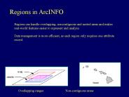
Data management is more efficient, as each region only requires one attribute record. ... has its own set of attributes because each. subclass has its own ...
| PowerPoint PPT presentation | free to download
Geographic Information Systems I. Procedure using ArcToolbox: ... Geographic Information Systems I. Shapefiles can contain only one feature class! GEOG 3150 ...
| PowerPoint PPT presentation | free to view
ArcCatalog resembles the Microsoft Windows Explorer but is ... To access data from ArcCatalog, you must set up a ... (screen prints via email) ...
| PowerPoint PPT presentation | free to view
Data Management Tools. Analysis Tools. Conversion Tools. My Tools. Tree is only 3 levels ... Custom. ArcCatalog. Metadata. ArcInfo 8. ESRI Stylesheet. Types of ...
| PowerPoint PPT presentation | free to download
License Must Not Restrict Other Software 10. ... gvSIG, QGIS, OSSIM ArcINFO/ArcGRID analysis - GRASS, OSSIM, SEXTANTE ArcPad ... ISU-ISU SEMAKN Author:
| PowerPoint PPT presentation | free to download
What's New in ESRI Tools? Charlie Fitzpatrick. K-12 Education Mgr. cfitzpatrick@esri.com ... ArcGIS Desktop (ArcView, ArcEditor, ArcInfo) ArcGIS Engine. ArGIS ...
| PowerPoint PPT presentation | free to download
Digital Mapping Techniques 04 MIGRATING FROM ARCINFO WORKSTATION TO ARCGIS By Vic Dohar, Natural Resources Canada Scope Managing datasets in a map production ...
| PowerPoint PPT presentation | free to download
Command-line interface. Required syntax, difficult to learn and use. still many fans ... Command line interface. Unix or NT hidden by ArcInfo Desktop ...
| PowerPoint PPT presentation | free to download
A user friendly Open Source Geographic Information System (GIS) that runs on ... Support for spatially enabled PostGIS tables. Support for shapefiles, ArcInfo ...
| PowerPoint PPT presentation | free to view
Developed in cooperation between WS Atkins, the Technical University of Denmark and ESRI ... In ArcInfo they can also follow connectivity rules to each other ...
| PowerPoint PPT presentation | free to download
customise ArcGIS applications; increase productivity. Example Tasks. Running batch jobs. ... See ArcDocs Customizing ArcInfo AML Using Variables ...
| PowerPoint PPT presentation | free to view
Ensures that any point on the surface is as close as possible to a node ... What do TINs Look Like ? TIN in ArcInfo. Arc: TINARC. Usage: TINARC in_tin out_tin ...
| PowerPoint PPT presentation | free to view
Direct read of standard GIS formats (shapefiles, ArcInfo coverages, ... Based on Macromedia Flash, Active Server Pages & the Extensible Markup Language (XML) ...
| PowerPoint PPT presentation | free to view
delineation based on satellite maps, built-up-areas and other. available map data ... Two ArcInfo Grids (raster surface) Grid A, all buildings, value 50 ...
| PowerPoint PPT presentation | free to view
High (3 degree) resolution along-ship. Depth resolution 1% of water depth ... 'gear bias' a problem with any survey gear. ArcInfo/ArcView 'Dynamic segmentation' ...
| PowerPoint PPT presentation | free to view
Dr. Baqer Al-Ramadan. The tutorial does not cover features unique to ArcEditor or ArcInfo, ... Dr. Baqer Al-Ramadan. You need to install both. The tutorial is ...
| PowerPoint PPT presentation | free to view
gp =win32com.client.Dispatch('esriGeoprocessing.GpDispatch.1' ... gp.SetProduct('ArcInfo') Python system. String module. Operating System. COM Dispatch ...
| PowerPoint PPT presentation | free to view
Alaska, often considered a frontier in ... The Municipality is one of the oldest ArcInfo GIS users in the state with lots ... MOA geographic database ...
| PowerPoint PPT presentation | free to view
This two-day course introduces students to ArcGIS and provides the foundation for becoming a successful ArcView 9.x, ArcEditor 9.x, or ArcInfo 9.x user.
| PowerPoint PPT presentation | free to view
EJERCICIO PR CTICO 1 : Explorando Informaci n con el M dulo ArcCatalog ... Enterprise. Database. ArcGIS. Servicios. Datos. Aumenta funcionalidad de ArcView a ArcInfo ...
| PowerPoint PPT presentation | free to view
GUS: 0265 Fundamentals of GIS Lecture Presentation 4: Raster Data Model and Operations Jeremy Mennis Department of Geography and Urban Studies Temple University
| PowerPoint PPT presentation | free to download
Water Availability Modeling. State Mandated. Resource Planning and Management ... New Idea. Separate the Trinity into smaller watersheds (HUCs) Use Wrap1117 on ...
| PowerPoint PPT presentation | free to download
Final exam - June 10th, 8:00-10:00 p.m. Grading. ArcGIS exercise (lab 1) - 10% Mid-Term - 25 ... expect bugs. First labs in ArcGIS ...
| PowerPoint PPT presentation | free to view
Spatial Data Model: Basic Data Types 2 basic spatial data models exist vector: based on geometry of points lines Polygons raster: based on geometry of
| PowerPoint PPT presentation | free to download
Integrated use of the different ArcGIS components in the context of a typical ... to navigate format, and provided with GUIs and wizards to ensure ease of use. ...
| PowerPoint PPT presentation | free to view
Title: PowerPoint Presentation Last modified by: MC SYSTEM Created Date: 1/1/1601 12:00:00 AM Document presentation format: Other titles
| PowerPoint PPT presentation | free to view
Zonal: use zones derived from a separate grid for evaluation. Functions: Local Multiple Values ... Functions: Zonal Entire Zones. Functions: Zonal - Max ...
| PowerPoint PPT presentation | free to download
Projektgruppe Vertiefer Kartographie und Geoinformation WS 00/01 Referentin: Ariane Middel Einf hrung Geodaten-Modelle Shapefiles ArcView 2 Desktop-GIS r umliche ...
| PowerPoint PPT presentation | free to view
Title: GIS at IARS Author: Larry Spear Last modified by: lspear Created Date: 10/6/2001 7:33:15 PM Document presentation format: On-screen Show Company
| PowerPoint PPT presentation | free to download
Title: Geograafia petajad Eesti Rahvusraamatukogus Author: user Last modified by: andy Created Date: 1/28/2004 12:03:59 PM Document presentation format
| PowerPoint PPT presentation | free to view
CARS. Concordance. Documentation. Geosuite. Maps. PCCF. PCFC. Census2001. Census1996 ... We're going to take a look at one concept today layers or themes of a map. ...
| PowerPoint PPT presentation | free to view
Derive target schema, feature classification and extraction; ... For on-line display or as batch process for creating persistent annotation ...
| PowerPoint PPT presentation | free to view
Bakal sk pr ce Barbora Ku ov Obor: Geoinformatika HGF, V B-TU Ostrava 2002/2003 N zev pr ce N vrh GIS o d jin ch dob v n uhl v Ostrav (na ...
| PowerPoint PPT presentation | free to download
Information management migrating from files to DBMS ... Map Templates and Symbology . . . Provide Easier, Faster, and Standardized Application Development ...
| PowerPoint PPT presentation | free to download
Importing Spatial and Attribute Data * * * * Uses and applications United States topographic quadrangles, 1:100,000. Large-scale topographic mapping of the Soviet Union.
| PowerPoint PPT presentation | free to download
Zastosowanie Geobazy w analizie przestrzennej Jaros aw Jasiewicz IPIG Wojciech Jaszczyk MPU Co to jest geobaza? Geobaza (ang. Geodatabase) to geograficzna baza ...
| PowerPoint PPT presentation | free to view
In ArcCatalog, you can browse, organize, distribute, and document your GIS data. ... maps for printing, embedding in other documents, or publishing electronically. ...
| PowerPoint PPT presentation | free to view
Vytvo en 3D modelu vybran v letn trasy po turistick ch zaj mavostech Moravskoslezsk ho kraje zpracov v : Petr Vavro Vedouc projektu : Mgr. Ivana ...
| PowerPoint PPT presentation | free to download
Standing still is NOT an option ... Arty. Battle Data. Version: OPPLAN A. Version: OPPLAN B. Version: Op Update. Default: Common ...
| PowerPoint PPT presentation | free to download
Title: GIS Data Models Author: Preferred Customer Last modified by: BUU Created Date: 12/25/2003 6:54:27 PM Document presentation format: On-screen Show (4:3)
| PowerPoint PPT presentation | free to view
Geographical information systems (GIS) . . -
| PowerPoint PPT presentation | free to download
ArcGIS Desktop software, an integrated suite of advanced GIS applications ... used for all mapbased tasks including cartography, map analysis, and editing. ...
| PowerPoint PPT presentation | free to view
Introduction to Geographic Information Systems (GIS) using ArcMap 9.2. Marcel Fortin. GIS & Map Librarian, University of Toronto. gis.maps@utoronto.ca ...
| PowerPoint PPT presentation | free to view
Digital Geographic Information Exchange Standard (DIGEST) DTED Level 0, 1, ... The geodatabase not only defines how data is stored, accessed, and managed, but ...
| PowerPoint PPT presentation | free to view
STATISTICS LITHUANIA NMA LITHUANIA Report on the use of GI in the NSI and NMA in Lithuania Vilius Zilevicius - Institute of Aerial Geodesy, Lithuania
| PowerPoint PPT presentation | free to view
Snow Route Prioritizing. John Schroeter. City of Olathe - GIS Technician ... Olathe's street centerline was then converted to a raster format and the cells ...
| PowerPoint PPT presentation | free to download
Attribute of type Geometry. Spatial relationships. Instance of a ... Control the default value and acceptable values for any attribute in a class (domains) ...
| PowerPoint PPT presentation | free to download
Why Would We Want to Bridge Them? SAS GMAP Mapping ... Process: Make XY Event Layer... PRIMEM['Greenwich',0.0],UNIT['Degree',0.0174532925199433]],PROJECTION ...
| PowerPoint PPT presentation | free to download
... AL-Ramadan. Introduction to ... Dr. Baqer AL-Ramadan. With ArcEditor you can: ... Dr. Baqer AL-Ramadan. Each version of ArcGIS includes three applications: ...
| PowerPoint PPT presentation | free to view
Title: No Slide Title Author: Dan Sadler Last modified by: daniec Created Date: 5/4/2001 4:22:07 PM Document presentation format: On-screen Show Company
| PowerPoint PPT presentation | free to download
Which of majority, centroid, or weighted are most similar to the others? ... Download, unzip, import, and display a quad that you are familiar with ...
| PowerPoint PPT presentation | free to download
What is ArcSDE, how can I use it and when should I use it? ... Hydraulic engineer B. Water pipe enlarge. New Default- Version. Default- Version. What s new? ...
| PowerPoint PPT presentation | free to view
John Smith - human being. Harrison Blvd. - street. Corvallis - city ... an offramp is required if a street and a freeway intersect ...
| PowerPoint PPT presentation | free to view


