Arcedit PowerPoint PPT Presentations
All Time
Recommended
Editing Coverages in ArcEdit
| PowerPoint PPT presentation | free to download
In ArcCatalog, you can browse, organize, distribute, and document your GIS data. ... maps for printing, embedding in other documents, or publishing electronically. ...
| PowerPoint PPT presentation | free to view
Newgrid = Mosaic([listfile * -grid]) will tile all of the grids in a directory ... ABBREVIATIONS ADDIMAGE ADDITEM ADDressBUILD ADDressCREATE ADDressERRORS ...
| PowerPoint PPT presentation | free to view
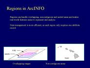
Data management is more efficient, as each region only requires one attribute record. ... has its own set of attributes because each. subclass has its own ...
| PowerPoint PPT presentation | free to download
ArcGIS is developed by the Environmental Systems Research Institute ... Free ArcGIS Add-Ons. ArcWeb Toolbar. Tablet PC Support for ArcGIS. ArcMap GPS Support ...
| PowerPoint PPT presentation | free to view
Shaping the Cadastral Infrastructure for a Digital Future Craig Sandy Esri Australia * So let s start with something a little controversial. Is the survey plan dead?
| PowerPoint PPT presentation | free to view
Starting from Text Files
| PowerPoint PPT presentation | free to view
Why Would We Want to Bridge Them? SAS GMAP Mapping ... Process: Make XY Event Layer... PRIMEM['Greenwich',0.0],UNIT['Degree',0.0174532925199433]],PROJECTION ...
| PowerPoint PPT presentation | free to download
CLEAN - generates a coverage with correct polygon or arc-node topology. ... do this, CLEAN edits and corrects geometric coordinate errors, assembles arcs ...
| PowerPoint PPT presentation | free to download
Created by Terry Reese, Oregon State Univ. Specialized Textpad designed specifically for MARC ... Know where temporary files are saved. MarcEdit Tour. MARC Format ...
| PowerPoint PPT presentation | free to view
* * Agenda ArcGIS Topology defined Validating a topology Editing a topology Geoprocessing tools Ephemeral topologies Data model design and performance Topology at ...
| PowerPoint PPT presentation | free to download
customise ArcGIS applications; increase productivity. Example Tasks. Running batch jobs. ... See ArcDocs Customizing ArcInfo AML Using Variables ...
| PowerPoint PPT presentation | free to view
The presenter's views expressed in this presentation do not necessarily ... Authority control: help collocate like-items together. Keyword searching. Background ...
| PowerPoint PPT presentation | free to view
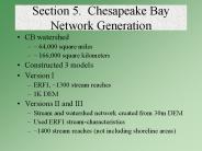
Networked Topological Properties. Trace up and down stream ... Spatially Referencing Monitoring Stations. Adding Nodes at Station Locations (Split.aml) ...
| PowerPoint PPT presentation | free to download
'Raster is faster but vector is corrector' (Berry 1995) ... Open Layer Properties and select Symbology tab. Three symbology methods: Stretched ...
| PowerPoint PPT presentation | free to view
ArcCatalog resembles the Microsoft Windows Explorer but is ... To access data from ArcCatalog, you must set up a ... (screen prints via email) ...
| PowerPoint PPT presentation | free to view
Photogrammetry. Online Updates. Secure extraction. Parcel ... Photogrammetry. Earth Observation. Outsourcing. Value-Added Resellers. Commercial, Academic, Govt. ...
| PowerPoint PPT presentation | free to view
Data Storage and Editing (Entity and attribute) DeMers Chapter 6 http://www.iupui.edu/~jeswilso/g438/lecture5/ Introduction Any analysis performs must be based on ...
| PowerPoint PPT presentation | free to download
We've looked at combining data that is about the same place. ... Makes Thiessen Polygons, ignoring/ditching Points Proximal Tolerance or less apart. ...
| PowerPoint PPT presentation | free to view
GIS is used to model complexity. full representation of reality? ... representation of information about the process. grid or layer (field) isoline (object) ...
| PowerPoint PPT presentation | free to view


