Land-Use Planning and Engineering Geology - PowerPoint PPT Presentation
1 / 38
Title:
Land-Use Planning and Engineering Geology
Description:
Chapter 20 Land-Use Planning and Engineering Geology La Conchita, California land. Photo from the United States Geological Survey Land Use Planning Why? – PowerPoint PPT presentation
Number of Views:302
Avg rating:3.0/5.0
Title: Land-Use Planning and Engineering Geology
1
Land-Use Planning and Engineering Geology
- Chapter 20
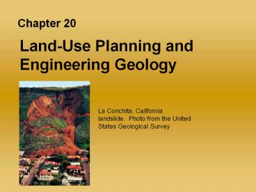
La Conchita, California landslide. Photo from
the United States Geological Survey
2
Land Use Planning Why?
- Safety?
- Is it the best use of a tract of land?
- Will the intended use be a misuse of the land?
- Are the resources required (water for example)
for the intended use available? - Is there a potential for pollution from this
intended use of a tract of land?
3
Conversion of Rural Land
- Between 1997 to 2001 2.2 million acres of rural
land were converted to developed uses - The rate of development is accelerating and the
amount of available land has not increased - Some lands will not support any or all forms of
uses
4
Land use in the United States
5
Land converted to developed land
6
Considerations in Planning
- What is the optimum use of a tract of land?
- We must consider
- Biological factors
- Ecological factors
- Geological factors
- Economic factors
- Political factors
- Aesthetic factors
7
Land-Use Options
- Multiple Use using the same land for two or
more purposes - Parks or green areas used for recreation and to
catch fresh water during a storm to allow it to
infiltrate into the ground water - Sequential use utilize the land for two or more
different purposes, one after another - Mines are used to provide the commodities found
in the subsurface, then they are re-used for
sanitary waste dumps, storage, or in-filled for
parks
8
Multiple land use
9
Sequential Land Use
10
Federal Government and Land-Use Planning
- Historically, federal lands are not equally
distributed throughout the states - Originally, federal emphasis was on resource
development rather than preservation - Federal lands fall into two categories
- Lands intended for preservation (national parks
and wilderness areas) - Lands intended for multiple use and compatible
use such as grazing, logging, mining, exploration
and drilling for petroleum (national forest)
11
Land ownership by state, 1997
12
Maps as a Planning Tool
- Land use planning requires abundant information,
maps often provide much of the information - Topography, bedrock geology, surface materials
and geology, soils, depth to ground water,
vegetation, population information, location of
fault zones and flood plains, and more - Maps can assist planners in long term planning,
establishing restrictive zoning for earthquake or
flood hazards, avoidance of other hazards as well
13
Map representation of geologic considerations
14
U.S. land-use classifications
15
Maps as a Planning Tool
- Computers have aided planners
- Information required by planners is voluminous
- Computers have played an increasing role for
planners to manipulate large volumes of
quantitative information - Geographic Information Systems (GIS) allow
planners to manipulate the data to see and use
what data is useful to a planning task while
minimize, or obscuring, unimportant data - GIS can allow a planner to see distinct layers
of information that are important to the decision
making process
16
Digitized maps can represent data
17
Composite map for land-use planning
18
(No Transcript)
19
(No Transcript)
20
(No Transcript)
21
Engineering Geology
- Geologic factors and considerations vary
depending on the site and the project - A few considerations for a major project may
include - Rock types present in project area, are they
uniform or variable - Are they fractured or faulted?
- If they are, are the faults active?
- Is there a landslide risk?
- What types of soil or soils are present? Are
they suitable for the project? - What are the hydrologic factors? Surface and
subsurface - The list is nearly endless
22
Failure of structure on unstable soil
23
Relative magnitudes of loss of life and property
damage from various geologic hazards
24
Engineering Geology
- Major projects often encounter major obstacles
- Alaskan Oil Pipeline Project (1300 km long)
- Spans a variety of geologic settings (rock types,
structures, faults, slopes, soils, mountains,
streams) - Active earthquakes, seasonal flooding, animal
migration routes all required solutions - Climate factors North Slope is very cold with
permafrost and a variable permafrost table
25
(No Transcript)
26
(No Transcript)
27
Permafrost and permafrost table
28
Differential subsidence of railroad tracks due to
partial thawing of permafrost
29
Role of Testing and Scale Modeling
- Models are physically constructed (at a reduced
scale) - Models may be tested in a computer
- Failures of a variety of structures can be tested
dams, bridges, or earthquake resistant buildings
30
Scale modeling
31
Case Histories
- Leaning Tower of Pisa the flow of the unstable
soft clay layers - Panama Canal Dipping layers of young volcanic
rocks, lava flows, and pyroclastic deposits and
dipping beds of shale and sandstone - Bostons Big Dig Glacial sediments and weakly
metamorphosed mudstone
32
Geologic factors complicated construction of the
Panama Canal
33
Bostons Big Dig Slurry walls keep excavations
from collapsing and nearby building foundations
from failing
34
Dams - Failures and Consequences
- A catastrophic dam failure can impact many
cities, thousands of lives, and cause millions of
dollars worth of property damage - St. Francis Dam coarse sandstones schists and
mica-rich metamorphic rocks a fault - Baldwin Hills reservoir an active fault zone
- Three Gorges Dam control the flooding, enhance
navigation, and produce energy
35
(No Transcript)
36
A regional overview of Hoover Dam
37
Failure of the St. Francis Dam in California
38
Benefits and issues in dam construction


