Model Evaluation Tools (MET): An Overview - PowerPoint PPT Presentation
1 / 23
Title:
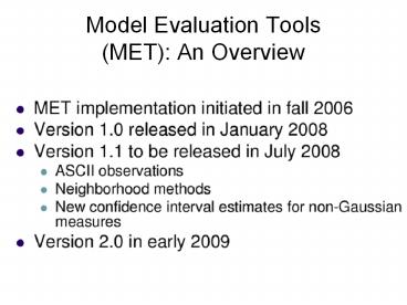
Model Evaluation Tools (MET): An Overview
Description:
STIV Obs Grid 1121x881,polar stereo, Dx,Dy 4763. WRF Data Grid ... polar stereo: Lat1 23.117000 Long1 -119.023000 Orient -105.000000, north pole (1121 x 881) ... – PowerPoint PPT presentation
Number of Views:51
Avg rating:3.0/5.0
Title: Model Evaluation Tools (MET): An Overview
1
Model Evaluation Tools(MET) An Overview
2
(No Transcript)
3
(No Transcript)
4
MET Verification Techniques
- Standard verification methods
- gridded model data to point-based observations
- gridded model data to gridded observations
- Object-based verification method
- comparing gridded model data to gridded
observations
5
(No Transcript)
6
Working Example6-h precip forecast valid 00z 2
June 08
Forecast
Observations
7
Stage IV Hourly Precip Files
- ST4.2008060119.01h
- ST4.2008060120.01h
- ST4.2008060121.01h
- ST4.2008060122.01h
- ST4.2008060123.01h
- ST4.2008060200.01h
8
4-km Stage IV grid Specification 1121 x 881
polar stereographic grid. LL point 23.117N
119.023W. UL point 53.509N 134.039W. LR point
19.805N 80.750W. UR point 45.619N 59.959W.
True longitude 105W. The resolution is
4.7625km at 60N. The pole point is (I,J)
(400.5,1600.5) This and numerous other standard
grids defined at http//www.nco.ncep.noaa.gov/pmb
/docs/on388/tableb.html
9
(No Transcript)
10
PCP-Combine command options
- pcp_combine init_time
- in_accum
- valid_time
- out_accum
- out_file
- -pcpdir path
- -pcprx reg_exp
11
PCP-combine command options
- init_time
- Initialization time of the input Grib files in
YYYYMMDD_HHMMSS format (required). - in_accum
- Accumulation interval of the input Grib files in
HH format (required). - valid_time
- Desired valid time in YYYYMMDD_HHMMSS format
(required). - out_accum
- Desired accumulation interval for the output
NetCDF file in HH format (required). - out_file
- Name of the output NetCDF file to be written
consisting of the sum of the accumulation
intervals (required).
12
PCP_combine example Summing individual Stage IV
hourly precip
- pcp_combine -sum 00000000_000000 01
20080602_000000 6 obs_6hr.nc -pcpdir . - Note Set init_time to 00000000_000000 when
summing observation files - Above command yields 6-hour OBS precip valid at
00z 2 June 2008 in netcdf format - Filename obs_6hr.nc
13
Regrid forecasts with copygb
- STIV Obs Grid 1121x881,polar stereo,Dx,Dy 4763
- WRF Data Grid
- 308 x 310 Lambert Proj with Dx,Dy 4000
- Extract precip grid from WRF output GRIB file
- Needs to be projected onto OBS grid (i.e. Stage
IV) - wgrib V filename provides necessary details on
each grid
14
Regrid forecasts with copygb
- Output of wgrib V on Stage IV file yieldspolar
stereo Lat1 23.117000 Long1 -119.023000 Orient
-105.000000, north pole (1121 x 881) Dx 4763
Dy 4763 scan 64 mode 8 - set grid"255 5 1121 881 23117 -119023 8 -105000
4763 4763 0 64"
15
WRF Forecast GRIB files 03z 1 June
initialization time
- copygb -xg "grid" -i1 -X WRFPRS15.tm00.d01.grb
WRFPRS15.tm00.d01.grb.new - copygb -xg "grid" -i1 -X WRFPRS21.tm00.d01.grb
WRFPRS21.tm00.d01.grb.new
16
PCP-Combine for WRF filesSubtract 15-h from
21-h precip
- pcp_combine -subtract WRFPRS21.tm00.d01.grb.new
21 WRFPRS15.tm00.d01.grb.new 15 WRFPRS_6hr.nc
17
(No Transcript)
18
(No Transcript)
19
MODE command
- mode fcst_file obs_file Config_file options
- Configuration file WrfModeConfig
- mode WRFPRS_6hr.nc obs_6hr.nc WrfModeConfig
20
MODE output
- 3 output formats ASCII,NetCDF,PS
- mode_APCP_06_SFC_vs_APCP_06_SFC_240000L_20080602_0
30000V_060000A_cts.txt - mode_APCP_06_SFC_vs_APCP_06_SFC_240000L_20080602_0
30000V_060000A_obj.nc - mode_APCP_06_SFC_vs_APCP_06_SFC_240000L_20080602_0
30000V_060000A_obj.txt - mode_APCP_06_SFC_vs_APCP_06_SFC_240000L_20080602_0
30000V_060000A.ps
21
No Mask Masking Obs
22
0.1 mm thresh 5.0 mm thresh
23
Centroid radius variations800/(delta-x)
200/(delta-x)


