IHOP Convection Initiation - PowerPoint PPT Presentation
1 / 27
Title:
IHOP Convection Initiation
Description:
... and gust fronts. Is this typical? 5. Initiation along boundaries (time ... influence on the evolution, lifetime and motion of. convective storm complexes. ... – PowerPoint PPT presentation
Number of Views:49
Avg rating:3.0/5.0
Title: IHOP Convection Initiation
1
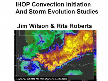
IHOP Convection Initiation And Storm Evolution
Studies Jim Wilson Rita Roberts
National Center for Atmospheric Research
2
(No Transcript)
3
DATA
Satellite 275 Surface Stations
4
DATA
Mosaic of NEXRAD and S-pol
5
Enter convergence lines every 20 min
6
112 Episodes
7
Findings
8
1. Afternoon and Nocturnal Initiation Maximum
112 Initiation Episodes
Afternoon peak
2. Elevated mostly night Surface based mostly
day
Night max
Number
9
3. Day tendency for NE-SW orientation
Night no preferred orientation
Solid surface Dashed elevated Red 6-22 CST
(day) Blue 22-6 CST (night)
10
4. Surface forcing was primarily associated with
fronts and gust fronts relatively few dry
line
NUMBER
Front GF UNK COL TL
DL Bore
Forcing Mechanism
11
5. Elevated initiation not closely associated
with low-level jet.
Large squall lines
Low-level jet
Elevated
12
6. 66 elevated initiations associated with
mid-level (900-600 hPa) convergence features
observed in RUC analysis
13
a) 1998 b) 1999
Was 2002 a Typical Year?
e) 2002 (IHOP)
Initiation episodes between 1800 and 0200 LST
Fig. 3) Thunderstorm initiation location
from 12 20 LST for the period 15 May through 30
June.
14
Evolution of all Initiation episodes examined.
15
What episodes evolved to
16
7. Lifetime of storm complex dependent on
development of a gust front.
17
Analysis 15-16 June 2002 case
8 hour loop
L
Synoptic low and trough line
18
High resolution convergence and stability analysis
19
8. Convergence and CIN influence storm initiation
more than CAPE. AN IMPRESION - high resolution
convergence and CIN fields needed to specify
timing and location
20
9. After initiation CIN takes on less importance
if convergence strong
21
10. Gust front characteristics heavily
influence storm evolution
22
11. Movement of storm complex greatly
influenced by gust front motion
Steering Flow
23
Impressions Implications
1. Elevated Initiation episodes more frequent
(day and night) then expected. In
Colorado and Florida elevated initiation rare,
upper mid-west more common than IHOP area.
Why?
2. Elevated Initiation episodes many not as
mysterious as previously suspected -
associated with mid-level (900-600 mb)
synoptic and mesoscale convergence features
visible in the RUC analysis.
3. Nocturnal precipitation maximum in the Great
Plains how much is due to advection of
convective systems from the west vs elevated
initiation?
24
Impressions Implications
4. Dry line initiation less than expected
relative to fronts and gust fronts. Is this
typical?
5. Initiation along boundaries (time space)
was very dependent on small scale variations
in convergence and CIN. Station spacing at
least as dense as in OK together with the
WSR-88D is needed to specify convergence on
scale required. Greater CIN resolution
required (radar refractivity promise) and
observation of cap evolution.
25
Impressions Implications
6. Gust fronts and their characteristics have
major influence on the evolution, lifetime
and motion of convective storm complexes.
Essential that accurate short period forecast
systems anticipate their emergence and
characteristics. This is a major research
challenge.
26
THANK YOU
_at_
27
a) 1998 b) 1999
Was 2002 a Typical Year?
IHOP_2002
Fig. 3) Thunderstorm initiation location
from 12 20 LST for the period 15 May through 30
June.


