An Overview of Animal-Habitat Modeling - PowerPoint PPT Presentation
1 / 43
Title: An Overview of Animal-Habitat Modeling
1
An Overview of Animal-Habitat Modeling
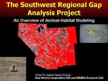
The Southwest Regional Gap Analysis Project
Center for Applied Spatial Ecology New Mexico
Cooperative Fish and Wildlife Research Unit
2
Gap Objectives
- Map the distributions of natural communities.
- Map predicted habitat of native animal species.
- Map the degree of management for biodiversity
maintenance of land tracts and water bodies
focusing on intent. - Analyze the representation of biotic elements in
the conservation network to identify gaps in
long-term security. - Provide this information to the public and those
entities charged with land use research, policy,
planning, and management.
3
Vertebrate Habitat Modeling and Mapping
- Modeling habitat of vertebrate species that
reside, breed, or use habitat in the five-state
region for a substantial portion of their life
history.
4
Habitat Modeling Objectives
- Geographic range
- Wildlife habitat associations
- Maps predicted distributions of habitat
- References
5
Habitat Modeling
- Deductive
- Knowledge based/expert based
- Habitat based
- General to specific
- Inductive
- Species occurrence based
- Specific to general
6
Decision rules are prepared for exclusion of
vertebrate species.
Step 1
- Taxa excluded based on
- Incidental, accidental, or vagrant occurrence
- Sources have eliminated species standing
- Extirpated from the area
- Represent unsuccessful introduction or
re-establishment in the area - Exotic (non-native), primarily urban-dwelling
taxa - Exotic taxa with restricted occurrence associated
with specialized or ephemeral landscapes or only
under human manipulation
Step 2
Step 3
Step 4
Step 5
Step 6
7
Modeling responsibilities for each species are
assigned to the state having the greatest
expertise.
Step 1
Step 2
Previously Modeled in Model Responsibility
1 state State
2 states State with Primary Distribution
3 or 4 states State with Primary Distribution or if widely distributed to New Mexico
5 states New Mexico
Step 3
Step 4
Step 5
Step 6
8
Number of Modeled Species
Step 1
Taxa Group Number of Species
Amphibians 37
Reptiles 130
Birds 437
Mammals 215
Total 819
Step 2
Step 3
Step 4
Step 5
Step 6
9
Hydrologic Unit for Range Limiting Maps
Step 1
Historical/ Recent Distribution Historical/ Recent Distribution
Known/Probable Potential Extirpated
Reproductive Use Reproductive Use
Breeding Non-Breeding Both
Seasonal Use Seasonal Use
Migratory Wintering Summering Winter and Summer
Step 2
Step 3
Step 4
Step 5
Map Code Description
18 k13 Known or probable occurrence, breeding, summering
21 k21 Known or probable occurrence, non-breeding, migratory
22 k22 Known or probable occurrence, non-breeding, wintering
Step 6
10
Collect and compile information on habitat
associations for each species
Step 1
- Range Delineation
- Mountain Range
- Habitat Variables
- Land Cover
- Elevation (min/max)
- Slope/Aspect
- Hydrology (Proximity)
- Streams, lakes, springs
- Soil
- Patch Size
Step 2
Step 3
Step 4
Step 5
Step 6
11
NatureServe Ecological Systems
Groups of plant communities and sparsely
vegetated habitats unified by similar ecological
processes, substrates, and/or environmental
gradients
Inter-Mountain Basins Subalpine
Limber-Bristlecone Pine Woodland
Dominant Specie(s)
Lifeform
Region
Environmental Setting
12
Contributing data/Deriving algorithms
Step 1
Step 2
Step 3
Step 4
Step 5
Step 6
Demo Database
13
Graphical Model
14
Prepare and run habitat models for each species
Step 1
Step 2
Step 3
Step 4
Step 5
Step 6
15
Model Review
- 80 Experts
- Workshops and individual reviews
- 1000 reviews
- Visual Sensitivity Analysis (VSA)
- All Models remain the responsibility of SWReGAP
16
Land Cover
17
Add Elevation
18
Add HUCs
19
Zoom into model
20
Habitat outside of known range
21
Add Ponderosa Pine
22
Run final habitat models
Step 1
Step 2
Step 3
Step 4
Step 5
Step 6
23
Step 1
Step 2
Step 3
Step 4
Step 5
Step 6
24
Contribute this information into the overall
regional analysis
Step 1
Step 2
Step 3
Step 4
Step 5
Step 6
25
Variables used in Models
26
Measure of Agreement
- Regional Approach
- NPS Inventory and Monitoring Data
- 14 Northern Colorado Plateau Parks
- Parks range from 16 to 135,533 Hectares
Taxon of Parks Matches Omission Commission Accuracy () Kappa
Amphibians 14 38 15 34 43.7 0.56
Birds 4 557 115 181 65.3 0.57
Mammals 5 191 12 159 52.8 0.65
Reptiles 14 131 10 155 44.3 0.59
27
Comparison with Previous Gap
- SWReGAP finer resolution
- Regional effort with standard framework
- Thematic resolution of land cover finer
- Report with model attributes
- Range Coding
28
Red-spotted Toad (Bufo punctatus)
29
Common Kingsnake(Lampropeltis getula)
30
Mammals
Aberts squirrel (Sciurus aberti)
31
Arizona Myotis (Myotis occultus) Not previously
modeled
32
Birdsnorthern goshawk(Accipiter gentilis)
33
Greater Sage Grouse(Centrocercus urophasianus)
34
Species Richness
35
Richness
36
Species Richness
37
Bat Richness
38
(No Transcript)
39
Products
- Digital datasets
- 30 m models
- 240 m models
- GMD File
- PDF Datasets
- Range
- Report
- Model
- Databases
Demo
40
Facilitate Use
- Species of Greatest Conservation Need
- Used in CWCS efforts
- Assemblages and guilds
41
Future Directions and Collaboration
- User Validation
- Accuracy Assessment
- Model Iterations through further review
- Deductive and Inductive modeling
- Modify existing models
- Use temperature and precipitation
42
Acknowledgement
- All the experts who participated
- Multiple agencies, NGOs
43
Habitat Modeling Contributors
Jones, Bruce Kamienski, Tomas Kepner, Bill King,
Cynthia La Sorte, Frank Lanser, Julie Lowry,
John Luna, Melanie Mettenbrink, Chris Oakes,
KatyJo O'Brien, Lee Persons, Trevor Prasad,
Maritha
Balanchandron, Nikhil Boykin, Kenneth Bradford,
Dave Casados, Tommy Chavez, Rachael Cross,
Chad Deitner, Bob DeLorenzo, Andrea Drost ,
Charles Ernst, Andrea Fox, Jodi Hamer,
Tammy Herndon, Kristine
Prior-Magee, Julie Propeck-Gray, Suzanne Puttere,
Jennifer Ramsey, Doug Rieth, Wendy Rimbert,
Celine Schrupp, Don Schwenke, Zach Shrader,
Scott Thomas, Kathryn Thompson, Bruce Wynne, J.
Judson Young, Kendal


