The Northern Stations Global Change Research Program - PowerPoint PPT Presentation
1 / 21
Title:
The Northern Stations Global Change Research Program
Description:
Jack pine. Sugar maple & immature sugar maple. Red pine. Basswood. Paper birch. Scrub ... Black spruce swamp. Lake. Upland Areas. Wetland Areas. White spruce ... – PowerPoint PPT presentation
Number of Views:50
Avg rating:3.0/5.0
Title: The Northern Stations Global Change Research Program
1
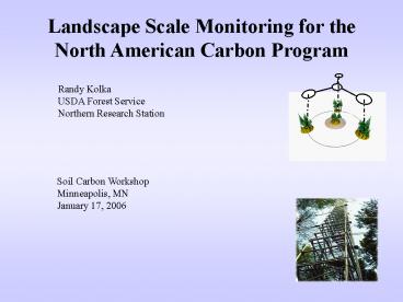
Landscape Scale Monitoring for the North American
Carbon Program
Randy Kolka USDA Forest Service Northern
Research Station
Soil Carbon Workshop Minneapolis, MN January 17,
2006
2
Review of the North American Carbon Program
- Aims to improve our ability to monitor carbon
sinks and sources - Uses a variety of observation techniques
- Field measurements
- Remote sensing
- Atmospheric sampling
- Direct flux measurements
- Ocean measurements
- Provide the mechanistic foundation for modeling
and data assimilation - GOAL Local, Regional, National and Continental
Estimates of Carbon Sinks and Sources
3
How It Fits Together
North American Carbon Program
Oceanic Research
Terrestrial Research
Atmospheric Research
Tier 1 Remote Sensing
Multi-tier Approach to Monitoring
Tier 2 FIA and NRI Plots
Tier 3 ISM Sites
Tier 4 AmeriFlux Sites
4
The Multi-tier Approach to Monitoring
NACP Approach
5
NACP Hierarchical land surface measurement program
- Tier One Remote Sensing and Mapping
- Wall-to-wall coverage stratification
- Temporal resolution high or low
- Tier Two Extensive Inventories and Surveys
- Representative regional statistical sample
- Temporal resolution low
- Tier Three Condition Sample (new)
- Representative of specified condition classes
- Temporal resolution medium
- Tier Four Intensive Areas
- Relatively small number of specific sites
- Temporal resolution high
6
Multi-tier Monitoring Concept for the Land
Component of NACP
Designed experiments
7
Objectives of Tier 3 of NACP
- Augment coverage of the land surface by tier 4
sites - Natural disturbances and management
- Edges/fragmented landscapes
- Mountain terrain
- Wetlands
- Model parameterization and validation
- Facilitate scaling from tier 2 to tier 4 sites
?Landscapes?Regions?Continent
8
Priority Measurements for Tier 3Ranked by
Workshop Participants (top 23 only)
- Aboveground biomass
- CWD by size class
- Litterfall
- Site history
- Foliar N
- Forest floor mass
- Air Temperature
- Stand age (site age)
- Soil CO2 fluxes
- Precipitation
- Coarse root biomass
- Vegetation height
- Dead wood decomposition
- LAI
- Soil moisture
- Woody shrubs
- Soil CN ratio
- 14 C incubation
- Soil carbon stocks (need to address organic
soils) - Net radiation
- Soil temperature
- Branchfall
- Specific gravity by spp
9
Primary sampling unit of a Tier 3 site is a 1 x 1
km grid of inventory plots surrounding a special
research installation
- Primary sampling units may be combined
- 9-36 inventory plots km-2
- Flux, meteorological tower or other installation
at center - Other measures (e.g. litterfall, respiration)
take place at inventory plots
10
Tier 3 Pilot Test Locations - Forests
11
NACP Conclusions
- NACP Enhancements to Forest Monitoring and
Modeling - Complete ecosystem and biome C estimates through
multi-tier design and model integration - Better temporal and spatial resolution of C stock
change estimates through integration of data
sources - Attribute causes to observed changes in the
carbon cycle - Ability to simulate carbon cycle responses to
alternative policies, management, and climate
scenarios
12
Further Landscape C Work
- NASA Carbon Cycle Science
- Further extend the on the ground work
- LIDAR measurements for Tier 3 Sites
- Development, testing and validation of models
13
Established 1km grid of FIA Plots June 2004
More recently, located plots for 3km grid
expansion
14
Vegetation Cover in Marcell Grid
Upland Areas
Trembling aspen
immature trembling aspen
Sugar maple
immature sugar maple
Jack pine
Paper birch
Red pine
Basswood
White spruce
Scrub
Wetland Areas
Open bog or fen
Alder/shrub swamp
Black spruce swamp
Lake
15
Marcell Experimental Forest Tier 3
- Understanding carbon pools and processes in
peatland landscapes FS RD, U of MN - 40 years of hydrology, climate and water quality
monitoring - Mobile flux tower planned for FY06
16
CO2 Flux from Wetland and Upland Plots
17
Modeling Work
- AMORPHYS Individual tree to stand scale
- CASA CQUEST - Decision support tool to estimate
C pools and fluxes as a result of management.
18
Other Landscape Level Carbon Related Research
- Prediction of soil carbon storage using
soil-landscape modeling - Silvicultural effects on ecosystem carbon storage
- Testing the flux tower upscaling hypothesis at a
regional scale in a complex forested landscape
19
Prediction of Soil Carbon Storage Using
Soil-Landscape Modeling
- Calibrate and model soil carbon storage using
landscape models - Marcell Experimental Forest
- Robinson Forest, KY
- Thompson and Kolka. 2005. SSSAJ, 69 1086-1093
- Coastal Plain of North Carolina
- RESULT Models developed that can predict soil
carbon storage across landscapes - IMPLICATIONS Using DEMs or similar we can
better estimate soil carbon storage across regions
20
Silvicultural Effects on Ecosystem Carbon Storage
- Utilizing our long-term silvicultural experiments
to assess the influence of management on
ecosystem carbon storage - Cutfoot EF
- Argonne EF
- RESULT Forest management affects long-term
ecosystem carbon storage - IMPLICATIONS Ability to manage forests to
maximize carbon
21
Testing the Flux Tower Upscaling Hypothesis at a
Regional Scale
- Flux tower design in NW Wisconsin to assess
scaling (Chequamegon Ecosystem Atmosphere Study
or ChEAS) - Tall Tower 447 m
- Short Tower - Wetland
- Short Tower Upland Hardwood
- Tall Short Short
- Augment with ground based measurements and mobile
flux tower - RESULT Better models to predict landscape level
carbon fluxes in managed forest landscapes - IMPLICATIONS Reasonable estimates for carbon
fluxes in managed forested landscapes


