
An Introduction and Overview of ArcGIS 9.0 - PowerPoint PPT Presentation
1 / 60
Title:
An Introduction and Overview of ArcGIS 9.0
Description:
What types of geoprocessing tasks do you currently, or plan to, run in the ... 2-D and 3-D symbolization, numerical statistics, querys, labeling and annotation, ... – PowerPoint PPT presentation
Number of Views:165
Avg rating:3.0/5.0
Title: An Introduction and Overview of ArcGIS 9.0
1
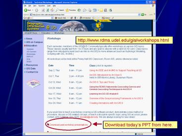
http//www.rdms.udel.edu/gis/workshops.html
Download todays PPT from here.
2
Overview of the ArcGIS 9.0 Geoprocessing
Framework
- John Callahan
- Research Data Management Services
- Information Technologies, UD
3
Todays Agenda
- Overview of geoprocessing in ArcGIS
- Five ways to perform geoprocessing
- ArcToolbox
- ArcGIS 8.x Geoprocessing Wizard???
- ModelBuilder
- Metadata for Models and Tools
4
Purpose
- Give you a brief background on geoprocessing
within ArcGIS - Show you the basics on how to get started and
find help with geoprocessing - Give examples of simple tasks using ArcToolbox,
ModelBuilder, and the command line window
5
Introductions
- Name
- Department
- What types of geoprocessing tasks do you
currently, or plan to, run in the near future?
6
What is ArcGIS?
- ArcGIS 9.0 is an integrated family of GIS
software products for building a complete GIS. - It is based upon a common library of shared GIS
software components, called ArcObjects.
7
ArcGIS 9.0 System Architecture
ArcView
ArcEditor
ArcReader
ArcInfo
Desktop
Clients
ArcGIS Engine
ArcPad
Engine
Application Servers
ArcGIS Server
ArcIMS
ArcSDE
DBMS
Data Servers
8
Geoprocessing Framework
- The collection of geoprocessing ArcObjects, APIs,
and related GUIs that can be accessed throughout
the ArcGIS suite of products. - Common architecture across products
9
ArcGIS Desktop
- The most common component of ArcGIS is the ArcGIS
Desktop - ArcView, ArcEditor, ArcInfo (ArcReader?)
- Desktop is typically the interface or medium to
other ArcGIS products - Extensions, ArcSDE, ArcGIS Server, ArcIMS
10
Desktop Products
ArcInfo
Advanced Geoprocessing
ArcEditor
ArcView
Advanced Editing
ArcReader
Data Access Mapping Query Simple
Editing Customization
Data Access Map Viewing Query
11
ArcGIS Desktop Comparison
12
ArcGIS DesktopArcMap and ArcCatalog
- ArcInfo 193 Tools
- Comprehensive
- Geoprocessing
- Write to eGDB
ArcReader (free) viewing, exploring, and
printing only
ArcEditor 34 Tools Basic Geoprocessing
Write to eGDB
- ArcView 32 Tools
- Basic Geoprocessing
- Fewer options
- Write to pGDB / Shp
Extensions (220 Tools) 3D, Spatial,
GeoStats, Plug in to desktops
13
ArcGIS Evolution
- Phase 1 Data modeling/data management
(ArcGIS 8.0) - Phase 2 Mapping/product integration
(ArcGIS 8.1/8.2) - Phase 3 Topology, editing, data compilation
(ArcGIS 8.3) - Phase 4 Advanced geoprocessing (ArcGIS 9)
14
2004 Geoprocessing, Raster Management, 3D,
Server Products, Development, Interoperability
ArcGIS Evolution
9.0
8.3
2003 Topology, Advanced Editing, Linear
Referencing
8.2
2002 ArcReader, ArcMap Server Rasters, refine
cartography, Perf.
8.1
2001 ArcEditor, Extensions Cartography, editing,
basic processing
ArcGIS 8.0
1999 ArcInfo only, basic mapping GDB, data
models, ArcObjects/VBA
15
What Geoprocessing?
- Geoprocessing is the processing of geographic
information. - Commonly used to describe a process when
geographic objects are manipulated to create a
new dataset. - Many examples of geoprocessing
16
Common Examples
- Buffer
- Overlay analysis of vectors/rasters
- Interpolation
- Slope, Aspect from DEMs
- Map/Grid algebra
- Hydrologic analysis
- Classification
17
Not-so-Common Examples
- Geocoding
- Converting between file formats
- Projecting
- Select and export
- Zonal statistics
- Proximity analysis
- Editing
18
What is Geoprocessing?
- So, its just about everything! Well, not
really - Geoprocessing is not cartography, 2-D and 3-D
symbolization, numerical statistics, querys,
labeling and annotation, GDB schema, metadata
19
A few notes
- Geoprocessing is just beginning in the 3-D world
and will likely increase. - Temporal modeling
- Significant improvements in 9.x
- Incorporated into SA, ModelBuilder, 3-D
- Solar radiation model into Framework
- Process-oriented GIS (not by ESRI)
20
(No Transcript)
21
Geoprocessing in ArcGIS
- Focus on ArcGIS Desktop applications
- Well use ArcMap
- Well use ArcInfo Desktop
22
Geoprocessing Help
- ArcGIS Desktop online Help is the best place to
start. - Overview of Geoprocessing
- Tool reference and description
- Command references
- Examples in ModelBuilder and Scripting
- ArcObjects Developer Kit (VB, C)
23
(No Transcript)
24
(No Transcript)
25
(No Transcript)
26
Geoprocessing Help
- PDFs in ESRI Library
- Geoprocessing in ArcGIS
- Geoprocessing Quick Reference Guide
- Writing Geoprocessing Scripts
- ESRI Support Center Geoprocessing
- Scripts, Models, Docs, Forums
27
Five Ways to Work With Tools
- Command line
- Dialogs
- Models
- Scripting
- ArcObjects
28
Five Ways to Work With Tools
- Command line
- Dialogs
- Models
- Scripting
- ArcObjects
Intelligent Command Line
29
Command Line
- Command line window is aware of layers in ArcMap
session - Auto-complete and parameter options
- Load and Save As from text files
- Show History and Recall
- Variables
- Formatting of window
30
Five Ways to Work With Tools
- Command line
- Dialogs
- ArcToolbox
- Models
- Scripting
- ArcObjects
31
ArcToolbox Dialogs
- Most dialogs are aware of layers in ArcMap
session - Help available per parameter
- Dialogs have link to environment settings
- Easy to use
32
Five Ways to Work With Tools
- Command line
- Dialogs
- Models
- ModelBuilder
- Scripting
- ArcObjects
33
Five Ways to Work With Tools
- Command line
- Dialogs
- Models
- Scripting
- Python, VBScript, JavaScript
- ArcObjects
34
Five Ways to Work With Tools
- Command line
- Dialogs
- Models
- Scripting
- ArcObjects
- VBA, VB, C, C (COM)
35
ArcToolbox
ArcToolbox is now a dockable window within ArcMap
and ArcCatalog.
36
ArcToolbox
- Geoprocessing tools are available through
toolboxes or toolsets. - Categorized by process type
- Create your own toolboxes and tools
- Full tool index and search functions
- Locate tool function
- Interface to ModelBuilder
37
Geoprocessing Wizard
- The ArcView 8.x Geoprocessing Wizard has been
removed from the ArcMap interface. - However, the functions are still available just
located in separate toolsets.
38
Geoprocessing Wizard
- Dissolve Data Management gt Generalization gt
Dissolve tool - Merge Data Management gt General gt Append tool
- Clip Analysis gt Extract gt Clip tool
- Intersect Analysis gt Overlay gt Intersect tool
- Union Analysis gt Overlay gt Union tool
39
ArcMap Settings
- ArcMap
- Tools
- Options
- Geoprocessing
40
ArcMap Settings
- C\ArcGIS\Utilities\AdvancedArcMapSettings.exe
41
Environment Settings
- Used by all geoprocessing tasks
- Settings include
- Workspace and mask
- Coordinate system
- Cell size and extent
- Resampling method
- Coverage and Geodatabase setting
- etc
42
Exercise 1
- Basics of Geoprocessing in ArcGIS Desktop
43
Exercise 1
- Start ArcMap.
- Open ArcToolbox. Find the tools that correspond
to the 8.x Geoprocessing Wizard - Create a new toolset, called GeoWizard Tools
and copy the appropriate tools into it.
44
Exercise 1
- Lets answer this question
- What is the most common land-use/land-cover type
for Delaware municipalities with populations over
5000?
45
Exercise 1 - Data
- 2002 Delaware Land-use/Land-cover
- http//www.state.de.us/planning/info/lulcdata/2002
_lulc.htm - Delaware Municipal Boundaries
- http//www.state.de.us/planning/info/munbounds/mun
bounds.htm - Dont download these datasets! Both datasets are
available on the classroom server in the share
drive.
46
Exercise 1 - Process
- Start ArcMap
- Add the lulc and munbounds data
- Run the following processes using both ArcToolbox
tools and the command line. - Project
- Select
- Clip
- Summary Statistics
47
What is ModelBuilder?
48
What is ModelBuilder?
- The ModelBuilder Window provides a graphical
environment in which you can build models. - A model is a representation of reality. It can
describe static physical and non-physical
properties, work-flow processes, or both.
49
ModelBuilder
- ModelBuilder starts when you create or modify a
model, done through ArcToolbox - Models can be exported as graphics or scripts
(models cannot loop, scripts can) - Similar to ArcView 3.x and ERDAS IMAGINE
ModelBuilder programs
50
ModelBuilder
- Data Elements
- Tool Elements
- Derived Data Elements
- Connectors
- Text labels
51
ModelBuilder
- Graphics keep track of running process
- Run running process
- Drop shadow process/data completed
- As data is created, it can be added to ArcMap as
layers - Right-click derived data, Add to Display
52
ModelBuilder
- Variables can be set on any process
- Models and scripts can be used as input to other
models and scripts - Models can be documented and shared
- Its not just about sharing data any more!
53
Exercise 2
- ModelBuilder
54
Exercise 2
- Start ArcMap.
- Open ArcToolbox and create a new toolbox called
My Models - Right-click the My Models toolbox and select New
-gt Model
55
Exercise 2
- Objective Find a home within the study region
for the rare trollopensis bibulosa (pickled
strumpet) - Habitat Criteria
- 2 degrees or less of slope
- 200 meters or further from primary roads AND 100
meters or further from secondary roads - forest cover 250 meters or closer to water OR
wetland cover with elevation 5 meters or greater
56
Exercise 2
- Process Criteria
- You must be able to share your work with
colleagues at other institutions - Your work-flow should be designed to accept
variations of habitat criteria - Your work-flow should be easy to explain
57
Exercise 2
- No problem!
- We have ModelBuilder!
58
Exercise 2 - Data
- Feature classes
- Waterways
- Primary roads
- Secondary roads
- Landuse
- Rasters
- Elevation in feet (DEM)
59
Exercise 2 - Process
- Input sources in various projections
- Use DE State Plane NAD83 meters
- Variables to set
- Distance to roads and water
- Elevation minimum
- Slope maximum
60
Exercise 2 - Process
- Demonstration
61
Overview of the ArcGIS 9.0 Geoprocessing
Framework
- Questions and Discussion
Recommended
CrystalGraphics Presentations


