The CT NEMO Program - PowerPoint PPT Presentation
1 / 1
Title: The CT NEMO Program
1
The CT NEMO Program
Linking Land Use to Natural Resource Protection
nemo.uconn.edu
About NEMO
Nonpoint Education for Municipal Officials
(NEMO)is an educational program for local land
use officials that addresses the relationship of
land use to natural resource protection.
Natural Resource Protection is the Goal. Land
Use is the Issue. We believe that better land use
decisions are the key to protecting the natural
resources, community character and long-term
economic health of our communities. Local
Officials are the Target Audience. Because land
use is the issue, the people making land use
decisions on local land use boards are our key
target audience. Education is the Method. Since
the local land use decision making process is
complex, political, and widely varying, we
believe that educationparticularly
research-based, non-advocacy professional
outreach educationis the best way to foster
better land use decisions.
Impacts Putting Communities in Charge!
How do we Spell Success? The NEMO program does
not just measure its success by the number of
workshops it gives. The goal of every workshop is
to give local decision-makers some tangible
action items toward protecting their
municipalitys resources. NEMO encourages these
town decision-makers to undertake a wide range of
actions, from changing their decision-making
process to changing land use regulations to using
development design concepts and best management
practices that are protective of water quality.
The NEMO program is the catalyst for local
action, but it is through the heroic efforts of
local volunteers and commission members that real
on the ground changes get done. Putting
Communites in Charge, a new publication detailing
the work CT towns have accomplished with NEMO,
was released in 2004.
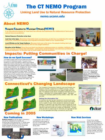
(L to R ) Glen Brook Green Subdivision in
Waterford Narrow roads and swales in Watertown
Pervious overflow parking in Old Saybrook East
Haddam joint commission meeting.
Connecticuts Changing Landscape
The University of Connecticuts Center for Land
use Education And Research (CLEAR), created from
CT NEMOs success, recently produced a
first-of-its-kind series of four dates of digital
land cover data. The datasets include eleven
consistently interpreted land cover classes
interpreted from Landsat satellite imagery -
that depict Connecticuts landscape patterns as
they existed in 1985, 1990, 1995 and 2002.
1985
1990
Getting the Information Out An extensive web site
has been developed to provide broad public access
to the data, interpreted products such as land
cover change and to a wealth of maps, charts,
educational materials and digital datasets. An
interactive map (right) allows users to access
any of the four dates of land cover data, a land
cover change dataset and some reference maps that
include town outlines and watersheds. The goal
of the web site is to make it easy for
individuals and organizations that do not have
geospatial technology to access and use the date.
1995
2002
Coming in 2005
New Publications
New Workshops
New Web Services
Buildout analyses are all the rage in
Connecticut, and yet few understand the benefits
and shortcomings of this planning tool. CT NEMO
plans a publication that address the whys and
hows of buildout analysis and shows how to
incorporate these analyses into community planning
In collaboration with CT DEP, a new training
module based on the new CT Stormwater Quality
Manual will be available in Spring 2005. In
addition,working with other NEMO Network
partners, a workshop on Map and Plan Reading is
in its final phase of development!
A host of new website services will be available
in 2005. A site dedicated to the measurement and
research of impervious surfaces is now on-line.
Coming soon is an on-line Community Resource
Inventory website, built along the lines of our
Focus on the Coast site(left).


