
Datum Transformation and Coordinate Conversion - PowerPoint PPT Presentation
1 / 17
Title:
Datum Transformation and Coordinate Conversion
Description:
... Continental US, Alaska, Hawaii, Virgin Islands and Puerto ... Converts coordinates among a wide variety of coordinate systems, map projections, and datums. ... – PowerPoint PPT presentation
Number of Views:1082
Avg rating:3.0/5.0
Title: Datum Transformation and Coordinate Conversion
1
Datum Transformation and Coordinate Conversion
2
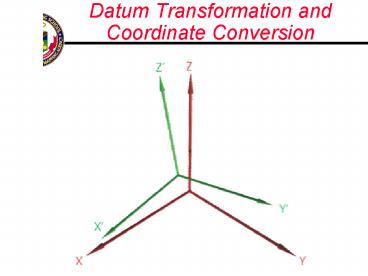
Cartesian Coordinate System
Z
Ellipsoid sized a f
WGS -84 is Earth Centered Earth Fixed Origin to
with /- 10 cm
Y
X
3
Datums and Defining Parameters
- To translate one datum to another we must
know the relationship between the chosen
ellipsoids in terms of position and orientation.
The relationship is is defined by 7 constants. - A. 3 - Distance of the ellipsoid center from the
center of the earth (?X, ?Y, ?Z) - B. 3 - Rotations around the X, Y, and Z of the
Cartesian Coordinate System Axes (?, ?, ?) - C. 1 - Scale change (S) of the survey control
network - 2 - The size and shape of the ellipsoid
(semi major axis a and flattening f
approximately 1/298
4
Translations (3 Parameters)
Movement of points along an Axis
?X
?Y
?Z
5
Rotations (3 Parameters)
Movement of points around an Axis
?
?
?
6
Scale (1 Parameter)
Changing the distance between points
S
7
Differences Between Horizontal Datums
- The two ellipsoid centers called ? X, ? Y, ? Z
- The rotation about the X,Y, and Z axes in seconds
of arc - The difference in size between the two ellipsoids
- Scale Change of the Survey Control Network ?S
Z
System 2 NAD-27
?
?
?
System 1 WGS-84
Y
? Z
? Y
?X
X
8
7 Parameters
S Rxyz
9
3 Parameters
10
Coordinate Conversion Datum Transformation
- References NIMA TR8350.2, TEC-SR-7, DMA TM
8358.1 - Convert from Grid to Geographic Coordinates
- Convert from Geographic to Cartesian Coordinates
- Apply Datum Transformation 3 Parameter (?X, ?Y,
?Z, and a f of Ellipsoid) 7 Parameter (?X ?,
?Y ?, ?Z ?, ?S, a F of Ellipsoid) For most
uses 3 parameter shifts are acceptable - Compute New Geographic Coordinates
- Compute New UTM, MGRS etc. Coordinates
- Error in transformation propagates to final
coordinates
11
Transformation Process
12
Transformation Error
B
A
A
B
The Shift required depends on the location on the
datums. It is not constant.
13
Transformation Error
14
3 Parameter Determination
Most Transformation Parameters can be found in
the NIMA technical report Department of Defense
World Geodetic System 1984 (TR 8350.2) NSN
7643-01-402-0347
15
More Precise Determination
Survey Using WGS-84
Local Control Points in Local Datum
Control Points in WGS-84
Transfer Control
Derive Transformation Parameters
Local Control Points in WGS-84
Standard Molodensky Formula Multiple Regression
Equations
Transform Local Points
7, 5, or 3 Parameter Transformation
Local Points in WGS-84
16
Transformation Software
- MADTRAN Mapping Accuracy Transformations - No
longer recommended. - DTCC4 DMA transformation program - No longer
recommended. - CORPSCON Survey Accuracy Transformations for
Continental US, Alaska, Hawaii, Virgin Islands
and Puerto Rico - GEOTRANS2 Mapping Accuracy Transformations for
preset datums and coordinate systems. The DoD
recommended system. - FalconView Mapping Accuracy Transformations in
conjunction with map display and mission planning
- single transformations - PLGR/EPLGR Built in transformation software for
coordinate transformations
17
Geographic Translator 2 (GEOTRANS2)
- Converts coordinates among a wide variety of
coordinate systems, map projections, and datums. - 11 different coordinate systems and map
projections - Over 200 different datums
- Choose between Ellipsoid and MSL height
- Program can receive coordinates from a text file,
convert them, and output results in another file.
- Mapping Level Transformations
18
Summary
- 7, 5, or 3 Parameter Transformation
- Survey vs Mapping Accuracy Transformations
- Traditional Parameter Derivation and application
- Geotrans Software
Recommended
CrystalGraphics Presentations


